| Home | City Bus | Maps | Villages | Cities | Rail | Tourist Places | School | College | Pin Codes | Corona Cases Count |
| Distance Calculator Bus Services IFSC Codes Trace Mobile Number Weather Search Place Trace IP Available Cash ATM/Banks Locate Polling Booth Report an Error contact People |
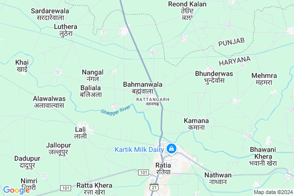
Rattangarh Map
EDIT Map
Add Your House
 ..
..
Current Corona Virus Infected Patients Count in Fatehabad District
| City Name | District Name | Total Covid cases |
|---|---|---|
| Fatehabad District | Fatehabad | 1 |
Locality Name :
Rattangarh
( रत्तनगढ़ )
Tehsil Name : Ratia
District : Fatehabad
State : Haryana
Division : Hisar
Language : Punjabi and Hindi, Bagri
Current Time 04:24 AM
Date: Saturday , Apr 26,2025 (IST)
Time zone: IST (UTC+5:30)
Elevation / Altitude: 228 meters. Above Seal level
Assembly constituency : Ratia assembly constituency
Assembly MLA : Lakshman Napa
Lok Sabha constituency : Sirsa parliamentary constituency
Parliament MP : Sunita Duggal
Serpanch Name :
Pin Code : 125051
Post Office Name : Rattia
Commodities Prices : Boha Market / Mandi
Edit below overview about Rattangarh
Edit below overview about Rattangarh
OverView of Rattangarh
This is the residence area of khokhar Bola family the community of jaddi sardars,the village name is based upon the man named rattan Singh Bola which was said to be a great human socially economically financially. the landlords which further got immigrants of other states or areas into this village and shared portions of land foe agriculture purposes. This is a multi community village a peaceful and God blessed place to live. Updated by Gary Bola the living generation of the village ancestorsEdit below overview about Rattangarh
National Highways Reachable To Rattangarh
Nationa High Way :NH148B
Nationa High Way :NH148B
Rivers Near Rattangarh
Ghaggar
Ghaggar
About Rattangarh
Rattangarh is a Village in Ratia Tehsil in Fatehabad District of Haryana State, India. It belongs to Hisar Division . It is located 24 KM towards North from District head quarters Fatehabad. 4 KM from Ratia. 189 KM from State capital Chandigarh
Rattangarh Pin code is 125051 and postal head office is Rattia .
Mirana ( 3 KM ) , Kamana ( 4 KM ) , Baliyala ( 4 KM ) , Nangal ( 4 KM ) , Bhunderwas ( 5 KM ) are the nearby Villages to Rattangarh. Rattangarh is surrounded by Budhlada Tehsil towards North , Jakhal Tehsil towards East , Bhuna Tehsil towards South , Fatehabad Tehsil towards South .
Ratia , Fatehabad , Budhlada , Tohana are the near by Cities to Rattangarh.
This Place is in the border of the Fatehabad District and Mansa District. Mansa District Budhlada is North towards this place . It is near to the Punjab State Border.
Rattangarh 2011 Census Details
Rattangarh Local Language is Punjabi. Rattangarh Village Total population is 2612 and number of houses are 518. Female Population is 49.7%. Village literacy rate is 48.7% and the Female Literacy rate is 20.6%.
Population
| Census Parameter | Census Data |
| Total Population | 2612 |
| Total No of Houses | 518 |
| Female Population % | 49.7 % ( 1298) |
| Total Literacy rate % | 48.7 % ( 1271) |
| Female Literacy rate | 20.6 % ( 537) |
| Scheduled Tribes Population % | 0.0 % ( 0) |
| Scheduled Caste Population % | 63.7 % ( 1663) |
| Working Population % | 45.3 % |
| Child(0 -6) Population by 2011 | 352 |
| Girl Child(0 -6) Population % by 2011 | 50.9 % ( 179) |
Rattangarh Census More Deatils.
Politics in Rattangarh
BJP , INLD , INC are the major political parties in this area.Polling Stations /Booths near Rattangarh
1)Boswal2)Brahmanwala
3)Rattangarh
4)Ratta Tibba Majra Hijrawan Khurd
5)Rattangarh
HOW TO REACH Rattangarh
By Rail
There is no railway station near to Rattangarh in less than 10 km.Colleges near Rattangarh
Khalsa Tricentry Govt. College Ratia
Address :
Schools in Rattangarh
Alpinetopschool
Address :
Govt Health Centers near Rattangarh
1) Rattan Garh , , ,2) Bahmanwala , , ,
3) Nangal , , ,
Hospitals in Rattangarh,Ratia
T P EYE AND GENERAL HOSPITAL
Jain samadhi; Balmiki Basti; Ratia; Haryana 125051; India
3.9 KM distance Detail
more ..
Petrol Bunks in Rattangarh,Ratia
Hindustan Petroleum
Ratia Bypass Rd; Rattangarh; Ratia; Haryana 125051; India
2.8 KM distance Detail
ASHOKA OIL COMPANY
Dealer : HPCL; Budhlada Road;; Near Kamana Mor; Ratia; Ratia - Budhlada; Rattangarh; Haryana 125051; India
2.9 KM distance Detail
Gill Submersible Parts
Near Old DAV School Tohana Road Ratia Tehsil District Fatehabad; Haryana Pin Code; 125051; India
4.9 KM distance Detail
more ..
Colleges in Rattangarh,Ratia
Pmkvy2 Smart Skill Development Institute Ratia
Ratia-Tohana Rd; Gaushala Colony; Tohana; Haryana 125120; India
5.0 KM distance Detail
Shaheed Baba Deep Singh College of Nursing; Ratia; Fatehabad
Aharwan; Ratia; Fatehabad; Haryana 125051; India
5.7 KM distance Detail
more ..
Schools in Rattangarh,Ratia
The Alpine Top School; Ratia
Ratia - Budhlada; Bahmanwala; Haryana 125051; India
1.6 KM distance Detail
Holy Heart School
Bola's street lahli AlalwasAlika; Ratia; Haryana 125051; India
3.7 KM distance Detail
Jindal Pre School
Model Town Road; Tibba Colony; Near Padmavati Dham; Ratia; Haryana 125051; India
3.9 KM distance Detail
Electronic Shops in Rattangarh,Ratia
BHULLAR ELECTRONIC
BUDHLADA ROAD NEAR POWER HOUSE; Ratia; Haryana 125051; India
3.9 KM distance Detail
Super Markets in Rattangarh,Ratia
Gatta factorry
gatta factory lali road; Rattangarh; Ratia; Haryana 125051; India
3.5 KM distance Detail
Local Parks in Rattangarh,Ratia
Shaheed Devender Singh Memorial Park
Dera Surjanhar; Ratia; Haryana 125051; India
4.1 KM distance Detail
Police Stations near Rattangarh,Ratia
Ratia Police Station
Lali Road Ratia; SH 21; Balmiki Basti; Ratia; Haryana 125051; India
3.7 KM distance Detail
Governement Offices near Rattangarh,Ratia
World Settlement Consultancy IELTS Institute & Visa Consultant - Ratia Fatehabad
Near Sati Mandir; Ratia; Haryana 125051; India
4.5 KM distance Detail
Employment Duniya
Tibba Colonny Gali no.9/10 house no.151 Ratia dist. fatehabad haryana; Ratia; Haryana 125051; India
5.4 KM distance Detail
About Rattangarh &
History
How to reach Rattangarh
Tourist Places Near By Rattangarh
Schools in Rattangarh
Colleges in Rattangarh
Temperature & weather of Rattangarh
places in Rattangarh
Rattangarh photos
More Information
How to reach Rattangarh
Tourist Places Near By Rattangarh
Schools in Rattangarh
Colleges in Rattangarh
Temperature & weather of Rattangarh
places in Rattangarh
Rattangarh photos
More Information
Village Talk
Post News or Events about this Village
Near Cities
Ratia 4 KM near
Fatehabad 23 KM near
Budhlada 26 KM near
Tohana 36 KM near
Ratia 4 KM near
Fatehabad 23 KM near
Budhlada 26 KM near
Tohana 36 KM near
Near By Taluks
Ratia 4 KM near
Budhlada 18 KM near
Jakhal 22 KM near
Bhuna 27 KM near
Ratia 4 KM near
Budhlada 18 KM near
Jakhal 22 KM near
Bhuna 27 KM near
Near By Air Ports
Ludhiana Airport 150 KM near
Chandigarh Airport 178 KM near
Surat Gujarat Airport 185 KM near
Indira Gandhi International Airport 221 KM near
Ludhiana Airport 150 KM near
Chandigarh Airport 178 KM near
Surat Gujarat Airport 185 KM near
Indira Gandhi International Airport 221 KM near
Near By Tourist Places
Mansa 38 KM near
Sangrur 72 KM near
Hansi 88 KM near
Bathinda 91 KM near
Fatehgarh-Sahib 109 KM near
Mansa 38 KM near
Sangrur 72 KM near
Hansi 88 KM near
Bathinda 91 KM near
Fatehgarh-Sahib 109 KM near
Near By Districts
Fatehabad 23 KM near
Mansa 38 KM near
Sirsa 60 KM near
Hisar 71 KM near
Fatehabad 23 KM near
Mansa 38 KM near
Sirsa 60 KM near
Hisar 71 KM near
Near By RailWay Station
Budhlada Rail Way Station 25 KM near
Jakhal Junction Rail Way Station 30 KM near
Budhlada Rail Way Station 25 KM near
Jakhal Junction Rail Way Station 30 KM near