| Home | City Bus | Maps | Villages | Cities | Rail | Tourist Places | School | College | Pin Codes | Corona Cases Count |
| Distance Calculator Bus Services IFSC Codes Trace Mobile Number Weather Search Place Trace IP Available Cash ATM/Banks Locate Polling Booth Report an Error contact People |
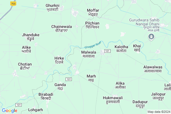
Malwala Map
EDIT Map
Add Your House
 ..
..
Current Corona Virus Infected Patients Count in Fatehabad District
| City Name | District Name | Total Covid cases |
|---|---|---|
| Fatehabad District | Fatehabad | 1 |
Locality Name :
Malwala
( मालवाला )
Tehsil Name : Ratia
District : Fatehabad
State : Haryana
Division : Hisar
Language : Punjabi and Hindi, Bagri
Current Time 12:58 PM
Date: Sunday , Apr 27,2025 (IST)
Time zone: IST (UTC+5:30)
Elevation / Altitude: 228 meters. Above Seal level
Assembly constituency : Ratia assembly constituency
Assembly MLA : Lakshman Napa
Lok Sabha constituency : Sirsa parliamentary constituency
Parliament MP : Sunita Duggal
Serpanch Name :
Pin Code : 125051
Post Office Name : Rattia
Commodities Prices : Boha Market / Mandi
Malwala Live Weather
Temperature: 41.4 °C
clear sky
Humidity: 5%
Wind : 3.52 mt/sec towards NW
StationName : "Sardulgarh"
observed on Now
Temperature: 41.4 °C
clear sky
Humidity: 5%
Wind : 3.52 mt/sec towards NW
StationName : "Sardulgarh"
observed on Now
Malwala Weather Forecast for Next 5 days
28-04-2025
28.5°C to 42.1°C
clear sky
28.5°C to 42.1°C
clear sky
29-04-2025
27.2°C to 43.0°C
clear sky
27.2°C to 43.0°C
clear sky
30-04-2025
28.2°C to 44.9°C
clear sky
28.2°C to 44.9°C
clear sky
01-05-2025
29.6°C to 45.6°C
clear sky
29.6°C to 45.6°C
clear sky
02-05-2025
28.7°C to 42.4°C
scattered clouds, broken clouds, overcast clouds, light rain
28.7°C to 42.4°C
scattered clouds, broken clouds, overcast clouds, light rain
National Highways Reachable To Malwala
Nationa High Way :NH148B
Nationa High Way :NH148B
Rivers Near Malwala
Ghaggar
Ghaggar
About Malwala
Correct below Info and add more info about MalwalaMalwala is a Village in Ratia Tehsil in Fatehabad District of Haryana State, India. It belongs to Hisar Division . It is located 25 KM towards North from District head quarters Fatehabad. 15 KM from Ratia. 200 KM from State capital Chandigarh
Malwala Pin code is 125051 and postal head office is Rattia .
Ganda ( 5 KM ) , Alika ( 6 KM ) , Khai ( 6 KM ) , Hukmawali ( 7 KM ) , Birabadi ( 8 KM ) are the nearby Villages to Malwala. Malwala is surrounded by Sardulgarh Tehsil towards west , Jhunir Tehsil towards North , Budhlada Tehsil towards East , Fatehabad Tehsil towards South .
Ratia , Fatehabad , Budhlada , Mansa are the near by Cities to Malwala.
This Place is in the border of the Fatehabad District and Mansa District. Mansa District Budhlada is East towards this place . It is near to the Punjab State Border.
Malwala 2011 Census Details
Malwala Local Language is Punjabi. Malwala Village Total population is 612 and number of houses are 115. Female Population is 49.2%. Village literacy rate is 47.9% and the Female Literacy rate is 23.0%.
Population
| Census Parameter | Census Data |
| Total Population | 612 |
| Total No of Houses | 115 |
| Female Population % | 49.2 % ( 301) |
| Total Literacy rate % | 47.9 % ( 293) |
| Female Literacy rate | 23.0 % ( 141) |
| Scheduled Tribes Population % | 0.0 % ( 0) |
| Scheduled Caste Population % | 44.3 % ( 271) |
| Working Population % | 32.7 % |
| Child(0 -6) Population by 2011 | 71 |
| Girl Child(0 -6) Population % by 2011 | 50.7 % ( 36) |
Malwala Census More Deatils.
Politics in Malwala
BJP , INLD , INC are the major political parties in this area.Polling Stations /Booths near Malwala
1)Malhar2)Alika
3)Alawalwas
4)Madh
5)Luthera
HOW TO REACH Malwala
By Rail
There is no railway station near to Malwala in less than 10 km.Colleges near Malwala
Khalsa Tricentry Govt. College Ratia
Address :
Schools in Malwala
Gps Malwala
Address : malwala , ratia , fatehabad , Haryana . PIN- 125051 , Post - Rattia
Govt Health Centers near Malwala
1) Pilchian , , ,2) Ganda , , ,
3) Alika , , ,
Hospitals in Malwala,Ratia
Govt. Ayurvedic Dispensary
Fatehabad - Nagpur Rd; Nagpur; Haryana 125051; India
9.8 KM distance Detail
more ..
Petrol Bunks in Malwala,Ratia
Neelkanth Filling Station Haroli
Ratia - Sardulgarh Rd; Haryana 125051; India
10.8 KM distance Detail
Neelkanth Filling Station
Ratia - Sardulgarh Rd; Haroli; Haryana 125051; India
11.3 KM distance Detail
NEELKANTH FILLING STATION
RATIA ;RATIA HAROLI RD;FAT; FATEHBAD; Haryana 125051; India
11.8 KM distance Detail
more ..
Colleges in Malwala,Ratia
Tirupati College of Education
Ratia - Sardulgarh Road; Near K.T. Govt. College; Ratia; Bharpur; Haryana 125051; India
16.5 KM distance Detail
Tirupati Group of Institutions; Ratia (Fatehabad)
Sardulgarh Road; Fatehabad; Near Govt. K. T. College; Ratia; Haryana 125051; India
16.6 KM distance Detail
K T Government College
Ratia - Sardulgarh Rd; Ratia Rural; Haryana 125051; India
18.0 KM distance Detail
more ..
Police Stations near Malwala,Ratia
Ratia Police Station
Lali Road Ratia; SH 21; Balmiki Basti; Ratia; Haryana 125051; India
18.3 KM distance Detail
About Malwala &
History
How to reach Malwala
Tourist Places Near By Malwala
Schools in Malwala
Colleges in Malwala
Temperature & weather of Malwala
places in Malwala
Malwala photos
More Information
How to reach Malwala
Tourist Places Near By Malwala
Schools in Malwala
Colleges in Malwala
Temperature & weather of Malwala
places in Malwala
Malwala photos
More Information
Village Talk
Post News or Events about this Village
Near Cities
Ratia 18 KM near
Fatehabad 24 KM near
Budhlada 30 KM near
Mansa 34 KM near
Ratia 18 KM near
Fatehabad 24 KM near
Budhlada 30 KM near
Mansa 34 KM near
Near By Taluks
Sardulgarh 14 KM near
Ratia 15 KM near
Jhunir 18 KM near
Budhlada 25 KM near
Sardulgarh 14 KM near
Ratia 15 KM near
Jhunir 18 KM near
Budhlada 25 KM near
Near By Air Ports
Ludhiana Airport 153 KM near
Surat Gujarat Airport 170 KM near
Chandigarh Airport 190 KM near
Indira Gandhi International Airport 234 KM near
Ludhiana Airport 153 KM near
Surat Gujarat Airport 170 KM near
Chandigarh Airport 190 KM near
Indira Gandhi International Airport 234 KM near
Near By Tourist Places
Mansa 33 KM near
Sangrur 79 KM near
Bathinda 79 KM near
Hansi 98 KM near
Muktsar 119 KM near
Mansa 33 KM near
Sangrur 79 KM near
Bathinda 79 KM near
Hansi 98 KM near
Muktsar 119 KM near
Near By Districts
Fatehabad 24 KM near
Mansa 33 KM near
Sirsa 46 KM near
Bathinda 77 KM near
Fatehabad 24 KM near
Mansa 33 KM near
Sirsa 46 KM near
Bathinda 77 KM near
Near By RailWay Station
Budhlada Rail Way Station 28 KM near
Mansa Rail Way Station 32 KM near
Budhlada Rail Way Station 28 KM near
Mansa Rail Way Station 32 KM near