| Home | City Bus | Maps | Villages | Cities | Rail | Tourist Places | School | College | Pin Codes | Corona Cases Count |
| Distance Calculator Bus Services IFSC Codes Trace Mobile Number Weather Search Place Trace IP Available Cash ATM/Banks Locate Polling Booth Report an Error contact People |
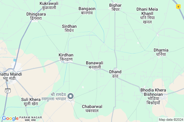
Banawali
Banawali Map
EDIT Map
Add Your House
 ..
..
Current Corona Virus Infected Patients Count in Fatehabad District
| City Name | District Name | Total Covid cases |
|---|---|---|
| Fatehabad District | Fatehabad | 1 |
Locality Name :
Banawali
( बनावली )
Tehsil Name : Bhattu Kalan
District : Fatehabad
State : Haryana
Division : Hisar
Language : Punjabi and Hindi, Bagri
Current Time 09:54 AM
Date: Thursday , Apr 24,2025 (IST)
Time zone: IST (UTC+5:30)
Elevation / Altitude: 212 meters. Above Seal level
Assembly constituency : Adampur assembly constituency
Assembly MLA : Kuldeep Bishnoi
Lok Sabha constituency : Hisar parliamentary constituency
Parliament MP : BRIJENDRA SINGH
Serpanch Name :
Pin Code : 125050
Post Office Name : Nai Mandi Fatehabad
Commodities Prices : Fatehabad Market / Mandi
National Highways Reachable To Banawali
Nationa High Way :NH52;NH148B
Nationa High Way :NH52
Nationa High Way :NH52;NH148B
Nationa High Way :NH52
About Banawali
Correct below Info and add more info about BanawaliBanawali is a Village in Bhattu Kalan Tehsil in Fatehabad District of Haryana State, India. It belongs to Hisar Division . It is located 19 KM towards South from District head quarters Fatehabad. 11 KM from Bhattu Kalan. 230 KM from State capital Chandigarh
Banawali Pin code is 125050 and postal head office is Nai Mandi Fatehabad .
Kirdhan ( 3 KM ) , Sekhupur Daroli ( 5 KM ) , Chabarwal ( 5 KM ) , Sirdhan ( 5 KM ) , Bangaon ( 6 KM ) are the nearby Villages to Banawali. Banawali is surrounded by Fatehabad Tehsil towards North , Adampur Tehsil towards South , Agroha Tehsil towards East , Bhuna Tehsil towards East .
Fatehabad , Ratia , Sirsa , Hisar are the near by Cities to Banawali.
This Place is in the border of the Fatehabad District and Hisar District. Hisar District Adampur is South towards this place .
Banawali 2011 Census Details
Banawali Local Language is Punjabi. Banawali Village Total population is 3688 and number of houses are 698. Female Population is 46.6%. Village literacy rate is 56.1% and the Female Literacy rate is 21.3%.
Population
| Census Parameter | Census Data |
| Total Population | 3688 |
| Total No of Houses | 698 |
| Female Population % | 46.6 % ( 1718) |
| Total Literacy rate % | 56.1 % ( 2069) |
| Female Literacy rate | 21.3 % ( 784) |
| Scheduled Tribes Population % | 0.0 % ( 0) |
| Scheduled Caste Population % | 21.5 % ( 793) |
| Working Population % | 47.8 % |
| Child(0 -6) Population by 2011 | 451 |
| Girl Child(0 -6) Population % by 2011 | 47.7 % ( 215) |
Banawali Census More Deatils.
Politics in Banawali
HJCBL , Bharatiya Janata Party , INC , INLD are the major political parties in this area.Polling Stations /Booths near Banawali
1)Govt.primary School Bir Babran Bir Hisar (west Wing)2)Govt.high School Bhodia Bishnoian (east Wing)
3)Govt.high School Bhana (west Wing)
4)Govt.primary School No.2 Sadalpur
5)Govt.middle School Ttc (hall)
HOW TO REACH Banawali
By Rail
Khabra Kalan Rail Way Station , Bhattu Rail Way Station are the very nearby railway stations to Banawali.Colleges near Banawali
Guru Dronacharya College Of Education, Bhuna
Address :
National Collage Of Nurcing
Address :
Guru Dronacharya College Of Education
Address :
M.m.college Fatehabad
Address :
Apex
Address :
Schools in Banawali
Adaresh Public School
Address : banawali , bhattu , fatehabad , Haryana . PIN- 125050 , Post - Nai Mandi Fatehabad
Gsss Banawali
Address : banawali , bhattu , fatehabad , Haryana . PIN- 125050 , Post - Nai Mandi Fatehabad
Govt Health Centers near Banawali
1) Banawali , , ,2) Dhand , , ,
3) Kirdhan , , ,
Petrol Bunks in Banawali,Bhattu Kalan
HP PETROL PUMP - HP ARUNA FILLING STATION
Kalan; Bhattu; Haryana 125050; India
9.4 KM distance Detail
more ..
Colleges in Banawali,Bhattu Kalan
Deeksha Institute of Technology
1 Mile Stone Bhattu Road; Kirdhan; Fatehabad; Haryana 125053; India
7.6 KM distance Detail
Government Post Graduate College
Shiv Colony; Bhattu Mandi; Haryana 125053; India
9.7 KM distance Detail
more ..
Super Markets in Banawali,Bhattu Kalan
Maa Santoshi Flex Bhattu
Bhattu Mandi - Khara Kheri Rd; Model Town; Bhattu Mandi; Haryana 125053; India
9.7 KM distance Detail
Local Parks in Banawali,Bhattu Kalan
Huda Sector Park
National Highway 10; Huda Sector; Fatehabad; Haryana 125050; India
14.0 KM distance Detail
Police Stations near Banawali,Bhattu Kalan
Police Station Bhattu Kalan
Market Colony; Bhattu Mandi; Haryana 125053; India
9.7 KM distance Detail
About Banawali &
History
How to reach Banawali
Tourist Places Near By Banawali
Schools in Banawali
Colleges in Banawali
Temperature & weather of Banawali
places in Banawali
Banawali photos
More Information
How to reach Banawali
Tourist Places Near By Banawali
Schools in Banawali
Colleges in Banawali
Temperature & weather of Banawali
places in Banawali
Banawali photos
More Information
Village Talk
Post News or Events about this Village
Near Cities
Fatehabad 18 KM near
Ratia 38 KM near
Sirsa 44 KM near
Hisar 45 KM near
Fatehabad 18 KM near
Ratia 38 KM near
Sirsa 44 KM near
Hisar 45 KM near
Near By Taluks
Bhattu Kalan 11 KM near
Fatehabad 14 KM near
Adampur 17 KM near
Agroha 26 KM near
Bhattu Kalan 11 KM near
Fatehabad 14 KM near
Adampur 17 KM near
Agroha 26 KM near
Near By Air Ports
Surat Gujarat Airport 164 KM near
Ludhiana Airport 192 KM near
Indira Gandhi International Airport 210 KM near
Chandigarh Airport 216 KM near
Surat Gujarat Airport 164 KM near
Ludhiana Airport 192 KM near
Indira Gandhi International Airport 210 KM near
Chandigarh Airport 216 KM near
Near By Tourist Places
Hansi 68 KM near
Mansa 74 KM near
Bhiwani 108 KM near
Sangrur 114 KM near
Bathinda 115 KM near
Hansi 68 KM near
Mansa 74 KM near
Bhiwani 108 KM near
Sangrur 114 KM near
Bathinda 115 KM near
Near By Districts
Fatehabad 18 KM near
Hisar 43 KM near
Sirsa 45 KM near
Mansa 74 KM near
Fatehabad 18 KM near
Hisar 43 KM near
Sirsa 45 KM near
Mansa 74 KM near
Near By RailWay Station
Hisar Junction Rail Way Station 44 KM near
Tohana Rail Way Station 65 KM near
Hisar Junction Rail Way Station 44 KM near
Tohana Rail Way Station 65 KM near