| Home | City Bus | Maps | Villages | Cities | Rail | Tourist Places | School | College | Pin Codes | Corona Cases Count |
| Distance Calculator Bus Services IFSC Codes Trace Mobile Number Weather Search Place Trace IP Available Cash ATM/Banks Locate Polling Booth Report an Error contact People |
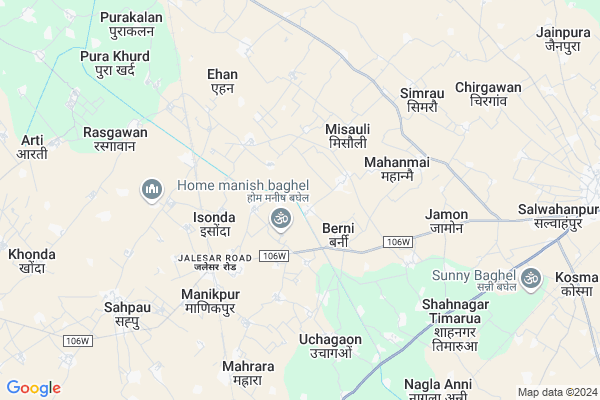
Kunjalpur
Kunjalpur Map
EDIT Map
Add Your House
 ..
..
Current Corona Virus Infected Patients Count in Etah District
| City Name | District Name | Total Covid cases |
|---|---|---|
| Etah District | Etah | 3 |
Locality Name :
Kunjalpur
( कुंजलपुर )
Block Name : Jalesar
District : Etah
State : Uttar Pradesh
Division : Aligarh
Language : Hindi and Urdu
Current Time 10:55 PM
Date: Sunday , Apr 27,2025 (IST)
Time zone: IST (UTC+5:30)
Elevation / Altitude: 171 meters. Above Seal level
Telephone Code / Std Code: 05745
Assembly constituency : Jalesar assembly constituency
Assembly MLA : Sanjeev Kumar
Lok Sabha constituency : Agra parliamentary constituency
Parliament MP : Satyapal Singh Baghel
Serpanch Name :
Pin Code : 207302
Post Office Name : Jalesar
Commodities Prices : Shadabad Market / Mandi
Kunjalpur Live Weather
Temperature: 32.6 °C
broken clouds
Humidity: 15%
Wind : 0.73 mt/sec towards NE
StationName : "Jalesar"
observed on 2 Hours Back
Temperature: 32.6 °C
broken clouds
Humidity: 15%
Wind : 0.73 mt/sec towards NE
StationName : "Jalesar"
observed on 2 Hours Back
Kunjalpur Weather Forecast for Next 5 days
28-04-2025
29.6°C to 32.6°C
broken clouds, scattered clouds
29.6°C to 32.6°C
broken clouds, scattered clouds
29-04-2025
27.4°C to 42.3°C
few clouds, clear sky
27.4°C to 42.3°C
few clouds, clear sky
30-04-2025
28.3°C to 43.1°C
clear sky
28.3°C to 43.1°C
clear sky
01-05-2025
28.7°C to 43.6°C
scattered clouds, clear sky
28.7°C to 43.6°C
scattered clouds, clear sky
02-05-2025
30.4°C to 42.1°C
broken clouds, overcast clouds, clear sky, few clouds
30.4°C to 42.1°C
broken clouds, overcast clouds, clear sky, few clouds
National Highways Reachable To Kunjalpur
Nationa High Way :NH21
Nationa High Way :NH509
Nationa High Way :NH21
Nationa High Way :NH509
Rivers Near Kunjalpur
Kali Nadi
Mathura Escape
Kali Nadi
Mathura Escape
About Kunjalpur
Correct below Info and add more info about KunjalpurKunjalpur is a Village in Jalesar Block in Etah District of Uttar Pradesh State, India. It belongs to Aligarh Division . It is located 54 KM towards west from District head quarters Etah. 9 KM from Jalesar Dehat. 327 KM from State capital Lucknow
Kunjalpur Pin code is 207302 and postal head office is Jalesar .
Berni ( 1 KM ) , Lohcha Naharpur ( 2 KM ) , Nagla Meera ( 2 KM ) , Misauli ( 3 KM ) , Bachhepura ( 3 KM ) are the nearby Villages to Kunjalpur. Kunjalpur is surrounded by Jalesar Block towards East , Hathras Block towards North , Etmadpur Block towards South , Hasayan Block towards North .
Sadabad , Hathras , Tundla , Sikandra Rao are the near by Cities to Kunjalpur.
This Place is in the border of the Etah District and Mahamaya Nagar District. Mahamaya Nagar District Hasayan is North towards this place .
Kunjalpur 2011 Census Details
Kunjalpur Local Language is Hindi. Kunjalpur Village Total population is 1438 and number of houses are 216. Female Population is 47.6%. Village literacy rate is 63.8% and the Female Literacy rate is 25.2%.
Population
| Census Parameter | Census Data |
| Total Population | 1438 |
| Total No of Houses | 216 |
| Female Population % | 47.6 % ( 685) |
| Total Literacy rate % | 63.8 % ( 918) |
| Female Literacy rate | 25.2 % ( 362) |
| Scheduled Tribes Population % | 0.0 % ( 0) |
| Scheduled Caste Population % | 7.2 % ( 103) |
| Working Population % | 25.5 % |
| Child(0 -6) Population by 2011 | 232 |
| Girl Child(0 -6) Population % by 2011 | 46.1 % ( 107) |
Kunjalpur Census More Deatils.
Politics in Kunjalpur
BJP , SP , BSP are the major political parties in this area.Polling Stations /Booths near Kunjalpur
1)P.p.nagla Mitan Purab2)P.p.nagla Daya
3)P.p.babugarh
4)P.p.lodhipur
5)P.p.dulha
HOW TO REACH Kunjalpur
By Rail
Jalesar Road Rail Way Station , Pora Rail Way Station are the very nearby railway stations to Kunjalpur.Colleges near Kunjalpur
S.b.s Inter Colleage
Address :
S.k.islamiyan Higher Secondery College
Address :
Schools in Kunjalpur
P S Kunjalpur
Address : kunjalpur , jalesar , etah , Uttar Pradesh . PIN- 207302 , Post - Jalesar
Govt Health Centers near Kunjalpur
1) SIMARAU , , ,2) SHAH NAGAR TIMRUA , , ,
3) SARAYNEEM , , ,
Hospitals in Kunjalpur,Jalesar
Government Hospital (Manikpur)
Jalesar Road; Manikpur; Uttar Pradesh 281104; India
4.9 KM distance Detail
Shree Ram Hospital And College Sahpau
Sahpau Road; Sadabad; Uttar Pradesh 204101; India
7.4 KM distance Detail
more ..
Petrol Bunks in Kunjalpur,Jalesar
HP PETROL PUMP - ANJALI FILLING STATION
ON Jalesar- Vill-shahnagar Timrua Teh-jalesar; Agra Rd; Uttar Pradesh 207302; India
8.0 KM distance Detail
KAMAL AGRO SERVICE STATION
BYE-PASS ROAD; JALESAR; ETAH; Uttar Pradesh 207302; India
11.1 KM distance Detail
more ..
Colleges in Kunjalpur,Jalesar
Lal Bahadur Shastri Inter College
Jalesar Road; Nagla Salem; Uttar Pradesh 281104; India
4.2 KM distance Detail
S.M.S Jain Inter College Jalesar Road Manikpur Hathras
Jalesar Road; Manikpur; Uttar Pradesh 281104; India
4.6 KM distance Detail
SMS Jain Inter College
Railway Road; Hathras District; Manikpur; Uttar Pradesh 281104; India
4.6 KM distance Detail
more ..
Schools in Kunjalpur,Jalesar
C.L.M Public School Nagwai Berni Etah
Nagla Meera; Uttar Pradesh 207302; India
1.8 KM distance Detail
Mahant Shri Shiv Das Maharaj Ji
Sant Seva Shanti dham Udasin aashram N Dayaram pyau; Berni; Uttar Pradesh 207302; India
2.1 KM distance Detail
F.S.inter College Nagwai
village nagwai post berani; Jalesar; Uttar Pradesh 207302; India
2.5 KM distance Detail
Electronic Shops in Kunjalpur,Jalesar
sony electronics and mobile center
Jalesar Road; Nagla Salem; Uttar Pradesh 281104; India
4.3 KM distance Detail
Balaji Furniture & electronics
Jalesar Road; Nagla Salem; Uttar Pradesh 281104; India
4.3 KM distance Detail
Governement Offices near Kunjalpur,Jalesar
Forest Colony
forest colony near roadway; bus stop; Jalesar; Uttar Pradesh; India
12.9 KM distance Detail
About Kunjalpur &
History
How to reach Kunjalpur
Tourist Places Near By Kunjalpur
Schools in Kunjalpur
Colleges in Kunjalpur
Temperature & weather of Kunjalpur
places in Kunjalpur
Kunjalpur photos
More Information
How to reach Kunjalpur
Tourist Places Near By Kunjalpur
Schools in Kunjalpur
Colleges in Kunjalpur
Temperature & weather of Kunjalpur
places in Kunjalpur
Kunjalpur photos
More Information
Village Talk
Post News or Events about this Village
Near Cities
Sadabad 18 KM near
Hathras 22 KM near
Tundla 32 KM near
Sikandra Rao 36 KM near
Sadabad 18 KM near
Hathras 22 KM near
Tundla 32 KM near
Sikandra Rao 36 KM near
Near By Taluks
Sehpau 7 KM near
Jalesar 8 KM near
Hathras 14 KM near
Hasayan 18 KM near
Sehpau 7 KM near
Jalesar 8 KM near
Hathras 14 KM near
Hasayan 18 KM near
Near By Air Ports
Kheria Airport 46 KM near
Gwalior Airport 146 KM near
Indira Gandhi International Airport 181 KM near
Pantnagar Airport 239 KM near
Kheria Airport 46 KM near
Gwalior Airport 146 KM near
Indira Gandhi International Airport 181 KM near
Pantnagar Airport 239 KM near
Near By Tourist Places
Agra 42 KM near
Aligarh 52 KM near
Vrindavan 57 KM near
Mathura 58 KM near
Fatehpur Sikri 75 KM near
Agra 42 KM near
Aligarh 52 KM near
Vrindavan 57 KM near
Mathura 58 KM near
Fatehpur Sikri 75 KM near
Near By Districts
Mahamaya Nagar 18 KM near
Agra 41 KM near
Firozabad 45 KM near
Etah 52 KM near
Mahamaya Nagar 18 KM near
Agra 41 KM near
Firozabad 45 KM near
Etah 52 KM near
Near By RailWay Station
Jalesar Road Rail Way Station 4.7 KM near
Hathras Junction Rail Way Station 20 KM near
Hathras City Rail Way Station 22 KM near
Jalesar Road Rail Way Station 4.7 KM near
Hathras Junction Rail Way Station 20 KM near
Hathras City Rail Way Station 22 KM near