| Home | City Bus | Maps | Villages | Cities | Rail | Tourist Places | School | College | Pin Codes | Corona Cases Count |
| Distance Calculator Bus Services IFSC Codes Trace Mobile Number Weather Search Place Trace IP Available Cash ATM/Banks Locate Polling Booth Report an Error contact People |
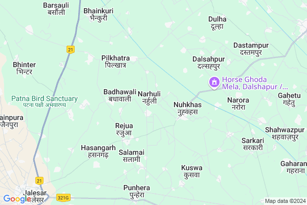
Narhuli
Narhuli Map
EDIT Map
Add Your House
 ..
..
Current Corona Virus Infected Patients Count in Etah District
| City Name | District Name | Total Covid cases |
|---|---|---|
| Etah District | Etah | 3 |
Locality Name :
Narhuli
( नारहुली )
Block Name : Awagarh
District : Etah
State : Uttar Pradesh
Division : Aligarh
Language : Hindi and Urdu
Current Time 12:26 AM
Date: Thursday , Feb 06,2025 (IST)
Time zone: IST (UTC+5:30)
Elevation / Altitude: 173 meters. Above Seal level
Telephone Code / Std Code: 05745
Assembly constituency : Jalesar assembly constituency
Assembly MLA : Sanjeev Kumar
Lok Sabha constituency : Agra parliamentary constituency
Parliament MP : Satyapal Singh Baghel
Serpanch Name :
Pin Code : 207302
Post Office Name : Jalesar
Commodities Prices : Awagarh Market / Mandi
Narhuli Live Weather
Temperature: 10.4 °C
clear sky
Humidity: 36%
Wind : 2.8 mt/sec towards NW
StationName : "Jalesar"
observed on 25 Mins Back
Temperature: 10.4 °C
clear sky
Humidity: 36%
Wind : 2.8 mt/sec towards NW
StationName : "Jalesar"
observed on 25 Mins Back
Narhuli Weather Forecast for Next 5 days
06-02-2025
9.6°C to 10.4°C
clear sky
9.6°C to 10.4°C
clear sky
07-02-2025
8.8°C to 23.9°C
clear sky
8.8°C to 23.9°C
clear sky
08-02-2025
9.4°C to 23.7°C
clear sky, scattered clouds, few clouds, broken clouds
9.4°C to 23.7°C
clear sky, scattered clouds, few clouds, broken clouds
09-02-2025
10.9°C to 26.1°C
broken clouds, scattered clouds, clear sky, few clouds
10.9°C to 26.1°C
broken clouds, scattered clouds, clear sky, few clouds
10-02-2025
12.7°C to 27.9°C
clear sky, broken clouds
12.7°C to 27.9°C
clear sky, broken clouds
Edit below overview about Narhuli
Edit below overview about Narhuli
OverView of Narhuli
Do you know about Narhuli?. write information about this place, history,origin . how to reach there ?. Share complete info about Narhuli Let world discover this place. TEMPLE- Here is a famous "Godess ambika temple" (where Rukmini worshiped to marriage God Krishna)Edit below overview about Narhuli
National Highways Reachable To Narhuli
Nationa High Way :NH21
Nationa High Way :NH34
Nationa High Way :NH21
Nationa High Way :NH34
Rivers Near Narhuli
Kali Nadi
Sengur
Kali Nadi
Sengur
About Narhuli
Narhuli is a Village in Awagarh Block in Etah District of Uttar Pradesh State, India. It belongs to Aligarh Division . It is located 31 KM towards west from District head quarters Etah. 8 KM from Awagarh Dehat. 309 KM from State capital Lucknow
Narhuli Pin code is 207302 and postal head office is Jalesar .
Balesara ( 3 KM ) , Nuhkhas ( 3 KM ) , Rejua ( 3 KM ) , Kheranuh ( 3 KM ) , Abdulhaipur ( 3 KM ) are the nearby Villages to Narhuli. Narhuli is surrounded by Jalesar Block towards west , Hasayan Block towards west , Nidhauli Kalan Block towards East , Sikandrarao Block towards North .
Sikandra Rao , Etah , Hathras , Sadabad are the near by Cities to Narhuli.
This Place is in the border of the Etah District and Firozabad District. Firozabad District Narkhi is South towards this place .
Narhuli 2011 Census Details
Narhuli Local Language is Hindi. Narhuli Village Total population is 2428 and number of houses are 400. Female Population is 45.3%. Village literacy rate is 52.1% and the Female Literacy rate is 17.6%.
Population
| Census Parameter | Census Data |
| Total Population | 2428 |
| Total No of Houses | 400 |
| Female Population % | 45.3 % ( 1100) |
| Total Literacy rate % | 52.1 % ( 1266) |
| Female Literacy rate | 17.6 % ( 427) |
| Scheduled Tribes Population % | 0.0 % ( 0) |
| Scheduled Caste Population % | 39.3 % ( 954) |
| Working Population % | 27.7 % |
| Child(0 -6) Population by 2011 | 418 |
| Girl Child(0 -6) Population % by 2011 | 45.7 % ( 191) |
Narhuli Census More Deatils.
Politics in Narhuli
BJP , SP , BSP are the major political parties in this area.Polling Stations /Booths near Narhuli
1)P.p.narhuli R.n.12)P.p.narauveer Nagar R.n.1
3)P.p.badhanpur Kunjmanpur
4)J.i.c.awagarh R.n.3 Paschim
5)J.n.m.v.noohkhas
HOW TO REACH Narhuli
By Rail
Kuswa Rail Way Station is the very nearby railway stations to Narhuli.Colleges near Narhuli
Scs Inter College Naraura Etah
Address :
Dr. Ramsingh And Rajbeti Inter College
Address :
Scs Inter College Naraura
Address :
Chet Ram Singh Inter Collge Naura Etah
Address :
Schools in Narhuli
Rashtriya Madhyamik Vidyalaya
Address : narhuli , awagarh , etah , Uttar Pradesh . PIN- 207302 , Post - Jalesar
Govt Health Centers near Narhuli
1) NARAURA , , ,2) Northa , , ,
3) Pachao , , ,
Sub Villages in Narhuli
Hospitals in Narhuli,Awagarh
Maa Vaishno Medical
Sadabad Jalesar Awagarh Marg; Punhera; Uttar Pradesh 207302; India
7.7 KM distance Detail
Shri Ram Hospital
Mahavir Ganj; maharara; Chowk; Jalesar; Uttar Pradesh 207302; India
11.9 KM distance Detail
more ..
Petrol Bunks in Narhuli,Awagarh
Ravi Gas Service Sarai Rajnagar Jalesar
RajnagarJalesar; Sikandra Rao - Jalesar Road; Sarai Rajnagar; Uttar Pradesh 207302; India
10.4 KM distance Detail
more ..
Colleges in Narhuli,Awagarh
Kunwar Shakoor Khan Degree College
Sikandrarao; Jalesar Road; Sakra; Etah; Uttar Pradesh 207302; India
10.0 KM distance Detail
more ..
Police Stations near Narhuli,Awagarh
Police Station Awagarh
Sadabad Jalesar Awagarh Marg; Awagarh; Uttar Pradesh 207301; India
14.6 KM distance Detail
Governement Offices near Narhuli,Awagarh
Forest Colony
forest colony near roadway; bus stop; Jalesar; Uttar Pradesh; India
11.8 KM distance Detail
About Narhuli &
History
How to reach Narhuli
Tourist Places Near By Narhuli
Schools in Narhuli
Colleges in Narhuli
Temperature & weather of Narhuli
places in Narhuli
Narhuli photos
More Information
How to reach Narhuli
Tourist Places Near By Narhuli
Schools in Narhuli
Colleges in Narhuli
Temperature & weather of Narhuli
places in Narhuli
Narhuli photos
More Information
Village Talk
Post News or Events about this Village
Near Cities
Sikandra Rao 21 KM near
Etah 30 KM near
Hathras 38 KM near
Sadabad 40 KM near
Sikandra Rao 21 KM near
Etah 30 KM near
Hathras 38 KM near
Sadabad 40 KM near
Near By Taluks
Awagarh 7 KM near
Jalesar 14 KM near
Hasayan 16 KM near
Nidhauli Kalan 17 KM near
Awagarh 7 KM near
Jalesar 14 KM near
Hasayan 16 KM near
Nidhauli Kalan 17 KM near
Near By Air Ports
Kheria Airport 66 KM near
Gwalior Airport 154 KM near
Indira Gandhi International Airport 190 KM near
Pantnagar Airport 221 KM near
Kheria Airport 66 KM near
Gwalior Airport 154 KM near
Indira Gandhi International Airport 190 KM near
Pantnagar Airport 221 KM near
Near By Tourist Places
Aligarh 55 KM near
Agra 60 KM near
Vrindavan 77 KM near
Mathura 79 KM near
Fatehpur Sikri 97 KM near
Aligarh 55 KM near
Agra 60 KM near
Vrindavan 77 KM near
Mathura 79 KM near
Fatehpur Sikri 97 KM near
Near By Districts
Etah 30 KM near
Mahamaya Nagar 40 KM near
Kanshiram Nagar 44 KM near
Firozabad 47 KM near
Etah 30 KM near
Mahamaya Nagar 40 KM near
Kanshiram Nagar 44 KM near
Firozabad 47 KM near
Near By RailWay Station
Kuswa Rail Way Station 7.5 KM near
Hathras Junction Rail Way Station 30 KM near
Hathras City Rail Way Station 38 KM near
Kuswa Rail Way Station 7.5 KM near
Hathras Junction Rail Way Station 30 KM near
Hathras City Rail Way Station 38 KM near