| Home | City Bus | Maps | Villages | Cities | Rail | Tourist Places | School | College | Pin Codes | Corona Cases Count |
| Distance Calculator Bus Services IFSC Codes Trace Mobile Number Weather Search Place Trace IP Available Cash ATM/Banks Locate Polling Booth Report an Error contact People |
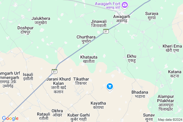
Khatauta
Khatauta Map
EDIT Map
Add Your House
 ..
..
Current Corona Virus Infected Patients Count in Etah District
| City Name | District Name | Total Covid cases |
|---|---|---|
| Etah District | Etah | 3 |
Locality Name :
Khatauta
( खटौटा )
Block Name : Awagarh
District : Etah
State : Uttar Pradesh
Division : Aligarh
Language : Hindi and Urdu
Current Time 01:06 PM
Date: Friday , Apr 25,2025 (IST)
Time zone: IST (UTC+5:30)
Elevation / Altitude: 173 meters. Above Seal level
Telephone Code / Std Code: 05745
Assembly constituency : Jalesar assembly constituency
Assembly MLA : Sanjeev Kumar
Lok Sabha constituency : Agra parliamentary constituency
Parliament MP : Satyapal Singh Baghel
Serpanch Name :
Pin Code : 207301
Post Office Name : Awagarh
Alternate Village Name : Khatota
Commodities Prices : Awagarh Market / Mandi
Khatauta Live Weather
Temperature: 41.8 °C
clear sky
Humidity: 5%
Wind : 4.9 mt/sec towards W
StationName : "Jalesar"
observed on 1 Hours Back
Temperature: 41.8 °C
clear sky
Humidity: 5%
Wind : 4.9 mt/sec towards W
StationName : "Jalesar"
observed on 1 Hours Back
Khatauta Weather Forecast for Next 5 days
26-04-2025
31.6°C to 43.1°C
clear sky, broken clouds, scattered clouds
31.6°C to 43.1°C
clear sky, broken clouds, scattered clouds
27-04-2025
29.8°C to 43.6°C
scattered clouds, broken clouds, overcast clouds
29.8°C to 43.6°C
scattered clouds, broken clouds, overcast clouds
28-04-2025
29.9°C to 42.5°C
broken clouds, overcast clouds, scattered clouds, few clouds
29.9°C to 42.5°C
broken clouds, overcast clouds, scattered clouds, few clouds
29-04-2025
28.2°C to 43.0°C
clear sky
28.2°C to 43.0°C
clear sky
30-04-2025
27.8°C to 40.6°C
clear sky
27.8°C to 40.6°C
clear sky
National Highways Reachable To Khatauta
Nationa High Way :NH21
Nationa High Way :NH34
Nationa High Way :NH21
Nationa High Way :NH34
Rivers Near Khatauta
Kali Nadi
Sengur
Kali Nadi
Sengur
About Khatauta
Correct below Info and add more info about KhatautaKhatauta is a Village in Awagarh Block in Etah District of Uttar Pradesh State, India. It belongs to Aligarh Division . It is located 32 KM towards west from District head quarters Etah. 10 KM from Awagarh Dehat. 298 KM from State capital Lucknow
Khatauta Pin code is 207301 and postal head office is Awagarh .
Tisar ( 3 KM ) , Babarpur ( 4 KM ) , Burrakalan ( 4 KM ) , Jinawali ( 4 KM ) , Jarani Khurd Kalan ( 5 KM ) are the nearby Villages to Khatauta. Khatauta is surrounded by Narkhi Block towards South , Eka Block towards East , Jalesar Block towards west , Nidhauli Kalan Block towards North .
Firozabad , Etah , Tundla , Sikandra Rao are the near by Cities to Khatauta.
This Place is in the border of the Etah District and Firozabad District. Firozabad District Narkhi is South towards this place .
Khatauta 2011 Census Details
Khatauta Local Language is Hindi. Khatauta Village Total population is 4074 and number of houses are 706. Female Population is 47.1%. Village literacy rate is 54.7% and the Female Literacy rate is 21.1%.
Population
| Census Parameter | Census Data |
| Total Population | 4074 |
| Total No of Houses | 706 |
| Female Population % | 47.1 % ( 1919) |
| Total Literacy rate % | 54.7 % ( 2228) |
| Female Literacy rate | 21.1 % ( 859) |
| Scheduled Tribes Population % | 0.0 % ( 0) |
| Scheduled Caste Population % | 22.9 % ( 934) |
| Working Population % | 33.9 % |
| Child(0 -6) Population by 2011 | 693 |
| Girl Child(0 -6) Population % by 2011 | 46.8 % ( 324) |
Khatauta Census More Deatils.
Politics in Khatauta
BJP , SP , BSP are the major political parties in this area.Polling Stations /Booths near Khatauta
1)P.p.himmatpur2)P.p.khanpur
3)P.p.nagla Raja
4)P.p.nijampur
5)P.p.nagla Rana
HOW TO REACH Khatauta
By Rail
Awa Garh Rail Way Station , Kuswa Rail Way Station are the very nearby railway stations to Khatauta.Colleges near Khatauta
Scs Inter College Naraura Etah
Address :
Dr. Ramsingh And Rajbeti Inter College
Address :
Scs Inter College Naraura
Address :
Chet Ram Singh Inter Collge Naura Etah
Address :
Schools in Khatauta
Ups Khatauta
Address : khatauta , awagarh , etah , Uttar Pradesh . PIN- 207301 , Post - Awagarh
Govt Health Centers near Khatauta
1) AWAGARH , , ,2) Naya Bans , Sub Center , ,
3) AWAGARH , , ,
Hospitals in Khatauta,Awagarh
Dr sudhama
Tundla - Awagarh Road; Fariha - Awagarh Road; Uttar Pradesh; India
5.1 KM distance Detail
more ..
Petrol Bunks in Khatauta,Awagarh
Essar DHANYA KUMAR JAIN PETROLEUM
Firozabad - Awagarh Road; Churthara; Uttar Pradesh 207301; India
3.7 KM distance Detail
Surajmukhi Filling Station (Indianoil)
Firozabad - Awagarh Road; Churthara; Uttar Pradesh 207301; India
5.7 KM distance Detail
HP PETROL PUMP - VIPNESH KUMAR AND COMPANY
Tundla Etah Road Awagarh Tehsil Jalesar; Agra; Uttar Pradesh 207300; India
6.7 KM distance Detail
HP PETROL PUMP - MAA JAGDAMBA HP FILLING STATION
Mohanpur MOD Etah; Agra; Uttar Pradesh 207301; India
7.4 KM distance Detail
more ..
Colleges in Khatauta,Awagarh
Sri Saheb Singh Inter College
Churthara; Etah; SH-31; Tundla Etah Road; Tundla; Tundla; Uttar Pradesh 207301; India
2.0 KM distance Detail
AWAGARH TECHNICAL INSTITUTE
Sahnaua Road; Near CANARA Bank; Awagarh; Etah; Uttar Pradesh 207001; India
7.0 KM distance Detail
more ..
Schools in Khatauta,Awagarh
Dr.Sanway Singh Inter College Awagarh Etah
Khatauta; Uttar Pradesh 207301; India
0.4 KM distance Detail
Samle Singh Inter Colleg Todarpur Awagarh Etah
Khatauta; Uttar Pradesh 207301; India
1.8 KM distance Detail
maa vaishno devi coaching centre awagarh
Tundla - Awagarh Road; Awagarh; Uttar Pradesh 207301; India
2.1 KM distance Detail
maa vaishno devi coaching centre awagarh
207301; Awagarh; Mahatma Gandhi Rd; Opp. Anjna Cinema; Kar Kunj Chauraha; Khandari; Agra; Uttar Pradesh 282002; India
2.4 KM distance Detail
Electronic Shops in Khatauta,Awagarh
Maa Kaila Devi Furniture And Electronics
Awagarh; Uttar Pradesh 207301; India
6.5 KM distance Detail
Raza Rediretar
Firozabad - Awagarh Road; Churthara; Uttar Pradesh 207301; India
6.5 KM distance Detail
Super Markets in Khatauta,Awagarh
Hariom Varshney Kirana Store
Sikandra Rao - Jalesar - Awagarh Road; Awagarh; Uttar Pradesh 207301; India
6.9 KM distance Detail
Police Stations near Khatauta,Awagarh
Police Station Awagarh
Sadabad Jalesar Awagarh Marg; Awagarh; Uttar Pradesh 207301; India
7.2 KM distance Detail
Governement Offices near Khatauta,Awagarh
Forest Colony
forest colony near roadway; bus stop; Jalesar; Uttar Pradesh; India
18.5 KM distance Detail
About Khatauta &
History
How to reach Khatauta
Tourist Places Near By Khatauta
Schools in Khatauta
Colleges in Khatauta
Temperature & weather of Khatauta
places in Khatauta
Khatauta photos
More Information
How to reach Khatauta
Tourist Places Near By Khatauta
Schools in Khatauta
Colleges in Khatauta
Temperature & weather of Khatauta
places in Khatauta
Khatauta photos
More Information
Village Talk
Post News or Events about this Village
Near Cities
Firozabad 30 KM near
Etah 30 KM near
Tundla 33 KM near
Sikandra Rao 37 KM near
Firozabad 30 KM near
Etah 30 KM near
Tundla 33 KM near
Sikandra Rao 37 KM near
Near By Taluks
Awagarh 10 KM near
Narkhi 16 KM near
Eka 16 KM near
Jalesar 20 KM near
Awagarh 10 KM near
Narkhi 16 KM near
Eka 16 KM near
Jalesar 20 KM near
Near By Air Ports
Kheria Airport 61 KM near
Gwalior Airport 139 KM near
Indira Gandhi International Airport 206 KM near
Pantnagar Airport 232 KM near
Kheria Airport 61 KM near
Gwalior Airport 139 KM near
Indira Gandhi International Airport 206 KM near
Pantnagar Airport 232 KM near
Near By Tourist Places
Agra 56 KM near
Aligarh 72 KM near
Vrindavan 86 KM near
Mathura 86 KM near
Fatehpur Sikri 95 KM near
Agra 56 KM near
Aligarh 72 KM near
Vrindavan 86 KM near
Mathura 86 KM near
Fatehpur Sikri 95 KM near
Near By Districts
Etah 30 KM near
Firozabad 31 KM near
Mahamaya Nagar 46 KM near
Kanshiram Nagar 54 KM near
Etah 30 KM near
Firozabad 31 KM near
Mahamaya Nagar 46 KM near
Kanshiram Nagar 54 KM near
Near By RailWay Station
Awa Garh Rail Way Station 8.9 KM near
Firozabad Rail Way Station 32 KM near
Tundla Junction Rail Way Station 33 KM near
Awa Garh Rail Way Station 8.9 KM near
Firozabad Rail Way Station 32 KM near
Tundla Junction Rail Way Station 33 KM near