| Home | City Bus | Maps | Villages | Cities | Rail | Tourist Places | School | College | Pin Codes | Corona Cases Count |
| Distance Calculator Bus Services IFSC Codes Trace Mobile Number Weather Search Place Trace IP Available Cash ATM/Banks Locate Polling Booth Report an Error contact People |
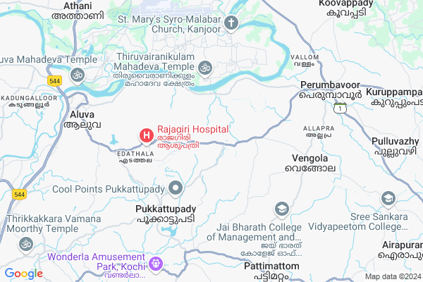
State Highway 16, Perumbavoor
State Highway 16, Perumbavoor Map
EDIT Map
Add Your House
 ..
..
Current Corona Virus Infected Patients Count in Ernakulam District
| City Name | District Name | Total Covid cases |
|---|---|---|
| Ernakulam District | Ernakulam | 15 |
| Kochi | Ernakulam | 9 |
Village Name :
State Highway 16, Perumbavoor
( സ്റ്റേറ്റ് ഹൈവേ ൧൬ പെരുമ്പാവൂർ )
Block Name : Vazhakkulam
District : Ernakulam
State : Kerala
Division : Central Kerala
Language : Malayalam and Tamil, English And Hindi.
Current Time 03:25 PM
Date: Wednesday , Feb 05,2025 (IST)
Time zone: IST (UTC+5:30)
Elevation / Altitude: 12 meters. Above Seal level
Telephone Code / Std Code: 0484
Ward : Ward
Assembly constituency : Kunnathunad assembly constituency
Assembly MLA : Adv. P.V.Sreenijin
Lok Sabha constituency : Chalakudy parliamentary constituency
Parliament MP : BENNY BEHANAN
Pin Code : 683547
Post Office Name : Mudikkal
Commodities Prices : Perumbavoor Market / Mandi
State Highway 16, Perumbavoor Live Weather
Temperature: 31.9 °C
haze
Humidity: 37%
Wind : 1.03 mt/sec towards N
StationName : "Aluva"
observed on 2 Hours Back
Temperature: 31.9 °C
haze
Humidity: 37%
Wind : 1.03 mt/sec towards N
StationName : "Aluva"
observed on 2 Hours Back
State Highway 16, Perumbavoor Weather Forecast for Next 5 days
06-02-2025
20.6°C to 34.9°C
few clouds, clear sky
20.6°C to 34.9°C
few clouds, clear sky
07-02-2025
20.0°C to 34.0°C
clear sky, scattered clouds, few clouds, broken clouds
20.0°C to 34.0°C
clear sky, scattered clouds, few clouds, broken clouds
08-02-2025
20.0°C to 35.4°C
clear sky, broken clouds, scattered clouds, few clouds
20.0°C to 35.4°C
clear sky, broken clouds, scattered clouds, few clouds
09-02-2025
18.8°C to 35.4°C
scattered clouds, few clouds
18.8°C to 35.4°C
scattered clouds, few clouds
10-02-2025
18.9°C to 34.6°C
broken clouds, scattered clouds, clear sky
18.9°C to 34.6°C
broken clouds, scattered clouds, clear sky
National Highways Reachable To State Highway 16, Perumbavoor
Nationa High Way :NH544
Nationa High Way :NH966A
Nationa High Way :NH544
Nationa High Way :NH966A
Rivers Near State Highway 16, Perumbavoor
കാളിയാർ :Kaliyar River
കാളിയാർ :Kaliyar River
About State Highway 16, Perumbavoor
Correct below Info and add more info about State Highway 16, PerumbavoorState Highway 16, Perumbavoor is a Locality in Vazhakkulam City in Kerala State, India. It is belongs to Central Kerala Division .
State Highway 16, Perumbavoor Pin code is 683547 and postal head office is Mudikkal .
Perumbavoor , Kochi , Kothamangalam , Chendamangalam are the nearby Cities to Vazhakkulam.
Demographics of State Highway 16, Perumbavoor
Malayalam is the Local Language here.Politics in State Highway 16, Perumbavoor
CPM , Indian National Congress , CPI(M) , INC are the major political parties in this area.Polling Stations /Booths near State Highway 16, Perumbavoor
1)Govt. High School (east Wing) South Vazhakulam2)Govt. Basic School Kokkappilly
3)Bethlahem Girls High School Njaralloor
4)Guardian Angel English Medium School Mannoor(west Wing)
5)Govt. Ups (north Wing)
HOW TO REACH State Highway 16, Perumbavoor
By Rail
Chovvara Rail Way Station , Aluva Rail Way Station are the very nearby railway station to State Highway 16, Perumbavoor.Hospitals in State Highway 16, Perumbavoor,Vazhakkulam
George Dr M I
Mudickal; Vazhakkulam; Mudickal; Ernakulam; Kerala 680543; India
0.6 KM distance Detail
more ..
Petrol Bunks in State Highway 16, Perumbavoor,Vazhakkulam
ENDURA PETROLEUM
Chembarakky Central; SH 16; Vazhakkulam; Kerala 683105; India
1.3 KM distance Detail
Kadavil Petroleum Agencies(Petrol Pump Pattipara)
SH 16; Vazhakkulam; Ponjassery; Kerala 683547; India
2.0 KM distance Detail
more ..
Colleges in State Highway 16, Perumbavoor,Vazhakkulam
Holy Crescent College of Architecture
Malipuram Nagar; Bavapady Rd; South Vazhakulam; Aluva; Kerala 683105; India
1.6 KM distance Detail
Azharul Uloom College of Islamic and Linguistic Studies
Chalakkal East; Keezhmad; Kerala 683105; India
3.1 KM distance Detail
more ..
Schools in State Highway 16, Perumbavoor,Vazhakkulam
Smitha Pre Primary Teachers Training Institute
Chembaraky; Ernakulam; SH-16; Aluva Munnar Road; Munnar; Perumbavoor; Perumbavoor; Kerala 683105; India
1.3 KM distance Detail
Jamia Hassania Public School
Aluva Munnar Road; South Vazhakkulam; Aluva; Kerala 683105; India
1.5 KM distance Detail
Super Markets in State Highway 16, Perumbavoor,Vazhakkulam
Akbar Super Market
Edappally - Pukkattupady Rd; Edathala P.O; Pukkattupady; Kochi; Kerala 682021; India
5.1 KM distance Detail
Local Parks in State Highway 16, Perumbavoor,Vazhakkulam
thenoor parappuram
Parappuram Mudikkal kadavu Rd; Kizhakkumbhagom; Kerala 683575; India
5.6 KM distance Detail
Police Stations near State Highway 16, Perumbavoor,Vazhakkulam
Thadiyittaparambu Police Station
Aluva - Munnar Rd; Vazhakulam; Kerala 683105; India
1.3 KM distance Detail
Police Telecommunication office
Pipe Line Rd; PWD Quarters; Periyar Nagar; Aluva; Kerala 683101; India
7.7 KM distance Detail
Governement Offices near State Highway 16, Perumbavoor,Vazhakkulam
Village Office Vazhakulam
Keenpuram; Keenpady; Ernakulam; SH-16; Aluva Munnar Road; Munnar Road; Perumbavoor; Perumbavoor; Kerala 683105; India
0.1 KM distance Detail
About State Highway 16, Perumbavoor &
History
How to reach State Highway 16, Perumbavoor
Tourist Places Near By State Highway 16, Perumbavoor
Schools in State Highway 16, Perumbavoor
Colleges in State Highway 16, Perumbavoor
Temperature & weather of State Highway 16, Perumbavoor
places in State Highway 16, Perumbavoor
State Highway 16, Perumbavoor photos
More Information
Locality Talk
Post News or Events about this Locality
Near Cities
Perumbavoor 10 KM near
Kochi 26 KM near
Kothamangalam 27 KM near
Chendamangalam 28 KM near
Perumbavoor 10 KM near
Kochi 26 KM near
Kothamangalam 27 KM near
Chendamangalam 28 KM near
Near By Taluks
Vazhakkulam 0 KM near
Vadavucode 11 KM near
Koovappady 11 KM near
Parakkadav 13 KM near
Vazhakkulam 0 KM near
Vadavucode 11 KM near
Koovappady 11 KM near
Parakkadav 13 KM near
Near By Air Ports
Kochi Airport 8 KM near
Peelamedu Airport 139 KM near
Calicut Airport 142 KM near
Madurai Airport 207 KM near
Kochi Airport 8 KM near
Peelamedu Airport 139 KM near
Calicut Airport 142 KM near
Madurai Airport 207 KM near
Near By Tourist Places
Kalady 9 KM near
valpari 25 KM near
Kochi 27 KM near
Athirappilly 29 KM near
Parambikulam Wildlife Sanctuary 49 KM near
Kalady 9 KM near
valpari 25 KM near
Kochi 27 KM near
Athirappilly 29 KM near
Parambikulam Wildlife Sanctuary 49 KM near
Near By Districts
Ernakulam 27 KM near
Thrissur 59 KM near
Kottayam 63 KM near
Idukki 74 KM near
Ernakulam 27 KM near
Thrissur 59 KM near
Kottayam 63 KM near
Idukki 74 KM near
Near By RailWay Station
Chovvara Rail Way Station 8.3 KM near
Aluva Rail Way Station 8.5 KM near
Angamaly For Kalady Rail Way Station 12 KM near
Chovvara Rail Way Station 8.3 KM near
Aluva Rail Way Station 8.5 KM near
Angamaly For Kalady Rail Way Station 12 KM near