| Home | City Bus | Maps | Villages | Cities | Rail | Tourist Places | School | College | Pin Codes | Corona Cases Count |
| Distance Calculator Bus Services IFSC Codes Trace Mobile Number Weather Search Place Trace IP Available Cash ATM/Banks Locate Polling Booth Report an Error contact People |
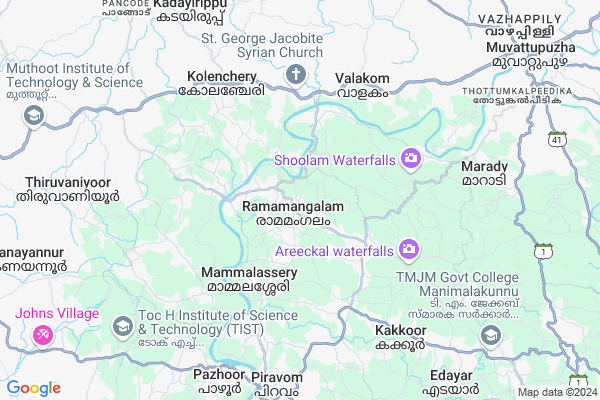
Ramamangalam Map
EDIT Map
Add Your House
 ..
..
Current Corona Virus Infected Patients Count in Ernakulam District
| City Name | District Name | Total Covid cases |
|---|---|---|
| Ernakulam District | Ernakulam | 15 |
| Kochi | Ernakulam | 9 |
Locality Name :
Ramamangalam
( രാമമംഗലം )
Block Name : Pampakuda
District : Ernakulam
State : Kerala
Division : Central Kerala
Language : Malayalam and Tamil, English And Hindi.
Current Time 07:37 AM
Date: Saturday , Apr 26,2025 (IST)
Time zone: IST (UTC+5:30)
Elevation / Altitude: 12 meters. Above Seal level
Telephone Code / Std Code: 0485
Assembly constituency : Piravom assembly constituency
Assembly MLA : Anoop Jacob
Lok Sabha constituency : Kottayam parliamentary constituency
Parliament MP : Thomas Chazhikadan
Serpanch Name :
Pin Code : 686663
Post Office Name : Ramamangalam
Commodities Prices : Piravam Market / Mandi
Ramamangalam Live Weather
Temperature: 25.7 °C
overcast clouds
Humidity: 94%
Wind : 0.8 mt/sec towards N
StationName : "Piravam"
observed on 2 Hours Back
Temperature: 25.7 °C
overcast clouds
Humidity: 94%
Wind : 0.8 mt/sec towards N
StationName : "Piravam"
observed on 2 Hours Back
Ramamangalam Weather Forecast for Next 5 days
27-04-2025
25.6°C to 34.2°C
light rain
25.6°C to 34.2°C
light rain
28-04-2025
25.4°C to 32.0°C
light rain, overcast clouds
25.4°C to 32.0°C
light rain, overcast clouds
29-04-2025
25.1°C to 33.6°C
overcast clouds, broken clouds, light rain
25.1°C to 33.6°C
overcast clouds, broken clouds, light rain
30-04-2025
23.2°C to 33.5°C
light rain, overcast clouds, moderate rain
23.2°C to 33.5°C
light rain, overcast clouds, moderate rain
National Highways Reachable To Ramamangalam
Nationa High Way :NH966A
Nationa High Way :NH185
Nationa High Way :NH966A
Nationa High Way :NH185
Rivers Near Ramamangalam
കാളിയാർ :Kaliyar River
കാളിയാർ :Kaliyar River
About Ramamangalam
Correct below Info and add more info about RamamangalamRamamangalam is a Village in Pampakuda Block in Ernakulam District of Kerala State, India. It belongs to Central Kerala Division . It is located 30 KM towards East from District head quarters Kakkanad. 7 KM from Pampakuda. 197 KM from State capital Thiruvananthapuram
Ramamangalam Pin code is 686663 and postal head office is Ramamangalam .
Poothrikka ( 5 KM ) , Valakom ( 6 KM ) , Maneed ( 6 KM ) , Piravom ( 8 KM ) , Marady ( 8 KM ) are the nearby Villages to Ramamangalam. Ramamangalam is surrounded by Vadavucode Block towards North , Muvattupuzha Block towards East , Mulanthuruthy Block towards west , Kaduthuruthy Block towards South .
Muvattupuzha , Perumbavoor , Kothamangalam , Aroor are the near by Cities to Ramamangalam.
This Place is in the border of the Ernakulam District and Kottayam District. Kottayam District Uzhavoor is South towards this place . Also it is in the Border of other district Idukki .
Ramamangalam 2011 Census Details
Ramamangalam Local Language is Malayalam. Ramamangalam Village Total population is 10035 and number of houses are 2602. Female Population is 49.8%. Village literacy rate is 88.2% and the Female Literacy rate is 43.3%.
Population
| Census Parameter | Census Data |
| Total Population | 10035 |
| Total No of Houses | 2602 |
| Female Population % | 49.8 % ( 4999) |
| Total Literacy rate % | 88.2 % ( 8847) |
| Female Literacy rate | 43.3 % ( 4347) |
| Scheduled Tribes Population % | 0.5 % ( 50) |
| Scheduled Caste Population % | 12.3 % ( 1233) |
| Working Population % | 43.2 % |
| Child(0 -6) Population by 2011 | 744 |
| Girl Child(0 -6) Population % by 2011 | 49.3 % ( 367) |
Ramamangalam Census More Deatils.
Politics in Ramamangalam
KEC (J) , CPM , KC(M) , JD(S) , Kerala Congress (M) , KEC(J) , CPI (M) , KEC(M) are the major political parties in this area.Polling Stations /Booths near Ramamangalam
1)Govt.vocational Higher Secondary School Maneed2)Govt. High School Ooramana
3)Govt. L.p. School Ramamangalam
4)Govt. High School Pulikkamali
5)Georgian Academy E.m School Thiruvankulam
HOW TO REACH Ramamangalam
By Rail
There is no railway station near to Ramamangalam in less than 10 km.Colleges near Ramamangalam
Yeldo Mar Baselios College
Address :
Marian Academy Of Management Studies
Address :
Mar Athanasius College Of Arts And Science
Address :
St. Alberts College Sac
Address : Banerjee Road
ernakulam
Kochin Academy Of Research & Education
Address : Kare Campus , Rajthaara Chambers, Thammanam Road, Palarivattom
ernakulam, Kochi
Schools in Ramamangalam
Ghss Mammalassery
Address : ramamangalam , piravom , ernakulam , Kerala . PIN- 686663 , Post - Ramamangalam
Ghss Oormana
Address : ramamangalam , piravom , ernakulam , Kerala . PIN- 686730
Ghs Ramamangalam
Address : ramamangalam , piravom , ernakulam , Kerala . PIN- 686663 , Post - Ramamangalam
Govt Health Centers near Ramamangalam
1) PHC CHITTAR , Chittar Community health centre , Chittar Maniyar road , police stationSub Villages in Ramamangalam
Hospitals in Ramamangalam,Pampakuda
Mangachalil Homeo Clinic
Ramamangalam - Ooramana Road; Vettithara; Ramamangalam; Kerala 686663; India
1.2 KM distance Detail
Community Health Centre Ramamangalam
Ramamangalam - Thodupuzha Rd; Kottappuram; Ramamangalam; Kerala 686663; India
1.3 KM distance Detail
Ramamangalam Primary Health Centre
Ramamangalam; Ramamangalam; Kerala 686667; India
1.4 KM distance Detail
more ..
Petrol Bunks in Ramamangalam,Pampakuda
Indian Oil Fuel (KARAVATTETHOTATHIL AUTO FUELS)
Ramamangalam - Thodupuzha Rd; Ramamangalam; Kerala 686663; India
2.3 KM distance Detail
Hindustan Petroleum
Muvattupuzha - Pampakuda Road; Pampakuda; Kerala 686667; India
3.5 KM distance Detail
Indian Oil Chirackapadikkal Fuels
Muvattupuzha - Pampakuda Rd; Pampakuda; Kerala 686667; India
3.9 KM distance Detail
JOHAN Fuels ; North Piramadom
Muvattupuzha - Pampakkuda - Mamalassery Rd; Piramadam; Kerala 686667; India
4.5 KM distance Detail
more ..
Colleges in Ramamangalam,Pampakuda
Stella Maris College of Commerce and Industry
Kizhumuri; Ramamangalam; Kerala 686663; India
2.4 KM distance Detail
Whitemart Good night Agency; Puthiyakunnel Complex
Muvattupuzha - Pampakuda Rd; Pampakuda; Kerala 686667; India
3.4 KM distance Detail
Baselios Poulose Second College
Muvattupuzha - Pampakkuda - Mamalassery Rd; Piramadam; Kerala 686667; India
4.7 KM distance Detail
more ..
Schools in Ramamangalam,Pampakuda
LP School Ramamangalam
Ramamangalam - Thodupuzha Rd; Ramamangalam; Kerala 686663; India
2.2 KM distance Detail
Electronic Shops in Ramamangalam,Pampakuda
Kanjirathinkal Electricals
Ramamangalam - Thodupuzha Rd; Ramamangalam; Kerala 686663; India
2.9 KM distance Detail
Super Markets in Ramamangalam,Pampakuda
Laabham Super Market
Ramamangalam - Thodupuzha Rd; Ramamangalam; Kerala 686663; India
2.9 KM distance Detail
Police Stations near Ramamangalam,Pampakuda
Police Station
Ramamangalam - Thodupuzha Rd; Ramamangalam; Kerala 686663; India
2.4 KM distance Detail
Piravom Police Station
Pump-Police Station Link Rd; Piravom; Kerala 686664; India
9.8 KM distance Detail
Governement Offices near Ramamangalam,Pampakuda
Ramamangalam Panchayath Office.
Ramamangalam - Thodupuzha Road; Ramamangalam; Kerala 686663; India
2.4 KM distance Detail
Akshaya E Centre-community Hall
Pampakuda Alumcheryppady Road; Pampakuda; Kerala 686667; India
3.8 KM distance Detail
About Ramamangalam &
History
How to reach Ramamangalam
Tourist Places Near By Ramamangalam
Schools in Ramamangalam
Colleges in Ramamangalam
Temperature & weather of Ramamangalam
places in Ramamangalam
Ramamangalam photos
More Information
How to reach Ramamangalam
Tourist Places Near By Ramamangalam
Schools in Ramamangalam
Colleges in Ramamangalam
Temperature & weather of Ramamangalam
places in Ramamangalam
Ramamangalam photos
More Information
Village Talk
Post News or Events about this Village
Near Cities
Muvattupuzha 14 KM near
Perumbavoor 21 KM near
Kothamangalam 24 KM near
Aroor 25 KM near
Muvattupuzha 14 KM near
Perumbavoor 21 KM near
Kothamangalam 24 KM near
Aroor 25 KM near
Near By Taluks
Pampakuda 7 KM near
Vadavucode 10 KM near
Muvattupuzha 12 KM near
Mulanthuruthy 15 KM near
Pampakuda 7 KM near
Vadavucode 10 KM near
Muvattupuzha 12 KM near
Mulanthuruthy 15 KM near
Near By Air Ports
Kochi Airport 30 KM near
Peelamedu Airport 151 KM near
Calicut Airport 163 KM near
Trivandrum International Airport 189 KM near
Kochi Airport 30 KM near
Peelamedu Airport 151 KM near
Calicut Airport 163 KM near
Trivandrum International Airport 189 KM near
Near By Tourist Places
Kochi 28 KM near
Kalady 29 KM near
valpari 36 KM near
Athirappilly 43 KM near
Kottayam 44 KM near
Kochi 28 KM near
Kalady 29 KM near
valpari 36 KM near
Athirappilly 43 KM near
Kottayam 44 KM near
Near By Districts
Ernakulam 29 KM near
Kottayam 43 KM near
Alappuzha 58 KM near
Idukki 58 KM near
Ernakulam 29 KM near
Kottayam 43 KM near
Alappuzha 58 KM near
Idukki 58 KM near
Near By RailWay Station
Piravom Road Rail Way Station 14 KM near
Thrippunithura Rail Way Station 18 KM near
Piravom Road Rail Way Station 14 KM near
Thrippunithura Rail Way Station 18 KM near