| Home | City Bus | Maps | Villages | Cities | Rail | Tourist Places | School | College | Pin Codes | Corona Cases Count |
| Distance Calculator Bus Services IFSC Codes Trace Mobile Number Weather Search Place Trace IP Available Cash ATM/Banks Locate Polling Booth Report an Error contact People |
Sathrapady
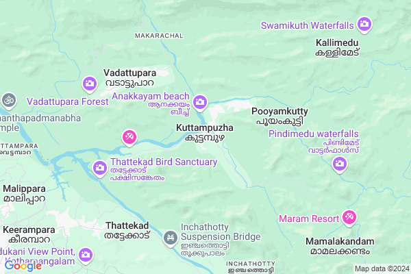
Sathrapady Map
EDIT Map
Add Your House
 ..
..
Current Corona Virus Infected Patients Count in Ernakulam District
| City Name | District Name | Total Covid cases |
|---|---|---|
| Ernakulam District | Ernakulam | 15 |
| Kochi | Ernakulam | 9 |
Locality Name :
Sathrapady
( സത്രപ്പാടി )
Block Name : Kothamangalam
District : Ernakulam
State : Kerala
Division : Central Kerala
Language : Malayalam and Tamil, English And Hindi.
Current Time 02:11 PM
Date: Tuesday , Apr 29,2025 (IST)
Time zone: IST (UTC+5:30)
Elevation / Altitude: 12 meters. Above Seal level
Telephone Code / Std Code: 0485
Assembly constituency : Kothamangalam assembly constituency
Assembly MLA :
Lok Sabha constituency : Idukki parliamentary constituency
Parliament MP :
Serpanch Name :
Pin Code : 686681
Post Office Name : Chelad Junction
Main Village Name : Kuttampuzha
Commodities Prices : Kothamangalam Market / Mandi
National Highways Reachable To Sathrapady
Nationa High Way :NH544
Nationa High Way :NH966A
Nationa High Way :NH544
Nationa High Way :NH966A
Rivers Near Sathrapady
കാളിയാർ :Kaliyar River
കാളിയാർ :Kaliyar River
About Sathrapady
Correct below Info and add more info about SathrapadySathrapady is a small Village/hamlet in Kothamangalam Block in Ernakulam District of Kerala State, India. It comes under Kuttampuzha Panchayath. It belongs to Central Kerala Division . It is located 67 KM towards East from District head quarters Kakkanad. 15 KM from Kothamangalam. 218 KM from State capital Thiruvananthapuram
Sathrapady Pin code is 686681 and postal head office is Chelad Junction .
Sathrapady is surrounded by Muvattupuzha Block towards South , Koovappady Block towards west , Thodupuzha Block towards South , Elemdesam Block towards South .
Kothamangalam , Muvattupuzha , Perumbavoor , Thodupuzha are the near by Cities to Sathrapady.
Demographics of Sathrapady
Malayalam is the Local Language here.Politics in Sathrapady
CPM , Indian National Congress , KEC , KEC(M) , INC are the major political parties in this area.Polling Stations /Booths near Sathrapady
1)Govt.high School.poika Vadattupara Main Building ( West Wing)2)Govt.higher Secondary School Kuttambuzha(east Wing)
3)Govt. Lp School Karingazha
4)Sunday School Thankalam
5)Govt. Lp School Kuttiyamchal( South Wing)
HOW TO REACH Sathrapady
By Rail
There is no railway station near to Sathrapady in less than 10 km.Colleges near Sathrapady
Yeldo Mar Baselios College
Address :
Marian Academy Of Management Studies
Address :
Mar Athanasius College Of Arts And Science
Address :
St. Josephs College Of Nursing
Address : St. Josephs College Of Nursingst. Josephs Hospital
Mar Athanasius College Of Engineering
Address : Kothamangalam (p.o), Ernakulam - 686 666.
Schools in Sathrapady
Ghss Kuttampuzha
Address : kuttampuzha , kothamangalam , ernakulam , Kerala . PIN- 686681 , Post - Chelad Junction
Ghs Poika
Address : kuttampuzha , kothamangalam , ernakulam , Kerala . PIN- 686691 , Post - Kothamangalam (Ernakulam)
Gups Mamalakandam
Address : kuttampuzha , kothamangalam , ernakulam , Kerala . PIN- 686691 , Post - Kothamangalam (Ernakulam)
St.antonys Ups Njayappilly
Address : kuttampuzha , kothamangalam , ernakulam , Kerala . PIN- 686691 , Post - Kothamangalam (Ernakulam)
Gtups Pinavoorkudy
Address : kuttampuzha , kothamangalam , ernakulam , Kerala . PIN- 686691 , Post - Kothamangalam (Ernakulam)
Govt Health Centers near Sathrapady
1) PHC CHITTAR , Chittar Community health centre , Chittar Maniyar road , police stationPetrol Bunks in Sathrapady,Kothamangalam
Kripa Fuels BPCL Petrol Pump
Kothamangalam - Perumbankuthu Road; Keerampara; Kerala 686681; India
13.2 KM distance Detail
HP PETROL PUMP - L&L FUELS
Chelad P.O; Chelad; Kothamangalam;; Cochin; Kerala 686681; India
14.2 KM distance Detail
more ..
Colleges in Sathrapady,Kothamangalam
Govt. Polytechnic College Kothamangalam
Chelad; Ernakulam; Kerala 686681; India
13.8 KM distance Detail
Mar Baselios Institute of Technology and Science
Kochi - Madurai - Dhanushkodi Road; Nellimattam; Ernakulam District; Kothamangalam; Kerala 686693; India
15.0 KM distance Detail
more ..
Schools in Sathrapady,Kothamangalam
Government Higher Secondary School
Thattakadu Kuttampuzha Road; Kuttampuzha; Kerala 686681; India
0.2 KM distance Detail
Govt LPS School
Koovappara P.O ;Kuttiamchal.; Kuttampuzha - Pooyamkutty Rd; Kuttampuzha; Kerala 686681; India
1.6 KM distance Detail
Govt LPS School
Kuttampuzha P.O; Thattekadu - Kuttampuzha Rd; Kerala 686681; India
1.7 KM distance Detail
Electronic Shops in Sathrapady,Kothamangalam
JMJ Traders
Theakkumkattile Building Velloorkunnam Market P. O; Muvattupuzha; Kerala 686681; India
12.0 KM distance Detail
Super Markets in Sathrapady,Kothamangalam
Palakunnel Super Market
Kochi - Madurai - Dhanushkodi Rd; Nellimattom; Kerala 686693; India
14.0 KM distance Detail
Local Parks in Sathrapady,Kothamangalam
Baby Oliapuram House
Oliapuram House koria velialchal thattekadu PO India; Kothamangalam; Kerala; India
8.2 KM distance Detail
Police Stations near Sathrapady,Kothamangalam
Kuttampuzha Police Station
Thattakadu Kuttampuzha Road; Kuttampuzha; Kerala 686681; India
0.4 KM distance Detail
Kothamangalam Police Station
Kochi-Dhanushkodi Road; Kothamangalam; Kerala 686691; India
18.4 KM distance Detail
Office Of The Inspector Of Police Kothamangalam
Angady; Kothamangalam; Kerala 686666; India
18.4 KM distance Detail
Governement Offices near Sathrapady,Kothamangalam
Keerampara Panchayat Office
Punnekkad; Kothamangalam - Perumbankuthu Rd; Punnekkad; Kerala 686691; India
10.5 KM distance Detail
About Sathrapady &
History
How to reach Sathrapady
Tourist Places Near By Sathrapady
Schools in Sathrapady
Colleges in Sathrapady
Temperature & weather of Sathrapady
places in Sathrapady
Sathrapady photos
More Information
How to reach Sathrapady
Tourist Places Near By Sathrapady
Schools in Sathrapady
Colleges in Sathrapady
Temperature & weather of Sathrapady
places in Sathrapady
Sathrapady photos
More Information
Village Talk
Post News or Events about this Village
Near Cities
Kothamangalam 15 KM near
Muvattupuzha 27 KM near
Perumbavoor 29 KM near
Thodupuzha 31 KM near
Kothamangalam 15 KM near
Muvattupuzha 27 KM near
Perumbavoor 29 KM near
Thodupuzha 31 KM near
Near By Taluks
Kothamangalam 15 KM near
Muvattupuzha 28 KM near
Koovappady 28 KM near
Thodupuzha 32 KM near
Kothamangalam 15 KM near
Muvattupuzha 28 KM near
Koovappady 28 KM near
Thodupuzha 32 KM near
Near By Air Ports
Kochi Airport 42 KM near
Peelamedu Airport 115 KM near
Calicut Airport 156 KM near
Madurai Airport 170 KM near
Kochi Airport 42 KM near
Peelamedu Airport 115 KM near
Calicut Airport 156 KM near
Madurai Airport 170 KM near
Near By Tourist Places
valpari 21 KM near
Parambikulam Wildlife Sanctuary 27 KM near
Athirappilly 29 KM near
Kalady 36 KM near
Munnar 39 KM near
valpari 21 KM near
Parambikulam Wildlife Sanctuary 27 KM near
Athirappilly 29 KM near
Kalady 36 KM near
Munnar 39 KM near
Near By Districts
Idukki 47 KM near
Ernakulam 64 KM near
Kottayam 74 KM near
Thrissur 79 KM near
Idukki 47 KM near
Ernakulam 64 KM near
Kottayam 74 KM near
Thrissur 79 KM near
Near By RailWay Station
Angamaly For Kalady Rail Way Station 44 KM near
Aluva Rail Way Station 47 KM near
Angamaly For Kalady Rail Way Station 44 KM near
Aluva Rail Way Station 47 KM near