| Home | City Bus | Maps | Villages | Cities | Rail | Tourist Places | School | College | Pin Codes | Corona Cases Count |
| Distance Calculator Bus Services IFSC Codes Trace Mobile Number Weather Search Place Trace IP Available Cash ATM/Banks Locate Polling Booth Report an Error contact People |
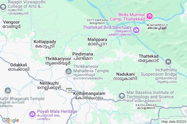
Chelad
Chelad Map
EDIT Map
Add Your House
 ..
..
Current Corona Virus Infected Patients Count in Ernakulam District
| City Name | District Name | Total Covid cases |
|---|---|---|
| Ernakulam District | Ernakulam | 15 |
| Kochi | Ernakulam | 9 |
Locality Name :
Chelad
( ചേലാട് )
Block Name : Kothamangalam
District : Ernakulam
State : Kerala
Division : Central Kerala
Language : Malayalam and Tamil, English And Hindi.
Current Time 06:07 AM
Date: Saturday , Apr 26,2025 (IST)
Time zone: IST (UTC+5:30)
Elevation / Altitude: 12 meters. Above Seal level
Telephone Code / Std Code: 0485
Assembly constituency : Kothamangalam assembly constituency
Assembly MLA :
Lok Sabha constituency : Idukki parliamentary constituency
Parliament MP :
Serpanch Name :
Pin Code : 686681
Post Office Name : Chelad Junction
Main Village Name : Pindimana
Commodities Prices : Kothamangalam Market / Mandi
Chelad Live Weather
Temperature: 24.8 °C
overcast clouds
Humidity: 97%
Wind : 0.82 mt/sec towards NE
StationName : "Kotamangalam"
observed on 1 Hours Back
Temperature: 24.8 °C
overcast clouds
Humidity: 97%
Wind : 0.82 mt/sec towards NE
StationName : "Kotamangalam"
observed on 1 Hours Back
Chelad Weather Forecast for Next 5 days
27-04-2025
24.9°C to 34.6°C
light rain, moderate rain
24.9°C to 34.6°C
light rain, moderate rain
28-04-2025
24.7°C to 33.4°C
light rain
24.7°C to 33.4°C
light rain
29-04-2025
24.4°C to 34.4°C
overcast clouds, broken clouds, light rain, moderate rain
24.4°C to 34.4°C
overcast clouds, broken clouds, light rain, moderate rain
30-04-2025
23.2°C to 34.4°C
overcast clouds, light rain, moderate rain
23.2°C to 34.4°C
overcast clouds, light rain, moderate rain
National Highways Reachable To Chelad
Nationa High Way :NH544
Nationa High Way :NH966A
Nationa High Way :NH544
Nationa High Way :NH966A
Rivers Near Chelad
കാളിയാർ :Kaliyar River
കാളിയാർ :Kaliyar River
About Chelad
Correct below Info and add more info about CheladChelad is a small Village/hamlet in Kothamangalam Block in Ernakulam District of Kerala State, India. It comes under Pindimana Panchayath. It belongs to Central Kerala Division . It is located 53 KM towards East from District head quarters Kakkanad. 5 KM from Kothamangalam. 213 KM from State capital Thiruvananthapuram
Chelad Pin code is 686681 and postal head office is Chelad Junction .
Valiapaara ( 4 KM ) , Kothamangalam ( 5 KM ) , Vayanasaala ( 5 KM ) , Ayyankavu ( 5 KM ) , Kuthukuzhi ( 5 KM ) are the nearby Villages to Chelad. Chelad is surrounded by Muvattupuzha Block towards South , Koovappady Block towards west , Vazhakkulam Block towards west , Vadavucode Block towards west .
Kothamangalam , Muvattupuzha , Perumbavoor , Thodupuzha are the near by Cities to Chelad.
Demographics of Chelad
Malayalam is the Local Language here.Politics in Chelad
CPM , Indian National Congress , KEC , KEC(M) , INC are the major political parties in this area.Polling Stations /Booths near Chelad
1)St.maryu0027s L P School Inchathotty2)St.stephens H S S Keerampara (east Wing)
3)St.stephence Basaniya Public School Chelad
4)Priya Darshini Mahila Samajam Anganwady Ramalloor
5)Govt. L.p School Kozhippilly (middle Wing)
HOW TO REACH Chelad
By Rail
There is no railway station near to Chelad in less than 10 km.Colleges near Chelad
Yeldo Mar Baselios College
Address :
Marian Academy Of Management Studies
Address :
Mar Athanasius College Of Arts And Science
Address :
St. Josephs College Of Nursing
Address : St. Josephs College Of Nursingst. Josephs Hospital
Mar Athanasius College Of Engineering
Address : Kothamangalam (p.o), Ernakulam - 686 666.
Schools in Chelad
Tv Joseph Memorial Hs Pindiman
Address : pindimana , kothamangalam , ernakulam , Kerala . PIN- 686681 , Post - Chelad Junction
Athanickal Ups Pindimana
Address : pindimana , kothamangalam , ernakulam , Kerala . PIN- 686698
Fathima Matha Ups Malippara
Address : pindimana , kothamangalam , ernakulam , Kerala . PIN- 686691 , Post - Kothamangalam (Ernakulam)
Gups Chenkara
Address : pindimana , kothamangalam , ernakulam , Kerala . PIN- 686681 , Post - Chelad Junction
Gups Pindimana
Address : pindimana , kothamangalam , ernakulam , Kerala . PIN- 686681 , Post - Chelad Junction
Govt Health Centers near Chelad
1) PHC CHITTAR , Chittar Community health centre , Chittar Maniyar road , police stationPetrol Bunks in Chelad,Kothamangalam
HP PETROL PUMP - L&L FUELS
Chelad P.O; Chelad; Kothamangalam;; Cochin; Kerala 686681; India
0.3 KM distance Detail
Kripa Fuels BPCL Petrol Pump
Kothamangalam - Perumbankuthu Road; Keerampara; Kerala 686681; India
1.3 KM distance Detail
more ..
Colleges in Chelad,Kothamangalam
Govt. Polytechnic College Kothamangalam
Chelad; Ernakulam; Kerala 686681; India
0.7 KM distance Detail
more ..
Schools in Chelad,Kothamangalam
T.V JOSEPH MEMORIAL High Secondary School Under St. Johns
Pindimana; Kerala 686681; India
0.4 KM distance Detail
T.V.JOSEPH MEMORIAL HIGHER SECONDARY SCHOOL PINDIMANA
Pindimana; Kerala 686681; India
0.4 KM distance Detail
Electronic Shops in Chelad,Kothamangalam
Mazhavil Digital Studio
KLM; opposite GUPS Pindimana; Chelad; Kerala 686681; India
0.4 KM distance Detail
Neelathamara Digital Studio
Keerampara; opposite St. Stephens HSS; Near KSEB; KLM; Keerampara; Kerala 686681; India
1.2 KM distance Detail
Super Markets in Chelad,Kothamangalam
Daily Bread Supermarket
Kothamangalam Perumbankuthu Rd; Kothamangalam; Kerala 686666; India
4.6 KM distance Detail
Local Parks in Chelad,Kothamangalam
Jungle Park; Bhoothathankettu
Kothamangalam - Idamalayar Road; Kerala 686681; India
5.0 KM distance Detail
childrens park Kothamangalam
Kochi - Madurai - Dhanushkodi Rd; Kothamangalam; Kerala 686691; India
5.2 KM distance Detail
Police Stations near Chelad,Kothamangalam
Kothamangalam Police Station
Kochi-Dhanushkodi Road; Kothamangalam; Kerala 686691; India
5.0 KM distance Detail
Office Of The Inspector Of Police Kothamangalam
Angady; Kothamangalam; Kerala 686666; India
5.0 KM distance Detail
Kottapady Police Station
Koramangalam District; Ernakulam Rural; Kottapady; Kerala 686692; India
6.9 KM distance Detail
Governement Offices near Chelad,Kothamangalam
Akshaya E Centre-muthamkuzhy
Muthamkuzhy - Ayroorpadam Rd; Pindimana; Kerala 686692; India
2.2 KM distance Detail
Keerampara Panchayat Office
Punnekkad; Kothamangalam - Perumbankuthu Rd; Punnekkad; Kerala 686691; India
4.0 KM distance Detail
About Chelad &
History
How to reach Chelad
Tourist Places Near By Chelad
Schools in Chelad
Colleges in Chelad
Temperature & weather of Chelad
places in Chelad
Chelad photos
More Information
How to reach Chelad
Tourist Places Near By Chelad
Schools in Chelad
Colleges in Chelad
Temperature & weather of Chelad
places in Chelad
Chelad photos
More Information
Village Talk
Post News or Events about this Village
Near Cities
Kothamangalam 3 KM near
Muvattupuzha 16 KM near
Perumbavoor 17 KM near
Thodupuzha 26 KM near
Kothamangalam 3 KM near
Muvattupuzha 16 KM near
Perumbavoor 17 KM near
Thodupuzha 26 KM near
Near By Taluks
Kothamangalam 5 KM near
Muvattupuzha 16 KM near
Koovappady 16 KM near
Vazhakkulam 26 KM near
Kothamangalam 5 KM near
Muvattupuzha 16 KM near
Koovappady 16 KM near
Vazhakkulam 26 KM near
Near By Air Ports
Kochi Airport 31 KM near
Peelamedu Airport 125 KM near
Calicut Airport 154 KM near
Madurai Airport 180 KM near
Kochi Airport 31 KM near
Peelamedu Airport 125 KM near
Calicut Airport 154 KM near
Madurai Airport 180 KM near
Near By Tourist Places
valpari 16 KM near
Kalady 25 KM near
Athirappilly 26 KM near
Parambikulam Wildlife Sanctuary 34 KM near
Painaw 48 KM near
valpari 16 KM near
Kalady 25 KM near
Athirappilly 26 KM near
Parambikulam Wildlife Sanctuary 34 KM near
Painaw 48 KM near
Near By Districts
Ernakulam 50 KM near
Idukki 51 KM near
Kottayam 64 KM near
Thrissur 74 KM near
Ernakulam 50 KM near
Idukki 51 KM near
Kottayam 64 KM near
Thrissur 74 KM near
Near By RailWay Station
Angamaly For Kalady Rail Way Station 33 KM near
Aluva Rail Way Station 34 KM near
Angamaly For Kalady Rail Way Station 33 KM near
Aluva Rail Way Station 34 KM near