| Home | City Bus | Maps | Villages | Cities | Rail | Tourist Places | School | College | Pin Codes | Corona Cases Count |
| Distance Calculator Bus Services IFSC Codes Trace Mobile Number Weather Search Place Trace IP Available Cash ATM/Banks Locate Polling Booth Report an Error contact People |
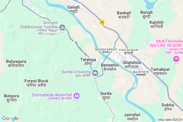
Terenga
Terenga Map
EDIT Map
Add Your House
 ..
..
Current Corona Virus Infected Patients Count in East Singhbum District
| City Name | District Name | Total Covid cases |
|---|
Locality Name :
Terenga
( टेरेंगा )
Block Name : Musabani
District : East Singhbum
State : Jharkhand
Language : Hindi and Urdu, Bengali, Oriya, Gujrati, Nepali, Marwari, Punjabi
Current Time 10:28 AM
Date: Wednesday , Apr 30,2025 (IST)
Time zone: IST (UTC+5:30)
Elevation / Altitude: 103 meters. Above Seal level
Telephone Code / Std Code: 06594
Assembly constituency : Ghatshila assembly constituency
Assembly MLA : Ramdas Soren
Lok Sabha constituency : Jamshedpur parliamentary constituency
Parliament MP : Bidyut Baran Mahato
Serpanch Name :
Alternate Village Name : Teranga
Commodities Prices : Saraskana Market / Mandi
Terenga Live Weather
Temperature: 31.6 °C
scattered clouds
Humidity: 37%
Wind : 0.9 mt/sec towards E
StationName : "GhÄ\u0081tsÄ«la"
observed on 40 Mins Back
Temperature: 31.6 °C
scattered clouds
Humidity: 37%
Wind : 0.9 mt/sec towards E
StationName : "GhÄ\u0081tsÄ«la"
observed on 40 Mins Back
Terenga Weather Forecast for Next 5 days
01-05-2025
25.2°C to 37.7°C
scattered clouds, clear sky, light rain, overcast clouds, broken clouds
25.2°C to 37.7°C
scattered clouds, clear sky, light rain, overcast clouds, broken clouds
02-05-2025
24.3°C to 39.0°C
scattered clouds, clear sky, light rain, moderate rain, overcast clouds, broken clouds
24.3°C to 39.0°C
scattered clouds, clear sky, light rain, moderate rain, overcast clouds, broken clouds
03-05-2025
23.7°C to 37.8°C
broken clouds, scattered clouds, clear sky, few clouds, light rain
23.7°C to 37.8°C
broken clouds, scattered clouds, clear sky, few clouds, light rain
04-05-2025
24.9°C to 40.0°C
clear sky, scattered clouds, moderate rain
24.9°C to 40.0°C
clear sky, scattered clouds, moderate rain
05-05-2025
25.1°C to 39.1°C
clear sky, moderate rain, scattered clouds
25.1°C to 39.1°C
clear sky, moderate rain, scattered clouds
National Highways Reachable To Terenga
Nationa High Way :NH16
Nationa High Way :NH118
Nationa High Way :NH16
Nationa High Way :NH118
Rivers Near Terenga
Shilabati
Subarnarheka River
Shilabati
Subarnarheka River
About Terenga
Correct below Info and add more info about TerengaTerenga is a Village in Musabani Block in East Singhbum District of Jharkhand State, India. It is located 40 KM towards East from District head quarters Jamshedpur. 9 KM from Musabani. 165 KM from State capital Ranchi
Moubhandar ( 2 KM ) , Moubhandar(east) ( 2 KM ) , Moubhandar(west) ( 2 KM ) , Surda ( 5 KM ) , Upparbandha ( 5 KM ) are the nearby Villages to Terenga. Terenga is surrounded by Musabani Block towards South , Dhalbhumgarh Block towards East , Dumaria Block towards South , Potka Block towards west .
Ghatshila , Musabani , Jamshedpur , Rairangpur are the near by Cities to Terenga.
Terenga 2011 Census Details
Terenga Local Language is Hindi. Terenga Village Total population is 2006 and number of houses are 414. Female Population is 50.6%. Village literacy rate is 52.5% and the Female Literacy rate is 20.6%.
Population
| Census Parameter | Census Data |
| Total Population | 2006 |
| Total No of Houses | 414 |
| Female Population % | 50.6 % ( 1016) |
| Total Literacy rate % | 52.5 % ( 1053) |
| Female Literacy rate | 20.6 % ( 414) |
| Scheduled Tribes Population % | 61.5 % ( 1234) |
| Scheduled Caste Population % | 1.5 % ( 31) |
| Working Population % | 42.7 % |
| Child(0 -6) Population by 2011 | 302 |
| Girl Child(0 -6) Population % by 2011 | 47.4 % ( 143) |
Terenga Census More Deatils.
Politics in Terenga
Bharatiya Janata Party , J.V.M (P) , JVM(P) , BJP , JMM , INC are the major political parties in this area.Polling Stations /Booths near Terenga
1)Govt Primary School Deoli2)Govt Primary School Fulpal (east Part)
3)Govt Upgraded Middle School Kankrishol
4)Primary School Upparbandha
5)U C I L Community Hall Jadugora Room No-1
HOW TO REACH Terenga
By Rail
Ghatsila Rail Way Station , Galudih Rail Way Station are the very nearby railway stations to Terenga.Pincodes near Terenga
832103 ( Moubhandar ) , 832106 ( Rakha Copper Project ) , 832304 ( Mahulia )Colleges near Terenga
Musabani Mines Inter College, Musabani
Address : Musabani Mines Inter College, Po+ps-musabani, Jharkhand-832104
Schools near Terenga
Utkramit Madya Vidyalaya Swaspur
Address : Middle School Swaspur
P.O- rakha copper project , PS- Jadugoda East singhbhum Jharkhand
Govt Health Centers near Terenga
1) HSC KENDADIH , KENDADIH , ,2) HSC SOMAIDIH , SOMAIDIH , ,
3) HSC TUMANGDUNGRI , , ,
Sub Villages in Terenga
Hospitals in Terenga,Musabani
स्वास्थ्य उप केंद्र; केन्दाडीह
Kendadi; 832303; NH 33; Darisai; Jharkhand 832304; India
1.7 KM distance Detail
more ..
Petrol Bunks in Terenga,Musabani
Bharat Petroleum; Moubhandar
84; Moubhander Rd; Dahigora; Ghatshila; Jharkhand 832103; India
3.4 KM distance Detail
indian oil petrol punp
84; Moubhander Rd; Dahigora; Ghatshila; Jharkhand 832103; India
3.4 KM distance Detail
HP PETROL PUMP - SHREE SHAKUMBHARI
HP Petrol Pump College Road PO & PS Ghatsila; Jharkhand 832303; India
5.4 KM distance Detail
Hindustan Petroleum
Phuldungri Road Railway Flyover; Phuldungri; Ghatsila; Jharkhand 832303; India
5.4 KM distance Detail
more ..
Colleges in Terenga,Musabani
Maryland College Of Engineering And Technology
East Singhbhum; Jharkhand 832303; India
5.0 KM distance Detail
IACT COMPUTERS EDUCATION (SOUVIK SHARMA)
Phuldungri; Ghatshila; Jharkhand 832303; India
5.2 KM distance Detail
Ghatshila College
College Road;; Phuldungri; Ghatshila; Jharkhand 832303; India
5.3 KM distance Detail
more ..
Schools in Terenga,Musabani
Utkramit Uchh Vidyalaya; Benashol
Surda - Kadandih Rd; Benashol; Jharkhand 832103; India
1.6 KM distance Detail
Electronic Shops in Terenga,Musabani
Mumtaj Auto Garage
84; Moubhander Rd; Dahigora; Ghatshila; Jharkhand 832103; India
3.8 KM distance Detail
About Terenga &
History
How to reach Terenga
Tourist Places Near By Terenga
Schools in Terenga
Colleges in Terenga
Temperature & weather of Terenga
places in Terenga
Terenga photos
More Information
How to reach Terenga
Tourist Places Near By Terenga
Schools in Terenga
Colleges in Terenga
Temperature & weather of Terenga
places in Terenga
Terenga photos
More Information
Village Talk
Post News or Events about this Village
Near Cities
Ghatshila 6 KM near
Musabani 11 KM near
Jamshedpur 34 KM near
Rairangpur 49 KM near
Ghatshila 6 KM near
Musabani 11 KM near
Jamshedpur 34 KM near
Rairangpur 49 KM near
Near By Taluks
Ghatshila 7 KM near
Musabani 9 KM near
Dhalbhumgarh 18 KM near
Dumaria 20 KM near
Ghatshila 7 KM near
Musabani 9 KM near
Dhalbhumgarh 18 KM near
Dumaria 20 KM near
Near By Air Ports
Ranchi Airport 156 KM near
Netaji Subhas Chandra Bose Airport 231 KM near
Bhubaneswar Airport 299 KM near
Gaya Airport 317 KM near
Ranchi Airport 156 KM near
Netaji Subhas Chandra Bose Airport 231 KM near
Bhubaneswar Airport 299 KM near
Gaya Airport 317 KM near
Near By Tourist Places
Jamshedpur 37 KM near
Seraikela 59 KM near
Purulia 78 KM near
Baripada 88 KM near
Medinipur 105 KM near
Jamshedpur 37 KM near
Seraikela 59 KM near
Purulia 78 KM near
Baripada 88 KM near
Medinipur 105 KM near
Near By Districts
East Singhbum 38 KM near
Saraikela Kharsawan 59 KM near
West Singhbhum 72 KM near
Mayurbhanj 89 KM near
East Singhbum 38 KM near
Saraikela Kharsawan 59 KM near
West Singhbhum 72 KM near
Mayurbhanj 89 KM near
Near By RailWay Station
Ghatsila Rail Way Station 5.9 KM near
Galudih Rail Way Station 8.0 KM near
Tatanagar Junction Rail Way Station 34 KM near
Ghatsila Rail Way Station 5.9 KM near
Galudih Rail Way Station 8.0 KM near
Tatanagar Junction Rail Way Station 34 KM near