| Home | City Bus | Maps | Villages | Cities | Rail | Tourist Places | School | College | Pin Codes | Corona Cases Count |
| Distance Calculator Bus Services IFSC Codes Trace Mobile Number Weather Search Place Trace IP Available Cash ATM/Banks Locate Polling Booth Report an Error contact People |
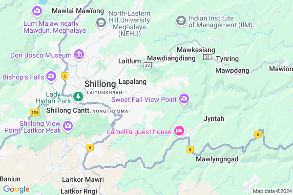
Nongrah
Nongrah Map
EDIT Map
Add Your House
 ..
..
Current Corona Virus Infected Patients Count in East Khasi Hills District
| City Name | District Name | Total Covid cases |
|---|---|---|
| East Khasi Hills District | East Khasi Hills | 11 |
| Shillong | East Khasi Hills | 1 |
Village Name :
Nongrah
( नांगरह )
Block Name : Shillong
District : East Khasi Hills
State : Meghalaya
Language : English and Khasi, Garo
Current Time 11:36 AM
Date: Monday , Apr 28,2025 (IST)
Time zone: IST (UTC+5:30)
Telephone Code / Std Code: 0364
Ward : Ward
Assembly constituency : Nongthymmai assembly constituency
Assembly MLA : jemino mawthoh
Lok Sabha constituency : Shillong parliamentary constituency
Parliament MP : VINCENT H. PALA
Commodities Prices : Mawiong Regulated Market Market / Mandi
Nongrah Live Weather
Temperature: 15.4 °C
overcast clouds
Humidity: 100%
Wind : 4.12 mt/sec towards NW
StationName : "Shillong"
observed on 2 Hours Back
Temperature: 15.4 °C
overcast clouds
Humidity: 100%
Wind : 4.12 mt/sec towards NW
StationName : "Shillong"
observed on 2 Hours Back
Nongrah Weather Forecast for Next 5 days
29-04-2025
12.6°C to 20.0°C
light rain, moderate rain, scattered clouds
12.6°C to 20.0°C
light rain, moderate rain, scattered clouds
30-04-2025
13.2°C to 21.7°C
broken clouds, light rain, moderate rain
13.2°C to 21.7°C
broken clouds, light rain, moderate rain
01-05-2025
13.1°C to 20.4°C
light rain, overcast clouds, scattered clouds
13.1°C to 20.4°C
light rain, overcast clouds, scattered clouds
02-05-2025
12.9°C to 20.2°C
light rain, overcast clouds, broken clouds
12.9°C to 20.2°C
light rain, overcast clouds, broken clouds
03-05-2025
13.8°C to 21.4°C
overcast clouds, light rain, moderate rain
13.8°C to 21.4°C
overcast clouds, light rain, moderate rain
National Highways Reachable To Nongrah
Nationa High Way :NH6
Nationa High Way :NH6
Rivers Near Nongrah
Umiam River
Um Lew
Umiam River
Um Lew
About Nongrah
Correct below Info and add more info about NongrahNongrah is a Locality in Shillong City in Meghalaya State, India.
Mawlynrei , Rynjah , Itshyrwat , Mawshbuit , Pohkseh are the nearby Localities to Nongrah.
Shillong , Jowai , Nongstoin , Dispur are the nearby Cities to Shillong.
Demographics of Nongrah
English is the Local Language here.Politics in Nongrah
UDP , Indian National Congress , INC are the major political parties in this area.Polling Stations /Booths near Nongrah
1)Nongrah U0027du00272)Nongrah U0027bu0027
3)Nongrah U0027cu0027
4)Madan Rynjah Lapalang U0027au0027
5)Lumshngain
HOW TO REACH Nongrah
By Rail
There is no railway station near to Nongrah in less than 10 km.Pincodes near Nongrah
793006 ( Rynjah ) , 793007 ( Happy Valley ) , 793018 ( Neigrihms )Govt Health Centers near Nongrah
1) Diengiei PHC , Diengiei PHC , , Centre of the village near Sacred Heart School2) Children Hospital (Pvt. Hospital) , , Pohkseh , Pohkseh
3) (NEIGRIHMS) North Eastern Indira Gandhi Regional Institute of Health and Medical Sciences , NEIGRIHMS, Mawdiangdiang , Shillong , .
Hospitals in Nongrah,Shillong
CAPF Composite Hospital BSF Umpling
Umpling; Mawarliang; Shillong; Meghalaya 793006; India
0.8 KM distance Detail
more ..
Petrol Bunks in Nongrah,Shillong
HP Petrol Pump - Star Service Station
Wah-heh; Mawpat Neigrihms Hospital Road; Gauhati; Meghalaya 793018; India
3.1 KM distance Detail
Nongmynsong Gas Station
gas station; Nongmynsong; Shillong; Meghalaya 793006; India
3.1 KM distance Detail
HP PETROL PUMP P MARBANIANG SERVICE STATION
Nongthymmai; Shillong; Gauhati; Meghalaya 793014; India
3.6 KM distance Detail
more ..
Colleges in Nongrah,Shillong
Martin Luther Christian University
Lummarboh; Block 1; Dongktieh; Nongrah; Shillong; Meghalaya 793006; India
1.0 KM distance Detail
more ..
Schools in Nongrah,Shillong
Army School Shillong
Shillong Cantonment; HQ 101 Area; P.O. Umlyngka; Shillong; Meghalaya 793005; India
0.2 KM distance Detail
Little Angels SSA L.P. & U.P. School
Lapalang; Rynjah; Shillong; Meghalaya 793006; India
1.0 KM distance Detail
Government L. P. School
Lummarboh; Nongrah; Shillong; Meghalaya 793006; India
1.1 KM distance Detail
Electronic Shops in Nongrah,Shillong
Rhino Electronics
Mawshbuit-Sweet Falls Rd; Shillong; Meghalaya 793007; India
1.7 KM distance Detail
RD Music Recording Studio
R. R. Colony; Rynjah; Shillong; Meghalaya 793006; India
1.8 KM distance Detail
Local Parks in Nongrah,Shillong
Vaiphei Welfare Assn Cemetry
Happy Valley;Long Range; Shillong; Meghalaya 793007; India
2.9 KM distance Detail
Police Stations near Nongrah,Shillong
Rynjah Traffic Branch
Rynjah; East Khasi Hills; Shillong; Meghalaya 793006; India
2.0 KM distance Detail
About Nongrah &
History
How to reach Nongrah
Tourist Places Near By Nongrah
Schools in Nongrah
Colleges in Nongrah
Temperature & weather of Nongrah
places in Nongrah
Nongrah photos
More Information
How to reach Nongrah
Tourist Places Near By Nongrah
Schools in Nongrah
Colleges in Nongrah
Temperature & weather of Nongrah
places in Nongrah
Nongrah photos
More Information
Locality Talk
Post News or Events about this Locality
Near Cities
Shillong 8 KM near
Jowai 41 KM near
Nongstoin 74 KM near
Dispur 74 KM near
Shillong 8 KM near
Jowai 41 KM near
Nongstoin 74 KM near
Dispur 74 KM near
Near By Taluks
Shillong 4 KM near
Mawryngkneng 4 KM near
Mylliem 10 KM near
Umsning 22 KM near
Shillong 4 KM near
Mawryngkneng 4 KM near
Mylliem 10 KM near
Umsning 22 KM near
Near By Air Ports
Shillong Airport 5 KM near
Borjhar Airport 76 KM near
Kumbhirgram Airport 143 KM near
Salonibari Airport 171 KM near
Shillong Airport 5 KM near
Borjhar Airport 76 KM near
Kumbhirgram Airport 143 KM near
Salonibari Airport 171 KM near
Near By Tourist Places
Shillong 4 KM near
Jowai 34 KM near
Nongpoh 41 KM near
Cherrapunjee 42 KM near
Dispur 72 KM near
Shillong 4 KM near
Jowai 34 KM near
Nongpoh 41 KM near
Cherrapunjee 42 KM near
Dispur 72 KM near
Near By Districts
East Khasi Hills 4 KM near
Jaintia Hills 33 KM near
Ri Bhoi 42 KM near
Kamrup Metro 86 KM near
East Khasi Hills 4 KM near
Jaintia Hills 33 KM near
Ri Bhoi 42 KM near
Kamrup Metro 86 KM near
Near By RailWay Station
Jagi Road Rail Way Station 75 KM near
Kamakhya Junction Rail Way Station 77 KM near
Jagi Road Rail Way Station 75 KM near
Kamakhya Junction Rail Way Station 77 KM near