| Home | City Bus | Maps | Villages | Cities | Rail | Tourist Places | School | College | Pin Codes | Corona Cases Count |
| Distance Calculator Bus Services IFSC Codes Trace Mobile Number Weather Search Place Trace IP Available Cash ATM/Banks Locate Polling Booth Report an Error contact People |
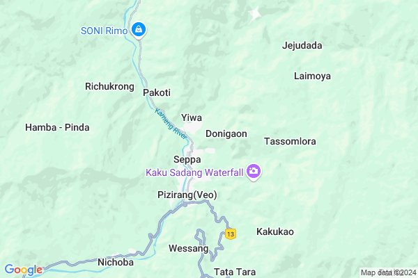
Lai Moya
Lai Moya Map
EDIT Map
Add Your House
 ..
..
Current Corona Virus Infected Patients Count in East Kameng District
| City Name | District Name | Total Covid cases |
|---|
Locality Name :
Lai Moya
( लै मोया )
Tehsil Name : Seppa
District : East Kameng
State : Arunachal Pradesh
Language : English and Sino-tibetan
Current Time 06:25 PM
Date: Wednesday , Feb 05,2025 (IST)
Time zone: IST (UTC+5:30)
Elevation / Altitude: 162 meters. Above Seal level
Telephone Code / Std Code: 03787
Assembly constituency : Seppa East assembly constituency
Assembly MLA : TAPUK TAKU
Lok Sabha constituency : parliamentary constituency
Parliament MP :
Serpanch Name :
National Highways Reachable To Lai Moya
Nationa High Way :NH13
Nationa High Way :NH13
Rivers Near Lai Moya
Bichom
Panyor
Bichom
Panyor
About Lai Moya
Correct below Info and add more info about Lai MoyaLai Moya is a Village in Seppa Tehsil in East Kameng District of Arunachal Pradesh State, India. It is located 1 KM towards North from District head quarters Seppa. 81 KM from State capital Itanagar
Lai Moya is surrounded by Bameng West Tehsil towards North , Bameng East Tehsil towards North , Pipu Tehsil towards North , Leporiang Tehsil towards East .
Bomdila , Itanagar , Naharlagun , Tezpur are the near by Cities to Lai Moya.
Demographics of Lai Moya
English is the Local Language here.Politics in Lai Moya
N.A , National People s Party , AITC , NCP , INC are the major political parties in this area.Polling Stations /Booths near Lai Moya
1)Middle School Building Pabua2)Middle School Building Pachi
3)Community School Building Patha
4)Primary School Building Nerewa
5)Assistant Director Textile & Handicraft Office Building Seppa
HOW TO REACH Lai Moya
By Rail
There is no railway station near to Lai Moya in less than 10 km.Pincodes near Lai Moya
790102 ( Seppa ) , 790103 ( Seijosa ) , 790116 ( Tenga Market )Colleges near Lai Moya
Ramakrishna
Address :
Schools near Lai Moya
Jnv Seppa
Address : new seppa , seppa , east kameng , Arunachal Pradesh . PIN- 790102 , Post - Seppa
Govt. Hr Sec. School, Fengche
Address : pampoli , seppa , east kameng , Arunachal Pradesh . PIN- 790102 , Post - Seppa
Ghss Bazarline, Seppa
Address : seppa , seppa , east kameng , Arunachal Pradesh . PIN- 790102 , Post - Seppa
St Joseph Sec. School
Address : sangria , seppa , east kameng , Arunachal Pradesh . PIN- 790102 , Post - Seppa
Govt Health Centers near Lai Moya
1) CHC Sangram , CHC Sangram , CHC Sangram ,2) SC Bello , SC Bello , ,
3) SC Miya , SC Miya , ,
Schools in Lai Moya,Seppa
Government Primary School; Pacha
Pacha colony; Seppa town; East Kameng dist; Arunachal Pradesh 790102
1.4 KM distance Detail
St. Joseph'S School
Seppa; Dt- East Kameng; Arunachal Pradesh- 790102; East Kameng; Arunachal Pradesh 790102
1.6 KM distance Detail
Govt. Hr. Sec. School Seppa
East Kameng District; Arunachal Pradesh; Seppa; Arunachal Pradesh 790102
1.6 KM distance Detail
Government Higher Secondary School;Bebo Colony
Bebo International; Dantu Vari St; G O Colony; Kakinada; Andhra Pradesh 533001
1.7 KM distance Detail
Electronic Shops in Lai Moya,Seppa
Super Markets in Lai Moya,Seppa
Local Parks in Lai Moya,Seppa
Police Stations near Lai Moya,Seppa
Governement Offices near Lai Moya,Seppa
Seppa Chief Judicial Magistrate cum Civil Judge
Between DC Office & SP Office Seppa; Cona; Seppa; Arunachal Pradesh 790102
1.4 KM distance Detail
About Lai Moya &
History
How to reach Lai Moya
Tourist Places Near By Lai Moya
Schools in Lai Moya
Colleges in Lai Moya
Temperature & weather of Lai Moya
places in Lai Moya
Lai Moya photos
More Information
How to reach Lai Moya
Tourist Places Near By Lai Moya
Schools in Lai Moya
Colleges in Lai Moya
Temperature & weather of Lai Moya
places in Lai Moya
Lai Moya photos
More Information
Village Talk
Post News or Events about this Village
Near Cities
Bomdila 69 KM near
Itanagar 71 KM near
Naharlagun 80 KM near
Tezpur 96 KM near
Bomdila 69 KM near
Itanagar 71 KM near
Naharlagun 80 KM near
Tezpur 96 KM near
Near By Taluks
Seppa 0 KM near
Bameng West 20 KM near
Bameng East 20 KM near
Pipu 26 KM near
Seppa 0 KM near
Bameng West 20 KM near
Bameng East 20 KM near
Pipu 26 KM near
Near By Air Ports
Salonibari Airport 86 KM near
Lilabari Airport 115 KM near
Rowriah Airport 148 KM near
Dimapur Airport 202 KM near
Salonibari Airport 86 KM near
Lilabari Airport 115 KM near
Rowriah Airport 148 KM near
Dimapur Airport 202 KM near
Near By Tourist Places
Nameri National Park 63 KM near
Bhalukpong 63 KM near
Sessa 64 KM near
Bomdila 71 KM near
Itanagar 71 KM near
Nameri National Park 63 KM near
Bhalukpong 63 KM near
Sessa 64 KM near
Bomdila 71 KM near
Itanagar 71 KM near
Near By Districts
East Kameng 1 KM near
West Kameng 69 KM near
Kurung Kumey 72 KM near
Papum Pare 73 KM near
East Kameng 1 KM near
West Kameng 69 KM near
Kurung Kumey 72 KM near
Papum Pare 73 KM near
Near By RailWay Station
Rangapara North Junction Rail Way Station 79 KM near
Furkating Junction Rail Way Station 154 KM near
Rangapara North Junction Rail Way Station 79 KM near
Furkating Junction Rail Way Station 154 KM near