| Home | City Bus | Maps | Villages | Cities | Rail | Tourist Places | School | College | Pin Codes | Corona Cases Count |
| Distance Calculator Bus Services IFSC Codes Trace Mobile Number Weather Search Place Trace IP Available Cash ATM/Banks Locate Polling Booth Report an Error contact People |
Subbampeta
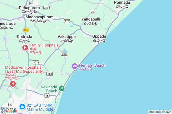
Subbampeta Map
EDIT Map
Add Your House
 ..
..
Current Corona Virus Infected Patients Count in East Godavari District
| City Name | District Name | Total Covid cases |
|---|---|---|
| East Godavari District | East Godavari | 30 |
| Kathipudi | East Godavari | 6 |
| Rajahmundry | East Godavari | 2 |
| Kakinada | East Godavari | 1 |
Locality Name :
Subbampeta
( సుబ్బంపేట )
Mandal Name : U.kothapalle
District : East Godavari
State : Andhra Pradesh
Region : Andhra
Language : Telugu
Current Time 07:17 PM
Date: Tuesday , Apr 29,2025 (IST)
Time zone: IST (UTC+5:30)
Elevation / Altitude: 22 meters. Above Seal level
Telephone Code / Std Code: 08869
Assembly constituency : Madakasira assembly constituency
Assembly MLA : Dorababu Pendem
Lok Sabha constituency : Tirupati parliamentary constituency
Parliament MP : Balli Durga Prasad Rao
Serpanch Name :
Pin Code : 533448
Post Office Name : Uppada
Main Village Name : Uppada
Commodities Prices : Rajahmundry Market / Mandi
Subbampeta Live Weather
Temperature: 31.0 °C
light rain
Humidity: 60%
Wind : 2.14 mt/sec towards SE
Rain : null
StationName : "PithÄ\u0081puram"
observed on 15 Mins Back
Temperature: 31.0 °C
light rain
Humidity: 60%
Wind : 2.14 mt/sec towards SE
Rain : null
StationName : "PithÄ\u0081puram"
observed on 15 Mins Back
Subbampeta Weather Forecast for Next 5 days
30-04-2025
28.1°C to 30.2°C
scattered clouds, few clouds
28.1°C to 30.2°C
scattered clouds, few clouds
01-05-2025
27.8°C to 35.6°C
few clouds, scattered clouds, clear sky, light rain, broken clouds
27.8°C to 35.6°C
few clouds, scattered clouds, clear sky, light rain, broken clouds
02-05-2025
27.7°C to 37.3°C
light rain, few clouds, scattered clouds, broken clouds
27.7°C to 37.3°C
light rain, few clouds, scattered clouds, broken clouds
03-05-2025
28.1°C to 39.2°C
few clouds, scattered clouds, broken clouds, light rain
28.1°C to 39.2°C
few clouds, scattered clouds, broken clouds, light rain
04-05-2025
27.5°C to 40.8°C
scattered clouds, few clouds, clear sky, light rain, overcast clouds
27.5°C to 40.8°C
scattered clouds, few clouds, clear sky, light rain, overcast clouds
National Highways Reachable To Subbampeta
Nationa High Way :NH16
Nationa High Way :NH216
Nationa High Way :NH16
Nationa High Way :NH216
Rivers Near Subbampeta
Pedda Eru
Godavari
Pedda Eru
Godavari
About Subbampeta
Correct below Info and add more info about SubbampetaSubbampeta is a small Village/hamlet in U.kothapalle Mandal in East Godavari District of Andhra Pradesh State, India. It comes under Uppada Panchayath. It belongs to Andhra region . It is located 17 KM towards North from District head quarters Kakinada. 3 KM from U.Kothapalle. 477 KM from State capital Hyderabad
Subbampeta Pin code is 533448 and postal head office is Uppada .
Vakatippa ( 3 KM ) , Nemam ( 3 KM ) , Uppada ( 3 KM ) , Kutukudumilli ( 4 KM ) , Gorsa ( 4 KM ) are the nearby Villages to Subbampeta. Subbampeta is surrounded by Kakinada Mandal towards South , Kakinada Rural Mandal towards west , Pithapuram Mandal towards west , Samalkota Mandal towards west .
Pithapuram , Samalkot , Kakinada , Peddapuram are the near by Cities to Subbampeta.
It is near to bay of bengal. There is a chance of humidity in the weather.
Subbampeta 2011 Census Details
Subbampeta Local Language is Telugu. Subbampeta Village Total population is 1242 and number of houses are 329. Female Population is 51.7%. Village literacy rate is 48.3% and the Female Literacy rate is 24.0%.
Population
| Census Parameter | Census Data |
| Total Population | 1242 |
| Total No of Houses | 329 |
| Female Population % | 51.7 % ( 642) |
| Total Literacy rate % | 48.3 % ( 600) |
| Female Literacy rate | 24.0 % ( 298) |
| Scheduled Tribes Population % | 0.0 % ( 0) |
| Scheduled Caste Population % | 0.0 % ( 0) |
| Working Population % | 47.7 % |
| Child(0 -6) Population by 2011 | 131 |
| Girl Child(0 -6) Population % by 2011 | 52.7 % ( 69) |
Subbampeta Census More Deatils.
Politics in Subbampeta
TDP , YSRC , Yuvajana Sramika Rythu Congress Party , YSRCP , BJP , INC are the major political parties in this area.Polling Stations /Booths near Subbampeta
1)Morubagal2)Neelakantapuram
3)Agali
4)Kodihalli
5)K.byadigera
HOW TO REACH Subbampeta
By Rail
Pithapuram Rail Way Station is the very nearby railway stations to Subbampeta.By Bus
Pithapuram APSRTC Bus Station , Samarlakota APSRTC Bus Station , Kakinada APSRTC Bus Station are the nearby by Bus Stations to Subbampeta .APSRTC runs Number of busses from major cities to here.Colleges near Subbampeta
Chakaravartula Bhaskara Rao (cbr) Degree College
Address : Uppada Bus Stand, Pithapuram - 533 450, E.g.dist.
Schools in Subbampeta
Mpps Subbampeta
Address : subbampeta , u.kothapalli , east godavari , Andhra Pradesh . PIN- 533448 , Post - Uppada
Govt Health Centers near Subbampeta
1) Komaragiri SC , 5/8/2009 , Main road , Ramalayam2) Komaragiri , Feb-67 , Main road , High school
3) Panduru , 1-128/1 , Sc peta , Panduru sc peta
Hospitals in Subbampeta,U.kothapalle
St. Joseph Hospital
Beside Panchayathi office;; Uppada; Andhra Pradesh 533448; India
3.4 KM distance Detail
more ..
Petrol Bunks in Subbampeta,U.kothapalle
HP GAS GODOWN
Uppada - Pithapuram Rd; Kothapalli; Andhra Pradesh 533447; India
4.9 KM distance Detail
more ..
Colleges in Subbampeta,U.kothapalle
V.V.S. College Of Education
Pithapuram Road; East Godavari District; Kothapalli; Andhra Pradesh 533448; India
3.2 KM distance Detail
Sri Siddhartha Vidya Niketan
Vakalapudi; Beach Approach Rd; Kakinada Industrial Area; Kakinada; Andhra Pradesh 533005; India
9.2 KM distance Detail
Williams College of Education
Teacher's Colony; Rayudupalem; Kakinada; Andhra Pradesh 533005; India
10.3 KM distance Detail
more ..
Electronic Shops in Subbampeta,U.kothapalle
Deepu Mobiles And Spare Parts
deepu mobiles; Uppada; Andhra Pradesh 533448; India
3.2 KM distance Detail
THAMAN COMPUTER EDUCATION
Aminabada ; near fish market; uppada; U kothapalli mandal ; 9030514115; Andhra Pradesh 533448; India
3.4 KM distance Detail
Super Markets in Subbampeta,U.kothapalle
Sai Sree Cool Home
NH216; Thimmapuram; Kakinada; Andhra Pradesh 533005; India
9.4 KM distance Detail
Police Stations near Subbampeta,U.kothapalle
Police Station
Uppada - Pithapuram Rd; Kothapalli; Andhra Pradesh 533447; India
5.0 KM distance Detail
Apsp COMMANDO TRAINING CENTRE
Teacher's Colony; Rayudupalem; Kakinada; Andhra Pradesh 533005; India
10.1 KM distance Detail
Governement Offices near Subbampeta,U.kothapalle
MeeSeva Center
2-123; Ratna Xerox Building; Beach Road Center;; Uppada; Andhra Pradesh 533448; India
3.3 KM distance Detail
About Subbampeta &
History
How to reach Subbampeta
Tourist Places Near By Subbampeta
Schools in Subbampeta
Colleges in Subbampeta
Temperature & weather of Subbampeta
places in Subbampeta
Subbampeta photos
More Information
How to reach Subbampeta
Tourist Places Near By Subbampeta
Schools in Subbampeta
Colleges in Subbampeta
Temperature & weather of Subbampeta
places in Subbampeta
Subbampeta photos
More Information
Village Talk
Post News or Events about this Village
Near Cities
Pithapuram 10 KM near
Samalkot 16 KM near
Kakinada 17 KM near
Peddapuram 21 KM near
Pithapuram 10 KM near
Samalkot 16 KM near
Kakinada 17 KM near
Peddapuram 21 KM near
Near By Taluks
U.Kothapalle 3 KM near
Kakinada 13 KM near
Pithapuram 14 KM near
Kakinada Rural 14 KM near
U.Kothapalle 3 KM near
Kakinada 13 KM near
Pithapuram 14 KM near
Kakinada Rural 14 KM near
Near By Air Ports
Rajahmundry Airport 59 KM near
Vishakhapatnam Airport 136 KM near
Vijayawada Airport 193 KM near
Rajiv Gandhi International Airport 463 KM near
Rajahmundry Airport 59 KM near
Vishakhapatnam Airport 136 KM near
Vijayawada Airport 193 KM near
Rajiv Gandhi International Airport 463 KM near
Near By Tourist Places
Kakinada 17 KM near
Rajahamundry 65 KM near
Konaseema 67 KM near
Papi Kondalu 110 KM near
Visakhapatnam 132 KM near
Kakinada 17 KM near
Rajahamundry 65 KM near
Konaseema 67 KM near
Papi Kondalu 110 KM near
Visakhapatnam 132 KM near
Near By Districts
East Godavari 17 KM near
Visakhapatanam 135 KM near
West Godavari 150 KM near
Malkangiri 168 KM near
East Godavari 17 KM near
Visakhapatanam 135 KM near
West Godavari 150 KM near
Malkangiri 168 KM near
Near By RailWay Station
Pithapuram Rail Way Station 9 KM near
Kakinada Town Junction Rail Way Station 15 KM near
Pithapuram Rail Way Station 9 KM near
Kakinada Town Junction Rail Way Station 15 KM near