| Home | City Bus | Maps | Villages | Cities | Rail | Tourist Places | School | College | Pin Codes | Corona Cases Count |
| Distance Calculator Bus Services IFSC Codes Trace Mobile Number Weather Search Place Trace IP Available Cash ATM/Banks Locate Polling Booth Report an Error contact People |
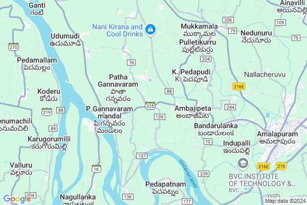
Munganda
Munganda Map
EDIT Map
Add Your House
 ..
..
Current Corona Virus Infected Patients Count in East Godavari District
| City Name | District Name | Total Covid cases |
|---|---|---|
| East Godavari District | East Godavari | 30 |
| Kathipudi | East Godavari | 6 |
| Rajahmundry | East Godavari | 2 |
| Kakinada | East Godavari | 1 |
Locality Name :
Munganda
( ముంగండ )
Mandal Name : P.gannavaram
District : East Godavari
State : Andhra Pradesh
Region : Andhra
Language : Telugu
Current Time 01:21 PM
Date: Sunday , Apr 27,2025 (IST)
Time zone: IST (UTC+5:30)
Elevation / Altitude: 14 meters. Above Seal level
Telephone Code / Std Code: 08856
Assembly constituency : Punganur assembly constituency
Assembly MLA : PEDDIREDDI RAMACHANDRA REDDY
Lok Sabha constituency : Rajampet parliamentary constituency
Parliament MP : P.V.MIDHUN REDDY
Serpanch Name :
Pin Code : 533214
Post Office Name : Ambajipeta
Alternate Village Name : Munganda Harijana colony
Commodities Prices : Ambajipeta Market / Mandi
Munganda Live Weather
Temperature: 38.5 °C
clear sky
Humidity: 30%
Wind : 2.97 mt/sec towards S
StationName : "AmalÄ\u0081puram"
observed on Now
Temperature: 38.5 °C
clear sky
Humidity: 30%
Wind : 2.97 mt/sec towards S
StationName : "AmalÄ\u0081puram"
observed on Now
Munganda Weather Forecast for Next 5 days
28-04-2025
24.7°C to 37.0°C
few clouds, scattered clouds
24.7°C to 37.0°C
few clouds, scattered clouds
29-04-2025
24.4°C to 36.8°C
broken clouds, clear sky, scattered clouds
24.4°C to 36.8°C
broken clouds, clear sky, scattered clouds
30-04-2025
25.2°C to 37.0°C
scattered clouds, few clouds, clear sky
25.2°C to 37.0°C
scattered clouds, few clouds, clear sky
01-05-2025
25.8°C to 38.1°C
few clouds, scattered clouds, clear sky
25.8°C to 38.1°C
few clouds, scattered clouds, clear sky
02-05-2025
26.8°C to 38.1°C
light rain, scattered clouds, broken clouds, few clouds
26.8°C to 38.1°C
light rain, scattered clouds, broken clouds, few clouds
Edit below overview about Munganda
Edit below overview about Munganda
OverView of Munganda
Munganda is a village in Konaseema, East Godavari District, Andhra Pradesh. Munganda's etymology goes far with originally called as Muni-khanda the land of sages. The village is the home of many people who are the progenies of the great families like Pulya, Khandavilli, Pinniti, Korada, Kuchi, Nemani, Susarla,Bhamidi,Vedanabhatla, manda, boddu, jalluri,mattaparthi etc..This village was the residence of the great Vedic scholars like Pulya Umamahesawara Sastry (Abhinava Pandita Raya, Vaiyyakarana Kesari - 10 titles twice Rastrapathi awardee) and still it is. Every year the Ganesh chaturdi and the devi navaratrulu will be celebrated with great pomp and show over here.One of the great thing during this time would be great vedic scholars reciting all the vedas in different pathas.The village dates back to early 14th century. Kesava Bhattu, the grand father of the great poet scholar Jagannadha Panditha Rayalu was said to have pleased Sri Krishna Deva Raya of Vijayanagara with his prowess in Literature and Kuchipudi Dance and received Agraharam Mungandaas a present. This village comes under the P.Gannavaram mandal and is on the Ambajipeta-Razole main road. Munganda has a planned village layout all streets are parallel to each other. Main streets areItikelameraka,kotimavullameraka,mungandapalem,pechetti vari palem,mu Sankhyana Raja Veedhi, Red-Cross Veedhi, Dravilla Veedhi, Ganapathy Mandiram Veedhi, Kalidasa Veedhi, In Raja Veedhi Junction (in the middle of the road between Munganda manchineella Cheruvu and Muleswara Swamy temple). This village is located 59 km towards the south from District headquarters Kakinada 4 km from P. Gannavaram.220 km from state capital Amaravathi. And one more:grama devata SRI MUTYALAMMA TALLI also
Edit below overview about Munganda
National Highways Reachable To Munganda
Nationa High Way :NH165
Nationa High Way :NH165
Rivers Near Munganda
Godavari
Vainateyam Godavari
Godavari
Vainateyam Godavari
About Munganda
Munganda is a Village in P.gannavaram Mandal in East Godavari District of Andhra Pradesh State, India. It belongs to Andhra region . It is located 60 KM towards South from District head quarters Kakinada. 2 KM from P.Gannavaram. 439 KM from State capital Hyderabad
Munganda Pin code is 533214 and postal head office is Ambajipeta .
Machavaram ( 2 KM ) , Isukapudi ( 2 KM ) , Mungandapalem ( 2 KM ) , Pathagannavaram ( 3 KM ) , Rajulapalem ( 3 KM ) are the nearby Villages to Munganda. Munganda is surrounded by Ambajipeta Mandal towards East , Amalapuram Mandal towards East , Achanta Mandal towards west , Kothapeta Mandal towards North .
Amalapuram , Kothapeta , Palacole , Mandapeta are the near by Cities to Munganda.
This Place is in the border of the East Godavari District and West Godavari District. West Godavari District Achanta is west towards this place .
Munganda 2011 Census Details
Munganda Local Language is Telugu. Munganda Village Total population is 5297 and number of houses are 1419. Female Population is 50.7%. Village literacy rate is 71.4% and the Female Literacy rate is 34.7%.
Population
| Census Parameter | Census Data |
| Total Population | 5297 |
| Total No of Houses | 1419 |
| Female Population % | 50.7 % ( 2688) |
| Total Literacy rate % | 71.4 % ( 3780) |
| Female Literacy rate | 34.7 % ( 1840) |
| Scheduled Tribes Population % | 1.2 % ( 66) |
| Scheduled Caste Population % | 30.1 % ( 1592) |
| Working Population % | 45.1 % |
| Child(0 -6) Population by 2011 | 496 |
| Girl Child(0 -6) Population % by 2011 | 50.0 % ( 248) |
Munganda Census More Deatils.
Politics in Munganda
TDP , YSRC , Yuvajana Sramika Rythu Congress Party , YSRCP , BJP , INC are the major political parties in this area.HOW TO REACH Munganda
By Road
Amalapuram is the Nearest Town to Munganda. Amalapuram is 13 km from Munganda. Road connectivity is there from Amalapuram to Munganda.By Rail
There is no railway station near to Munganda in less than 10 km.By Bus
P.Gannavaram APSRTC Bus Station , Ambajipet APSRTC Bus Station , Bandarulanka APSRTC Bus Station are the nearby by Bus Stations to Munganda .APSRTC runs Number of busses from major cities to here.Colleges near Munganda
G R R S Junior College Munganda
Address : G R R S Junior College Munganda
Schools in Munganda
Zphs Munganda
Address : munganda , p.gannavaram , east godavari , Andhra Pradesh . PIN- 533214 , Post - Ambajipeta
Sri Sai Convent (em) U P
Address : munganda , p.gannavaram , east godavari , Andhra Pradesh . PIN- 533224
S S Teja Pub School
Address : munganda , p.gannavaram , east godavari , Andhra Pradesh . PIN- 533224
Govt Health Centers near Munganda
1) Munganda SC , 5-123 , near muthyalamma temple , near ambedkar statue2) Pothavaram SC , 3-123 , Water Tank Colony , Near Water tank
3) Machavaram- I SC , 16-72 , Bharathi Nagar , Ambedkar Statue Pothailanka Road
Sub Villages in Munganda
Hospitals in Munganda,P.gannavaram
శ్రీమతి మంత్రవాది ఇందిరాకుమారి గ్రామీణ వైద్యశాల
Munganda; Andhra Pradesh 533214; India
0.2 KM distance Detail
more ..
Petrol Bunks in Munganda,P.gannavaram
BALAJI AGENCIES
P GANNAVARAM; EAST GODAVAR; EAST GODAVARI; Andhra Pradesh 533240; India
2.6 KM distance Detail
more ..
Colleges in Munganda,P.gannavaram
Sri Chaitanya College
Ambajipeta - Gannavaram Rd; Ambajipeta; Andhra Pradesh 533214; India
2.2 KM distance Detail
more ..
Schools in Munganda,P.gannavaram
P.V.R. Z.P.High School
Ambajipeta Road; Munganda; Andhra Pradesh 533214; India
0.6 KM distance Detail
Super Markets in Munganda,P.gannavaram
sri Mahalakshmi General Stores;Main Road; Ambajipeta
Chappidivari Palem; Ambajipeta; Andhra Pradesh 533221; India
3.5 KM distance Detail
sri venkatrama general stores
Ambajipet - Nandampudi Rd; Ambajipeta; Andhra Pradesh 533214; India
3.5 KM distance Detail
Local Parks in Munganda,P.gannavaram
Vidyavetha Chalamayya Gari Satue
BVC College Rd; Bhatlapalem; Andhra Pradesh 533221; India
9.5 KM distance Detail
Muncipal And Lions Children Health Park
Amalapuram; Andhra Pradesh 533201; India
10.8 KM distance Detail
Police Stations near Munganda,P.gannavaram
ID Party (Crime) Office
Amalapuram - Indupalli Rd; Indupalli; Andhra Pradesh 533201; India
10.4 KM distance Detail
Governement Offices near Munganda,P.gannavaram
MeeSeva Center; మి సేవ కేంద్రం
5-20; Rajiv Internet Village;Main Road; Near RTC Bus Stand; Machavaram; Ambajipeta; East Godavari;533214.; Ambajipeta; Andhra Pradesh 533221; India
3.4 KM distance Detail
About Munganda &
History
How to reach Munganda
Tourist Places Near By Munganda
Schools in Munganda
Colleges in Munganda
Temperature & weather of Munganda
places in Munganda
Munganda photos
More Information
How to reach Munganda
Tourist Places Near By Munganda
Schools in Munganda
Colleges in Munganda
Temperature & weather of Munganda
places in Munganda
Munganda photos
More Information
Village Talk
Post News or Events about this Village
Near Cities
Amalapuram 11 KM near
Kothapeta 14 KM near
Palacole 25 KM near
Mandapeta 31 KM near
Amalapuram 11 KM near
Kothapeta 14 KM near
Palacole 25 KM near
Mandapeta 31 KM near
Near By Taluks
P.Gannavaram 2 KM near
Ambajipeta 3 KM near
Amalapuram 10 KM near
Achanta 10 KM near
P.Gannavaram 2 KM near
Ambajipeta 3 KM near
Amalapuram 10 KM near
Achanta 10 KM near
Near By Air Ports
Rajahmundry Airport 64 KM near
Vijayawada Airport 134 KM near
Vishakhapatnam Airport 209 KM near
Rajiv Gandhi International Airport 423 KM near
Rajahmundry Airport 64 KM near
Vijayawada Airport 134 KM near
Vishakhapatnam Airport 209 KM near
Rajiv Gandhi International Airport 423 KM near
Near By Tourist Places
Konaseema 18 KM near
Rajahamundry 52 KM near
Kakinada 57 KM near
Machelipatnam 107 KM near
Papi Kondalu 120 KM near
Konaseema 18 KM near
Rajahamundry 52 KM near
Kakinada 57 KM near
Machelipatnam 107 KM near
Papi Kondalu 120 KM near
Near By Districts
East Godavari 57 KM near
West Godavari 97 KM near
Krishna 108 KM near
Guntur 181 KM near
East Godavari 57 KM near
West Godavari 97 KM near
Krishna 108 KM near
Guntur 181 KM near
Near By RailWay Station
Tanuku Rail Way Station 34 KM near
Attili Rail Way Station 37 KM near
Tanuku Rail Way Station 34 KM near
Attili Rail Way Station 37 KM near