| Home | City Bus | Maps | Villages | Cities | Rail | Tourist Places | School | College | Pin Codes | Corona Cases Count |
| Distance Calculator Bus Services IFSC Codes Trace Mobile Number Weather Search Place Trace IP Available Cash ATM/Banks Locate Polling Booth Report an Error contact People |
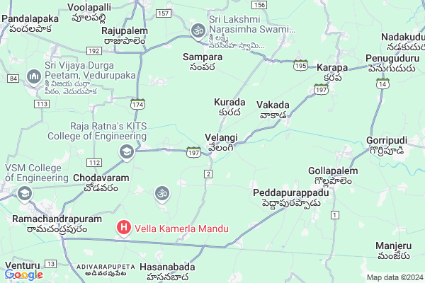
Velangi
Velangi Map
EDIT Map
Add Your House
 ..
..
Current Corona Virus Infected Patients Count in East Godavari District
| City Name | District Name | Total Covid cases |
|---|---|---|
| East Godavari District | East Godavari | 30 |
| Kathipudi | East Godavari | 6 |
| Rajahmundry | East Godavari | 2 |
| Kakinada | East Godavari | 1 |
Locality Name :
Velangi
( వేళంగి )
Mandal Name : Karapa
District : East Godavari
State : Andhra Pradesh
Region : Andhra
Language : Telugu
Current Time 09:31 AM
Date: Wednesday , Apr 30,2025 (IST)
Time zone: IST (UTC+5:30)
Elevation / Altitude: 7 meters. Above Seal level
Telephone Code / Std Code: 0884
Assembly constituency : Hindupur assembly constituency
Assembly MLA : Nandamuri Balakrishna
Lok Sabha constituency : Tirupati parliamentary constituency
Parliament MP : Balli Durga Prasad Rao
Serpanch Name :
Pin Code : 533260
Post Office Name : Velangi
Commodities Prices : Ambajipeta Market / Mandi
Edit below overview about Velangi
Edit below overview about Velangi
OverView of Velangi
Jillella SrinivasS/o sanyasi RaoTadipalli (village)Yanamdala postVia: velangiRamachandrapuram mandalamIndia A.p E. G . DTPiN: 533260Edit below overview about Velangi
National Highways Reachable To Velangi
Nationa High Way :NH216A
Nationa High Way :NH5
Nationa High Way :NH216A
Nationa High Way :NH5
About Velangi
Velangi is a Village in Karapa Mandal in East Godavari District of Andhra Pradesh State, India. It belongs to Andhra region . It is located 17 KM towards west from District head quarters Kakinada. 6 KM from Karapa. 455 KM from State capital Hyderabad
Velangi Pin code is 533260 and postal head office is Velangi .
Oduru ( 3 KM ) , Kandregula ( 3 KM ) , Vakada ( 3 KM ) , Vemulavada ( 4 KM ) , Yandamuru ( 4 KM ) are the nearby Villages to Velangi. Velangi is surrounded by Pedapudi Mandal towards North , Kajuluru Mandal towards South , Ramachandrapuram Mandal towards South , Biccavolu Mandal towards west .
Ramachandrapuram , Kakinada , Yanam , Mandapeta are the near by Cities to Velangi.
It is near to bay of bengal. There is a chance of humidity in the weather.
Velangi 2011 Census Details
Velangi Local Language is Telugu. Velangi Village Total population is 7408 and number of houses are 2170. Female Population is 49.8%. Village literacy rate is 65.0% and the Female Literacy rate is 31.4%.
Population
| Census Parameter | Census Data |
| Total Population | 7408 |
| Total No of Houses | 2170 |
| Female Population % | 49.8 % ( 3692) |
| Total Literacy rate % | 65.0 % ( 4814) |
| Female Literacy rate | 31.4 % ( 2323) |
| Scheduled Tribes Population % | 0.8 % ( 56) |
| Scheduled Caste Population % | 11.6 % ( 860) |
| Working Population % | 41.0 % |
| Child(0 -6) Population by 2011 | 727 |
| Girl Child(0 -6) Population % by 2011 | 49.0 % ( 356) |
Velangi Census More Deatils.
Politics in Velangi
TDP , YSRC , Yuvajana Sramika Rythu Congress Party , Telugu Desam , YSRCP , BJP , INC are the major political parties in this area.Polling Stations /Booths near Velangi
1)Settipalli2)Shirivaram
3)Shirivaram
4)Gollapuram
5)Maluguru
HOW TO REACH Velangi
By Road
Kakinada is the Nearest Town to Velangi. Kakinada is 17 km from Velangi. Road connectivity is there from Kakinada to Velangi.By Rail
Velangi Rail Way Station , Narasapurapupeta Rail Way Station are the very nearby railway stations to Velangi. Also you can consider railway Stations from Near By town Kakinada. Kakinada Port Rail Way Station , Kakinada Town Junction Rail Way Station are the railway Stations near to Kakinada. You can reach from Kakinada to Velangi by road after .By Bus
Draksharamam APSRTC Bus Station , Ramachandrapuram APSRTC Bus Station , Kakinada/J P Bridge APSRTC Bus Station are the nearby by Bus Stations to Velangi .APSRTC runs Number of busses from major cities to here.Colleges near Velangi
G T R Junior College Velangi
Address : G T R Junior College Velangi
Govt Junior College Velangi
Address : Govt Junior College Velangi
Velangi College
Address : Velangi, Karapa (m), E.g.dist. - 533 260.
Schools in Velangi
Zphs Velangi
Address : velangi , karapa , east godavari , Andhra Pradesh . PIN- 533260 , Post - Velangi
Bhanu Prakash Con
Address : velangi , karapa , east godavari , Andhra Pradesh . PIN- 533260 , Post - Velangi
Govt Health Centers near Velangi
1) Velangi , Apr-72 , Main Road , Opp State Bank of India2) Velangi SC , Apr-99 , Main Road , Vinayaka Temple
3) Peddapurappadu SC , 3-149 , Gramapanchayathi Street , MPP School
Sub Villages in Velangi
Hospitals in Velangi,Karapa
Dr.B.vekkanna Rao Nursing Home
Kakinada - Ramachandrapuram Rd; Velangi; Andhra Pradesh 533260; India
0.7 KM distance Detail
more ..
Petrol Bunks in Velangi,Karapa
HP PETROL PUMP - SRI GOWTHAMI AGENCIES
Survey NO.80/5 Ramachandrapuram-velangi Road R C Puram; Mandal; Oduru Village; Visakhapatnam; Andhra Pradesh 533255; India
2.5 KM distance Detail
Hindustan Petroleum
Kakinada - Ramachandrapuram Rd; Oduru; Andhra Pradesh 533260; India
3.2 KM distance Detail
more ..
Colleges in Velangi,Karapa
Velangi Junior College
Kakinada - Ramachandrapuram Rd; Velangi; Andhra Pradesh 533260; India
0.7 KM distance Detail
Kakinada Institute Of Technological Sciences
Ambikapalli Agrahaaram; Andhra Pradesh 533260; India
5.3 KM distance Detail
MS Naicker Degree COllege; Kakinada
Yanam Road; Kakinada; Turangi; Andhra Pradesh 533016; India
5.8 KM distance Detail
Mother Integral College of Education
Karapa-Kakinada Rd; Aryavatam; Andhra Pradesh 533468; India
6.6 KM distance Detail
more ..
Schools in Velangi,Karapa
Bhanu Prakash (E.M.) School; Velangi
Market center; Velangi; Karapa mandal; East Godavari dt; Andhra Pradesh 533260; India
0.7 KM distance Detail
M.Z.P.H.School
Kakinada - Ramachandrapuram Rd; Velangi; Andhra Pradesh 533260; India
0.8 KM distance Detail
Srt School
M.Z.P.H.School; Kakinada - Ramachandrapuram Road; Velangi; Andhra Pradesh; India
0.8 KM distance Detail
Electronic Shops in Velangi,Karapa
MY ONLINE e SERVICES Distributor
Kakinada - Draksharama Rd; Aryavatam; Andhra Pradesh 533468; India
7.3 KM distance Detail
SRI LAKSHMI VENKATESWARA TRACTOR SHED
Kuyyeru - Gollapalem Rd; Gollapalem; Andhra Pradesh 533468; India
7.6 KM distance Detail
Super Markets in Velangi,Karapa
sahithi kirana
Rajgopal Center; Ramachandrapuram - Draksharamam Rd; Ramachandrapuram; Andhra Pradesh; India
10.5 KM distance Detail
Police Stations near Velangi,Karapa
gollapalem police station
Kakinada - Draksharama Rd; Gollapalem; Andhra Pradesh 533468; India
7.7 KM distance Detail
Police Station
Kakinada - Ramachandrapuram Rd; Karapa; Andhra Pradesh 533462; India
7.9 KM distance Detail
Governement Offices near Velangi,Karapa
MeeSeva Center
3-112; ; ; Manrond; Velangi(V);; Kakinada - Ramachandrapuram Rd; Velangi; Andhra Pradesh 533260; India
0.4 KM distance Detail
MeeSeva Center
Kakinada - Ramachandrapuram Rd; Narasapurapupeta; Andhra Pradesh 533260; India
4.4 KM distance Detail
About Velangi &
History
How to reach Velangi
Tourist Places Near By Velangi
Schools in Velangi
Colleges in Velangi
Temperature & weather of Velangi
places in Velangi
Velangi photos
More Information
How to reach Velangi
Tourist Places Near By Velangi
Schools in Velangi
Colleges in Velangi
Temperature & weather of Velangi
places in Velangi
Velangi photos
More Information
Village Talk
Post News or Events about this Village
Near Cities
Ramachandrapuram 11 KM near
Kakinada 17 KM near
Yanam 21 KM near
Mandapeta 23 KM near
Ramachandrapuram 11 KM near
Kakinada 17 KM near
Yanam 21 KM near
Mandapeta 23 KM near
Near By Taluks
Karapa 6 KM near
Pedapudi 7 KM near
Ramachandrapuram 9 KM near
Kajuluru 9 KM near
Karapa 6 KM near
Pedapudi 7 KM near
Ramachandrapuram 9 KM near
Kajuluru 9 KM near
Near By Air Ports
Rajahmundry Airport 45 KM near
Vijayawada Airport 162 KM near
Vishakhapatnam Airport 170 KM near
Rajiv Gandhi International Airport 440 KM near
Rajahmundry Airport 45 KM near
Vijayawada Airport 162 KM near
Vishakhapatnam Airport 170 KM near
Rajiv Gandhi International Airport 440 KM near
Near By Tourist Places
Kakinada 17 KM near
Konaseema 33 KM near
Rajahamundry 42 KM near
Papi Kondalu 104 KM near
Machelipatnam 144 KM near
Kakinada 17 KM near
Konaseema 33 KM near
Rajahamundry 42 KM near
Papi Kondalu 104 KM near
Machelipatnam 144 KM near
Near By Districts
East Godavari 17 KM near
West Godavari 121 KM near
Krishna 145 KM near
Visakhapatanam 169 KM near
East Godavari 17 KM near
West Godavari 121 KM near
Krishna 145 KM near
Visakhapatanam 169 KM near
Near By RailWay Station
Velangi Rail Way Station 0.2 KM near
Narasapurapupeta Rail Way Station 3.2 KM near
Vakada Rail Way Station 4.4 KM near
Kakinada Port Rail Way Station 18 KM near
Kakinada Town Junction Rail Way Station 19 KM near
Velangi Rail Way Station 0.2 KM near
Narasapurapupeta Rail Way Station 3.2 KM near
Vakada Rail Way Station 4.4 KM near
Kakinada Port Rail Way Station 18 KM near
Kakinada Town Junction Rail Way Station 19 KM near