| Home | City Bus | Maps | Villages | Cities | Rail | Tourist Places | School | College | Pin Codes | Corona Cases Count |
| Distance Calculator Bus Services IFSC Codes Trace Mobile Number Weather Search Place Trace IP Available Cash ATM/Banks Locate Polling Booth Report an Error contact People |
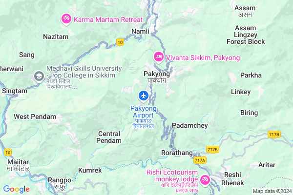
Pakyong
Pakyong Map
EDIT Map
Add Your House
 ..
..
Current Corona Virus Infected Patients Count in East District District
| City Name | District Name | Total Covid cases |
|---|
Locality Name :
Pakyong
( पक्योंग )
Tehsil Name : Pakyong
District : East District
State : Sikkim
Language : Nepali
Current Time 11:57 AM
Date: Sunday , Apr 27,2025 (IST)
Time zone: IST (UTC+5:30)
Telephone Code / Std Code: 03592
Assembly constituency : Gnathang-Machong assembly constituency
Assembly MLA : dorjee tsh. lepcha
Lok Sabha constituency : Sikkim parliamentary constituency
Parliament MP : INDRA HANG SUBBA
Serpanch Name :
Pin Code : 737106
Post Office Name : Pakyong
Commodities Prices : Kalimpong Market / Mandi
Pakyong Live Weather
Temperature: 24.5 °C
broken clouds
Humidity: 54%
Wind : 1.1 mt/sec towards SW
StationName : "Rangpo"
observed on 2 Hours Back
Temperature: 24.5 °C
broken clouds
Humidity: 54%
Wind : 1.1 mt/sec towards SW
StationName : "Rangpo"
observed on 2 Hours Back
Pakyong Weather Forecast for Next 5 days
28-04-2025
15.2°C to 26.1°C
light rain, moderate rain, overcast clouds
15.2°C to 26.1°C
light rain, moderate rain, overcast clouds
29-04-2025
15.7°C to 23.7°C
overcast clouds, light rain, moderate rain
15.7°C to 23.7°C
overcast clouds, light rain, moderate rain
30-04-2025
15.1°C to 20.2°C
light rain, moderate rain, clear sky, scattered clouds, overcast clouds
15.1°C to 20.2°C
light rain, moderate rain, clear sky, scattered clouds, overcast clouds
01-05-2025
15.0°C to 19.5°C
overcast clouds, light rain
15.0°C to 19.5°C
overcast clouds, light rain
02-05-2025
14.9°C to 23.0°C
overcast clouds, light rain, broken clouds
14.9°C to 23.0°C
overcast clouds, light rain, broken clouds
Edit below overview about Pakyong
Edit below overview about Pakyong
OverView of Pakyong
The nearest railway station to pakyong is njp. The nearest airport is bagdogra airport. Pakyong is a small Valley which lies on the adjacent Hill to gangtok. It has a small market where people can buy their basic needs. It has a big reputation school called st. Xaviers. School.Edit below overview about Pakyong
National Highways Reachable To Pakyong
Nationa High Way :NH 717B
Nationa High Way :NH717B
Nationa High Way :NH 717B
Nationa High Way :NH717B
Rivers Near Pakyong
Di Chu
Bindu Khola
Di Chu
Bindu Khola
About Pakyong
Pakyong is a Town in Pakyong Tehsil in East District District of Sikkim State, India. It is located 48 KM towards South from District head quarters Gangtok. It is a Tehsil head quarter.
Pakyong Pin code is 737106 and postal head office is Pakyong .
East Pendam ( 3 KM ) , Central Pendam ( 4 KM ) , Kartok Namcheybong ( 4 KM ) , Taza ( 4 KM ) , Amba ( 5 KM ) are the nearby Villages to Pakyong. Pakyong is surrounded by Duga Tehsil towards west , Rhenock Tehsil towards South , Namthang Tehsil towards west , Khamdong Tehsil towards west .
Gangtok , Kalimpong , Darjeeling , Mal are the nearby Cities to Pakyong.
This Place is in the border of the East District District and South District District. South District District Namthang is west towards this place .
Demographics of Pakyong
Nepali is the Local Language here.Polling Stations /Booths near Pakyong
1)Machong Sr. Sec. School Room No.ii2)Pakyong Range Office Room No.i
3)Pakyong Range Office Room No.ii
4)Pakyong Sub Divisional Administrative Centre R.no.i
5)Latuk Pry. School
HOW TO REACH Pakyong
By Rail
There is no railway station near to Pakyong in less than 10 km.Govt Health Centers near Pakyong
1) Central Pedam PHSc , Central Pedam PHSc , Central Pedam , Central Pedam PHSc2) Middle Camp PHSC , MIDDLE CAMP PHSC , MIDDLE CAMP , MIDDLE CAMP PHSC
3) Tumblabung PHSC , TUMLABONG PHSC , TUMLABONG , TUMLABONG PHSC
Petrol Bunks in Pakyong,Pakyong
Indian Oil Petrol Pump
Middle Camp; East District; NH-31A; Upper Tadong Road; Ranipool; Ranipool; Sikkim 737102; India
4.9 KM distance Detail
more ..
Colleges in Pakyong,Pakyong
Palatine College
Near Hospital Road; Namcheypong; East Sikkim; Pakyong; Sikkim 737106; India
2.0 KM distance Detail
National Institute of Electronics & Information Technology
Rangpo-Rorathang Rd; Sikkim 737106; India
3.7 KM distance Detail
more ..
Schools in Pakyong,Pakyong
Govt Sr. Secondary School
Dikling; Pakyong; East Sikkim; Sikkim- 737106; East Sikkim; Sikkim 737106; India
1.4 KM distance Detail
Govt Senior Secondary School; Dikling
Dikling Rd; Dikling; Sikkim 737106; India
1.4 KM distance Detail
Bhuddhist Monastic school & meditation center
East Sikkim; Sikkim 737106; India
1.9 KM distance Detail
Electronic Shops in Pakyong,Pakyong
Guddu Electronic
Plot no. 243A Gangtok District; Pakyong; Sikkim 737106; India
1.7 KM distance Detail
Super Markets in Pakyong,Pakyong
Big Bazaar
Commerical Complex; Nam Nang Gantok; Nam Nang Road; Gangtok; Sikkim 737101; India
12.2 KM distance Detail
Super Market
Tadong to Zero Point Road; Vishal Gaon; Gangtok; Sikkim 737102; India
12.8 KM distance Detail
About Pakyong &
History
How to reach Pakyong
Tourist Places Near By Pakyong
Schools in Pakyong
Colleges in Pakyong
Temperature & weather of Pakyong
places in Pakyong
Pakyong photos
More Information
How to reach Pakyong
Tourist Places Near By Pakyong
Schools in Pakyong
Colleges in Pakyong
Temperature & weather of Pakyong
places in Pakyong
Pakyong photos
More Information
Town Talk
Post News or Events about this Town
Near Cities
Gangtok 13 KM near
Kalimpong 25 KM near
Darjeeling 43 KM near
Mal 50 KM near
Gangtok 13 KM near
Kalimpong 25 KM near
Darjeeling 43 KM near
Mal 50 KM near
Near By Taluks
Pakyong 4 KM near
Duga 7 KM near
Rhenock 9 KM near
Namthang 11 KM near
Pakyong 4 KM near
Duga 7 KM near
Rhenock 9 KM near
Namthang 11 KM near
Near By Air Ports
Bagdogra Airport 73 KM near
Rupsi Airport 199 KM near
Borjhar Airport 361 KM near
Shillong Airport 421 KM near
Bagdogra Airport 73 KM near
Rupsi Airport 199 KM near
Borjhar Airport 361 KM near
Shillong Airport 421 KM near
Near By Tourist Places
Aritar 10 KM near
Rumtek 11 KM near
Gangtok 13 KM near
Namchi 24 KM near
Kalimpong 24 KM near
Aritar 10 KM near
Rumtek 11 KM near
Gangtok 13 KM near
Namchi 24 KM near
Kalimpong 24 KM near
Near By Districts
Darjeeling 43 KM near
East District 46 KM near
South District 46 KM near
North District 46 KM near
Darjeeling 43 KM near
East District 46 KM near
South District 46 KM near
North District 46 KM near
Near By RailWay Station
New Mal Junction Rail Way Station 46 KM near
Siliguri Junction Rail Way Station 66 KM near
New Mal Junction Rail Way Station 46 KM near
Siliguri Junction Rail Way Station 66 KM near