| Home | City Bus | Maps | Villages | Cities | Rail | Tourist Places | School | College | Pin Codes | Corona Cases Count |
| Distance Calculator Bus Services IFSC Codes Trace Mobile Number Weather Search Place Trace IP Available Cash ATM/Banks Locate Polling Booth Report an Error contact People |
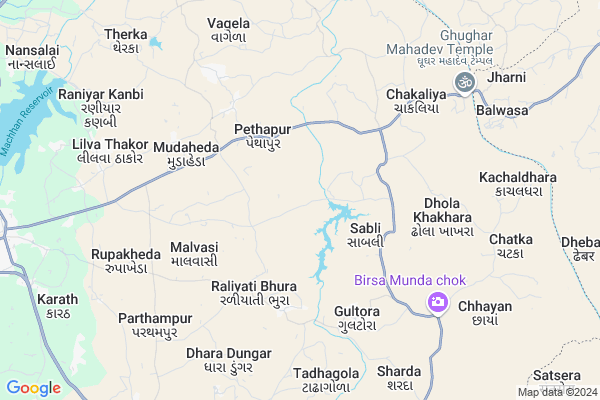
Piplet Map
EDIT Map
Add Your House
 ..
..
Current Corona Virus Infected Patients Count in Dohad District
| City Name | District Name | Total Covid cases |
|---|
Locality Name :
Piplet
( પીપલેટ )
Taluka Name : Jhalod
District : Dohad
State : Gujarat
Language : Gujarati and Hindi
Current Time 01:44 PM
Date: Tuesday , Apr 29,2025 (IST)
Time zone: IST (UTC+5:30)
Elevation / Altitude: 345 meters. Above Seal level
Telephone Code / Std Code: 02679
Assembly constituency : Jhalod assembly constituency
Assembly MLA : Maheshbhai Somjibhai Bhuriya
Lok Sabha constituency : Dahod parliamentary constituency
Parliament MP : JASHVANTSINH SUMANBHAI BHABHOR
Serpanch Name :
Pin Code : 389180
Post Office Name : Limdi
Main Village Name : Piplet
Commodities Prices : Jhalod Market / Mandi
Piplet Live Weather
Temperature: 41.9 °C
clear sky
Humidity: 10%
Wind : 7.25 mt/sec towards W
StationName : "Dohad"
observed on Now
Temperature: 41.9 °C
clear sky
Humidity: 10%
Wind : 7.25 mt/sec towards W
StationName : "Dohad"
observed on Now
Piplet Weather Forecast for Next 5 days
30-04-2025
28.6°C to 42.5°C
clear sky, few clouds
28.6°C to 42.5°C
clear sky, few clouds
01-05-2025
26.9°C to 43.0°C
clear sky
26.9°C to 43.0°C
clear sky
02-05-2025
27.0°C to 42.8°C
clear sky, few clouds
27.0°C to 42.8°C
clear sky, few clouds
03-05-2025
26.5°C to 42.1°C
clear sky
26.5°C to 42.1°C
clear sky
04-05-2025
26.2°C to 41.2°C
clear sky
26.2°C to 41.2°C
clear sky
National Highways Reachable To Piplet
Nationa High Way :NH47
Nationa High Way :NH47;NH56
Nationa High Way :NH47
Nationa High Way :NH47;NH56
Rivers Near Piplet
Pat
Machhan
Pat
Machhan
About Piplet
Correct below Info and add more info about PipletPiplet is a small Village/hamlet in Jhalod Taluka in Dohad District of Gujarat State, India. It comes under Piplet Panchayath. It is located 24 KM towards North from District head quarters Dahod. 14 KM from . 193 KM from State capital Gandhinagar
Piplet Pin code is 389180 and postal head office is Limdi .
Raliyati Bhura ( 3 KM ) , Malvasi ( 4 KM ) , Mudaheda ( 4 KM ) , Gultora ( 5 KM ) , Dhola Khakhara ( 6 KM ) are the nearby Villages to Piplet. Piplet is surrounded by Dohad Taluka towards South , Dahod Taluka towards South , Sajjangarh Taluka towards North , Fatepura Taluka towards North .
Dahod , Jhabua , Banswara , Lunawada are the near by Cities to Piplet.
Piplet 2011 Census Details
Piplet Local Language is Gujarati. Piplet Village Total population is 1739 and number of houses are 276. Female Population is 49.2%. Village literacy rate is 31.3% and the Female Literacy rate is 11.4%.
Population
| Census Parameter | Census Data |
| Total Population | 1739 |
| Total No of Houses | 276 |
| Female Population % | 49.2 % ( 856) |
| Total Literacy rate % | 31.3 % ( 545) |
| Female Literacy rate | 11.4 % ( 198) |
| Scheduled Tribes Population % | 99.5 % ( 1731) |
| Scheduled Caste Population % | 0.0 % ( 0) |
| Working Population % | 49.6 % |
| Child(0 -6) Population by 2011 | 416 |
| Girl Child(0 -6) Population % by 2011 | 47.6 % ( 198) |
Piplet Census More Deatils.
Politics in Piplet
Bharatiya Janata Party , BJP , INC are the major political parties in this area.Polling Stations /Booths near Piplet
1)Pethapur-42)Pethapur-5
3)Malvasi-2
4)Rajpur
5)Raliyati Bhura-3
HOW TO REACH Piplet
By Rail
There is no railway station near to Piplet in less than 10 km.Colleges near Piplet
P.t.c College Of Sanjeli
Address :
Arts Commence College Zalod
Address :
Schools in Piplet
Piplet Pri.shala
Address : piplet , zalod , dohad , Gujarat . PIN- 389180 , Post - Limdi
Govt Health Centers near Piplet
1) Kharoda , BARMA FALIYA , BARAM FALIYA , chakaliyaroad2) Retiya , Retiya , Zalod Road Dahod , Retiya
3) Bhathivada , GAMTAL. NEAR PRIMARY SCHOOL. , GAMTAL , BHATHIVADA
Hospitals in Piplet,Jhalod
Shriji Clinic (Dr:Kalpesh. Panchal)
Limdi-Titaria Rd; Limdi; Gujarat 389180; India
5.3 KM distance Detail
more ..
Petrol Bunks in Piplet,Jhalod
Mahalakshmi Petroleum Reliance Petroleum
Dahod; SH-62; Dahod Road; Zalhod; Zalhod; Gujarat 389180; India
13.0 KM distance Detail
more ..
Colleges in Piplet,Jhalod
Shree Ambalal Vyas Uttarbuniyadi Highschool
College Rd; Jhalod; Gujarat 389170; India
15.3 KM distance Detail
Mahila Adhyapan Mandir P.T.C. College
College Rd; Jhalod; Gujarat 389170; India
15.4 KM distance Detail
more ..
Schools in Piplet,Jhalod
Shir Shreyas Vidhyalay ;asha Nagar-2 B/h
Harinagar-2; Harinagar; Udhna; Surat; Gujarat 389180; India
3.4 KM distance Detail
Super Markets in Piplet,Jhalod
SHRENIKKUMAR TEJKERAN CHHAJED...{MAHAVIR} DISTRIBUTERS OF FMCG
Opp:POST OFFICE JAIN UPSARAY MARG; Limdi; Gujarat 389180; India
12.1 KM distance Detail
Chandramani Super Store
mahadev road; Near Jain Mandir; Dahod; Limdi; Gujarat 389180; India
12.6 KM distance Detail
Local Parks in Piplet,Jhalod
Prabhuta party plot
NR-Agrawal Society; GJ SH 58; Agrawal Society; Jhalod; Gujarat 389170; India
16.2 KM distance Detail
About Piplet &
History
How to reach Piplet
Tourist Places Near By Piplet
Schools in Piplet
Colleges in Piplet
Temperature & weather of Piplet
places in Piplet
Piplet photos
More Information
How to reach Piplet
Tourist Places Near By Piplet
Schools in Piplet
Colleges in Piplet
Temperature & weather of Piplet
places in Piplet
Piplet photos
More Information
Village Talk
Post News or Events about this Village
Near Cities
Dahod 22 KM near
Jhabua 48 KM near
Banswara 66 KM near
Lunawada 74 KM near
Dahod 22 KM near
Jhabua 48 KM near
Banswara 66 KM near
Lunawada 74 KM near
Near By Taluks
Jhalod 14 KM near
Dohad 22 KM near
Dahod 24 KM near
Sajjangarh 25 KM near
Jhalod 14 KM near
Dohad 22 KM near
Dahod 24 KM near
Sajjangarh 25 KM near
Near By Air Ports
Vadodara Airport 147 KM near
Indore Airport 181 KM near
Ahmedabad Airport 187 KM near
Dabok Airport 203 KM near
Vadodara Airport 147 KM near
Indore Airport 181 KM near
Ahmedabad Airport 187 KM near
Dabok Airport 203 KM near
Near By Tourist Places
Dahod 19 KM near
Banswara 68 KM near
Ratlam 99 KM near
Champaner 106 KM near
Pavagadh 111 KM near
Dahod 19 KM near
Banswara 68 KM near
Ratlam 99 KM near
Champaner 106 KM near
Pavagadh 111 KM near
Near By Districts
Dohad 23 KM near
Jhabua 49 KM near
Banswara 69 KM near
Panch Mahals 79 KM near
Dohad 23 KM near
Jhabua 49 KM near
Banswara 69 KM near
Panch Mahals 79 KM near
Near By RailWay Station
Dahod Rail Way Station 21 KM near
Meghnagar Rail Way Station 35 KM near
Dahod Rail Way Station 21 KM near
Meghnagar Rail Way Station 35 KM near