| Home | City Bus | Maps | Villages | Cities | Rail | Tourist Places | School | College | Pin Codes | Corona Cases Count |
| Distance Calculator Bus Services IFSC Codes Trace Mobile Number Weather Search Place Trace IP Available Cash ATM/Banks Locate Polling Booth Report an Error contact People |
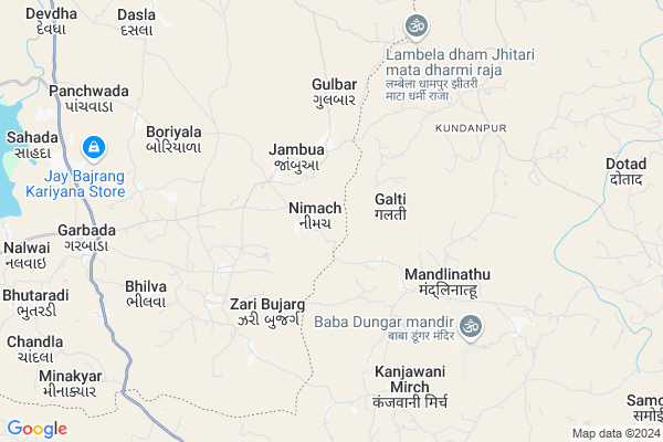
Nimach Map
EDIT Map
Add Your House
 ..
..
Current Corona Virus Infected Patients Count in Dohad District
| City Name | District Name | Total Covid cases |
|---|
Locality Name :
Nimach
( નિમચ )
Taluka Name : Garbada
District : Dohad
State : Gujarat
Language : Gujarati and Hindi
Current Time 12:11 PM
Date: Tuesday , Apr 29,2025 (IST)
Time zone: IST (UTC+5:30)
Elevation / Altitude: 313 meters. Above Seal level
Telephone Code / Std Code: 02673
Assembly constituency : Garbada assembly constituency
Assembly MLA : Bhabhor Mahendrabhai Rameshbhai
Lok Sabha constituency : Dahod parliamentary constituency
Parliament MP : JASHVANTSINH SUMANBHAI BHABHOR
Serpanch Name :
Pin Code : 389155
Post Office Name : Garbada
Commodities Prices : Dahod Market / Mandi
Nimach Live Weather
Temperature: 38.4 °C
clear sky
Humidity: 12%
Wind : 7.18 mt/sec towards W
StationName : "RÄ\u0081nÄ\u0081pur"
observed on 38 Mins Back
Temperature: 38.4 °C
clear sky
Humidity: 12%
Wind : 7.18 mt/sec towards W
StationName : "RÄ\u0081nÄ\u0081pur"
observed on 38 Mins Back
Nimach Weather Forecast for Next 5 days
30-04-2025
28.3°C to 41.6°C
clear sky
28.3°C to 41.6°C
clear sky
01-05-2025
26.4°C to 41.8°C
clear sky
26.4°C to 41.8°C
clear sky
02-05-2025
26.4°C to 41.7°C
clear sky
26.4°C to 41.7°C
clear sky
03-05-2025
26.1°C to 41.7°C
clear sky
26.1°C to 41.7°C
clear sky
04-05-2025
25.5°C to 40.3°C
clear sky
25.5°C to 40.3°C
clear sky
Edit below overview about Nimach
Edit below overview about Nimach
OverView of Nimach
Nimach village is the best village in Dahod district,Nimach village name is the created by the public that was the mataji name in the created in from all over the nimach village surrounded other people and nimach village ancestors are the best thing about this village historyEdit below overview about Nimach
National Highways Reachable To Nimach
Nationa High Way :NH47
Nationa High Way :NH47;NH56
Nationa High Way :NH47
Nationa High Way :NH47;NH56
Rivers Near Nimach
Sunar
Hatni
Sunar
Hatni
About Nimach
Nimach is a Village in Garbada Taluka in Dohad District of Gujarat State, India. It is located 23 KM towards South from District head quarters Dahod. 12 KM from Garbada. 219 KM from State capital Gandhinagar
Nimach Pin code is 389155 and postal head office is Garbada .
Gangarda ( 3 KM ) , Zari Bujarg ( 3 KM ) , Gulbar ( 4 KM ) , Simaliya Bujarg ( 5 KM ) , Boriyala ( 5 KM ) are the nearby Villages to Nimach. Nimach is surrounded by Ranapur Taluka towards East , Bhabra Taluka towards South , Dahod Taluka towards North , Dohad Taluka towards North .
Dahod , Jhabua , Rajgarh , Godhra are the near by Cities to Nimach.
This Place is in the border of the Dohad District and Alirajpur District. Alirajpur District Bhabra is South towards this place . It is near to the Madhya Pradesh State Border.
Nimach 2011 Census Details
Nimach Local Language is Gujarati. Nimach Village Total population is 2717 and number of houses are 431. Female Population is 51.8%. Village literacy rate is 44.2% and the Female Literacy rate is 19.0%.
Population
| Census Parameter | Census Data |
| Total Population | 2717 |
| Total No of Houses | 431 |
| Female Population % | 51.8 % ( 1408) |
| Total Literacy rate % | 44.2 % ( 1201) |
| Female Literacy rate | 19.0 % ( 516) |
| Scheduled Tribes Population % | 99.9 % ( 2714) |
| Scheduled Caste Population % | 0.0 % ( 0) |
| Working Population % | 48.6 % |
| Child(0 -6) Population by 2011 | 604 |
| Girl Child(0 -6) Population % by 2011 | 47.5 % ( 287) |
Nimach Census More Deatils.
Politics in Nimach
Bharatiya Janata Party , BJP , INC are the major political parties in this area.Polling Stations /Booths near Nimach
1)Nimach-12)Nelasur-3
3)Jambua-1
4)Harakhpur
5)Jaribujarga-2
HOW TO REACH Nimach
By Rail
There is no railway station near to Nimach in less than 10 km.Colleges near Nimach
Maa Gayatri B. Ed. College
Address : Urmi Building, Nr. Garbada Chokdi, Dahod – 389 151
Schools in Nimach
Nimach Pri.shala
Address : nimach , garbada , dohad , Gujarat . PIN- 389155 , Post - Garbada
Govt Health Centers near Nimach
1) Jambua , PHC Jambua , Gamtal , Near2) Agavada , Agavada , near school , near school
3) Garbada - T , CHC Garbada , Nava Faliya , Garbada Chowkdi
Sub Villages in Nimach
Petrol Bunks in Nimach,Garbada
M/s.Govardhan Automobile
National Highway 59; Katwara; Gujarat 389154; India
12.8 KM distance Detail
more ..
Colleges in Nimach,Garbada
Gurjar Bharti B.ed. College; Nagarala
Sotiyajalam; Madhya Pradesh 457661; India
3.0 KM distance Detail
more ..
Local Parks in Nimach,Garbada
Indraprasth Tourist Homestay
SH 39; District Jhabua; Ranapur; Madhya Pradesh 457993; India
16.7 KM distance Detail
About Nimach &
History
How to reach Nimach
Tourist Places Near By Nimach
Schools in Nimach
Colleges in Nimach
Temperature & weather of Nimach
places in Nimach
Nimach photos
More Information
How to reach Nimach
Tourist Places Near By Nimach
Schools in Nimach
Colleges in Nimach
Temperature & weather of Nimach
places in Nimach
Nimach photos
More Information
Village Talk
Post News or Events about this Village
Near Cities
Dahod 24 KM near
Jhabua 25 KM near
Rajgarh 64 KM near
Godhra 90 KM near
Dahod 24 KM near
Jhabua 25 KM near
Rajgarh 64 KM near
Godhra 90 KM near
Near By Taluks
Garbada 12 KM near
Ranapur 14 KM near
Bhabra 17 KM near
Dahod 20 KM near
Garbada 12 KM near
Ranapur 14 KM near
Bhabra 17 KM near
Dahod 20 KM near
Near By Air Ports
Vadodara Airport 142 KM near
Indore Airport 163 KM near
Ahmedabad Airport 207 KM near
Dabok Airport 246 KM near
Vadodara Airport 142 KM near
Indore Airport 163 KM near
Ahmedabad Airport 207 KM near
Dabok Airport 246 KM near
Near By Tourist Places
Dahod 27 KM near
Toranmal 101 KM near
Champaner 101 KM near
Pavagadh 105 KM near
Banswara 106 KM near
Dahod 27 KM near
Toranmal 101 KM near
Champaner 101 KM near
Pavagadh 105 KM near
Banswara 106 KM near
Near By Districts
Dohad 22 KM near
Jhabua 25 KM near
Alirajpur 48 KM near
Panch Mahals 88 KM near
Dohad 22 KM near
Jhabua 25 KM near
Alirajpur 48 KM near
Panch Mahals 88 KM near
Near By RailWay Station
Dahod Rail Way Station 24 KM near
Meghnagar Rail Way Station 32 KM near
Dahod Rail Way Station 24 KM near
Meghnagar Rail Way Station 32 KM near