| Home | City Bus | Maps | Villages | Cities | Rail | Tourist Places | School | College | Pin Codes | Corona Cases Count |
| Distance Calculator Bus Services IFSC Codes Trace Mobile Number Weather Search Place Trace IP Available Cash ATM/Banks Locate Polling Booth Report an Error contact People |
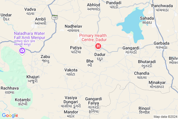
Bhe Map
EDIT Map
Add Your House
 ..
..
Current Corona Virus Infected Patients Count in Dohad District
| City Name | District Name | Total Covid cases |
|---|
Locality Name :
Bhe
( ભે )
Taluka Name : Garbada
District : Dohad
State : Gujarat
Language : Gujarati and Hindi
Current Time 08:19 PM
Date: Wednesday , Feb 05,2025 (IST)
Time zone: IST (UTC+5:30)
Elevation / Altitude: 313 meters. Above Seal level
Telephone Code / Std Code: 02673
Assembly constituency : Garbada assembly constituency
Assembly MLA : Bhabhor Mahendrabhai Rameshbhai
Lok Sabha constituency : Dahod parliamentary constituency
Parliament MP : JASHVANTSINH SUMANBHAI BHABHOR
Serpanch Name :
Pin Code : 389155
Post Office Name : Garbada
Alternate Village Name : Bhey
Commodities Prices : Dahod Market / Mandi
Bhe Live Weather
Temperature: 18.6 °C
clear sky
Humidity: 23%
Wind : 3.04 mt/sec towards N
StationName : "Dohad"
observed on 4 Mins Back
Temperature: 18.6 °C
clear sky
Humidity: 23%
Wind : 3.04 mt/sec towards N
StationName : "Dohad"
observed on 4 Mins Back
Bhe Weather Forecast for Next 5 days
06-02-2025
16.2°C to 19.1°C
clear sky
16.2°C to 19.1°C
clear sky
07-02-2025
15.0°C to 28.1°C
clear sky
15.0°C to 28.1°C
clear sky
08-02-2025
15.9°C to 29.9°C
clear sky, few clouds
15.9°C to 29.9°C
clear sky, few clouds
09-02-2025
17.4°C to 31.5°C
clear sky, scattered clouds, broken clouds
17.4°C to 31.5°C
clear sky, scattered clouds, broken clouds
10-02-2025
20.0°C to 33.6°C
scattered clouds, overcast clouds, broken clouds, clear sky
20.0°C to 33.6°C
scattered clouds, overcast clouds, broken clouds, clear sky
National Highways Reachable To Bhe
Nationa High Way :NH47
Nationa High Way :NH47;NH56
Nationa High Way :NH47
Nationa High Way :NH47;NH56
Rivers Near Bhe
Sunar
Hatni
Sunar
Hatni
About Bhe
Correct below Info and add more info about BheBhe is a Village in Garbada Taluka in Dohad District of Gujarat State, India. It is located 21 KM towards South from District head quarters Dahod. 7 KM from Garbada. 202 KM from State capital Gandhinagar
Bhe Pin code is 389155 and postal head office is Garbada .
Dadur ( 1 KM ) , Patiya ( 2 KM ) , Nandva ( 2 KM ) , Navanagar ( 2 KM ) , Vakota ( 2 KM ) are the nearby Villages to Bhe. Bhe is surrounded by Dhanpur Taluka towards west , Dohad Taluka towards North , Dahod Taluka towards North , Bhabra Taluka towards East .
Dahod , Jhabua , Godhra , Rajgarh are the near by Cities to Bhe.
This Place is in the border of the Dohad District and Alirajpur District. Alirajpur District Bhabra is East towards this place . It is near to the Madhya Pradesh State Border.
Bhe 2011 Census Details
Bhe Local Language is Gujarati. Bhe Village Total population is 8421 and number of houses are 984. Female Population is 50.1%. Village literacy rate is 30.5% and the Female Literacy rate is 12.2%.
Population
| Census Parameter | Census Data |
| Total Population | 8421 |
| Total No of Houses | 984 |
| Female Population % | 50.1 % ( 4216) |
| Total Literacy rate % | 30.5 % ( 2572) |
| Female Literacy rate | 12.2 % ( 1031) |
| Scheduled Tribes Population % | 96.9 % ( 8160) |
| Scheduled Caste Population % | 0.1 % ( 7) |
| Working Population % | 46.1 % |
| Child(0 -6) Population by 2011 | 2129 |
| Girl Child(0 -6) Population % by 2011 | 49.4 % ( 1051) |
Bhe Census More Deatils.
Politics in Bhe
Bharatiya Janata Party , BJP , INC are the major political parties in this area.Polling Stations /Booths near Bhe
1)Jesawada-32)Bhanapur(ka)-2
3)Bhe-1
4)Bhe-2
5)Navanagar-1
HOW TO REACH Bhe
By Rail
There is no railway station near to Bhe in less than 10 km.Colleges near Bhe
Maa Gayatri B. Ed. College
Address : Urmi Building, Nr. Garbada Chokdi, Dahod – 389 151
Schools in Bhe
Bhe Mu. Pri.shala
Address : bhe , garbada , dohad , Gujarat . PIN- 389155 , Post - Garbada
Bhe Handiya F V Pri Shala
Address : bhe , garbada , dohad , Gujarat . PIN- 389155 , Post - Garbada
Govt Health Centers near Bhe
1) Gangardi , GANGARDI , BHARSHDA ROAD , BEHIND VODAFONE TOWER2) Garbada - T , CHC Garbada , Nava Faliya , Garbada Chowkdi
3) Nagrala , PHC NAGRALA , NAGRALA GAMTA; , JESAVADA ROAD
Sub Villages in Bhe
Colleges in Bhe,Garbada
Tentative location Zydus Medical college
muvalia; Rabdal; Gujarat 389151; India
18.0 KM distance Detail
more ..
Governement Offices near Bhe,Garbada
Panchshil Jaman Vadi
Main Bazar; Garbada; Ta.Garbada; Dist; Gujarat 389155; India
10.0 KM distance Detail
About Bhe &
History
How to reach Bhe
Tourist Places Near By Bhe
Schools in Bhe
Colleges in Bhe
Temperature & weather of Bhe
places in Bhe
Bhe photos
More Information
How to reach Bhe
Tourist Places Near By Bhe
Schools in Bhe
Colleges in Bhe
Temperature & weather of Bhe
places in Bhe
Bhe photos
More Information
Village Talk
Post News or Events about this Village
Near Cities
Dahod 21 KM near
Jhabua 43 KM near
Godhra 73 KM near
Rajgarh 82 KM near
Dahod 21 KM near
Jhabua 43 KM near
Godhra 73 KM near
Rajgarh 82 KM near
Near By Taluks
Garbada 7 KM near
Dhanpur 15 KM near
Dohad 21 KM near
Dahod 22 KM near
Garbada 7 KM near
Dhanpur 15 KM near
Dohad 21 KM near
Dahod 22 KM near
Near By Air Ports
Vadodara Airport 124 KM near
Indore Airport 181 KM near
Ahmedabad Airport 190 KM near
Dabok Airport 245 KM near
Vadodara Airport 124 KM near
Indore Airport 181 KM near
Ahmedabad Airport 190 KM near
Dabok Airport 245 KM near
Near By Tourist Places
Dahod 24 KM near
Champaner 83 KM near
Pavagadh 87 KM near
Toranmal 101 KM near
Banswara 111 KM near
Dahod 24 KM near
Champaner 83 KM near
Pavagadh 87 KM near
Toranmal 101 KM near
Banswara 111 KM near
Near By Districts
Dohad 20 KM near
Jhabua 44 KM near
Alirajpur 47 KM near
Panch Mahals 70 KM near
Dohad 20 KM near
Jhabua 44 KM near
Alirajpur 47 KM near
Panch Mahals 70 KM near
Near By RailWay Station
Dahod Rail Way Station 21 KM near
Meghnagar Rail Way Station 46 KM near
Dahod Rail Way Station 21 KM near
Meghnagar Rail Way Station 46 KM near