| Home | City Bus | Maps | Villages | Cities | Rail | Tourist Places | School | College | Pin Codes | Corona Cases Count |
| Distance Calculator Bus Services IFSC Codes Trace Mobile Number Weather Search Place Trace IP Available Cash ATM/Banks Locate Polling Booth Report an Error contact People |
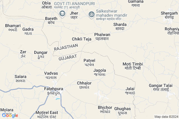
Patvel Map
EDIT Map
Add Your House
 ..
..
Current Corona Virus Infected Patients Count in Dohad District
| City Name | District Name | Total Covid cases |
|---|
Locality Name :
Patvel
( પટવેલ )
Taluka Name : Fatepura
District : Dohad
State : Gujarat
Language : Gujarati and Hindi
Current Time 12:43 PM
Date: Monday , Apr 28,2025 (IST)
Time zone: IST (UTC+5:30)
Elevation / Altitude: 345 meters. Above Seal level
Telephone Code / Std Code: 02675
Assembly constituency : Fatepura assembly constituency
Assembly MLA : Katara Rameshbhai Bhurabhai
Lok Sabha constituency : Dahod parliamentary constituency
Parliament MP : JASHVANTSINH SUMANBHAI BHABHOR
Serpanch Name :
Pin Code : 389172
Post Office Name : Fatepura (Dahod)
Alternate Village Name : Patavel
Commodities Prices : Jhalod Market / Mandi
Rivers Near Patvel
Pat
Machhan
Pat
Machhan
About Patvel
Correct below Info and add more info about PatvelPatvel is a Village in Fatepura Taluka in Dohad District of Gujarat State, India. It is located 63 KM towards North from District head quarters Dahod. 11 KM from Fatepura. 170 KM from State capital Gandhinagar
Patvel Pin code is 389172 and postal head office is Fatepura (Dahod).
Nava Talav ( 3 KM ) , Piplara ( 3 KM ) , Navagam ( 4 KM ) , Karmel ( 4 KM ) , Nani Charoli ( 5 KM ) are the nearby Villages to Patvel. Patvel is surrounded by Anandpuri Taluka towards North , Bagidora Taluka towards East , Santrampur Taluka towards west , Sajjangarh Taluka towards East .
Sagwara , Banswara , Lunawada , Dahod are the near by Cities to Patvel.
This Place is in the border of the Dohad District and Banswara District. Banswara District Anandpuri is North towards this place . Also it is in the Border of other district Panch Mahals . It is near to the Rajasthan State Border.
Patvel 2011 Census Details
Patvel Local Language is Gujarati. Patvel Village Total population is 1846 and number of houses are 267. Female Population is 50.1%. Village literacy rate is 38.9% and the Female Literacy rate is 14.9%.
Population
| Census Parameter | Census Data |
| Total Population | 1846 |
| Total No of Houses | 267 |
| Female Population % | 50.1 % ( 924) |
| Total Literacy rate % | 38.9 % ( 718) |
| Female Literacy rate | 14.9 % ( 275) |
| Scheduled Tribes Population % | 100.0 % ( 1846) |
| Scheduled Caste Population % | 0.0 % ( 0) |
| Working Population % | 51.9 % |
| Child(0 -6) Population by 2011 | 401 |
| Girl Child(0 -6) Population % by 2011 | 47.4 % ( 190) |
Patvel Census More Deatils.
Politics in Patvel
Bharatiya Janata Party , BJP , INC are the major political parties in this area.Polling Stations /Booths near Patvel
1)Patadiya2)Anika-2
3)Jagola-1
4)Itadi
5)Bariyani Hathod
HOW TO REACH Patvel
By Rail
There is no railway station near to Patvel in less than 10 km.Colleges near Patvel
P.t.c College Of Sanjeli
Address :
Govt. Engineering College, Dahod
Address : Opp. Navjivan Arts And Science College,
zalod Raod, Dahod
Arts Commence College Zalod
Address :
Government Engineering College, Dahod
Address : Opp. Navjivan Science Collegedahod-zalod Road,daho
J & R B. Ed. College
Address : Navjeevan Arts & Commerce College Campus, Jhalod R
Schools in Patvel
Patvel
Address : patvel , fatepura , dohad , Gujarat . PIN- 389172 , Post - Fatepura (Dahod)
Govt Health Centers near Patvel
1) Ghughas , Ghughas primary Health center , Talgam faliya , Mukhya shala2) Madhva , Madhva , Zalod raod , near primary school
3) Salara , Salara Primary Health Center , Dungara faliya , Near Talav
Hospitals in Patvel,Fatepura
Fatehpura Referal Hospital & Primery Health Center
Valundi; Fatehpura; Gujarat 389172; India
6.2 KM distance Detail
more ..
Petrol Bunks in Patvel,Fatepura
HP PETROL PUMP - HAMARA PUMP ANANDAPURI
Hpcl Petrol Pump Village: Anandapuri Dist: Banswara; Udaipur; Rajasthan 327031; India
12.6 KM distance Detail
more ..
Schools in Patvel,Fatepura
Bright Jalaram School
Fatepura Alias Valu; Dohad; Fatehpura; Gujarat 389172; India
5.6 KM distance Detail
Electronic Shops in Patvel,Fatepura
Nav Sarjan Electric And mitor Reviding (Ligigh And plumber Fitting)
Fatehpura-Anandpuri Road; Fatehpura; Gujarat 389172; India
6.0 KM distance Detail
Local Parks in Patvel,Fatepura
Governement Offices near Patvel,Fatepura
Mamalatdar & Executive Magistrate Kacheri
Valundi; Fatehpura; Gujarat 389172; India
6.3 KM distance Detail
About Patvel &
History
How to reach Patvel
Tourist Places Near By Patvel
Schools in Patvel
Colleges in Patvel
Temperature & weather of Patvel
places in Patvel
Patvel photos
More Information
How to reach Patvel
Tourist Places Near By Patvel
Schools in Patvel
Colleges in Patvel
Temperature & weather of Patvel
places in Patvel
Patvel photos
More Information
Village Talk
Post News or Events about this Village
Near Cities
Sagwara 48 KM near
Banswara 51 KM near
Lunawada 56 KM near
Dahod 59 KM near
Sagwara 48 KM near
Banswara 51 KM near
Lunawada 56 KM near
Dahod 59 KM near
Near By Taluks
Fatepura 11 KM near
Anandpuri 12 KM near
Bagidora 17 KM near
Santrampur 26 KM near
Fatepura 11 KM near
Anandpuri 12 KM near
Bagidora 17 KM near
Santrampur 26 KM near
Near By Air Ports
Vadodara Airport 155 KM near
Dabok Airport 166 KM near
Ahmedabad Airport 168 KM near
Indore Airport 210 KM near
Vadodara Airport 155 KM near
Dabok Airport 166 KM near
Ahmedabad Airport 168 KM near
Indore Airport 210 KM near
Near By Tourist Places
Banswara 51 KM near
Dahod 56 KM near
Dungarpur 80 KM near
Ratlam 113 KM near
Champaner 118 KM near
Banswara 51 KM near
Dahod 56 KM near
Dungarpur 80 KM near
Ratlam 113 KM near
Champaner 118 KM near
Near By Districts
Banswara 54 KM near
Dohad 61 KM near
Dungarpur 80 KM near
Panch Mahals 83 KM near
Banswara 54 KM near
Dohad 61 KM near
Dungarpur 80 KM near
Panch Mahals 83 KM near
Near By RailWay Station
Dahod Rail Way Station 59 KM near
Meghnagar Rail Way Station 71 KM near
Dahod Rail Way Station 59 KM near
Meghnagar Rail Way Station 71 KM near