| Home | City Bus | Maps | Villages | Cities | Rail | Tourist Places | School | College | Pin Codes | Corona Cases Count |
| Distance Calculator Bus Services IFSC Codes Trace Mobile Number Weather Search Place Trace IP Available Cash ATM/Banks Locate Polling Booth Report an Error contact People |
Sonarthawa
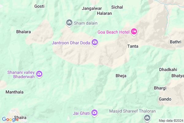
Sonarthawa Map
EDIT Map
Add Your House
 ..
..
Current Corona Virus Infected Patients Count in Doda District
| City Name | District Name | Total Covid cases |
|---|
Locality Name :
Sonarthawa
( सोनारथवा )
Block Name : Thathri
District : Doda
State : Jammu & Kashmir
Language : Urdu and Bhadrawahi,
Current Time 04:58 PM
Date: Wednesday , Mar 12,2025 (IST)
Time zone: IST (UTC+5:30)
Elevation / Altitude: 662 meters. Above Seal level
Telephone Code / Std Code: 01995
Assembly constituency : assembly constituency
Assembly MLA :
Lok Sabha constituency : parliamentary constituency
Parliament MP :
Serpanch Name :
Commodities Prices : Batote Market / Mandi
Sonarthawa Live Weather
Temperature: 13.8 °C
broken clouds
Humidity: 57%
Wind : 2.13 mt/sec towards SW
StationName : "BhadarwÄ\u0081h"
observed on Now
Temperature: 13.8 °C
broken clouds
Humidity: 57%
Wind : 2.13 mt/sec towards SW
StationName : "BhadarwÄ\u0081h"
observed on Now
Sonarthawa Weather Forecast for Next 5 days
13-03-2025
4.4°C to 9.6°C
light rain, overcast clouds
4.4°C to 9.6°C
light rain, overcast clouds
14-03-2025
1.4°C to 8.4°C
moderate rain, light rain, overcast clouds
1.4°C to 8.4°C
moderate rain, light rain, overcast clouds
15-03-2025
1.1°C to 8.2°C
overcast clouds, light snow, light rain
1.1°C to 8.2°C
overcast clouds, light snow, light rain
16-03-2025
0.8°C to 6.6°C
moderate rain, light rain
0.8°C to 6.6°C
moderate rain, light rain
17-03-2025
1.8°C to 8.4°C
scattered clouds, light rain, overcast clouds, light snow
1.8°C to 8.4°C
scattered clouds, light rain, overcast clouds, light snow
National Highways Reachable To Sonarthawa
Nationa High Way :NH44
Nationa High Way :NH44
Rivers Near Sonarthawa
Chandrabhaga :Chenab River :चनाब :ਚਨਾਬ :چناب
Tavi
Chandrabhaga :Chenab River :चनाब :ਚਨਾਬ :چناب
Tavi
About Sonarthawa
Correct below Info and add more info about SonarthawaSonarthawa is a Village in Thathri Block in Doda District of Jammu & Kashmir State, India. It is located 25 KM towards East from District head quarters Doda. 5 KM from Thathri. 167 KM from State capital Srinagar, Jammu
Jangalwar ( 5 KM ) , Rokali ( 6 KM ) , Puneja ( 8 KM ) , Sharote ( 9 KM ) , Kandote ( 9 KM ) are the nearby Villages to Sonarthawa. Sonarthawa is surrounded by Bhaderwah Block towards South , Drabshalla Block towards North , Bhalessa(Gandoh) Block towards East , Doda Block towards west .
Udhampur , Dalhousie , Chamba , Kathua are the near by Cities to Sonarthawa.
Demographics of Sonarthawa
Urdu is the Local Language here.HOW TO REACH Sonarthawa
By Rail
There is no railway station near to Sonarthawa in less than 10 km.Pincodes near Sonarthawa
182221 ( Udrana ) , 182222 ( Bhaderwah ) , 182201 ( Puldoda )Colleges near Sonarthawa
Govt. Digree College Kilhotran
Address :
Government Degree College Kilhotran
Address :
Govt. Polytechnical College Khellani
Address : Khellani Doda
Govt Degree College Bhalessa
Address : Doda, Jammu
G R Azad College Of Education
Address : Kilhotran Bhalessa
Schools near Sonarthawa
Gghs(g) Thatri
Address : thathri , thatri , doda , Jammu & Kashmir . PIN- 182203 , Post - Thathri
Ghss Chirala
Address : bajja , thatri , doda , Jammu & Kashmir . PIN- 182201 , Post - Puldoda
Hss Malnoo
Address : malanoo , bhatyas , doda , Jammu & Kashmir . PIN- 182203 , Post - Thathri
Ghs Halaran
Address : halaran , bhatyas , doda , Jammu & Kashmir . PIN- 182203 , Post - Thathri
Govt Health Centers near Sonarthawa
1) PHC CHINTA , , Chinta , Near Indra Memorial Public School Chinta Bhaderwah.2) SC Jamble , , JAMBLE ,
3) Bari , SC Bari , ,
Petrol Bunks in Sonarthawa,Thathri
HP PETROL PUMP - J K FILLING STATION
Hpcl Dealers Vill Gatha Bhaderwah; Jammu; Jammu and Kashmir 182222
13.0 KM distance Detail
more ..
Schools in Sonarthawa,Thathri
Govt.hss Boys Chiralla
Govt; Hamirpur-Galore Rd; Budhwin; Himachal Pradesh 177026
3.6 KM distance Detail
Electronic Shops in Sonarthawa,Thathri
DAR ELECTRIC ELECTRONIC & COMMUNICATION
Jammu and Kashmir; Bhalessa RD ROAD; Gandoh Bhalessa; 182203
16.9 KM distance Detail
Super Markets in Sonarthawa,Thathri
Local Parks in Sonarthawa,Thathri
Police Stations near Sonarthawa,Thathri
Office of the Senior Superintendent of Police
Kotli; Jammu and Kashmir 182222
13.1 KM distance Detail
Governement Offices near Sonarthawa,Thathri
Tourist Reception Center Bhaderwah
TRC;Sarna; Bhaderwah; Jammu and Kashmir 182222
12.5 KM distance Detail
About Sonarthawa &
History
How to reach Sonarthawa
Tourist Places Near By Sonarthawa
Schools in Sonarthawa
Colleges in Sonarthawa
Temperature & weather of Sonarthawa
places in Sonarthawa
Sonarthawa photos
More Information
How to reach Sonarthawa
Tourist Places Near By Sonarthawa
Schools in Sonarthawa
Colleges in Sonarthawa
Temperature & weather of Sonarthawa
places in Sonarthawa
Sonarthawa photos
More Information
Village Talk
Post News or Events about this Village
Near Cities
Udhampur 68 KM near
Dalhousie 71 KM near
Chamba 73 KM near
Kathua 91 KM near
Udhampur 68 KM near
Dalhousie 71 KM near
Chamba 73 KM near
Kathua 91 KM near
Near By Taluks
Thathri 5 KM near
Drabshalla 13 KM near
Bhaderwah 13 KM near
Bhalessa(Gandoh) 18 KM near
Thathri 5 KM near
Drabshalla 13 KM near
Bhaderwah 13 KM near
Bhalessa(Gandoh) 18 KM near
Near By Air Ports
Pathankot Airport 108 KM near
Satwari Airport 108 KM near
Gaggal Airport 110 KM near
Srinagar Airport 155 KM near
Pathankot Airport 108 KM near
Satwari Airport 108 KM near
Gaggal Airport 110 KM near
Srinagar Airport 155 KM near
Near By Tourist Places
Patnitop 48 KM near
Sanasar 53 KM near
Udhampur 69 KM near
Dalhousie 71 KM near
Khajjiar 73 KM near
Patnitop 48 KM near
Sanasar 53 KM near
Udhampur 69 KM near
Dalhousie 71 KM near
Khajjiar 73 KM near
Near By Districts
Doda 24 KM near
Kishtwar 29 KM near
Ramban 59 KM near
Udhampur 69 KM near
Doda 24 KM near
Kishtwar 29 KM near
Ramban 59 KM near
Udhampur 69 KM near
Near By RailWay Station
Udhampur Rail Way Station 66 KM near
Kathua Rail Way Station 87 KM near
Udhampur Rail Way Station 66 KM near
Kathua Rail Way Station 87 KM near