| Home | City Bus | Maps | Villages | Cities | Rail | Tourist Places | School | College | Pin Codes | Corona Cases Count |
| Distance Calculator Bus Services IFSC Codes Trace Mobile Number Weather Search Place Trace IP Available Cash ATM/Banks Locate Polling Booth Report an Error contact People |
Bheja
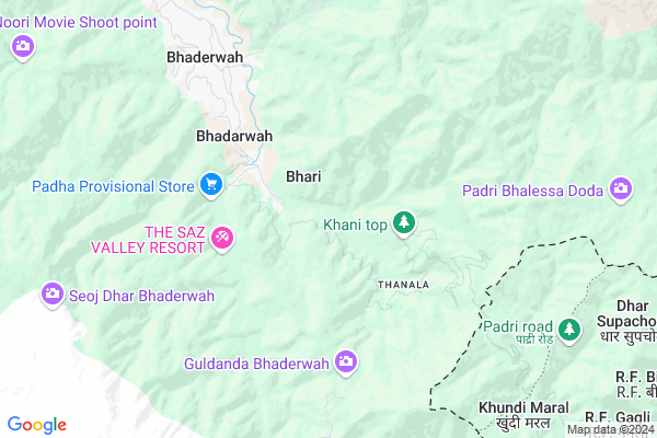
Bheja Map
EDIT Map
Add Your House
 ..
..
Current Corona Virus Infected Patients Count in Doda District
| City Name | District Name | Total Covid cases |
|---|
Locality Name :
Bheja
( भेजा )
Block Name : Bhaderwah
District : Doda
State : Jammu & Kashmir
Language : Urdu and Bhadrawahi,
Current Time 11:42 AM
Date: Sunday , Apr 27,2025 (IST)
Time zone: IST (UTC+5:30)
Elevation / Altitude: 662 meters. Above Seal level
Telephone Code / Std Code: 01997
Assembly constituency : assembly constituency
Assembly MLA :
Lok Sabha constituency : parliamentary constituency
Parliament MP :
Serpanch Name :
Pin Code : 182222
Post Office Name : Bhaderwah
Commodities Prices : Batote Market / Mandi
National Highways Reachable To Bheja
Nationa High Way :NH44
Nationa High Way :NH44
Rivers Near Bheja
Tavi
Sach Nala
Tavi
Sach Nala
About Bheja
Correct below Info and add more info about BhejaBheja is a Village in Bhaderwah Block in Doda District of Jammu & Kashmir State, India. It is located 34 KM towards South from District head quarters Doda. 10 KM from Bhaderwah. 179 KM from State capital Srinagar, Jammu
Bheja Pin code is 182222 and postal head office is Bhaderwah .
Sungli ( 4 KM ) , Chinote ( 6 KM ) , Manthla ( 7 KM ) , Dandi ( 8 KM ) , Sarna ( 9 KM ) are the nearby Villages to Bheja. Bheja is surrounded by Thathri Block towards North , Bhalessa(Gandoh) Block towards East , Duggan Block towards South , Dudu Block towards west .
Dalhousie , Chamba , Udhampur , Kathua are the near by Cities to Bheja.
Bheja 2011 Census Details
Bheja Local Language is Urdu. Bheja Village Total population is 953 and number of houses are 186. Female Population is 50.2%. Village literacy rate is 57.4% and the Female Literacy rate is 21.6%.
Population
| Census Parameter | Census Data |
| Total Population | 953 |
| Total No of Houses | 186 |
| Female Population % | 50.2 % ( 478) |
| Total Literacy rate % | 57.4 % ( 547) |
| Female Literacy rate | 21.6 % ( 206) |
| Scheduled Tribes Population % | 0.3 % ( 3) |
| Scheduled Caste Population % | 46.1 % ( 439) |
| Working Population % | 46.6 % |
| Child(0 -6) Population by 2011 | 145 |
| Girl Child(0 -6) Population % by 2011 | 47.6 % ( 69) |
Bheja Census More Deatils.
HOW TO REACH Bheja
By Rail
There is no railway station near to Bheja in less than 10 km.Colleges near Bheja
Govt. Digree College Kilhotran
Address :
Government Degree College Kilhotran
Address :
Govt. Polytechnical College Khellani
Address : Khellani Doda
Govt Degree College Bhalessa
Address : Doda, Jammu
G R Azad College Of Education
Address : Kilhotran Bhalessa
Schools in Bheja
Gms Bheja
Address : bheja , bhaderwah , doda , Jammu & Kashmir . PIN- 182222 , Post - Bhaderwah
Govt Health Centers near Bheja
1) PHC CHINTA , , Chinta , Near Indra Memorial Public School Chinta Bhaderwah.2) SC Jamble , , JAMBLE ,
3) Mottu , Sub Centre Mottu , Mottu , Middle School Mottu
Petrol Bunks in Bheja,Bhaderwah
HP PETROL PUMP - J K FILLING STATION
Hpcl Dealers Vill Gatha Bhaderwah; Jammu; Jammu and Kashmir 182222
9.9 KM distance Detail
more ..
Schools in Bheja,Bhaderwah
Shemrock Dolphin 1
House NO 3; Mohalla Khakhal University Road Badewah; Near Kartar Gas Agency bhadrewah Jammu and Kashmir; 182222
4.4 KM distance Detail
Kendriya Vidyalaya
Bhadarwah; Distt Doda; Doda; Jammu & Kashmir; Doda; Jammu and Kashmir 182222
6.6 KM distance Detail
Electronic Shops in Bheja,Bhaderwah
Haq Nawaz Electronics And Electricals
Gowari; Gandoh Bhalessa; Jammu and Kashmir 182203
20.0 KM distance Detail
Super Markets in Bheja,Bhaderwah
Local Parks in Bheja,Bhaderwah
Police Stations near Bheja,Bhaderwah
Office of the Senior Superintendent of Police
Kotli; Jammu and Kashmir 182222
8.0 KM distance Detail
Governement Offices near Bheja,Bhaderwah
Tourist Reception Center Bhaderwah
TRC;Sarna; Bhaderwah; Jammu and Kashmir 182222
10.6 KM distance Detail
About Bheja &
History
How to reach Bheja
Tourist Places Near By Bheja
Schools in Bheja
Colleges in Bheja
Temperature & weather of Bheja
places in Bheja
Bheja photos
More Information
How to reach Bheja
Tourist Places Near By Bheja
Schools in Bheja
Colleges in Bheja
Temperature & weather of Bheja
places in Bheja
Bheja photos
More Information
Village Talk
Post News or Events about this Village
Near Cities
Dalhousie 56 KM near
Chamba 60 KM near
Udhampur 65 KM near
Kathua 73 KM near
Dalhousie 56 KM near
Chamba 60 KM near
Udhampur 65 KM near
Kathua 73 KM near
Near By Taluks
Bhaderwah 10 KM near
Thathri 21 KM near
Bhalessa(Gandoh) 23 KM near
Duggan 25 KM near
Bhaderwah 10 KM near
Thathri 21 KM near
Bhalessa(Gandoh) 23 KM near
Duggan 25 KM near
Near By Air Ports
Pathankot Airport 90 KM near
Gaggal Airport 96 KM near
Satwari Airport 100 KM near
Srinagar Airport 167 KM near
Pathankot Airport 90 KM near
Gaggal Airport 96 KM near
Satwari Airport 100 KM near
Srinagar Airport 167 KM near
Near By Tourist Places
Patnitop 50 KM near
Dalhousie 55 KM near
Sanasar 56 KM near
Khajjiar 58 KM near
Chamba 62 KM near
Patnitop 50 KM near
Dalhousie 55 KM near
Sanasar 56 KM near
Khajjiar 58 KM near
Chamba 62 KM near
Near By Districts
Doda 33 KM near
Kishtwar 46 KM near
Chamba 62 KM near
Udhampur 64 KM near
Doda 33 KM near
Kishtwar 46 KM near
Chamba 62 KM near
Udhampur 64 KM near
Near By RailWay Station
Udhampur Rail Way Station 62 KM near
Kathua Rail Way Station 70 KM near
Udhampur Rail Way Station 62 KM near
Kathua Rail Way Station 70 KM near