| Home | City Bus | Maps | Villages | Cities | Rail | Tourist Places | School | College | Pin Codes | Corona Cases Count |
| Distance Calculator Bus Services IFSC Codes Trace Mobile Number Weather Search Place Trace IP Available Cash ATM/Banks Locate Polling Booth Report an Error contact People |
 ..
..
Current Corona Virus Infected Patients Count in Dinajpur Uttar District
| City Name | District Name | Total Covid cases |
|---|
Block Name : Goalpokhar-i
District : Dinajpur Uttar
State : West Bengal
Division : Jalpaiguri
Language : Bengali and Urdu, Hindi And Maithilispeaking
Current Time 01:06 PM
Date: Monday , Apr 28,2025 (IST)
Time zone: IST (UTC+5:30)
Elevation / Altitude: 58 meters. Above Seal level
Telephone Code / Std Code: 03526
Assembly constituency : Goalpokhar assembly constituency
Assembly MLA : Md. Ghulam Rabbani
Lok Sabha constituency : Raiganj parliamentary constituency
Parliament MP : DEBASREE CHAUDHURI
Serpanch Name :
Pin Code : 733208
Post Office Name : Panjipara
Commodities Prices : Islampur Market / Mandi
OverView of Panjipara
About Panjipara Panjipara, a land of farmers,
now a prosperous land for business; lies between Latitude: 26° 7' 60 N, and
Longitude: 88° 1' 60 E. It has Total Population of 9,515 Panjipara located
between Kishanganj and Islampur, provides the biggest Source of relief to the
person living in between this two town. It is a border Area between Bihar &
West Bengal, and even 35km from Panjipara there is Bangladesh Border. It is
well connected by Roads (NH 31) & Railways, it has Panjipara Railway
Station where local train stops. It has BSF Camp in Shantinagar. Panjipara
houses as many as more than 100+ Villages, and its a relief town of all the
Gran panchayat under Goalpokher 1 block, about 2/3rd villages under Kishanganj
district of Bihar & almost 100% people of Islampur Sub division. Panjipara
now is the home of famous business man, its literacy rate has risen upto 35.5%
from 5.5%. It provide oppurtinuity to its people in various scope.
About Market Its market is famous for its
cheap price, especially chinese product & Electronic gadget. Near by Big
Town like Kishanganj, Islampur Shopper too hoop to this Market for its Cheap
Price. Many big Companies came with their office. Companies like Rose Valley,
Village Finance, LIC and others opened their door. As the area grew to
prosperity, there is inflation in its land price. It is one of the Life-Line
satellite Town of thousand of farmers living in and around that particular Area
(Approx 100 above Village). Its BAZAAR is famous in the ambient, which houses
PAAT HATTI, HALDI HATTI, BAAS HATTI, ADRAK HATTI And its CHAMRA HATTI. New
Market (Lal Market), Liyakat Market, Masjid Market, Bus Stand Market, Javed
Market, Shams Market etc are some of its famous market, which houses Market
apart from Office. It Has State Bank of India, Raiganj Co-operative bank and
Bandhan bank which has recently opened its door. State Bank of India has its
ATM in Lal Market & Inside the BSF premise, Axis bank has also provided Atm
in Market Area, Recently Raiganj Co-operative bank too had given ATM, United
Bank of India has ATM in Colony More.
About Its Village Its Villages are scattered
randomly. It has a high profile Alluvium soil which makes it one of the most
productive zone in WEST BENGAL. It produces the highest quantity of jute in
West Bengal. Around 1/4th quantity of Rice in West Bengal. Lives in the Village
mostly depends on Agriculture and many family sent their wards to DELHI,
PUNJAB, HARYANA for work. It lack modern technology to cultivate farm n lack
industry. Now parents send their ward to school but before there was misery.
Villages are well connected to the maket by Metalled Roads, which came under
Prime Minister Garam Sadak Yojna.
Its People It has a high density of
Population. Maximum people here are farmers. Now many of them are trying their
hands in business. People living near Market are Prosperous than those in the
Villages. Its people are helpful & peaceful. Its a Crime free Area.
Panjipara Police Out Post looks after its Peace.
Education It houses the Famous EB High
School, which produces people of many aspect. It has BSF Primary School in BSF
Campus, BTE School in Barkat Nagar, CM School in Siksha Nagar, Children Academy
in School Chowk, Topper Public School in Aam Bagh, Sunshine Model School in
Station Chowk. All these schools have low fee & imparts quality education
to its students. Hundreds of Child studies in these school & there are many
upcoming schools too. It has many Coaching Centres & private tutors for
grooming a child.
Religion In Case of Faith it is a Muslim faith based Region, but there are other religion too. Famous Mosque- Jama Masjid. Makki Masjid. School Chowk Masjid. Teliapokher Masjid. Apart from Mosque, it has Darloom Faizul Gorba Madarsah It also has a Mandir in Kali Bari, which is Located just a stone Throw Distance from Panjipara.
Edit below overview about Panjipara
Nationa High Way :NH27;NH327
Nationa High Way :NH27
Mahananda River
Keshaliya River
About Panjipara
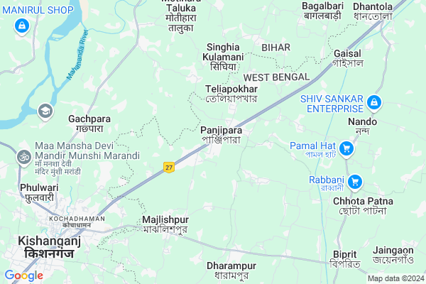
Panjipara is a Village in Goalpokhar-i Block in Dinajpur Uttar District of West Bengal State, India. It belongs to Jalpaiguri Division . It is located 68 KM towards North from District head quarters Raiganj. 11 KM from Goalpokhar. 466 KM from State capital Kolkata
Panjipara Pin code is 733208 and postal head office is Panjipara .
Mahua ( 10 KM ) , Jaingaon ( 11 KM ) , Lodhan ( 13 KM ) , Gunjaria ( 15 KM ) , Goalpokhar ( 16 KM ) are the nearby Villages to Panjipara. Panjipara is surrounded by Goalpokhar-I Block towards East , Goalpokhar Ii Block towards South , Kochadhaman Block towards west , Pothia Block towards North .
Kishanganj , Islampur , Bahadurganj , Dalkhola are the near by Cities to Panjipara.
This Place is in the border of the Dinajpur Uttar District and Kishanganj District. Kishanganj District Kishanganj is west towards this place . It is near to the Bihar State Border.
Panjipara 2011 Census Details
Panjipara Local Language is Bengali. Panjipara Village Total population is 12376 and number of houses are 2243. Female Population is 44.0%. Village literacy rate is 53.7% and the Female Literacy rate is 19.4%.
Population
| Census Parameter | Census Data |
| Total Population | 12376 |
| Total No of Houses | 2243 |
| Female Population % | 44.0 % ( 5442) |
| Total Literacy rate % | 53.7 % ( 6646) |
| Female Literacy rate | 19.4 % ( 2402) |
| Scheduled Tribes Population % | 2.3 % ( 286) |
| Scheduled Caste Population % | 25.8 % ( 3196) |
| Working Population % | 35.9 % |
| Child(0 -6) Population by 2011 | 1745 |
| Girl Child(0 -6) Population % by 2011 | 50.5 % ( 882) |
Panjipara Census More Deatils.
Politics in Panjipara
FBL , AITC , AIFB , INC are the major political parties in this area.Polling Stations /Booths near Panjipara
1)Panjipada G.p.office2)Panjipada Ihbihuchch Bidyalay
3)Velagachhi F.p.s
4)Panjipada Colony F P School
5)Panjipada G.p.office
HOW TO REACH Panjipara
By Rail
Panjipara Rail Way Station , Gaisal Rail Way Station are the very nearby railway stations to Panjipara.Colleges near Panjipara
North Bengal College & TechnologySchools in Panjipara
Mordel Madarsha English Medium SchoolGovt Health Centers near Panjipara
1) Manjhok SC , , ,2) Panjipara SC , , , TOWER
3) Maruagaon SC , , ,
Colleges in Panjipara,Goalpokhar-i
ITI College; Panjipara
৩১ নং ৰাষ্ট্ৰীয় ঘাইপথ; Panjipara; West Bengal 733208; India
1.2 KM distance Detail
Millia Kishanganj College of Engineering & Polytechnic
Kishanganj; Veriadangi; Bihar 855107; India
12.5 KM distance Detail
more ..
Super Markets in Panjipara,Goalpokhar-i
Maa Sarswati Traders
Purab Palli Road; Dharamganj; Kishanganj; West Bengal 733208; India
8.8 KM distance Detail
Governement Offices near Panjipara,Goalpokhar-i
Raashan Vitaran Kendra;Kishanganj
Kochadhaman; Kishanganj; West Bengal 733208; India
8.2 KM distance Detail
Bihar Motor Parts
Dharamganj Road; Dharamganj; Kishanganj; West Bengal 733208; India
8.7 KM distance Detail
How to reach Panjipara
Tourist Places Near By Panjipara
Schools in Panjipara
Colleges in Panjipara
Temperature & weather of Panjipara
places in Panjipara
Panjipara photos
More Information
Village Talk
Post News or Events about this Village
Kishanganj 11 KM near
Islampur 25 KM near
Bahadurganj 27 KM near
Dalkhola 40 KM near
Kishanganj 9 KM near
Goalpokhar-I 11 KM near
Goalpokhar Ii 14 KM near
Kochadhaman 22 KM near
Bagdogra Airport 75 KM near
Rupsi Airport 212 KM near
Patna Airport 335 KM near
Gaya Airport 386 KM near
Samsing 73 KM near
Siliguri 84 KM near
Jalpaiguri 92 KM near
Mirik 95 KM near
Kurseong 96 KM near
Kishanganj 8 KM near
Araria 61 KM near
Dinajpur Uttar 65 KM near
Purnia 75 KM near
Panjipara Rail Way Station 0.3 KM near
Gaisal Rail Way Station 8.9 KM near
Kishanganj Rail Way Station 9 KM near
Aluabari Road Junction Rail Way Station 24 KM near