| Home | City Bus | Maps | Villages | Cities | Rail | Tourist Places | School | College | Pin Codes | Corona Cases Count |
| Distance Calculator Bus Services IFSC Codes Trace Mobile Number Weather Search Place Trace IP Available Cash ATM/Banks Locate Polling Booth Report an Error contact People |
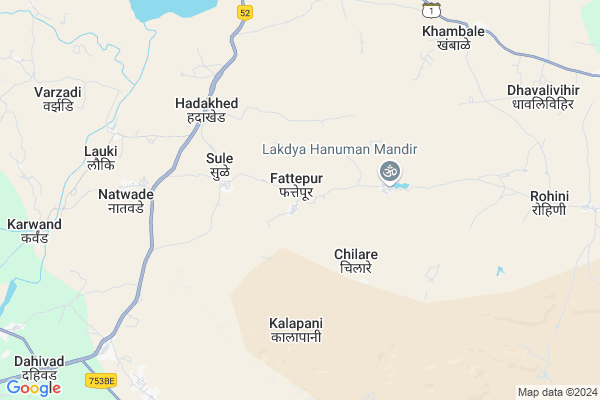
Fattepur
Fattepur Map
EDIT Map
Add Your House
 ..
..
Current Corona Virus Infected Patients Count in Dhule District
| City Name | District Name | Total Covid cases |
|---|---|---|
| Dhule District | Dhule | 10 |
Locality Name :
Fattepur
( फत्तेपूर )
Taluka Name : Shirpur
District : Dhule
State : Maharashtra
Region : Khandesh and Northern Maharashtra
Division : Nashik
Language : Ahirani and A Kandeshi,marathi, Bhili, Andh, Indo-aryan
Current Time 12:44 PM
Date: Tuesday , Apr 29,2025 (IST)
Time zone: IST (UTC+5:30)
Elevation / Altitude: 188 meters. Above Seal level
Telephone Code / Std Code: 02563
Assembly constituency : Shirpur assembly constituency
Assembly MLA : Kashiram Vechan Pawara
Lok Sabha constituency : Nandurbar parliamentary constituency
Parliament MP : Dr. Heena Vijaykumar Gavit
Serpanch Name :
Pin Code : 425405
Post Office Name : Uppr Shirpur
Commodities Prices : Balwadi Market / Mandi
Fattepur Live Weather
Temperature: 41.8 °C
clear sky
Humidity: 9%
Wind : 6.39 mt/sec towards W
StationName : "Shirpur"
observed on Now
Temperature: 41.8 °C
clear sky
Humidity: 9%
Wind : 6.39 mt/sec towards W
StationName : "Shirpur"
observed on Now
Fattepur Weather Forecast for Next 5 days
30-04-2025
29.3°C to 42.7°C
clear sky
29.3°C to 42.7°C
clear sky
01-05-2025
27.6°C to 43.5°C
clear sky
27.6°C to 43.5°C
clear sky
02-05-2025
27.7°C to 43.7°C
clear sky, few clouds
27.7°C to 43.7°C
clear sky, few clouds
03-05-2025
28.9°C to 43.5°C
clear sky
28.9°C to 43.5°C
clear sky
04-05-2025
26.5°C to 41.4°C
clear sky
26.5°C to 41.4°C
clear sky
National Highways Reachable To Fattepur
Nationa High Way :NH160H
Nationa High Way :NH160H
Rivers Near Fattepur
Bhad
Kaner Nadi
Bhad
Kaner Nadi
About Fattepur
Correct below Info and add more info about FattepurFattepur is a Village in Shirpur Taluka in Dhule District of Maharashtra State, India. It belongs to Khandesh and Northern Maharashtra region . It belongs to Nashik Division . It is located 69 KM towards North from District head quarters Dhule. 13 KM from Shirpur. 405 KM from State capital Mumbai
Fattepur Pin code is 425405 and postal head office is Uppr Shirpur .
Chilare ( 4 KM ) , Hadakhed ( 4 KM ) , Natwade ( 7 KM ) , Lauki ( 8 KM ) , Khambale ( 8 KM ) are the nearby Villages to Fattepur. Fattepur is surrounded by Sendhawa Taluka towards North , Newali Taluka towards North , Shindkhede Taluka towards west , Amalner Taluka towards South .
Shirpur-Warwade , Sendhwa , Parola , Shahade are the near by Cities to Fattepur.
Fattepur 2011 Census Details
Fattepur Local Language is Ahirani. Fattepur Village Total population is 5534 and number of houses are 815. Female Population is 50.9%. Village literacy rate is 16.9% and the Female Literacy rate is 7.5%.
Population
| Census Parameter | Census Data |
| Total Population | 5534 |
| Total No of Houses | 815 |
| Female Population % | 50.9 % ( 2818) |
| Total Literacy rate % | 16.9 % ( 934) |
| Female Literacy rate | 7.5 % ( 417) |
| Scheduled Tribes Population % | 99.9 % ( 5528) |
| Scheduled Caste Population % | 0.0 % ( 0) |
| Working Population % | 57.9 % |
| Child(0 -6) Population by 2011 | 1180 |
| Girl Child(0 -6) Population % by 2011 | 49.8 % ( 588) |
Fattepur Census More Deatils.
Politics in Fattepur
Bharatiya Janata Party , BJP , SP , INC are the major political parties in this area.Polling Stations /Booths near Fattepur
1)Z.p. Primary School Durbdya Westernside Building2)Z.p. Primary School Kharde Kh East - West Building West Part Room No.1
3)Z.p. Primary School Lauki South -north Building North Side Room No.1
4)Z.p. Primary School Shingave Northenside Room No.3
5)Z.p. Primary School Sule Northenside Room No.1
HOW TO REACH Fattepur
By Rail
There is no railway station near to Fattepur in less than 10 km. are the Rail way stations reachable from near by towns.By Road
Shirpur-Warwade are the nearby by towns to Fattepur having road connectivity to FattepurColleges near Fattepur
R.c.patel Institute Of Technology
Address :
Avps Thalner
Address :
H.r.patel Institute Of Pharmaceutical Education And Research
Address :
Schools near Fattepur
M.r. Patel Militry School
Address : tande , shirpur , dhule , Maharashtra . PIN- 425405 , Post - Uppr Shirpur
R.c. Patel High School
Address : khambale , shirpur , dhule , Maharashtra . PIN- 425405 , Post - Uppr Shirpur
R.c. Patel High School
Address : bhorkheda , shirpur , dhule , Maharashtra . PIN- 425421 , Post - Thalner
R.c. Patel High School
Address : tekwade , shirpur , dhule , Maharashtra . PIN- 425427 , Post - Vikharan (Shirpur)
Govt Health Centers near Fattepur
1) Fattepur , , Fattepur road , At post Fattepur2) Sule , , Sule , At post Sule
3) Lauki , , Lauki , At Post Lauki
Petrol Bunks in Fattepur,Shirpur
VAIBHAV PETROLEUM-BPCL
National Highway 3; Natwade; Maharashtra 425405; India
6.3 KM distance Detail
more ..
Colleges in Fattepur,Shirpur
M R P CBSE School; Tande
Shirpur - Chopda Hwy; Tande; Maharashtra 425421; India
11.4 KM distance Detail
Govt. I T I College; Shirpur
Shirpur - Chopda Hwy; Kalmasare; Maharashtra 425405; India
13.0 KM distance Detail
more ..
Electronic Shops in Fattepur,Shirpur
Saptshrungi Enterprises Dahivad
Shirpur Gold Refinery Limited; Dahivad; Maharashtra State Highway 4; Tande; Maharashtra 425421; India
11.1 KM distance Detail
Super Markets in Fattepur,Shirpur
LAXMI MARBAL GRANITE SHIRPUR
Shirpur - Chopda Hwy; Hulesighnana Nagar; Kalmasare; Maharashtra 425405; India
13.9 KM distance Detail
Police Stations near Fattepur,Shirpur
Police Line
425405; Ganesh Colony; Saraswti Colony; Shirpur; Maharashtra 425405; India
16.9 KM distance Detail
Police Station Shirpur
Ganesh Colony; Ambika Nagar; Shirpur; Maharashtra 425405; India
17.0 KM distance Detail
Governement Offices near Fattepur,Shirpur
Maharashtra State Electricity Distribution Office
Panakhed; Dhule; NH-3; Mumbai Agra Road; Dhule; Dhule; Maharashtra 425405; India
14.7 KM distance Detail
About Fattepur &
History
How to reach Fattepur
Tourist Places Near By Fattepur
Schools in Fattepur
Colleges in Fattepur
Temperature & weather of Fattepur
places in Fattepur
Fattepur photos
More Information
How to reach Fattepur
Tourist Places Near By Fattepur
Schools in Fattepur
Colleges in Fattepur
Temperature & weather of Fattepur
places in Fattepur
Fattepur photos
More Information
Village Talk
Post News or Events about this Village
Near Cities
Shirpur-Warwade 15 KM near
Sendhwa 37 KM near
Parola 64 KM near
Shahade 65 KM near
Shirpur-Warwade 15 KM near
Sendhwa 37 KM near
Parola 64 KM near
Shahade 65 KM near
Near By Taluks
Shirpur 13 KM near
Sendhawa 34 KM near
Newali 35 KM near
Shindkhede 39 KM near
Shirpur 13 KM near
Sendhawa 34 KM near
Newali 35 KM near
Shindkhede 39 KM near
Near By Air Ports
Indore Airport 190 KM near
Chikkalthana Airport 195 KM near
Gandhinagar Airport 225 KM near
Vadodara Airport 238 KM near
Indore Airport 190 KM near
Chikkalthana Airport 195 KM near
Gandhinagar Airport 225 KM near
Vadodara Airport 238 KM near
Near By Tourist Places
Dhule 67 KM near
Toranmal 87 KM near
Maheshwar 118 KM near
Burhanpur 131 KM near
Kevadia Narmada 164 KM near
Dhule 67 KM near
Toranmal 87 KM near
Maheshwar 118 KM near
Burhanpur 131 KM near
Kevadia Narmada 164 KM near
Near By Districts
Dhule 66 KM near
Jalgaon 79 KM near
Barwani 82 KM near
Khargone 85 KM near
Dhule 66 KM near
Jalgaon 79 KM near
Barwani 82 KM near
Khargone 85 KM near
Near By RailWay Station
Amalner Rail Way Station 42 KM near
Dondaicha Rail Way Station 52 KM near
Amalner Rail Way Station 42 KM near
Dondaicha Rail Way Station 52 KM near