| Home | City Bus | Maps | Villages | Cities | Rail | Tourist Places | School | College | Pin Codes | Corona Cases Count |
| Distance Calculator Bus Services IFSC Codes Trace Mobile Number Weather Search Place Trace IP Available Cash ATM/Banks Locate Polling Booth Report an Error contact People |
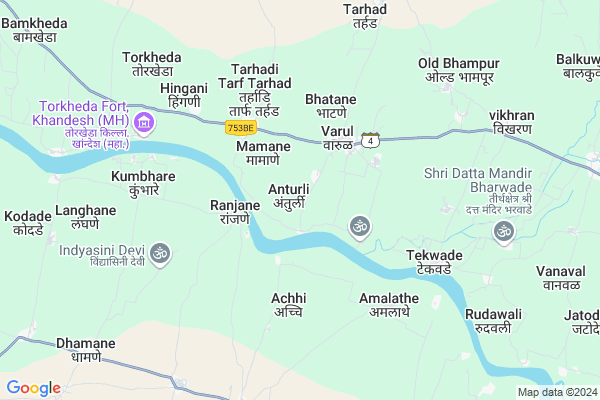
Anturli
Anturli Map
EDIT Map
Add Your House
 ..
..
Current Corona Virus Infected Patients Count in Dhule District
| City Name | District Name | Total Covid cases |
|---|---|---|
| Dhule District | Dhule | 10 |
Locality Name :
Anturli
( अंतुर्ली )
Taluka Name : Shirpur
District : Dhule
State : Maharashtra
Region : Khandesh and Northern Maharashtra
Division : Nashik
Language : Ahirani and A Kandeshi,marathi, Bhili, Andh, Indo-aryan
Current Time 06:02 AM
Date: Saturday , Apr 26,2025 (IST)
Time zone: IST (UTC+5:30)
Elevation / Altitude: 188 meters. Above Seal level
Telephone Code / Std Code: 02563
Assembly constituency : Shirpur assembly constituency
Assembly MLA : Kashiram Vechan Pawara
Lok Sabha constituency : Nandurbar parliamentary constituency
Parliament MP : Dr. Heena Vijaykumar Gavit
Serpanch Name :
Pin Code : 425427
Post Office Name : Vikharan (Shirpur)
Commodities Prices : Dondaicha Market / Mandi
Anturli Live Weather
Temperature: 28.2 °C
few clouds
Humidity: 42%
Wind : 7.38 mt/sec towards W
StationName : "Dondaicha"
observed on 1 Hours Back
Temperature: 28.2 °C
few clouds
Humidity: 42%
Wind : 7.38 mt/sec towards W
StationName : "Dondaicha"
observed on 1 Hours Back
Anturli Weather Forecast for Next 5 days
27-04-2025
28.8°C to 41.1°C
scattered clouds, broken clouds, few clouds, clear sky
28.8°C to 41.1°C
scattered clouds, broken clouds, few clouds, clear sky
28-04-2025
27.8°C to 42.7°C
clear sky
27.8°C to 42.7°C
clear sky
29-04-2025
28.1°C to 43.8°C
clear sky
28.1°C to 43.8°C
clear sky
30-04-2025
28.4°C to 44.0°C
clear sky
28.4°C to 44.0°C
clear sky
National Highways Reachable To Anturli
Nationa High Way :NH160H
Nationa High Way :NH160H
Rivers Near Anturli
Bhad
Kaner Nadi
Bhad
Kaner Nadi
About Anturli
Correct below Info and add more info about AnturliAnturli is a Village in Shirpur Taluka in Dhule District of Maharashtra State, India. It belongs to Khandesh and Northern Maharashtra region . It belongs to Nashik Division . It is located 64 KM towards North from District head quarters Dhule. 21 KM from Shirpur. 383 KM from State capital Mumbai
Anturli Pin code is 425427 and postal head office is Vikharan (Shirpur) .
Bhatane ( 3 KM ) , Achhi ( 4 KM ) , Hispur ( 4 KM ) , Jasane ( 4 KM ) , Kumbhare ( 6 KM ) are the nearby Villages to Anturli. Anturli is surrounded by Shirpur Taluka towards East , Shahada Taluka towards west , Pansemal Taluka towards North , Newali Taluka towards North .
Shirpur-Warwade , Shahade , Nandurbar , Sendhwa are the near by Cities to Anturli.
Anturli 2011 Census Details
Anturli Local Language is Ahirani. Anturli Village Total population is 1977 and number of houses are 437. Female Population is 45.2%. Village literacy rate is 60.7% and the Female Literacy rate is 23.0%.
Population
| Census Parameter | Census Data |
| Total Population | 1977 |
| Total No of Houses | 437 |
| Female Population % | 45.2 % ( 894) |
| Total Literacy rate % | 60.7 % ( 1201) |
| Female Literacy rate | 23.0 % ( 455) |
| Scheduled Tribes Population % | 90.0 % ( 1779) |
| Scheduled Caste Population % | 9.9 % ( 195) |
| Working Population % | 51.6 % |
| Child(0 -6) Population by 2011 | 249 |
| Girl Child(0 -6) Population % by 2011 | 41.8 % ( 104) |
Anturli Census More Deatils.
Politics in Anturli
Bharatiya Janata Party , BJP , SP , INC are the major political parties in this area.Polling Stations /Booths near Anturli
1)Z.p. Primary School Jatode New South -north Building Northenside Room No.32)Z.p. Primary School Anjanpada Westernside Room No.1
3)Z.p. Primary School Anturli New Building Northenside Room No.1
4)Z.p. Primary School Bharwade Southern Side Room (slab)no.1
5)Z.p. Primary School Bhatane East-westernside Building Easternside Room No.02
HOW TO REACH Anturli
By Rail
There is no railway station near to Anturli in less than 10 km. are the Rail way stations reachable from near by towns.By Road
Shirpur-Warwade are the nearby by towns to Anturli having road connectivity to AnturliColleges near Anturli
R.c.patel Institute Of Technology
Address :
Avps Thalner
Address :
H.r.patel Institute Of Pharmaceutical Education And Research
Address :
Schools near Anturli
M.r. Patel Militry School
Address : tande , shirpur , dhule , Maharashtra . PIN- 425405 , Post - Uppr Shirpur
R.c. Patel High School
Address : khambale , shirpur , dhule , Maharashtra . PIN- 425405 , Post - Uppr Shirpur
R.c. Patel High School
Address : bhorkheda , shirpur , dhule , Maharashtra . PIN- 425421 , Post - Thalner
R.c. Patel High School
Address : tekwade , shirpur , dhule , Maharashtra . PIN- 425427 , Post - Vikharan (Shirpur)
Govt Health Centers near Anturli
1) Ranjane , SC Ranjane , Lohagaon Road , Behind Anganwadi ZP School2) Tharadi , , Tharadi , At post Tharadi
3) Varul , , Varul , At post Varul
Petrol Bunks in Anturli,Shirpur
HP PETROL PUMP - MHALSA PETROLEUM
GAT NO.106/1E 5 & 6; AT & Post: Arthe SH-4 Shirpur; Maharashtra 425427; India
2.4 KM distance Detail
Indian Oil Petrol Pump
Bhatane; Dhule; SH-4; Shirpur Shahada Talode Road; Shirpur; Shirpur; Maharashtra 425427; India
2.7 KM distance Detail
Hindustan Petroleum
Vikharan Bk; Dhule; SH-4; Shirpur Shahada Talode Road; Shirpur; Shirpur; Maharashtra 425427; India
10.8 KM distance Detail
more ..
Colleges in Anturli,Shirpur
Nutan Vidyalaya and Mukesh Bhai Patel Junior College
Bhatane; Dhule; SH-4; Shirpur Shahada Talode Road; Shirpur; Shirpur; Maharashtra 425427; India
2.9 KM distance Detail
SSSVPSS LATE S.D.PATIL ARTS.COLLEGE SHINDKHEDA
Shindkheda; Dhule; Maharashtra 425406; India
16.3 KM distance Detail
more ..
Schools in Anturli,Shirpur
Zila Parishad Marathi School
Varul; Dhule; SH-4; Shirpur Shahada Talode Road; Shirpur; Shirpur; Maharashtra 425427; India
3.2 KM distance Detail
Super Markets in Anturli,Shirpur
JAY YOGESHWAR SUPER SHOPEE
3; Varul Rd; Sindkheda; Maharashtra 425406; India
15.5 KM distance Detail
Police Stations near Anturli,Shirpur
Police Line
425405; Ganesh Colony; Saraswti Colony; Shirpur; Maharashtra 425405; India
19.7 KM distance Detail
Police Station Shirpur
Ganesh Colony; Ambika Nagar; Shirpur; Maharashtra 425405; India
19.7 KM distance Detail
Governement Offices near Anturli,Shirpur
Government Security Office Society Pic Sanrakshak Sahakari Society
Tarhadi; Dhule; SH-4; Shirpur Shahada Talode Road; Shirpur; Shirpur; Maharashtra 425427; India
3.6 KM distance Detail
Sanction Office Talathi Karyalaya
Tarhadi; Dhule; SH-4; Shirpur Shahada Talode Road; Shirpur; Shirpur; Maharashtra 425427; India
3.7 KM distance Detail
About Anturli &
History
How to reach Anturli
Tourist Places Near By Anturli
Schools in Anturli
Colleges in Anturli
Temperature & weather of Anturli
places in Anturli
Anturli photos
More Information
How to reach Anturli
Tourist Places Near By Anturli
Schools in Anturli
Colleges in Anturli
Temperature & weather of Anturli
places in Anturli
Anturli photos
More Information
Village Talk
Post News or Events about this Village
Near Cities
Shirpur-Warwade 19 KM near
Shahade 34 KM near
Nandurbar 54 KM near
Sendhwa 56 KM near
Shirpur-Warwade 19 KM near
Shahade 34 KM near
Nandurbar 54 KM near
Sendhwa 56 KM near
Near By Taluks
Shindkhede 19 KM near
Shirpur 20 KM near
Shahada 33 KM near
Pansemal 37 KM near
Shindkhede 19 KM near
Shirpur 20 KM near
Shahada 33 KM near
Pansemal 37 KM near
Near By Air Ports
Chikkalthana Airport 205 KM near
Gandhinagar Airport 206 KM near
Indore Airport 208 KM near
Vadodara Airport 209 KM near
Chikkalthana Airport 205 KM near
Gandhinagar Airport 206 KM near
Indore Airport 208 KM near
Vadodara Airport 209 KM near
Near By Tourist Places
Dhule 61 KM near
Toranmal 67 KM near
Kevadia Narmada 133 KM near
Maheshwar 140 KM near
Saputara 143 KM near
Dhule 61 KM near
Toranmal 67 KM near
Kevadia Narmada 133 KM near
Maheshwar 140 KM near
Saputara 143 KM near
Near By Districts
Nandurbar 55 KM near
Dhule 61 KM near
Barwani 83 KM near
Jalgaon 107 KM near
Nandurbar 55 KM near
Dhule 61 KM near
Barwani 83 KM near
Jalgaon 107 KM near
Near By RailWay Station
Dondaicha Rail Way Station 19 KM near
Nandurbar Rail Way Station 55 KM near
Dondaicha Rail Way Station 19 KM near
Nandurbar Rail Way Station 55 KM near