| Home | City Bus | Maps | Villages | Cities | Rail | Tourist Places | School | College | Pin Codes | Corona Cases Count |
| Distance Calculator Bus Services IFSC Codes Trace Mobile Number Weather Search Place Trace IP Available Cash ATM/Banks Locate Polling Booth Report an Error contact People |
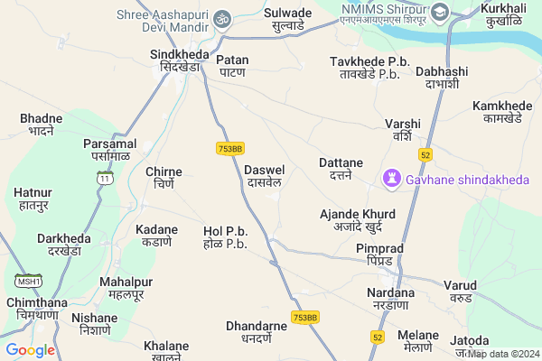
Daswel
Daswel Map
EDIT Map
Add Your House
 ..
..
Current Corona Virus Infected Patients Count in Dhule District
| City Name | District Name | Total Covid cases |
|---|---|---|
| Dhule District | Dhule | 10 |
Locality Name :
Daswel
( दसवेल )
Taluka Name : Shindkhede
District : Dhule
State : Maharashtra
Region : Khandesh and Northern Maharashtra
Division : Nashik
Language : Ahirani and A Kandeshi,marathi, Bhili, Andh, Indo-aryan
Current Time 11:02 AM
Date: Tuesday , Apr 29,2025 (IST)
Time zone: IST (UTC+5:30)
Elevation / Altitude: 178 meters. Above Seal level
Telephone Code / Std Code: 02566
Assembly constituency : Sindkheda assembly constituency
Assembly MLA : Jaykumar Jitendrasinh Rawal
Lok Sabha constituency : Dhule parliamentary constituency
Parliament MP : Bhamre Subhash Ramrao
Serpanch Name :
Pin Code : 425406
Post Office Name : Shindkheda
Commodities Prices : Dondaicha Market / Mandi
Edit below overview about Daswel
Edit below overview about Daswel
OverView of Daswel
Ichhapurti Ganpati Temple is located In Daswel Village which is very famous temple in Hindu religionEdit below overview about Daswel
Rivers Near Daswel
Sur
Kordi
Sur
Kordi
About Daswel
Daswel is a Village in Shindkhede Taluka in Dhule District of Maharashtra State, India. It belongs to Khandesh and Northern Maharashtra region . It belongs to Nashik Division . It is located 42 KM towards North from District head quarters Dhule. 7 KM from Shindkhede. 371 KM from State capital Mumbai
Daswel Pin code is 425406 and postal head office is Shindkheda .
Nirgudi ( 3 KM ) , Dabli ( 4 KM ) , Patan ( 5 KM ) , Kadane ( 5 KM ) , Chirane ( 5 KM ) are the nearby Villages to Daswel. Daswel is surrounded by Shirpur Taluka towards North , Amalner Taluka towards East , Dhule Taluka towards South , Shahada Taluka towards North .
Shirpur-Warwade , Dhule , Shahade , Parola are the near by Cities to Daswel.
Daswel 2011 Census Details
Daswel Local Language is Ahirani. Daswel Village Total population is 1342 and number of houses are 296. Female Population is 45.9%. Village literacy rate is 72.3% and the Female Literacy rate is 32.7%.
Population
| Census Parameter | Census Data |
| Total Population | 1342 |
| Total No of Houses | 296 |
| Female Population % | 45.9 % ( 616) |
| Total Literacy rate % | 72.3 % ( 970) |
| Female Literacy rate | 32.7 % ( 439) |
| Scheduled Tribes Population % | 19.2 % ( 257) |
| Scheduled Caste Population % | 1.9 % ( 25) |
| Working Population % | 39.5 % |
| Child(0 -6) Population by 2011 | 169 |
| Girl Child(0 -6) Population % by 2011 | 36.7 % ( 62) |
Daswel Census More Deatils.
Politics in Daswel
Bharatiya Janata Party , BJP , NCP , INC are the major political parties in this area.Polling Stations /Booths near Daswel
1)Z P Marathi Girls School No. 7. East&west Building Room No 1 Form West2)Z.p.primary School Room No. 1
3)Z.p.primary School East & West Building. Room No.2 From West
4)Z.p.primary School West Side Building Room No. 1 From North
5)Z.p.primary School West Side Building Room No. 1 From South
HOW TO REACH Daswel
By Rail
Hol Rail Way Station , Sindkheda Rail Way Station are the very nearby railway stations to Daswel. Vikhran Rail Way Station (near to Dondaicha) , Dondaicha Rail Way Station (near to Dondaicha) , Dhule Rail Way Station (near to Dhule) , Mohadi Pragane Laling Rail Way Station (near to Dhule) are the Rail way stations reachable from near by towns.By Road
Dondaicha , Shirpur-Warwade , Dhule are the nearby by towns to Daswel having road connectivity to DaswelColleges near Daswel
Junior College, Raghuprem, Raghunathnagar, Jakhane
Address :
Shre.tukaram.gujar.vidiyalay
Address :
Madhyamik Vidyalay & Junior College, Jakhane, Tal Shindkheda, Dist Dhule
Address : Chhatrapati Shivaji Maharaj Road, Raghupremnagar, Jakhane, Tal Shindkheda, Dist Dhule Pin 425407
Schools near Daswel
V.j.n.t. Ashram High School
Address : ward no. 3 , shindkheda , dhule , Maharashtra . PIN- 425408 , Post - Dondaicha
High School
Address : jakhane , shindkheda , dhule , Maharashtra . PIN- 425407 , Post - Chimthana
Vasantdada Patil High School
Address : dangurne , shindkheda , dhule , Maharashtra . PIN- 425407 , Post - Chimthana
P. Indira Gandhi High School
Address : betawad , shindkheda , dhule , Maharashtra . PIN- 425403 , Post - Betawad
Govt Health Centers near Daswel
1) Hol , SC Hol , Opp. Anganwadi , Hol2) Ghavhane , SC Ghavhane , Near Gaon Darvaja , Near Grampanchayat
3) Shindkheda 2 , SC Shindkheda 2 , Near ZP Marathi School , Near Burai River Bay
Petrol Bunks in Daswel,Shindkhede
Bharat Petroleum
Patan; Haiderali Chowk; Dhule; SH-11; Sindkheda Chimthane Shewad Balsane Raipur Road; Dhule; Dhule; Maharashtra 425406; India
6.3 KM distance Detail
Indian Oil Petrol Pump
Nardana; Dhule; NH-3; Dhule Nashik Thane Road; Mumbai Highway; Dhule; Dhule; Maharashtra 424005; India
6.8 KM distance Detail
more ..
Colleges in Daswel,Shindkhede
SSSVPSS LATE S.D.PATIL ARTS.COLLEGE SHINDKHEDA
Shindkheda; Dhule; Maharashtra 425406; India
6.8 KM distance Detail
more ..
Schools in Daswel,Shindkhede
Anganwadi School
Gorane; Sindhkheda; Dhule; SH-6; Jalgaon Dhule Nandurbar Road; Dhule; Dhule; Maharashtra 424309; India
3.3 KM distance Detail
Super Markets in Daswel,Shindkhede
Shreeji Trading Company
No 6; Market Yard; station road; Sindkheda; Maharashtra 425406; India
6.9 KM distance Detail
Governement Offices near Daswel,Shindkhede
Smita Patil Town Hall;shirpur
pataleshwar chauk; Shirpur; Maharashtra 425405; India
19.3 KM distance Detail
About Daswel &
History
How to reach Daswel
Tourist Places Near By Daswel
Schools in Daswel
Colleges in Daswel
Temperature & weather of Daswel
places in Daswel
Daswel photos
More Information
How to reach Daswel
Tourist Places Near By Daswel
Schools in Daswel
Colleges in Daswel
Temperature & weather of Daswel
places in Daswel
Daswel photos
More Information
Village Talk
Post News or Events about this Village
Near Cities
Shirpur-Warwade 19 KM near
Dhule 40 KM near
Shahade 53 KM near
Parola 58 KM near
Shirpur-Warwade 19 KM near
Dhule 40 KM near
Shahade 53 KM near
Parola 58 KM near
Near By Taluks
Shindkhede 7 KM near
Shirpur 22 KM near
Amalner 39 KM near
Dhule 41 KM near
Shindkhede 7 KM near
Shirpur 22 KM near
Amalner 39 KM near
Dhule 41 KM near
Near By Air Ports
Chikkalthana Airport 184 KM near
Gandhinagar Airport 193 KM near
Indore Airport 221 KM near
Vadodara Airport 226 KM near
Chikkalthana Airport 184 KM near
Gandhinagar Airport 193 KM near
Indore Airport 221 KM near
Vadodara Airport 226 KM near
Near By Tourist Places
Dhule 41 KM near
Toranmal 88 KM near
Saputara 139 KM near
Kevadia Narmada 149 KM near
Maheshwar 150 KM near
Dhule 41 KM near
Toranmal 88 KM near
Saputara 139 KM near
Kevadia Narmada 149 KM near
Maheshwar 150 KM near
Near By Districts
Dhule 40 KM near
Nandurbar 64 KM near
Jalgaon 93 KM near
Barwani 102 KM near
Dhule 40 KM near
Nandurbar 64 KM near
Jalgaon 93 KM near
Barwani 102 KM near
Near By RailWay Station
Hol Rail Way Station 3.5 KM near
Sindkheda Rail Way Station 7.1 KM near
Nardana Rail Way Station 8.5 KM near
Dondaicha Rail Way Station 28 KM near
Amalner Rail Way Station 39 KM near
Hol Rail Way Station 3.5 KM near
Sindkheda Rail Way Station 7.1 KM near
Nardana Rail Way Station 8.5 KM near
Dondaicha Rail Way Station 28 KM near
Amalner Rail Way Station 39 KM near