| Home | City Bus | Maps | Villages | Cities | Rail | Tourist Places | School | College | Pin Codes | Corona Cases Count |
| Distance Calculator Bus Services IFSC Codes Trace Mobile Number Weather Search Place Trace IP Available Cash ATM/Banks Locate Polling Booth Report an Error contact People |
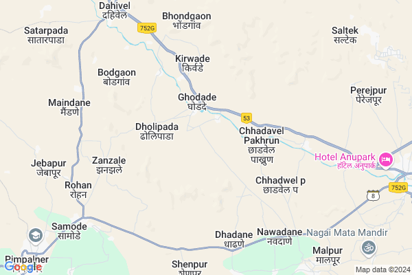
Rohad
Rohad Map
EDIT Map
Add Your House
 ..
..
Current Corona Virus Infected Patients Count in Dhule District
| City Name | District Name | Total Covid cases |
|---|---|---|
| Dhule District | Dhule | 10 |
Locality Name :
Rohad
( रोहिडा )
Taluka Name : Sakri
District : Dhule
State : Maharashtra
Region : Khandesh and Northern Maharashtra
Division : Nashik
Language : Ahirani and A Kandeshi,marathi, Bhili, Andh, Indo-aryan
Current Time 09:34 AM
Date: Thursday , Apr 24,2025 (IST)
Time zone: IST (UTC+5:30)
Elevation / Altitude: 215 meters. Above Seal level
Telephone Code / Std Code: 02568
Assembly constituency : Sakri assembly constituency
Assembly MLA : Mohan Gokul Suryawanshi
Lok Sabha constituency : Nandurbar parliamentary constituency
Parliament MP : Dr. Heena Vijaykumar Gavit
Serpanch Name :
Pin Code : 424304
Post Office Name : Sakri (Dhule)
Alternate Village Name : Rohod
Commodities Prices : Sakri Market / Mandi
National Highways Reachable To Rohad
Nationa High Way :NH53
Nationa High Way :NH53
Rivers Near Rohad
Gul
Purna
Gul
Purna
About Rohad
Correct below Info and add more info about RohadRohad is a Village in Sakri Taluka in Dhule District of Maharashtra State, India. It belongs to Khandesh and Northern Maharashtra region . It belongs to Nashik Division . It is located 70 KM towards west from District head quarters Dhule. 307 KM from State capital Mumbai
Rohad Pin code is 424304 and postal head office is Sakri (Dhule) .
Rohad is surrounded by Baglan Taluka towards South , Navapur Taluka towards west , Nandurbar Taluka towards North , Uchchhal Taluka towards west .
Nandurbar , Satana , Dhule , Malegaon are the near by Cities to Rohad.
Rohod 2011 Census Details
Rohad Local Language is Ahirani. Rohod Village Total population is 2238 and number of houses are 360. Female Population is 50.2%. Village literacy rate is 59.3% and the Female Literacy rate is 26.1%.
Population
| Census Parameter | Census Data |
| Total Population | 2238 |
| Total No of Houses | 360 |
| Female Population % | 50.2 % ( 1124) |
| Total Literacy rate % | 59.3 % ( 1327) |
| Female Literacy rate | 26.1 % ( 585) |
| Scheduled Tribes Population % | 98.9 % ( 2213) |
| Scheduled Caste Population % | 0.0 % ( 0) |
| Working Population % | 46.4 % |
| Child(0 -6) Population by 2011 | 201 |
| Girl Child(0 -6) Population % by 2011 | 55.2 % ( 111) |
Rohod Census More Deatils.
Politics in Rohad
Bharatiya Janata Party , BJP , SP , INC are the major political parties in this area.Polling Stations /Booths near Rohad
1)Z.p. Primary School Sitarampur North-south Building Room No 2 From South2)Z.p. Primary Center School Dahiwel Northern Side East-west Building Room No.3 From East.
3)Z.p. Primary Center School Ghodade Northern Side East-west New Building Room No.1 From East
4)Z.p. Primary School Dhavalivihir East-west Building Room No.1 From West
5)Z.p. Primary School Dholipada East-west Building Room No.2 From East
HOW TO REACH Rohad
By Rail
There is no railway station near to Rohad in less than 10 km. Choupale Rail Way Station (near to Nandurbar) , Vikhran Rail Way Station (near to Dondaicha) , Dondaicha Rail Way Station (near to Dondaicha) , Dhule Rail Way Station (near to Dhule) , Mohadi Pragane Laling Rail Way Station (near to Dhule) , Nandurbar Rail Way Station (near to Nandurbar) are the Rail way stations reachable from near by towns.By Road
Nandurbar , Dondaicha , Dhule are the nearby by towns to Rohad having road connectivity to RohadColleges near Rohad
Late Nspp College Pimpalner
Address :
I.t.i. Samode Tal. Sakri
Address : Samode Tal. Sakri
Industrial Training Institute
Address : Near Kanya School
Schools in Rohad
M.s. Kokani High School
Address : rohod , sakri , dhule , Maharashtra . PIN- 424304 , Post - Sakri (Dhule)
Govt. Ashram High School
Address : rohod , sakri , dhule , Maharashtra . PIN- 424304 , Post - Sakri (Dhule)
Dr. S.m. Todakar Eng. Med. School
Address : rohod , sakri , dhule , Maharashtra . PIN- 424306 , Post - Pimpalenr
Govt Health Centers near Rohad
1) Ghodade , 0 , 1 , 22) Jebapur , 0 , 0 , 0
3) Chadwel Pakhrun , 2 , main road , 4
Sub Villages in Rohad
Hospitals in Rohad,Sakri
Primary Health Centre
Shewadi; Dhule; NH-6; Dhule Nagpur Kolkata Highway; Mumbai Highway; Dhule; Dhule; Maharashtra 424304; India
17.6 KM distance Detail
more ..
Petrol Bunks in Rohad,Sakri
Indian Oil Petrol Pump
Shakri; Dhule; NH-6; Dhule Nagpur Kolkata Highway; Mumbai Highway; Dhule; Dhule; Maharashtra 424304; India
15.9 KM distance Detail
Hindustan Petroleum
Shakri; Dhule; NH-6; Dhule Nagpur Kolkata Highway; Mumbai Highway; Dhule; Dhule; Maharashtra 424304; India
20.2 KM distance Detail
more ..
Colleges in Rohad,Sakri
Government D T Ed College
Shakri; Dhule; NH-6; Dhule Nagpur Kolkata Highway; Mumbai Highway; Dhule; Dhule; Maharashtra 424304; India
22.0 KM distance Detail
more ..
Schools in Rohad,Sakri
Shewali Middle High School
Shewadi; Dhule; NH-6; Dhule Nagpur Kolkata Highway; Mumbai Highway; Dhule; Dhule; Maharashtra 424304; India
17.8 KM distance Detail
Government School
Shewadi; Dhule; NH-6; Dhule Nagpur Kolkata Highway; Mumbai Highway; Dhule; Dhule; Maharashtra 424304; India
19.0 KM distance Detail
Super Markets in Rohad,Sakri
Local Parks in Rohad,Sakri
Police Stations near Rohad,Sakri
Governement Offices near Rohad,Sakri
About Rohad &
History
How to reach Rohad
Tourist Places Near By Rohad
Schools in Rohad
Colleges in Rohad
Temperature & weather of Rohad
places in Rohad
Rohad photos
More Information
How to reach Rohad
Tourist Places Near By Rohad
Schools in Rohad
Colleges in Rohad
Temperature & weather of Rohad
places in Rohad
Rohad photos
More Information
Village Talk
Post News or Events about this Village
Near Cities
Nandurbar 46 KM near
Satana 53 KM near
Dhule 67 KM near
Malegaon 69 KM near
Nandurbar 46 KM near
Satana 53 KM near
Dhule 67 KM near
Malegaon 69 KM near
Near By Taluks
Sakri 0 KM near
Baglan 37 KM near
Navapur 41 KM near
Nandurbar 47 KM near
Sakri 0 KM near
Baglan 37 KM near
Navapur 41 KM near
Nandurbar 47 KM near
Near By Air Ports
Gandhinagar Airport 137 KM near
Chikkalthana Airport 198 KM near
Vadodara Airport 200 KM near
Bhavnagar Airport 252 KM near
Gandhinagar Airport 137 KM near
Chikkalthana Airport 198 KM near
Vadodara Airport 200 KM near
Bhavnagar Airport 252 KM near
Near By Tourist Places
Dhule 66 KM near
Saputara 68 KM near
Toranmal 112 KM near
Kevadia Narmada 123 KM near
Nasik 134 KM near
Dhule 66 KM near
Saputara 68 KM near
Toranmal 112 KM near
Kevadia Narmada 123 KM near
Nasik 134 KM near
Near By Districts
Nandurbar 44 KM near
Dang 67 KM near
Dhule 67 KM near
Narmada 135 KM near
Nandurbar 44 KM near
Dang 67 KM near
Dhule 67 KM near
Narmada 135 KM near
Near By RailWay Station
Nandurbar Rail Way Station 45 KM near
Dondaicha Rail Way Station 57 KM near
Nandurbar Rail Way Station 45 KM near
Dondaicha Rail Way Station 57 KM near