| Home | City Bus | Maps | Villages | Cities | Rail | Tourist Places | School | College | Pin Codes | Corona Cases Count |
| Distance Calculator Bus Services IFSC Codes Trace Mobile Number Weather Search Place Trace IP Available Cash ATM/Banks Locate Polling Booth Report an Error contact People |
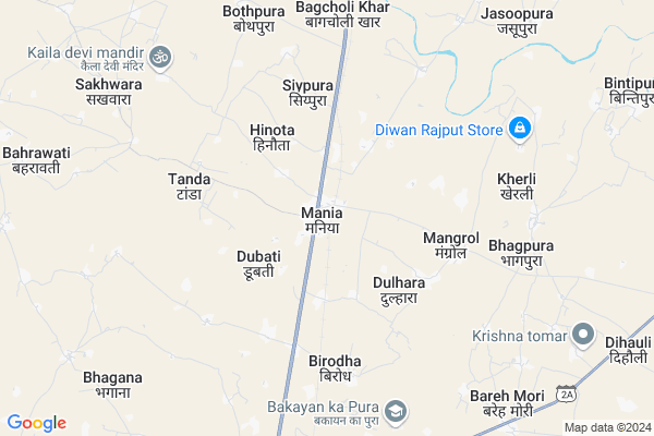
Maniya Map
EDIT Map
Add Your House
 ..
..
Current Corona Virus Infected Patients Count in Dholpur District
| City Name | District Name | Total Covid cases |
|---|
Locality Name :
Maniya
( मनिया )
Tehsil Name : Dhaulpur
District : Dholpur
State : Rajasthan
Division : Bharatpur
Language : Hindi and Rajasthani
Current Time 07:42 AM
Date: Saturday , Apr 26,2025 (IST)
Time zone: IST (UTC+5:30)
Elevation / Altitude: 177 meters. Above Seal level
Telephone Code / Std Code: 05642
Assembly constituency : Rajakhera assembly constituency
Assembly MLA : Rohit Bohra
Lok Sabha constituency : Karauli-Dholpur parliamentary constituency
Parliament MP : MANOJ RAJORIA
Serpanch Name :
Pin Code : 328024
Post Office Name : Maniya
Alternate Village Name : Maniyan
Commodities Prices : Dholpur Market / Mandi
Edit below overview about Maniya
Edit below overview about Maniya
OverView of Maniya
Maniyan village was settled by Bona Chor 400-500 years ago. Bona Chor was a very clever thief of those times who used to steal gold and silver from rich people and hide it in the ground.There is a historical building in Maniyan which is known as the Tower, which was the refuge of Bona Chor. Even today, within a radius of 400 meters around this area, people find gold elephants, horses in the excavations of their houses And we keep getting more pigs.Maniyan The first doctor to provide medical services in the village and its surrounding villages was Dr. Radheshyam Dixit. Who served the patients all his life. At that time, despite the lack of resources and transport routes, He did not hold back in providing his services. Be it knee-deep sand or river water, night time or torrential rain, he used to reach the patient on his bicycle. His spirit of service also affected the bandits. The effect was, he also respected him a lot.Edit below overview about Maniya
Rivers Near Maniya
Chambal River :चम्बल
Bamni
Chambal River :चम्बल
Bamni
About Maniya
Maniya is a Village in Dhaulpur Tehsil in Dholpur District of Rajasthan State, India. It belongs to Bharatpur Division . It is located 16 KM towards North from District head quarters Dholpur. 11 KM from Dhaulpur. 244 KM from State capital Jaipur
Maniya Pin code is 328024 and postal head office is Maniya .
Jalalpur ( 3 KM ) , Hinota ( 3 KM ) , Mangrol ( 4 KM ) , Tanda ( 5 KM ) , Kotpura ( 7 KM ) are the nearby Villages to Maniya. Maniya is surrounded by Rajakhera Tehsil towards East , Dholpur Tehsil towards South , Saiyan Tehsil towards North , Kheragarh Tehsil towards North .
Rajakhera , Shamsabad, Agra , Morena , Fatehpur Sikri are the near by Cities to Maniya.
Maniyan 2011 Census Details
Maniya Local Language is Hindi. Maniyan Village Total population is 13740 and number of houses are 2390. Female Population is 46.9%. Village literacy rate is 64.2% and the Female Literacy rate is 26.3%.
Population
| Census Parameter | Census Data |
| Total Population | 13740 |
| Total No of Houses | 2390 |
| Female Population % | 46.9 % ( 6443) |
| Total Literacy rate % | 64.2 % ( 8822) |
| Female Literacy rate | 26.3 % ( 3615) |
| Scheduled Tribes Population % | 0.1 % ( 7) |
| Scheduled Caste Population % | 19.6 % ( 2695) |
| Working Population % | 33.3 % |
| Child(0 -6) Population by 2011 | 2295 |
| Girl Child(0 -6) Population % by 2011 | 47.0 % ( 1078) |
Maniyan Census More Deatils.
Politics in Maniya
BJP , SP , INC are the major political parties in this area.Polling Stations /Booths near Maniya
1)Govt. Girls Senior Secondary School Rajakhera2)Samudayik Bhavan Jatav Basti Ambar Pur
3)Govt. Girls Senior Secondary School Maniya Left Side
4)Govt. Secondary School Tanda
5)Govt. Senior Secondary School Maniya Part 2 Govt Upper Primary School Maniya Right Side
HOW TO REACH Maniya
By Rail
Mania Rail Way Station is the very nearby railway stations to Maniya.Colleges near Maniya
Shri Vishwa Nath College Saipau.dholpur
Address :
Master Vidyaram College Tasimo Dholpur
Address : Village & Post - Tasimo Tah.-saipau
Schools near Maniya
Pathak Koching Classes
Address : near by choraha
Subodh Shikshan Sansthan Saipau Dholpur
Address : SAIPAU
Keshav Das Vidhya Mandir
Address : Ab road tor daniyal
Govt Sr. Sec School Basai Nawab
Address : Main market
Govt Health Centers near Maniya
1) NOTIONAL Maniya , Maniya , Maniya , Maniya2) Maniya , Maniya , Maniya ,
3) Dandoli , Dandoli , Dandoli ,
Schools in Maniya,Dhaulpur
Electronic Shops in Maniya,Dhaulpur
Super Markets in Maniya,Dhaulpur
Local Parks in Maniya,Dhaulpur
Police Stations near Maniya,Dhaulpur
Governement Offices near Maniya,Dhaulpur
About Maniya &
History
How to reach Maniya
Tourist Places Near By Maniya
Schools in Maniya
Colleges in Maniya
Temperature & weather of Maniya
places in Maniya
Maniya photos
More Information
How to reach Maniya
Tourist Places Near By Maniya
Schools in Maniya
Colleges in Maniya
Temperature & weather of Maniya
places in Maniya
Maniya photos
More Information
Village Talk
Post News or Events about this Village
Near Cities
Rajakhera 28 KM near
Shamsabad, Agra 34 KM near
Morena 39 KM near
Fatehpur Sikri 43 KM near
Rajakhera 28 KM near
Shamsabad, Agra 34 KM near
Morena 39 KM near
Fatehpur Sikri 43 KM near
Near By Taluks
Dhaulpur 11 KM near
Rajakhera 12 KM near
Dholpur 16 KM near
Saiyan 19 KM near
Dhaulpur 11 KM near
Rajakhera 12 KM near
Dholpur 16 KM near
Saiyan 19 KM near
Near By Air Ports
Kheria Airport 42 KM near
Gwalior Airport 74 KM near
Indira Gandhi International Airport 234 KM near
Sanganeer Airport 235 KM near
Kheria Airport 42 KM near
Gwalior Airport 74 KM near
Indira Gandhi International Airport 234 KM near
Sanganeer Airport 235 KM near
Near By Tourist Places
Fatehpur Sikri 44 KM near
Agra 45 KM near
Bharatpur 68 KM near
Gwalior 79 KM near
Mathura 88 KM near
Fatehpur Sikri 44 KM near
Agra 45 KM near
Bharatpur 68 KM near
Gwalior 79 KM near
Mathura 88 KM near
Near By Districts
Dholpur 16 KM near
Morena 40 KM near
Agra 46 KM near
Firozabad 66 KM near
Dholpur 16 KM near
Morena 40 KM near
Agra 46 KM near
Firozabad 66 KM near
Near By RailWay Station
Mania Rail Way Station 0.2 KM near
Dholpur Junction Rail Way Station 15 KM near
Morena Rail Way Station 40 KM near
Mania Rail Way Station 0.2 KM near
Dholpur Junction Rail Way Station 15 KM near
Morena Rail Way Station 40 KM near