| Home | City Bus | Maps | Villages | Cities | Rail | Tourist Places | School | College | Pin Codes | Corona Cases Count |
| Distance Calculator Bus Services IFSC Codes Trace Mobile Number Weather Search Place Trace IP Available Cash ATM/Banks Locate Polling Booth Report an Error contact People |
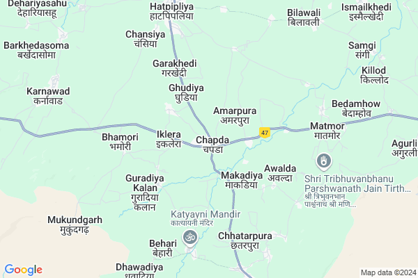
Chapda
Chapda Map
EDIT Map
Add Your House
 ..
..
Current Corona Virus Infected Patients Count in Dewas District
| City Name | District Name | Total Covid cases |
|---|---|---|
| Dewas District | Dewas | 23 |
Locality Name :
Chapda
( चापड़ा )
Tehsil Name : Bagli
District : Dewas
State : Madhya Pradesh
Division : Ujjain
Language : Bhil and Hindi, Devanagari
Current Time 08:10 AM
Date: Thursday , Apr 24,2025 (IST)
Time zone: IST (UTC+5:30)
Elevation / Altitude: 348 meters. Above Seal level
Telephone Code / Std Code: 07271
Assembly constituency : Bagali assembly constituency
Assembly MLA : Murli Bhawara
Lok Sabha constituency : Khandwa parliamentary constituency
Parliament MP : NANDKUMAR SINGH CHOUHAN (NANDU BHAIYA)
Serpanch Name :
Pin Code : 455227
Post Office Name : Bagli
Commodities Prices : Haatpipliya Market / Mandi
Chapda Live Weather
Temperature: 29.8 °C
clear sky
Humidity: 12%
Wind : 4.42 mt/sec towards NW
StationName : "BÄ\u0081gli"
observed on 1 Hours Back
Temperature: 29.8 °C
clear sky
Humidity: 12%
Wind : 4.42 mt/sec towards NW
StationName : "BÄ\u0081gli"
observed on 1 Hours Back
Chapda Weather Forecast for Next 5 days
25-04-2025
28.9°C to 39.6°C
clear sky
28.9°C to 39.6°C
clear sky
26-04-2025
27.5°C to 40.4°C
clear sky
27.5°C to 40.4°C
clear sky
27-04-2025
27.8°C to 40.3°C
clear sky, scattered clouds, few clouds, broken clouds
27.8°C to 40.3°C
clear sky, scattered clouds, few clouds, broken clouds
28-04-2025
27.1°C to 40.7°C
clear sky, scattered clouds, few clouds
27.1°C to 40.7°C
clear sky, scattered clouds, few clouds
29-04-2025
28.0°C to 41.8°C
clear sky, scattered clouds, few clouds
28.0°C to 41.8°C
clear sky, scattered clouds, few clouds
Edit below overview about Chapda
Edit below overview about Chapda
OverView of Chapda
Malwi and Hindi is the local language. Not bhil , mostly people are farmer and they have a nice nature. People are helping in nature.Edit below overview about Chapda
National Highways Reachable To Chapda
Nationa High Way :NH 47
Nationa High Way :NH52
Nationa High Way :NH 47
Nationa High Way :NH52
Rivers Near Chapda
Kasarni Nadi
Gambhir
Kasarni Nadi
Gambhir
About Chapda
Chapda is a Village in Bagli Tehsil in Dewas District of Madhya Pradesh State, India. It belongs to Ujjain Division . It is located 46 KM towards South from District head quarters Dewas. 0 KM from Bagli. 149 KM from State capital Bhopal
Chapda Pin code is 455227 and postal head office is Bagli .
Lakhwada ( 4 KM ) , Guradiyakala ( 4 KM ) , Mahukheda ( 5 KM ) , Bhamori ( 5 KM ) , Bawadikheda ( 5 KM ) are the nearby Villages to Chapda. Chapda is surrounded by Sonkatch Tehsil towards North , Kannod Tehsil towards East , Dewas Tehsil towards North , Indore Tehsil towards west .
Dewas , Indore , Rau , Mhow Cantonment are the near by Cities to Chapda.
Demographics of Chapda
Bhil is the Local Language here.Politics in Chapda
Bharatiya Janata Party , BJP , INC are the major political parties in this area.Polling Stations /Booths near Chapda
1)Chapada2)Chapda
3)Chapda
4)Chapda
5)Chandupura
HOW TO REACH Chapda
By Rail
There is no railway station near to Chapda in less than 10 km.Colleges near Chapda
Satwas
Address :
Sant Singaji Institute Of Science And Management,sandalpur
Address : Sant Singaji Institute Of Science & Management
nh 59, Sandalpur
tehsil, Khategaon, District
dewas, Sandalpur, Madhya Pradesh
ph: +91-731-4239664, +91-9926042424
email- Contact@ssism.org
website : Www.ssism.org
Acropolis Institute Of Technology And Research
Address : Bypass Rd, Manglia Square, Manglia, Indore, Madhya Pradesh 453771
0731 473 0000
Synargy Institute Of Technology
Address : Synargy Institute Of Technology Gram- Rajpur, Dewa
Govt. College Of Education
Address : Govt. College Of Educationdewas, Madhya Pradesh
Schools near Chapda
Maa Amiya Convent School
Address : bhamori , bagli , dewas , Madhya Pradesh . PIN- 455227 , Post - Bagli
Indian Public School Bagli
Address : ward no. 7 bagli , bagli , dewas , Madhya Pradesh . PIN- 455221 , Post - Karnawad
Mahrishi Dayanand Viddhya Man
Address : ward no. 7 bagli , bagli , dewas , Madhya Pradesh . PIN- 455227 , Post - Bagli
Sarswati Shishu V. Mandir
Address : ward no. 5 karnavad , bagli , dewas , Madhya Pradesh . PIN- 455221 , Post - Karnawad
Govt Health Centers near Chapda
1) SHC Bijjukheda , , , Near Primary School2) SHC Bhamori , Upswasthya Kendra Bhamori , 1 Km Distance From Bhamori Fata From NH 59 Highway Indore-Betul , Near Gram Panchayat Bhamori
3) SHC Karnavad , Up Swasthya Kendra Karnawad , Ward 08 , Near Mataji Mandir
Hospitals in Chapda,Bagli
सामुदायिक स्वास्थ्य केंद्र बागली
Mangliya Gaon; Bagli; Madhya Pradesh 455227; India
9.1 KM distance Detail
more ..
Petrol Bunks in Chapda,Bagli
HP PETROL PUMP - SAVITRI SERVICE STATION
HPC Dealer; Village Bhamori (chapda); Indore Betul Road (NH 59 A) Tehsil Bagli; Indore; Madhya Pradesh 455227; India
4.6 KM distance Detail
more ..
Colleges in Chapda,Bagli
Government college Hatpipliya
Dewas road Hatpipliya; Tilyakhedi; Madhya Pradesh 455223; India
10.8 KM distance Detail
more ..
Schools in Chapda,Bagli
eminent education academy
Guradiya Kalan; Chapda; Madhya Pradesh 455227; India
1.9 KM distance Detail
MAA Umiya Vidya Niketan H.S. SChool Chapda
Guradiya Kalan; Chapda; Madhya Pradesh 455227; India
2.0 KM distance Detail
Super Markets in Chapda,Bagli
समर्थ पतंजलि किसान सेवा केन्द्र
1/35; Makund Bag Marg; Mangliya Gaon; Bagli; Madhya Pradesh 455227; India
9.3 KM distance Detail
Governement Offices near Chapda,Bagli
नगर परिषद (नगर पंचायत)बागली
Mangliya Gaon; Bagli; Madhya Pradesh 455227; India
9.1 KM distance Detail
Seva Sahkari Snstha Maryadit Arlawada
Arlawada; Madhya Pradesh 455223; India
15.9 KM distance Detail
About Chapda &
History
How to reach Chapda
Tourist Places Near By Chapda
Schools in Chapda
Colleges in Chapda
Temperature & weather of Chapda
places in Chapda
Chapda photos
More Information
How to reach Chapda
Tourist Places Near By Chapda
Schools in Chapda
Colleges in Chapda
Temperature & weather of Chapda
places in Chapda
Chapda photos
More Information
Village Talk
Post News or Events about this Village
Near Cities
Dewas 33 KM near
Indore 52 KM near
Rau 59 KM near
Mhow Cantonment 67 KM near
Dewas 33 KM near
Indore 52 KM near
Rau 59 KM near
Mhow Cantonment 67 KM near
Near By Taluks
Bagli 0 KM near
Sonkatch 33 KM near
Kannod 44 KM near
Dewas 48 KM near
Bagli 0 KM near
Sonkatch 33 KM near
Kannod 44 KM near
Dewas 48 KM near
Near By Air Ports
Indore Airport 58 KM near
Bhopal Airport 137 KM near
Vadodara Airport 360 KM near
Dabok Airport 365 KM near
Indore Airport 58 KM near
Bhopal Airport 137 KM near
Vadodara Airport 360 KM near
Dabok Airport 365 KM near
Near By Tourist Places
Indore 53 KM near
Omkareshwar 60 KM near
Ujjain 84 KM near
Maheshwar 107 KM near
Bhopal 142 KM near
Indore 53 KM near
Omkareshwar 60 KM near
Ujjain 84 KM near
Maheshwar 107 KM near
Bhopal 142 KM near
Near By Districts
Dewas 44 KM near
Indore 51 KM near
Ujjain 82 KM near
Shajapur 89 KM near
Dewas 44 KM near
Indore 51 KM near
Ujjain 82 KM near
Shajapur 89 KM near
Near By RailWay Station
Dewas Junction Rail Way Station 45 KM near
Indore Junction Rail Way Station 51 KM near
Dewas Junction Rail Way Station 45 KM near
Indore Junction Rail Way Station 51 KM near