| Home | City Bus | Maps | Villages | Cities | Rail | Tourist Places | School | College | Pin Codes | Corona Cases Count |
| Distance Calculator Bus Services IFSC Codes Trace Mobile Number Weather Search Place Trace IP Available Cash ATM/Banks Locate Polling Booth Report an Error contact People |
 ..
..
Current Corona Virus Infected Patients Count in Deoghar District
| City Name | District Name | Total Covid cases |
|---|---|---|
| Deoghar District | Deoghar | 2 |
Block Name : Sarath
District : Deoghar
State : Jharkhand
Language : Hindi and Santali
Current Time 05:47 AM
Date: Saturday , Apr 26,2025 (IST)
Time zone: IST (UTC+5:30)
Elevation / Altitude: 208 meters. Above Seal level
Telephone Code / Std Code: 06438
Assembly constituency : Sarath assembly constituency
Assembly MLA :
Lok Sabha constituency : Dumka parliamentary constituency
Parliament MP :
Serpanch Name :
Pin Code : 815357
Post Office Name : Karogram
Commodities Prices : Asansol Market / Mandi
Temperature: 26.5 °C
clear sky
Humidity: 69%
Wind : 3.17 mt/sec towards S
StationName : "JÄ\u0081mtÄ\u0081ra"
observed on 36 Mins Back
26.2°C to 41.6°C
clear sky
24.9°C to 38.6°C
scattered clouds, broken clouds, light rain
24.4°C to 32.3°C
overcast clouds, light rain, broken clouds, scattered clouds
22.7°C to 33.3°C
overcast clouds, clear sky, scattered clouds, light rain, broken clouds
OverView of Chitra
About Chitra.
Chitra is a colleary area of
Estern Coalfields Limited.
It is a dustfull and dirty
place but nothing is bad.
there is all types of shop.
Gandhi Chowk, Tiwari Chowk,
Ambetkar Chowk and Tedhi mode is it's famous place.
here also organized a sri
sri 1008 yag yearly mela.
Girja and T.D. Kawadi is two
part of khadan.
Baramsholi(5), Kanki ( 3 KM ), Palma ( 5 KM ), Simla ( 5 KM
), Asanbani ( 5 KM ), Khaga ( 7 KM ) are the nearby Villages to Chitra.
D.A.V Public school, s.p mines chitra is the main school of chitra.
Edit below overview about Chitra
Puthro
lal pokhra
About Chitra
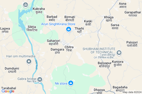
Chitra is a Village in Sarath Block in Deoghar District of Jharkhand State, India. It is located 52 KM towards South from District head quarters Deoghar. 12 KM from Sarath. 211 KM from State capital Ranchi
Chitra Pin code is 815357 and postal head office is Karogram .
Palma ( 3 KM ) , Barjori ( 4 KM ) , Kanki ( 5 KM ) , Asanbani ( 5 KM ) , Simla ( 6 KM ) are the nearby Villages to Chitra. Chitra is surrounded by Palojori Block towards North , Jamtara Block towards South , Karown Block towards west , Nala Block towards South .
Jamtara , Madhupur , Mihijam , Barakar are the near by Cities to Chitra.
Chitra 2011 Census Details
Chitra Local Language is Hindi. Chitra Village Total population is 2430 and number of houses are 472. Female Population is 48.5%. Village literacy rate is 66.4% and the Female Literacy rate is 29.2%.
Population
| Census Parameter | Census Data |
| Total Population | 2430 |
| Total No of Houses | 472 |
| Female Population % | 48.5 % ( 1178) |
| Total Literacy rate % | 66.4 % ( 1614) |
| Female Literacy rate | 29.2 % ( 710) |
| Scheduled Tribes Population % | 1.2 % ( 29) |
| Scheduled Caste Population % | 25.8 % ( 628) |
| Working Population % | 28.2 % |
| Child(0 -6) Population by 2011 | 330 |
| Girl Child(0 -6) Population % by 2011 | 51.8 % ( 171) |
Chitra Census More Deatils.
Politics in Chitra
Bharatiya Janata Party , BJP , JMM , JVMP , INC are the major political parties in this area.Polling Stations /Booths near Chitra
1)Panchayat Building Angwali2)M.s. Building Bhurkundi (e. Part)
3)M.s. Building Chitra (e. Part)
4)U.p.s. Building Chaktelo
5)U. P.s. Building Hemladih
HOW TO REACH Chitra
By Rail
There is no railway station near to Chitra in less than 10 km.Colleges near Chitra
Madhupur Collge MadhupurSchools in Chitra
Mishra Residentiant Public SchoolGovt Health Centers near Chitra
1) HSC PALMA , , ,2) HSC BARBAD , , ,
3) HSC NAUNI , , ,
Hospitals in Chitra,Sarath
Kissan Medical Hall
Tiwari Chowk; SP Mines(ECL); 815351; Chitra; Jharkhand; India
0.2 KM distance Detail
more ..
Petrol Bunks in Chitra,Sarath
HP PETROL PUMP - NIRBHAY FUELS
Kalipokhar Deoghar-giridih SH14 Sarath Dist; Ranchi; Jharkhand 814149; India
15.3 KM distance Detail
more ..
Colleges in Chitra,Sarath
Rajkiya Polytechnic college Katanki Jamtara
Jamtara; Jharkhand 815352; India
19.8 KM distance Detail
Womens College Jamtara
Court Rd; Rajpalli Jamtara; Jamtara; Jharkhand 815351; India
22.3 KM distance Detail
more ..
Local Parks in Chitra,Sarath
Chitra Park
SP Mines(ECL); Chitra; Deoghar; Jharkhand; Chitra; Jharkhand 815351; India
0.1 KM distance Detail
Mahatma Narayan Das Grover Uddyaan (Garden)
Bhawanipur; Jharkhand 815357; India
0.5 KM distance Detail
Police Stations near Chitra,Sarath
Chitra Police Station
Near Gandhi Chowk; S.P. Mines (ECL); 815351; Chitra; Jharkhand; India
0.8 KM distance Detail
Governement Offices near Chitra,Sarath
PANCHAYAT BHAWAN THARHI
Dudhichuwa - Thari - Chikinia Road; Dudhichuwa; Jharkhand 815357; India
2.6 KM distance Detail
How to reach Chitra
Tourist Places Near By Chitra
Schools in Chitra
Colleges in Chitra
Temperature & weather of Chitra
places in Chitra
Chitra photos
More Information
Village Talk
Post News or Events about this Village
Jamtara 22 KM near
Madhupur 29 KM near
Mihijam 31 KM near
Barakar 47 KM near
Sarath 11 KM near
Palojori 14 KM near
Jamtara 17 KM near
Karown 19 KM near
Ranchi Airport 202 KM near
Gaya Airport 231 KM near
Netaji Subhas Chandra Bose Airport 256 KM near
Patna Airport 272 KM near
Jamtara 22 KM near
Maithan 43 KM near
Dumka 46 KM near
Deoghar 50 KM near
Asansol 56 KM near
Jamtara 20 KM near
Dumka 46 KM near
Deoghar 50 KM near
Dhanbad 64 KM near
Vidyasagar Rail Way Station 19 KM near
Jamtara Rail Way Station 21 KM near