| Home | City Bus | Maps | Villages | Cities | Rail | Tourist Places | School | College | Pin Codes | Corona Cases Count |
| Distance Calculator Bus Services IFSC Codes Trace Mobile Number Weather Search Place Trace IP Available Cash ATM/Banks Locate Polling Booth Report an Error contact People |
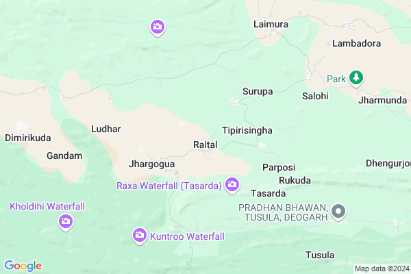
Raital Map
EDIT Map
Add Your House
 ..
..
Current Corona Virus Infected Patients Count in Deogarh District
| City Name | District Name | Total Covid cases |
|---|
Locality Name :
Raital
( ରାଇଟଲ )
Tehsil Name : Tileibani
District : Deogarh
State : Odisha
Language : Oriya and Hindi
Current Time 07:12 AM
Date: Saturday , Apr 26,2025 (IST)
Time zone: IST (UTC+5:30)
Telephone Code / Std Code: 06641
Assembly constituency : Deogarh assembly constituency
Assembly MLA : nitesh gangadeb
Lok Sabha constituency : Sambalpur parliamentary constituency
Parliament MP : NITESH GANGA DEB
Serpanch Name :
Pin Code : 768108
Post Office Name : Deogarh (Debagarh)
Commodities Prices : Kuchinda Market / Mandi
Raital Live Weather
Temperature: 31.3 °C
clear sky
Humidity: 27%
Wind : 1.59 mt/sec towards SE
StationName : "Deogarh"
observed on Now
Temperature: 31.3 °C
clear sky
Humidity: 27%
Wind : 1.59 mt/sec towards SE
StationName : "Deogarh"
observed on Now
Raital Weather Forecast for Next 5 days
27-04-2025
27.8°C to 42.7°C
clear sky, scattered clouds, broken clouds, overcast clouds
27.8°C to 42.7°C
clear sky, scattered clouds, broken clouds, overcast clouds
28-04-2025
25.7°C to 34.9°C
overcast clouds, light rain
25.7°C to 34.9°C
overcast clouds, light rain
29-04-2025
22.5°C to 40.0°C
broken clouds, scattered clouds, few clouds, light rain
22.5°C to 40.0°C
broken clouds, scattered clouds, few clouds, light rain
30-04-2025
21.2°C to 39.1°C
few clouds, clear sky, scattered clouds, broken clouds
21.2°C to 39.1°C
few clouds, clear sky, scattered clouds, broken clouds
01-05-2025
20.0°C to 40.8°C
clear sky, few clouds, light rain, scattered clouds
20.0°C to 40.8°C
clear sky, few clouds, light rain, scattered clouds
National Highways Reachable To Raital
Nationa High Way :NH53
Nationa High Way :NH53
Rivers Near Raital
Brahmani :Brahmani :Брагмані
Mankarha
Brahmani :Brahmani :Брагмані
Mankarha
About Raital
Correct below Info and add more info about RaitalRaital is a small Village/hamlet in Tileibani Tehsil in Deogarh District of Odisha State, India. It is located 15 KM towards North from District head quarters Debagarh. 17 KM from Tilaibani. 229 KM from State capital Bhubaneswar
Raital Pin code is 768108 and postal head office is Deogarh (Debagarh).
Tainsar ( 12 KM ) , Kantapali ( 15 KM ) , Deogarh ( 16 KM ) are the nearby Villages to Raital. Raital is surrounded by Deogarh Tehsil towards South , Kuchinda Tehsil towards west , Bonaigarh Tehsil towards East , Gurundia Tehsil towards North .
Debagarh , Kuchinda , Bamra , Rajagangapur are the near by Cities to Raital.
Raital 2011 Census Details
Raital Local Language is Oriya. Raital Village Total population is 411 and number of houses are 101. Female Population is 49.9%. Village literacy rate is 61.8% and the Female Literacy rate is 26.3%.
Population
| Census Parameter | Census Data |
| Total Population | 411 |
| Total No of Houses | 101 |
| Female Population % | 49.9 % ( 205) |
| Total Literacy rate % | 61.8 % ( 254) |
| Female Literacy rate | 26.3 % ( 108) |
| Scheduled Tribes Population % | 37.2 % ( 153) |
| Scheduled Caste Population % | 10.7 % ( 44) |
| Working Population % | 64.5 % |
| Child(0 -6) Population by 2011 | 52 |
| Girl Child(0 -6) Population % by 2011 | 46.2 % ( 24) |
Raital Census More Deatils.
Politics in Raital
BJP , BJD , INC are the major political parties in this area.Polling Stations /Booths near Raital
1)Karlaga U.g.u.p.school (s)2)Raitabahal Pry. School
3)Harekrishnapur Pry. School
4)Tinkbir Pry. School
5)Para U.g.u.p. School
HOW TO REACH Raital
By Rail
There is no railway station near to Raital in less than 10 km.Colleges near Raital
Panchayat Samiti College Suguda
Address :
Subash Naik Higer Secondary School,ludhar
Address : At-ludhar,
Schools in Raital
Raital P.s.
Address : raital , tileibani , deogarh , Sikkim . PIN- 768108 , Post - Deogarh (Debagarh)
Govt Health Centers near Raital
1) Hatibari , , ,2) UFWC, AITHAPALI , URBAN FAMILY WELFARE CENTER AINTHAPALI , Aithapali , Near Trafic
3) DR.JANARDAN PUJARI MATERNITY HOME SAMBALPUR , JPM SAMBALPUR , GOLEBAZAR , Golebazar
Petrol Bunks in Raital,Tileibani
Jyotimanjari Fuels; Indian Oil Fuel Pump
Pradhanpat Road; Deogarh; Odisha 768108; India
17.2 KM distance Detail
more ..
Colleges in Raital,Tileibani
Deogarh College;Deogarh
Purunagarh;768119; College Road; Deogarh; Odisha 768108; India
16.3 KM distance Detail
more ..
Super Markets in Raital,Tileibani
About Raital &
History
How to reach Raital
Tourist Places Near By Raital
Schools in Raital
Colleges in Raital
Temperature & weather of Raital
places in Raital
Raital photos
More Information
How to reach Raital
Tourist Places Near By Raital
Schools in Raital
Colleges in Raital
Temperature & weather of Raital
places in Raital
Raital photos
More Information
Village Talk
Post News or Events about this Village
Near Cities
Debagarh 17 KM near
Kuchinda 35 KM near
Bamra 64 KM near
Rajagangapur 70 KM near
Debagarh 17 KM near
Kuchinda 35 KM near
Bamra 64 KM near
Rajagangapur 70 KM near
Near By Taluks
Deogarh 16 KM near
Tileibani 16 KM near
Kuchinda 26 KM near
Bonaigarh 32 KM near
Deogarh 16 KM near
Tileibani 16 KM near
Kuchinda 26 KM near
Bonaigarh 32 KM near
Near By Air Ports
Bhubaneswar Airport 220 KM near
Ranchi Airport 223 KM near
Raipur Airport 340 KM near
Gaya Airport 388 KM near
Bhubaneswar Airport 220 KM near
Ranchi Airport 223 KM near
Raipur Airport 340 KM near
Gaya Airport 388 KM near
Near By Tourist Places
Sambalpur 79 KM near
Rourkela 80 KM near
Hirakud 87 KM near
Simdega 121 KM near
Raigarh 147 KM near
Sambalpur 79 KM near
Rourkela 80 KM near
Hirakud 87 KM near
Simdega 121 KM near
Raigarh 147 KM near
Near By Districts
Deogarh 15 KM near
Jharsuguda 76 KM near
Sambalpur 77 KM near
Sundargarh 91 KM near
Deogarh 15 KM near
Jharsuguda 76 KM near
Sambalpur 77 KM near
Sundargarh 91 KM near
Near By RailWay Station
Bamra Rail Way Station 65 KM near
Rajgangpur Rail Way Station 68 KM near
Bamra Rail Way Station 65 KM near
Rajgangpur Rail Way Station 68 KM near