| Home | City Bus | Maps | Villages | Cities | Rail | Tourist Places | School | College | Pin Codes | Corona Cases Count |
| Distance Calculator Bus Services IFSC Codes Trace Mobile Number Weather Search Place Trace IP Available Cash ATM/Banks Locate Polling Booth Report an Error contact People |
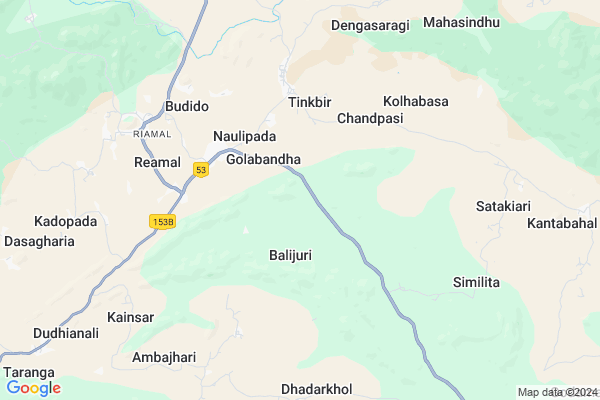
Deojharan Map
EDIT Map
Add Your House
 ..
..
Current Corona Virus Infected Patients Count in Deogarh District
| City Name | District Name | Total Covid cases |
|---|
Locality Name :
Deojharan
( ଦେଓଝାରଣ )
Tehsil Name : Reamal
District : Deogarh
State : Odisha
Language : Oriya and Hindi
Current Time 03:36 PM
Date: Wednesday , Apr 30,2025 (IST)
Time zone: IST (UTC+5:30)
Elevation / Altitude: 197 meters. Above Seal level
Telephone Code / Std Code: 06647
Assembly constituency : Deogarh assembly constituency
Assembly MLA : nitesh gangadeb
Lok Sabha constituency : Sambalpur parliamentary constituency
Parliament MP : NITESH GANGA DEB
Serpanch Name :
Commodities Prices : Kuchinda Market / Mandi
Deojharan Live Weather
Temperature: 38.2 °C
scattered clouds
Humidity: 23%
Wind : 3.53 mt/sec towards SE
StationName : "Deogarh"
observed on 26 Mins Back
Temperature: 38.2 °C
scattered clouds
Humidity: 23%
Wind : 3.53 mt/sec towards SE
StationName : "Deogarh"
observed on 26 Mins Back
Deojharan Weather Forecast for Next 5 days
01-05-2025
23.6°C to 35.8°C
light rain, clear sky, scattered clouds
23.6°C to 35.8°C
light rain, clear sky, scattered clouds
02-05-2025
21.6°C to 40.1°C
scattered clouds, clear sky, light rain, broken clouds
21.6°C to 40.1°C
scattered clouds, clear sky, light rain, broken clouds
03-05-2025
21.3°C to 41.0°C
clear sky, few clouds, scattered clouds, moderate rain
21.3°C to 41.0°C
clear sky, few clouds, scattered clouds, moderate rain
04-05-2025
24.1°C to 38.5°C
clear sky, scattered clouds, light rain, broken clouds, overcast clouds
24.1°C to 38.5°C
clear sky, scattered clouds, light rain, broken clouds, overcast clouds
05-05-2025
24.8°C to 42.0°C
broken clouds, few clouds, clear sky, scattered clouds, light rain
24.8°C to 42.0°C
broken clouds, few clouds, clear sky, scattered clouds, light rain
National Highways Reachable To Deojharan
Nationa High Way :NH53
Nationa High Way :NH53
Rivers Near Deojharan
Brahmani :Brahmani :Брагмані
Mankarha
Brahmani :Brahmani :Брагмані
Mankarha
About Deojharan
Correct below Info and add more info about DeojharanDeojharan is a small Village/hamlet in Reamal Tehsil in Deogarh District of Odisha State, India. It is located 25 KM towards South from District head quarters Debagarh. 195 KM from State capital Bhubaneswar
Deojharan is surrounded by Tileibani Tehsil towards North , Deogarh Tehsil towards North , Naktideul Tehsil towards west , Barkote Tehsil towards East .
Debagarh , Kuchinda , Talcher , Anugul are the near by Cities to Deojharan.
This Place is in the border of the Deogarh District and Sambalpur District. Sambalpur District Naktideul is west towards this place .
Deojharan 2011 Census Details
Deojharan Local Language is Oriya. Deojharan Village Total population is 156 and number of houses are 37. Female Population is 44.2%. Village literacy rate is 50.6% and the Female Literacy rate is 17.3%.
Population
| Census Parameter | Census Data |
| Total Population | 156 |
| Total No of Houses | 37 |
| Female Population % | 44.2 % ( 69) |
| Total Literacy rate % | 50.6 % ( 79) |
| Female Literacy rate | 17.3 % ( 27) |
| Scheduled Tribes Population % | 0.0 % ( 0) |
| Scheduled Caste Population % | 18.6 % ( 29) |
| Working Population % | 57.7 % |
| Child(0 -6) Population by 2011 | 19 |
| Girl Child(0 -6) Population % by 2011 | 42.1 % ( 8) |
Deojharan Census More Deatils.
Politics in Deojharan
BJP , BJD , INC are the major political parties in this area.Polling Stations /Booths near Deojharan
1)Khulundikudar Sevashram2)Golabandh U.g.u.p. School
3)Kanjiamb Pup School
4)Nalabandh U.g.u.p. School
5)Palunipada P.u.pry. School
HOW TO REACH Deojharan
By Rail
There is no railway station near to Deojharan in less than 10 km.Pincodes near Deojharan
768109 ( Reamal ) , 768118 ( Naktideul Ed ) , 768119 ( Purunagarh )Colleges near Deojharan
Palsama Science College
Address : Palsama, Deogarh
Ps +3 Degree College
Address : Budhapal, Deogarh
Schools in Deojharan
Deojharan P.s.
Address : deojharan , reamal , deogarh , Sikkim . PIN- 768109 , Post - Reamal
Govt Health Centers near Deojharan
1) Hatibari , , ,2) UFWC, AITHAPALI , URBAN FAMILY WELFARE CENTER AINTHAPALI , Aithapali , Near Trafic
3) DR.JANARDAN PUJARI MATERNITY HOME SAMBALPUR , JPM SAMBALPUR , GOLEBAZAR , Golebazar
Hospitals in Deojharan,Reamal
Primary Health Centre
Kundheigola; Debagarh; NH-200; Raipur Chandikhol Highway; Sambalpur; Sambalpur; Odisha 768109; India
3.4 KM distance Detail
more ..
Schools in Deojharan,Reamal
Odisha Computer Science Management
Angul - Deogarh Rd; Naulipada; Odisha 768109; India
2.5 KM distance Detail
Sri Aurobinda Integral Education Centre;Naulipada
Deogarh; Odisha 768109; India
3.3 KM distance Detail
Naulipada Primary and Upper Primary School
Naulipada; Debagarh; NH-200; Raipur Chandikhol Highway; Sambalpur; Sambalpur; Odisha 768109; India
3.3 KM distance Detail
Super Markets in Deojharan,Reamal
About Deojharan &
History
How to reach Deojharan
Tourist Places Near By Deojharan
Schools in Deojharan
Colleges in Deojharan
Temperature & weather of Deojharan
places in Deojharan
Deojharan photos
More Information
How to reach Deojharan
Tourist Places Near By Deojharan
Schools in Deojharan
Colleges in Deojharan
Temperature & weather of Deojharan
places in Deojharan
Deojharan photos
More Information
Village Talk
Post News or Events about this Village
Near Cities
Debagarh 23 KM near
Kuchinda 65 KM near
Talcher 76 KM near
Anugul 77 KM near
Debagarh 23 KM near
Kuchinda 65 KM near
Talcher 76 KM near
Anugul 77 KM near
Near By Taluks
Reamal 0 KM near
Tileibani 22 KM near
Deogarh 24 KM near
Naktideul 26 KM near
Reamal 0 KM near
Tileibani 22 KM near
Deogarh 24 KM near
Naktideul 26 KM near
Near By Air Ports
Bhubaneswar Airport 186 KM near
Ranchi Airport 256 KM near
Raipur Airport 345 KM near
Gaya Airport 425 KM near
Bhubaneswar Airport 186 KM near
Ranchi Airport 256 KM near
Raipur Airport 345 KM near
Gaya Airport 425 KM near
Near By Tourist Places
Sambalpur 86 KM near
Hirakud 97 KM near
Rourkela 115 KM near
Phulbani 121 KM near
Simdega 159 KM near
Sambalpur 86 KM near
Hirakud 97 KM near
Rourkela 115 KM near
Phulbani 121 KM near
Simdega 159 KM near
Near By Districts
Deogarh 25 KM near
Anugul 75 KM near
Boudh 77 KM near
Sambalpur 85 KM near
Deogarh 25 KM near
Anugul 75 KM near
Boudh 77 KM near
Sambalpur 85 KM near
Near By RailWay Station
Boinda Rail Way Station 52 KM near
Rairakhol Rail Way Station 57 KM near
Boinda Rail Way Station 52 KM near
Rairakhol Rail Way Station 57 KM near