| Home | City Bus | Maps | Villages | Cities | Rail | Tourist Places | School | College | Pin Codes | Corona Cases Count |
| Distance Calculator Bus Services IFSC Codes Trace Mobile Number Weather Search Place Trace IP Available Cash ATM/Banks Locate Polling Booth Report an Error contact People |
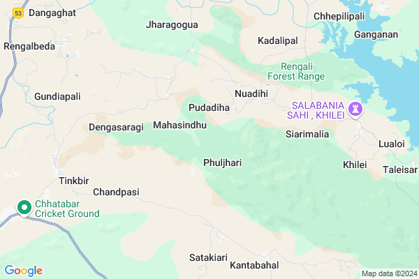
Bhejikudar Map
EDIT Map
Add Your House
 ..
..
Current Corona Virus Infected Patients Count in Deogarh District
| City Name | District Name | Total Covid cases |
|---|
Locality Name :
Bhejikudar
( ଭେଜିକୁଦର )
Tehsil Name : Reamal
District : Deogarh
State : Odisha
Language : Oriya and Hindi
Current Time 03:19 PM
Date: Wednesday , Apr 30,2025 (IST)
Time zone: IST (UTC+5:30)
Elevation / Altitude: 197 meters. Above Seal level
Telephone Code / Std Code: 06647
Assembly constituency : Deogarh assembly constituency
Assembly MLA : nitesh gangadeb
Lok Sabha constituency : Sambalpur parliamentary constituency
Parliament MP : NITESH GANGA DEB
Serpanch Name :
Commodities Prices : Bonai Market / Mandi
National Highways Reachable To Bhejikudar
Nationa High Way :NH53
Nationa High Way :NH53
Rivers Near Bhejikudar
Brahmani :Brahmani :Брагмані
Mankarha
Brahmani :Brahmani :Брагмані
Mankarha
About Bhejikudar
Correct below Info and add more info about BhejikudarBhejikudar is a small Village/hamlet in Reamal Tehsil in Deogarh District of Odisha State, India. It is located 20 KM towards South from District head quarters Debagarh. 10 KM from Reamal. 194 KM from State capital Bhubaneswar
Tinkbir ( 8 KM ) , Khilei ( 8 KM ) , Gundiapali ( 9 KM ) , Naulipada ( 11 KM ) , Suguda ( 12 KM ) are the nearby Villages to Bhejikudar. Bhejikudar is surrounded by Deogarh Tehsil towards North , Tileibani Tehsil towards west , Barkote Tehsil towards East , Naktideul Tehsil towards west .
Debagarh , Kuchinda , Talcher , Anugul are the near by Cities to Bhejikudar.
This Place is in the border of the Deogarh District and Sambalpur District. Sambalpur District Naktideul is west towards this place .
Bhejikudar 2011 Census Details
Bhejikudar Local Language is Oriya. Bhejikudar Village Total population is 436 and number of houses are 96. Female Population is 50.2%. Village literacy rate is 59.9% and the Female Literacy rate is 26.4%.
Population
| Census Parameter | Census Data |
| Total Population | 436 |
| Total No of Houses | 96 |
| Female Population % | 50.2 % ( 219) |
| Total Literacy rate % | 59.9 % ( 261) |
| Female Literacy rate | 26.4 % ( 115) |
| Scheduled Tribes Population % | 56.2 % ( 245) |
| Scheduled Caste Population % | 1.1 % ( 5) |
| Working Population % | 55.5 % |
| Child(0 -6) Population by 2011 | 69 |
| Girl Child(0 -6) Population % by 2011 | 43.5 % ( 30) |
Bhejikudar Census More Deatils.
Politics in Bhejikudar
BJP , BJD , INC are the major political parties in this area.Polling Stations /Booths near Bhejikudar
1)Patrapali Pry. School Deogarh2)Chilantikhol Pry. School
3)Nirgunipali Pry. School
4)Dehuripal U.p. School
5)Boys U.p. School Deogarh
HOW TO REACH Bhejikudar
By Rail
There is no railway station near to Bhejikudar in less than 10 km.Pincodes near Bhejikudar
768109 ( Reamal ) , 768108 ( Deogarh (Debagarh) ) , 768119 ( Purunagarh )Colleges near Bhejikudar
Palsama Science College
Address : Palsama, Deogarh
Ps +3 Degree College
Address : Budhapal, Deogarh
Schools near Bhejikudar
Tentalabahal H.s.
Address : tentlabahal , reamal , deogarh , Sikkim . PIN- 768119 , Post - Purunagarh
Maheswari H.s., Kumal
Address : kumala (paika) , reamal , deogarh , Sikkim . PIN- 768109 , Post - Reamal
Kushakhalia Anchalik H.s.
Address : kushkhulia , reamal , deogarh , Sikkim . PIN- 768109 , Post - Reamal
Nuapada Sanskrit School.
Address : nuapada , reamal , deogarh , Sikkim . PIN- 768109 , Post - Reamal
Govt Health Centers near Bhejikudar
1) Hatibari , , ,2) UFWC, AITHAPALI , URBAN FAMILY WELFARE CENTER AINTHAPALI , Aithapali , Near Trafic
3) DR.JANARDAN PUJARI MATERNITY HOME SAMBALPUR , JPM SAMBALPUR , GOLEBAZAR , Golebazar
Hospitals in Bhejikudar,Reamal
Primary Health Centre
Kundheigola; Debagarh; NH-200; Raipur Chandikhol Highway; Sambalpur; Sambalpur; Odisha 768109; India
12.1 KM distance Detail
more ..
Petrol Bunks in Bhejikudar,Reamal
Jyotimanjari Fuels; Indian Oil Fuel Pump
Pradhanpat Road; Deogarh; Odisha 768108; India
20.4 KM distance Detail
more ..
Governement Offices near Bhejikudar,Reamal
Pilot Project Centre. Balam
Rourkela - Deogarh Road; Ballam; Odisha 768108; India
19.3 KM distance Detail
About Bhejikudar &
History
How to reach Bhejikudar
Tourist Places Near By Bhejikudar
Schools in Bhejikudar
Colleges in Bhejikudar
Temperature & weather of Bhejikudar
places in Bhejikudar
Bhejikudar photos
More Information
How to reach Bhejikudar
Tourist Places Near By Bhejikudar
Schools in Bhejikudar
Colleges in Bhejikudar
Temperature & weather of Bhejikudar
places in Bhejikudar
Bhejikudar photos
More Information
Village Talk
Post News or Events about this Village
Near Cities
Debagarh 18 KM near
Kuchinda 66 KM near
Talcher 74 KM near
Anugul 78 KM near
Debagarh 18 KM near
Kuchinda 66 KM near
Talcher 74 KM near
Anugul 78 KM near
Near By Taluks
Reamal 9 KM near
Deogarh 19 KM near
Tileibani 21 KM near
Barkote 27 KM near
Reamal 9 KM near
Deogarh 19 KM near
Tileibani 21 KM near
Barkote 27 KM near
Near By Air Ports
Bhubaneswar Airport 186 KM near
Ranchi Airport 248 KM near
Raipur Airport 353 KM near
Gaya Airport 418 KM near
Bhubaneswar Airport 186 KM near
Ranchi Airport 248 KM near
Raipur Airport 353 KM near
Gaya Airport 418 KM near
Near By Tourist Places
Sambalpur 93 KM near
Hirakud 104 KM near
Rourkela 107 KM near
Phulbani 130 KM near
Simdega 155 KM near
Sambalpur 93 KM near
Hirakud 104 KM near
Rourkela 107 KM near
Phulbani 130 KM near
Simdega 155 KM near
Near By Districts
Deogarh 20 KM near
Anugul 76 KM near
Boudh 87 KM near
Sambalpur 92 KM near
Deogarh 20 KM near
Anugul 76 KM near
Boudh 87 KM near
Sambalpur 92 KM near
Near By RailWay Station
Boinda Rail Way Station 58 KM near
Rairakhol Rail Way Station 67 KM near
Boinda Rail Way Station 58 KM near
Rairakhol Rail Way Station 67 KM near