| Home | City Bus | Maps | Villages | Cities | Rail | Tourist Places | School | College | Pin Codes | Corona Cases Count |
| Distance Calculator Bus Services IFSC Codes Trace Mobile Number Weather Search Place Trace IP Available Cash ATM/Banks Locate Polling Booth Report an Error contact People |
Attal
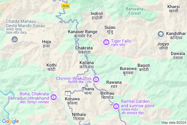
Attal Map
EDIT Map
Add Your House
 ..
..
Current Corona Virus Infected Patients Count in Dehradun District
| City Name | District Name | Total Covid cases |
|---|---|---|
| Dehradun District | Dehradun | 22 |
| Dehradun | Dehradun | 3 |
Locality Name :
Attal
( अटल )
Block Name : Chakrata
District : Dehradun
State : Uttarakhand
Language : Hindu and Sindhi, Punjabi, Garhwali And Urdu.
Current Time 08:02 AM
Date: Saturday , Apr 26,2025 (IST)
Time zone: IST (UTC+5:30)
Elevation / Altitude: 648 meters. Above Seal level
Telephone Code / Std Code: 01360
Assembly constituency : Chakrata assembly constituency
Assembly MLA : Pritam Singh
Lok Sabha constituency : Tehri Garhwal parliamentary constituency
Parliament MP : MALA RAJYA LAXMI SHAH
Serpanch Name :
Pin Code : 248199
Post Office Name : Tuini
Commodities Prices : Vikasnagar Market / Mandi
Attal Live Weather
Temperature: 22.1 °C
clear sky
Humidity: 19%
Wind : 3.04 mt/sec towards NE
StationName : "ChakrÄ\u0081ta"
observed on Now
Temperature: 22.1 °C
clear sky
Humidity: 19%
Wind : 3.04 mt/sec towards NE
StationName : "ChakrÄ\u0081ta"
observed on Now
Attal Weather Forecast for Next 5 days
27-04-2025
11.9°C to 25.8°C
clear sky, scattered clouds, overcast clouds
11.9°C to 25.8°C
clear sky, scattered clouds, overcast clouds
28-04-2025
10.8°C to 27.3°C
broken clouds, few clouds, clear sky, scattered clouds, light rain
10.8°C to 27.3°C
broken clouds, few clouds, clear sky, scattered clouds, light rain
29-04-2025
11.1°C to 26.4°C
scattered clouds, clear sky, few clouds, overcast clouds, broken clouds
11.1°C to 26.4°C
scattered clouds, clear sky, few clouds, overcast clouds, broken clouds
30-04-2025
11.8°C to 27.6°C
broken clouds, few clouds, clear sky, light rain, scattered clouds
11.8°C to 27.6°C
broken clouds, few clouds, clear sky, light rain, scattered clouds
01-05-2025
12.6°C to 26.0°C
clear sky, few clouds, scattered clouds, light rain, broken clouds
12.6°C to 26.0°C
clear sky, few clouds, scattered clouds, light rain, broken clouds
Edit below overview about Attal
Edit below overview about Attal
OverView of Attal
Attal is also spelled as Hatal Distance between Hatal/Attal to Dehradun is about 172 km via Minas-Ichhari.Edit below overview about Attal
National Highways Reachable To Attal
Nationa High Way :NH707A
Nationa High Way :NH707A
Rivers Near Attal
Benal Gad
Dhanpati Gad
Benal Gad
Dhanpati Gad
About Attal
Attal is a Village in Chakrata Block in Dehradun District of Uttarakhand State, India. It is located 49 KM towards North from District head quarters Dehradun. 7 KM from Chakrata. 51 KM from State capital Dehradun
Attal Pin code is 248199 and postal head office is Tuini .
Chakrata ( 1 KM ) , Thana ( 3 KM ) , Rawana ( 4 KM ) , Sujau ( 4 KM ) , Lorli ( 4 KM ) are the nearby Villages to Attal. Attal is surrounded by Kalsi Block towards South , Shillai Block towards west , Naugaon Block towards East , Vikasnagar Block towards South .
Mussoorie , Dehradun , Nahan , Chamba are the near by Cities to Attal.
This Place is in the border of the Dehradun District and Sirmaur District. Sirmaur District Shillai is west towards this place . It is near to the Himachal Pradesh State Border.
Demographics of Attal
Hindu is the Local Language here.Politics in Attal
UJP , INC are the major political parties in this area.Polling Stations /Booths near Attal
1)Chakarata Cantt2)Burayala
3)Chorkunawa
4)Mandoli
5)Rajanu
HOW TO REACH Attal
By Rail
There is no railway station near to Attal in less than 10 km.Colleges near Attal
Paras International Public School
Address :
Dayanand Anglo Vedic Post Greguate Collage Vikasnagar
Address :
Will Field School
Address :
Mahadevi Institute Of Technology, Dehradun
Address : 10-new Road, Dehradun
Schools near Attal
Shri Shiv Vidhya Quansi
Address : jogiyo , chakrata , dehradun , Uttarakhand . PIN- 248001 , Post - Dilaram Bazar
Rema English Academy
Address : jogiyo , chakrata , dehradun , Uttarakhand . PIN- 241824
Rulak P.s Sundhok
Address : jogiyo , chakrata , dehradun , Uttarakhand . PIN- 248123 , Post - Kailana
G.i.c. Hataal
Address : sainj taranu , chakrata , dehradun , Uttarakhand . PIN- 248199 , Post - Tuini
Govt Health Centers near Attal
1) Gadugad , Sub center Gadugaad , Gadugaad , Near telephone tower2) Naugaon , Naugaon CHC , Naugaon , Near BDO Office
3) Naugoan-MCH , Naugaon MCH , Naugaon , CHC Naugaon
Hospitals in Attal,Chakrata
Government ayurvedic health centre; Banaur; Himachal Pradesh
Banaur; Himachal Pradesh 173029; India
20.8 KM distance Detail
more ..
Petrol Bunks in Attal,Chakrata
HP PETROL PUMP - JASPAL RANA BULLSEYE S/S
Sumankyari; Nainbagh Dist:tehri Grwl Uttaranchal; Dehradun; 249186; India
21.7 KM distance Detail
Hindustan Petroleum
Sumankyari; Tehri Garhwal; NH-123; Vikash Nagar Barkot Road; Tehri Garhwal; Tehri Garhwal; Uttarakhand 249186; India
21.7 KM distance Detail
HP PETROL PUMP - SHRI SATYA SAI FILLING STATION
Village Haripur Post Office Kaslsi Gate Chakrata Road;nh-123; Dehradun; 248159; India
23.3 KM distance Detail
Hindustan Petroleum
Vyas Nehari; Dehradun NH-123; Vikash Nagar; Vikasnagar - Barkot Rd; Dehradun; Uttarakhand 248159; India
23.3 KM distance Detail
more ..
Colleges in Attal,Chakrata
Shri Gulab Singh Govt. Degree College
Zila Panchayat Guest House; Mussoorie Road; Chakrata; Dehradun; Uttarakhand 248123; India
2.1 KM distance Detail
Sarva Computer Sakshatra Mission Damta Uttarkashi
Damta; Kandi; Uttarakhand 249171; India
16.2 KM distance Detail
more ..
Electronic Shops in Attal,Chakrata
New Market Chakrata
Chakarata Rd; Puran Market; Ashirwad Enclave; Balliwala; Dehradun; Uttarakhand 248006; India
1.9 KM distance Detail
Super Markets in Attal,Chakrata
Police Stations near Attal,Chakrata
Police Station
Dehradun; NH-123; Vikasnagar Barkot Road; Dehradun; Dehradun; Uttarakhand 248159; India
22.0 KM distance Detail
Governement Offices near Attal,Chakrata
Sahayak Abhiyanta Chakrata Upmandal
Chakrati; Uttarkashi; SH-1; Chakrata Road; Dehradun; Dehradun; Uttarakhand 248001; India
1.4 KM distance Detail
Employment Exchange Office
Sahiya; Dehradun; NH-123; Vikash Nagar Barkot Road; Dehradun; Dehradun; Uttarakhand 248159; India
20.9 KM distance Detail
About Attal &
History
How to reach Attal
Tourist Places Near By Attal
Schools in Attal
Colleges in Attal
Temperature & weather of Attal
places in Attal
Attal photos
More Information
How to reach Attal
Tourist Places Near By Attal
Schools in Attal
Colleges in Attal
Temperature & weather of Attal
places in Attal
Attal photos
More Information
Village Talk
Post News or Events about this Village
Near Cities
Mussoorie 36 KM near
Dehradun 52 KM near
Nahan 65 KM near
Chamba 71 KM near
Mussoorie 36 KM near
Dehradun 52 KM near
Nahan 65 KM near
Chamba 71 KM near
Near By Taluks
Chakrata 7 KM near
Kalsi 12 KM near
Shillai 22 KM near
Naugaon 33 KM near
Chakrata 7 KM near
Kalsi 12 KM near
Shillai 22 KM near
Naugaon 33 KM near
Near By Air Ports
Dehra Dun Airport 49 KM near
Simla Airport 94 KM near
Chandigarh Airport 115 KM near
Muzaffarnagar Airport 158 KM near
Dehra Dun Airport 49 KM near
Simla Airport 94 KM near
Chandigarh Airport 115 KM near
Muzaffarnagar Airport 158 KM near
Near By Tourist Places
Chakrata 2 KM near
Kalsi 21 KM near
Mussoorie 35 KM near
Barkot 37 KM near
Paonta Sahib 42 KM near
Chakrata 2 KM near
Kalsi 21 KM near
Mussoorie 35 KM near
Barkot 37 KM near
Paonta Sahib 42 KM near
Near By Districts
Dehradun 47 KM near
Uttar Kashi 60 KM near
Sirmaur 65 KM near
Tehri Garhwal 72 KM near
Dehradun 47 KM near
Uttar Kashi 60 KM near
Sirmaur 65 KM near
Tehri Garhwal 72 KM near
Near By RailWay Station
Dehradun Rail Way Station 49 KM near
Doiwala Rail Way Station 69 KM near
Dehradun Rail Way Station 49 KM near
Doiwala Rail Way Station 69 KM near