| Home | City Bus | Maps | Villages | Cities | Rail | Tourist Places | School | College | Pin Codes | Corona Cases Count |
| Distance Calculator Bus Services IFSC Codes Trace Mobile Number Weather Search Place Trace IP Available Cash ATM/Banks Locate Polling Booth Report an Error contact People |
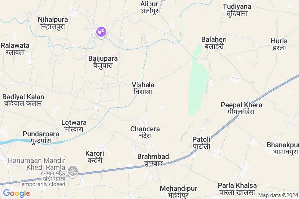
Chandera Map
EDIT Map
Add Your House
 ..
..
Current Corona Virus Infected Patients Count in Dausa District
| City Name | District Name | Total Covid cases |
|---|---|---|
| Dausa District | Dausa | 21 |
Locality Name :
Chandera
( चंदेरा )
Tehsil Name : Sikrai
District : Dausa
State : Rajasthan
Division : Jaipur
Language : Hindi and Rajasthani
Current Time 09:35 PM
Date: Wednesday , Feb 05,2025 (IST)
Time zone: IST (UTC+5:30)
Elevation / Altitude: 283 meters. Above Seal level
Telephone Code / Std Code: 01420
Assembly constituency : Mahwa assembly constituency
Assembly MLA : Rajendra
Lok Sabha constituency : Dausa parliamentary constituency
Parliament MP : Jaskaur Meena
Serpanch Name :
Pin Code : 303509
Post Office Name : Manpur (Dausa)
Commodities Prices : Mahua Mandabar(Mahua) Market / Mandi
Edit below overview about Chandera
Edit below overview about Chandera
OverView of Chandera
It's almost 3 km far from NH11 from balaji mode bus stop.. N 35 km from BANDIKUI JN railway station. It's located near Banganga river.It's tribal community village. gotra Mahar. Mahar community worship Ghatvashan Mata ji. Ghatvashan Mata is of mahar gotra. There is Gram Vikas samiti committed for govt school students welfare motivation as all levels.
Edit below overview about Chandera
National Highways Reachable To Chandera
Nationa High Way :NH148
Nationa High Way :NH21
Nationa High Way :NH148
Nationa High Way :NH21
Rivers Near Chandera
Gambhir
Sesar
Gambhir
Sesar
About Chandera
Chandera is a Village in Sikrai Tehsil in Dausa District of Rajasthan State, India. It belongs to Jaipur Division . It is located 54 KM towards East from District head quarters Dausa. 21 KM from Sikrai. 111 KM from State capital Jaipur
Chandera Pin code is 303509 and postal head office is Manpur (Dausa).
Karodi ( 4 KM ) , Lotwara ( 5 KM ) , Patoli ( 5 KM ) , Udaipura ( 6 KM ) , Theekariya ( 6 KM ) are the nearby Villages to Chandera. Chandera is surrounded by Sikrai Tehsil towards west , Bandikui Tehsil towards west , Todabhim Tehsil towards South , Reni Tehsil towards North .
Todabhim , Mahwa , Bandikui , Rajgarh (Alwar) are the near by Cities to Chandera.
This Place is in the border of the Dausa District and Karauli District. Karauli District Todabhim is South towards this place .
Chandera 2011 Census Details
Chandera Local Language is Hindi. Chandera Village Total population is 2372 and number of houses are 387. Female Population is 47.9%. Village literacy rate is 57.5% and the Female Literacy rate is 21.5%.
Population
| Census Parameter | Census Data |
| Total Population | 2372 |
| Total No of Houses | 387 |
| Female Population % | 47.9 % ( 1136) |
| Total Literacy rate % | 57.5 % ( 1365) |
| Female Literacy rate | 21.5 % ( 510) |
| Scheduled Tribes Population % | 43.3 % ( 1027) |
| Scheduled Caste Population % | 16.6 % ( 394) |
| Working Population % | 46.6 % |
| Child(0 -6) Population by 2011 | 406 |
| Girl Child(0 -6) Population % by 2011 | 48.0 % ( 195) |
Chandera Census More Deatils.
Politics in Chandera
Independent , Bharatiya Janata Party , BJP , BSP , NPP are the major political parties in this area.Polling Stations /Booths near Chandera
1)Govt. Sr. Secondary School Thekada2)Govt Sr. Secondary School Raseedpur West Part
3)Govt. Upper Primary School Dulhapura
4)Govt.sr.sec. School Pakhar Room No 3
5)Govt. Primary School Fort South East Part Paota
HOW TO REACH Chandera
By Rail
There is no railway station near to Chandera in less than 10 km.Colleges near Chandera
Saraswati College Kalwan Dausa
Address : Kalwan Sikrai Dausa
Govt. College Sikrai Dausa
Address : College Road, Near Mored, Sikrai, Rajasthan 303508
Govt Sec.school Torda
Address :
Govt. Mahavidhayal College Nandri
Address :
Sonam Group Of College
Address : Gurjar Seemla,mahendipur Balaji , Sikrai ,dausa
Schools in Chandera
Govt. Ups Maliyon Ki Dhani
Address : chandera , sikrai , dausa , Rajasthan . PIN- 303509 , Post - Manpur (Dausa)
Govt. Ups Chandera
Address : chandera , sikrai , dausa , Rajasthan . PIN- 303509 , Post - Manpur (Dausa)
Govt Health Centers near Chandera
1) Chandera , sc chandera , , Manpur road2) Brahambad , , Village + Post - Brahambad, Teh. - Bayana ,
3) Thanadang , , Village + Post - Thanadang, Teh. - Bayana ,
Hospitals in Chandera,Sikrai
State Health Center; Patolli
Bayana - Jaipur Rd; Patoli; Rajasthan 321608; India
5.4 KM distance Detail
more ..
Petrol Bunks in Chandera,Sikrai
Hindustan Petrol Pump - Ramesh Auto
Village & Post Patoli NH11 TAH. Todabhim; Jaipur; Rajasthan 311610; India
5.6 KM distance Detail
HP Petrol Pump-Hindustan Petroleum Liquid Filling Station
Village Meena Simla Mehndipur Tehsil Sikrai; Balaji City Rd; Jaipura; Rajasthan 322002; India
5.9 KM distance Detail
more ..
Colleges in Chandera,Sikrai
Sri Balaji Polytechnic College (Polytechnic Dausa Rajasthan)
Mehandipur Balaji Mode ; Padali NH11 Jaipur Agra Highway; Rajasthan 303509; India
5.0 KM distance Detail
DEI-Skill Development
Dayal Bagh Road; Nagla Padi; New Agra Colony; Agra; 282005; India
9.3 KM distance Detail
SHRI SHYAM COMPUTERS
Bihari Ji Ka Chowk; Main Market Manpur; Bihari Ji Ka Chowk; Manpur Village Rd; Rajasthan 303509; India
12.5 KM distance Detail
more ..
Schools in Chandera,Sikrai
Government Primary School
Bairwa Bas; Naurangwara; tehsil-Mahwa; Rajasthan 321608; India
3.2 KM distance Detail
Super Markets in Chandera,Sikrai
Yogi Computers & E-Mitra Service Center;Lotwara
Nangal; Rajasthan 303509; India
4.1 KM distance Detail
Governement Offices near Chandera,Sikrai
Shatabdi Travels
princh sekawati hotal; NH11; balaji mod; Brahmbad; Rajasthan 303509; India
6.3 KM distance Detail
About Chandera &
History
How to reach Chandera
Tourist Places Near By Chandera
Schools in Chandera
Colleges in Chandera
Temperature & weather of Chandera
places in Chandera
Chandera photos
More Information
How to reach Chandera
Tourist Places Near By Chandera
Schools in Chandera
Colleges in Chandera
Temperature & weather of Chandera
places in Chandera
Chandera photos
More Information
Village Talk
Post News or Events about this Village
Near Cities
Todabhim 12 KM near
Mahwa 17 KM near
Bandikui 23 KM near
Rajgarh (Alwar) 33 KM near
Todabhim 12 KM near
Mahwa 17 KM near
Bandikui 23 KM near
Rajgarh (Alwar) 33 KM near
Near By Taluks
Mahwa 15 KM near
Sikrai 20 KM near
Bandikui 21 KM near
Todabhim 22 KM near
Mahwa 15 KM near
Sikrai 20 KM near
Bandikui 21 KM near
Todabhim 22 KM near
Near By Air Ports
Sanganeer Airport 111 KM near
Kheria Airport 132 KM near
Gwalior Airport 184 KM near
Indira Gandhi International Airport 195 KM near
Sanganeer Airport 111 KM near
Kheria Airport 132 KM near
Gwalior Airport 184 KM near
Indira Gandhi International Airport 195 KM near
Near By Tourist Places
Kalakho 34 KM near
Sariska 65 KM near
Karauli 69 KM near
Alwar 71 KM near
Bharatpur 82 KM near
Kalakho 34 KM near
Sariska 65 KM near
Karauli 69 KM near
Alwar 71 KM near
Bharatpur 82 KM near
Near By Districts
Dausa 52 KM near
Karauli 69 KM near
Alwar 72 KM near
Bharatpur 83 KM near
Dausa 52 KM near
Karauli 69 KM near
Alwar 72 KM near
Bharatpur 83 KM near
Near By RailWay Station
Bandikui Junction Rail Way Station 23 KM near
Baswa Rail Way Station 28 KM near
Bandikui Junction Rail Way Station 23 KM near
Baswa Rail Way Station 28 KM near