| Home | City Bus | Maps | Villages | Cities | Rail | Tourist Places | School | College | Pin Codes | Corona Cases Count |
| Distance Calculator Bus Services IFSC Codes Trace Mobile Number Weather Search Place Trace IP Available Cash ATM/Banks Locate Polling Booth Report an Error contact People |
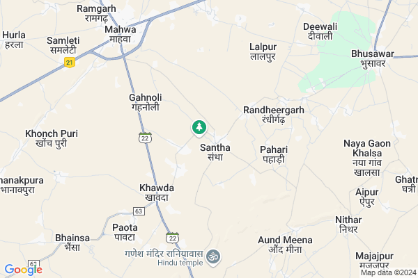
Santha Map
EDIT Map
Add Your House
 ..
..
Current Corona Virus Infected Patients Count in Dausa District
| City Name | District Name | Total Covid cases |
|---|---|---|
| Dausa District | Dausa | 21 |
Locality Name :
Santha
( संथा )
Tehsil Name : Mahwa
District : Dausa
State : Rajasthan
Division : Jaipur
Language : Hindi and Rajasthani
Current Time 07:27 AM
Date: Saturday , Apr 26,2025 (IST)
Time zone: IST (UTC+5:30)
Elevation / Altitude: 253 meters. Above Seal level
Telephone Code / Std Code: 07461
Assembly constituency : Mahwa assembly constituency
Assembly MLA : Rajendra
Lok Sabha constituency : Dausa parliamentary constituency
Parliament MP : Jaskaur Meena
Serpanch Name :
Pin Code : 321612
Post Office Name : Paota (Dausa)
Commodities Prices : Mahua Mandabar(Mahua) Market / Mandi
Edit below overview about Santha
Edit below overview about Santha
OverView of Santha
This is very broad village,surrounded by villages mohanpur, kohra,etc. having govt. approved hospital, sr. sec. school, also a domestic market.there are major caste of meena(Ghusinga).Santha is a very large village in Dausa district and of Meena society, in which eighty percent people of the Ghusinga gotra reside. This village was settled by Meena Sardar named Bhavsingh in 1327 AD by defeating Tahldi, Rustampur and another village in which Gurjars, Mali, Rajput and Dhakad resided. Baba Bhavsingh had settled this village with the help of twelve villages of Jarwal gotra, hence the name of this village was Santha. At the same time, Baba Bhavsingh and Meena chieftains of twelve villages of jarwal gotra. Santha was an important and last destination of the princely state of Jaipur. Santha Thikana was located on the border of the princely states of Jaipur and Bharatpur. In ancient times, the village of Santha got the title of Meena Emperor and the entire Meena community used to follow the decision of the panchayat here. In the south of this village, Aund Meena, Nithar, Khirni, Malpur, Pahadi in the south-east, Mahua and Naygaon in the north, Ghanturi and Baritaki in the north-west and Gahnoli in the west and Palanheda, Lalpur in the east Dand and Hadiya villages are inhabited. Santha had 56 dhanis in 1980 AD. Whose number is currently reduced to 72. There are sixteen family members divided in this village, out of which the eldest family is Baba Nathu Singh. Which has a population of about 1500. In any wedding and other programs, the invitation is given only to your family, so that the expenses of the organizer are reduced. Each family has a Patel who leads his family in the village panchayat. Similarly, there is a Patel of the whole village, who is chosen with the consent of all sixteen patelos. That Patel leads the village in any social panchayat. The village has a very ancient Hanuman temple and a Jain temple. There was an ancient court and old mansions of princely period in Santha, in which the decisions of the Santha whereabouts of the princely state of Jaipur were made during the time of the kings. Those who were broken up in 2007 have been made a big hospital with all kinds of facilities there. Ancient palace in the eastern part of Santha even today is present. There is a great sage Ghatamdas Baba in Santha. Where in ancient times Baba Ghatmadas ji used to do penance. He was a freedom fighter. There are two Athai (Meena Samrat Maharaja virat meena athai and Hiraman baba athai ) in the Santha on which the Panchayat is done. And any matter of the public of the village is heard. Santha also has a commercial market in which all kinds of needy goods are available. There is also a famous Siddha Baba temple in Santha. The primary school in Santha was established in the British era in 1882 and the higher secondary school was established in 1930. People of Meena, Jatav, Prajapat, Jain, Brahmin, San, Koli, Khatik, Harijan, Joshi, Priest, Rana, Yogi, Chaubdar, Rana, Muslim and Jangid etc. reside in Santha.
Edit below overview about Santha
National Highways Reachable To Santha
Nationa High Way :NH148
Nationa High Way :NH48
Nationa High Way :NH148
Nationa High Way :NH48
Rivers Near Santha
Chakan
Chakan
About Santha
Santha is a Village in Mahwa Tehsil in Dausa District of Rajasthan State, India. It belongs to Jaipur Division . It is located 76 KM towards East from District head quarters Dausa. 8 KM from Mahwa. 134 KM from State capital Jaipur
Santha Pin code is 321612 and postal head office is Paota (Dausa) .
Gazipur ( 4 KM ) , Gahnoli ( 4 KM ) , Aund Meena ( 6 KM ) , Paota ( 7 KM ) , Kherla Gadali ( 7 KM ) are the nearby Villages to Santha. Santha is surrounded by Weir Tehsil towards East , Todabhim Tehsil towards South , Hindaun Tehsil towards South , Nadbai Tehsil towards East .
Mahwa , Todabhim , Nadbai , Bandikui are the near by Cities to Santha.
This Place is in the border of the Dausa District and Karauli District. Karauli District Todabhim is South towards this place .
Santha 2011 Census Details
Santha Local Language is Hindi. Santha Village Total population is 6556 and number of houses are 1122. Female Population is 46.2%. Village literacy rate is 57.2% and the Female Literacy rate is 19.4%.
Population
| Census Parameter | Census Data |
| Total Population | 6556 |
| Total No of Houses | 1122 |
| Female Population % | 46.2 % ( 3030) |
| Total Literacy rate % | 57.2 % ( 3753) |
| Female Literacy rate | 19.4 % ( 1272) |
| Scheduled Tribes Population % | 64.1 % ( 4202) |
| Scheduled Caste Population % | 14.7 % ( 961) |
| Working Population % | 42.5 % |
| Child(0 -6) Population by 2011 | 1039 |
| Girl Child(0 -6) Population % by 2011 | 45.5 % ( 473) |
Santha Census More Deatils.
Politics in Santha
Independent , Bharatiya Janata Party , BJP , BSP , NPP are the major political parties in this area.Polling Stations /Booths near Santha
1)Govt Girls Sr. Secondary School Mahwa Left Part2)Govt Girls Sr. Secondary School Mahwa Middle Part
3)Govt. Sanskrit Sr. Secondary School Badawas
4)Govt Sr.sec. School Hurla East Part
5)Govt Girls Sr. Secondary School Mahwa Right Part
HOW TO REACH Santha
By Rail
There is no railway station near to Santha in less than 10 km.Colleges near Santha
Jagrauti Women Collage Kherla Bujurg
Address :
Kd Collage
Address :
Veena Polytechnic College
Address : New Bus Stand Mandawar
Shivshakti Collage
Address :
Schools in Santha
Rawat Bal Shiksha Niketan Sant
Address : santha , mahuwa , dausa , Rajasthan . PIN- 321612 , Post - Paota (Dausa)
Bhim Adarsh Santah
Address : santha , mahuwa , dausa , Rajasthan . PIN- 321612 , Post - Paota (Dausa)
Jagritri Ups Santh
Address : santha , mahuwa , dausa , Rajasthan . PIN- 321612 , Post - Paota (Dausa)
Meeneshwar Adarsh Shiksha Nike
Address : santha , mahuwa , dausa , Rajasthan . PIN- 321612 , Post - Paota (Dausa)
Govt. Sss Santha
Address : santha , mahuwa , dausa , Rajasthan . PIN- 321612 , Post - Paota (Dausa)
Govt Health Centers near Santha
1) Kheda , Sub Center Kheda , Sub Center Kheda , Sub Center Kheda2) Palanpur , Sub Center Palanpur , Sub Center Palanpur , Sub Center Palanpur
3) Gavdameena , Sub Center Gavda Meena , Sub Center Gavda Meena , Sub Center Gavda Meena
Petrol Bunks in Santha,Mahwa
HP PETROL PUMP - HP KHATANA FILLING STATION
Mahwa Hindaun Road Baritki Mahwa; Jaipur; Rajasthan 321608; India
5.7 KM distance Detail
more ..
Colleges in Santha,Mahwa
Shree Dev Fire And Safety College
Hindon Road; Dausa District; Mahwa; Rajasthan 321608; India
7.3 KM distance Detail
more ..
Schools in Santha,Mahwa
Sardar Vallabh bhai Patel Upper Primary School Santha
Santha; Rajasthan 321612; India
0.6 KM distance Detail
Electronic Shops in Santha,Mahwa
Saini Mobile & Tape Reparing Center
Mahwa Bypass; Dhanturi; Rajasthan 321608; India
7.1 KM distance Detail
Super Markets in Santha,Mahwa
BANSAL TRADERS (BSNL FRANCHISEE)
PRADHAN JI KA KATLA; MAIN MARKET; Mahwa; Rajasthan 321608; India
7.7 KM distance Detail
UMESH TRADER OF PLASTIC TRIPAL
MAIN MARKET Rd; Mahwa; Rajasthan 321608; India
7.8 KM distance Detail
Local Parks in Santha,Mahwa
Raghuvansh Marriage Garden
Mahwa- Ramgarh Road; Raghuvansh Nagar; RJ SH 35; Mahwa; Rajasthan 321608; India
9.2 KM distance Detail
Police Stations near Santha,Mahwa
Police Station Mahwa
near of post office; SH22; Mahwa; Rajasthan 321608; India
7.9 KM distance Detail
Governement Offices near Santha,Mahwa
Gahnoli Main Stand
Santha - Todabhim Rd; Bhopur Shahpur; Rajasthan 321612; India
1.6 KM distance Detail
Govind Mahawar Indian Blogger & YouTuber
Vpo Paota;Dist. dausa; Paota; Rajasthan 321612; India
7.1 KM distance Detail
About Santha &
History
How to reach Santha
Tourist Places Near By Santha
Schools in Santha
Colleges in Santha
Temperature & weather of Santha
places in Santha
Santha photos
More Information
How to reach Santha
Tourist Places Near By Santha
Schools in Santha
Colleges in Santha
Temperature & weather of Santha
places in Santha
Santha photos
More Information
Village Talk
Post News or Events about this Village
Near Cities
Mahwa 6 KM near
Todabhim 19 KM near
Nadbai 36 KM near
Bandikui 44 KM near
Mahwa 6 KM near
Todabhim 19 KM near
Nadbai 36 KM near
Bandikui 44 KM near
Near By Taluks
Mahwa 7 KM near
Weir 16 KM near
Todabhim 21 KM near
Hindaun 33 KM near
Mahwa 7 KM near
Weir 16 KM near
Todabhim 21 KM near
Hindaun 33 KM near
Near By Air Ports
Kheria Airport 111 KM near
Sanganeer Airport 131 KM near
Gwalior Airport 165 KM near
Indira Gandhi International Airport 194 KM near
Kheria Airport 111 KM near
Sanganeer Airport 131 KM near
Gwalior Airport 165 KM near
Indira Gandhi International Airport 194 KM near
Near By Tourist Places
Kalakho 54 KM near
Karauli 62 KM near
Bharatpur 63 KM near
Fatehpur Sikri 77 KM near
Alwar 80 KM near
Kalakho 54 KM near
Karauli 62 KM near
Bharatpur 63 KM near
Fatehpur Sikri 77 KM near
Alwar 80 KM near
Near By Districts
Karauli 62 KM near
Bharatpur 64 KM near
Dausa 72 KM near
Alwar 81 KM near
Karauli 62 KM near
Bharatpur 64 KM near
Dausa 72 KM near
Alwar 81 KM near
Near By RailWay Station
Kherli Rail Way Station 26 KM near
Hindaun City Rail Way Station 31 KM near
Kherli Rail Way Station 26 KM near
Hindaun City Rail Way Station 31 KM near