| Home | City Bus | Maps | Villages | Cities | Rail | Tourist Places | School | College | Pin Codes | Corona Cases Count |
| Distance Calculator Bus Services IFSC Codes Trace Mobile Number Weather Search Place Trace IP Available Cash ATM/Banks Locate Polling Booth Report an Error contact People |
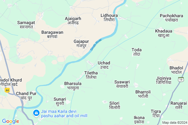
Uchad
Uchad Map
EDIT Map
Add Your House
 ..
..
Current Corona Virus Infected Patients Count in Datia District
| City Name | District Name | Total Covid cases |
|---|
Locality Name :
Uchad
( उचाड़ )
Tehsil Name : Seondha
District : Datia
State : Madhya Pradesh
Division : Gwalior
Language : Hindi and Bharia, Dravidian,devanagari
Current Time 09:54 PM
Date: Sunday , Apr 27,2025 (IST)
Time zone: IST (UTC+5:30)
Elevation / Altitude: 157 meters. Above Seal level
Telephone Code / Std Code: 07521
Assembly constituency : Sewda assembly constituency
Assembly MLA : Pradeep Agrawal
Lok Sabha constituency : Bhind parliamentary constituency
Parliament MP : SANDHYA RAY
Serpanch Name :
Pin Code : 475675
Post Office Name : Indergarh (Datia)
Commodities Prices : Dabra Market / Mandi
Edit below overview about Uchad
Edit below overview about Uchad
OverView of Uchad
Uchad was during the reign of Akbar the headquarter of a pargana of Pawaya Sarkar. Later it became headquarter of the Jhabharia Jat dynasty. The Uchad state came to existence during the 17th century when Uchad was conquered by Raja Balwant Singh Jhabharia the hailing from the nearby Sarkar of Narwar. He was followed by Indersen. The last ruler of Uchad was Dalpat ShahEdit below overview about Uchad
Rivers Near Uchad
Pahuj :पहूज :ಪಹೂಜ್
Pahuj :पहूज :ಪಹೂಜ್
Pahuj :पहूज :ಪಹೂಜ್
Pahuj :पहूज :ಪಹೂಜ್
About Uchad
Uchad is a Village in Seondha Tehsil in Datia District of Madhya Pradesh State, India. It belongs to Gwalior Division . It is located 25 KM towards North from District head quarters Datia. 37 KM from Seondha. 362 KM from State capital Bhopal
Uchad Pin code is 475675 and postal head office is Indergarh (Datia).
Silori ( 5 KM ) , Gora ( 9 KM ) , Behruka ( 10 KM ) , Banoli ( 11 KM ) , Badera ( 12 KM ) are the nearby Villages to Uchad. Uchad is surrounded by Datia Tehsil towards South , Bhander Tehsil towards East , Seondha Tehsil towards East , Bhitarwar Tehsil towards west .
Dabra , Datia , Samthar , Gwalior are the near by Cities to Uchad.
This Place is in the border of the Datia District and Bhind District. Bhind District Lahar is East towards this place .
Uchad 2011 Census Details
Uchad Local Language is Hindi. Uchad Village Total population is 2388 and number of houses are 447. Female Population is 47.0%. Village literacy rate is 57.9% and the Female Literacy rate is 22.7%.
Population
| Census Parameter | Census Data |
| Total Population | 2388 |
| Total No of Houses | 447 |
| Female Population % | 47.0 % ( 1123) |
| Total Literacy rate % | 57.9 % ( 1383) |
| Female Literacy rate | 22.7 % ( 543) |
| Scheduled Tribes Population % | 1.3 % ( 32) |
| Scheduled Caste Population % | 14.9 % ( 356) |
| Working Population % | 40.4 % |
| Child(0 -6) Population by 2011 | 374 |
| Girl Child(0 -6) Population % by 2011 | 45.5 % ( 170) |
Uchad Census More Deatils.
Politics in Uchad
Bharatiya Janata Party , BJP , INC are the major political parties in this area.Polling Stations /Booths near Uchad
1)Bhaisai2)Sikaree
3)Tharet
4)Vagapura
5)Laharakalan
HOW TO REACH Uchad
By Rail
There is no railway station near to Uchad in less than 10 km.Colleges near Uchad
Sict Institute
Address :
Schools in Uchad
Ms Uchad
Address : uchad , seondha , datia , Madhya Pradesh . PIN- 475693
Govt Health Centers near Uchad
1) SHC ParsondaGurjar , Govt.Fiber Building , Kudari , Sethri se Main roud parsonda2) SHC Bhadona , Govt. Building , Jujharpur , Uchad Road
3) SHC Badera , Badera , Upraiy , Badera
Hospitals in Uchad,Seondha
Dr. Satish Sahu Hospital
9/72; Madhya Pradesh State Highway 19; Sahu General Sector; Indergarh; Madhya Pradesh 475675; India
14.0 KM distance Detail
Sanjivani Hospital
Natwarpura; Datia; SH-19; Datia Mau Road; Datia; Datia; Madhya Pradesh 475673; India
14.1 KM distance Detail
Dr.Rpkushwaha
9/72; MP SH 19;Ram sken clinic; Indergarh; Madhya Pradesh 475675; India
14.1 KM distance Detail
Agrawal Medical
9/72; MP SH 19; Sahu General Sector; MP SH 19; Sahu General Sector; Indergarh; Madhya Pradesh 475675; India
14.2 KM distance Detail
more ..
Petrol Bunks in Uchad,Seondha
bhagwati gopal filling station
Gwalior - Jhansi Road; Badera; Madhya Pradesh 475685; India
13.8 KM distance Detail
PITAMBRA FILLING STATION
INDERGARH; DIST DATIA; DATIA; Madhya Pradesh 475675; India
14.3 KM distance Detail
Indian Oil Petrol Pump
Pohar; Datia; SH-19; Natwarpura Road; Datia; Datia; Madhya Pradesh 475673; India
14.9 KM distance Detail
HP PETROL PUMP - SHRI SWAMIJI FILLING STATION
Sewda Road SH 19 Indergarh; Bhopal; Madhya Pradesh 475675; India
15.0 KM distance Detail
more ..
Colleges in Uchad,Seondha
Govt. Polytechnic Collage ; Datia
in front of new collectrate; Datia; Madhya Pradesh; India
23.1 KM distance Detail
more ..
Schools in Uchad,Seondha
शासकीय नवीन हाई स्कूल बड़ैरा
बड़ैरा; 475685; MP SH 14; Badora; Madhya Pradesh 470115; India
12.5 KM distance Detail
Electronic Shops in Uchad,Seondha
Geda Ji Ka Mobile Soroom
9/72; MP SH 19; Sahu General Sector; MP SH 19; Sahu General Sector; Indergarh; Madhya Pradesh 475675; India
13.9 KM distance Detail
Local Parks in Uchad,Seondha
Dr. Bheem Rao Ambedkar Park Indergarh
9/72; Madhya Pradesh State Highway 19; Indergarh; Madhya Pradesh 475675; India
14.0 KM distance Detail
Police Stations near Uchad,Seondha
Police Station Sonagiri
Sonagiri Station Rd; Sinawal; Madhya Pradesh 475685; India
22.2 KM distance Detail
About Uchad &
History
How to reach Uchad
Tourist Places Near By Uchad
Schools in Uchad
Colleges in Uchad
Temperature & weather of Uchad
places in Uchad
Uchad photos
More Information
How to reach Uchad
Tourist Places Near By Uchad
Schools in Uchad
Colleges in Uchad
Temperature & weather of Uchad
places in Uchad
Uchad photos
More Information
Village Talk
Post News or Events about this Village
Near Cities
Dabra 13 KM near
Datia 25 KM near
Samthar 52 KM near
Gwalior 54 KM near
Dabra 13 KM near
Datia 25 KM near
Samthar 52 KM near
Gwalior 54 KM near
Near By Taluks
Dabra 15 KM near
Datia 24 KM near
Bhander 33 KM near
Seondha 35 KM near
Dabra 15 KM near
Datia 24 KM near
Bhander 33 KM near
Seondha 35 KM near
Near By Air Ports
Gwalior Airport 57 KM near
Kheria Airport 168 KM near
Khajuraho Airport 211 KM near
Kanpur Airport 228 KM near
Gwalior Airport 57 KM near
Kheria Airport 168 KM near
Khajuraho Airport 211 KM near
Kanpur Airport 228 KM near
Near By Tourist Places
Sonagir 21 KM near
Datia 26 KM near
Gwalior 52 KM near
Jhansi 55 KM near
Orchha 69 KM near
Sonagir 21 KM near
Datia 26 KM near
Gwalior 52 KM near
Jhansi 55 KM near
Orchha 69 KM near
Near By Districts
Datia 24 KM near
Gwalior 52 KM near
Jhansi 55 KM near
Morena 91 KM near
Datia 24 KM near
Gwalior 52 KM near
Jhansi 55 KM near
Morena 91 KM near
Near By RailWay Station
Dabra Rail Way Station 13 KM near
Datia Rail Way Station 29 KM near
Dabra Rail Way Station 13 KM near
Datia Rail Way Station 29 KM near