| Home | City Bus | Maps | Villages | Cities | Rail | Tourist Places | School | College | Pin Codes | Corona Cases Count |
| Distance Calculator Bus Services IFSC Codes Trace Mobile Number Weather Search Place Trace IP Available Cash ATM/Banks Locate Polling Booth Report an Error contact People |
Paimbechalu
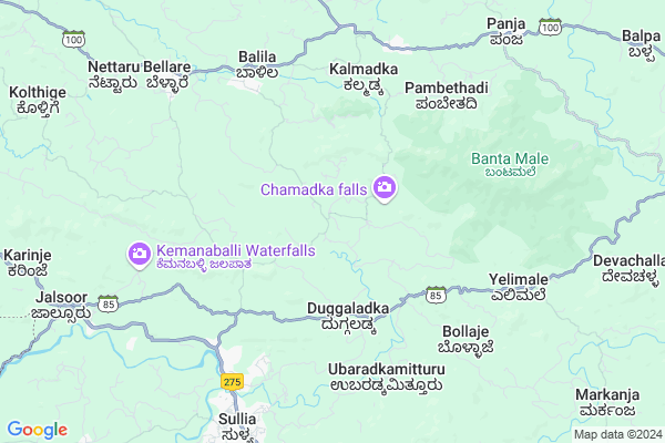
Paimbechalu Map
EDIT Map
Add Your House
 ..
..
Current Corona Virus Infected Patients Count in Dakshin Kannad District
| City Name | District Name | Total Covid cases |
|---|---|---|
| Dakshina Kannada District | Dakshina Kannada | 7 |
| Uppinangadi | Dakshina Kannada | 2 |
| Bantwala | Dakshina Kannada | 2 |
| Bantwal | Dakshina Kannada | 1 |
| Panemangalore | Dakshina Kannada | 1 |
Locality Name :
Paimbechalu
( ಪಾಇಂಬಿಚಲು )
Taluk Name : Sulya
District : Dakshin Kannad
State : Karnataka
Division : Mysore
Language : Tulu and Kannada, Konkani, Beary Bashe.
Current Time 04:17 PM
Date: Wednesday , Feb 05,2025 (IST)
Time zone: IST (UTC+5:30)
Elevation / Altitude: 82 meters. Above Seal level
Telephone Code / Std Code: 08257
Assembly constituency : Sullia assembly constituency
Assembly MLA : Bhagirathi Murulya
Lok Sabha constituency : Dakshina Kannada parliamentary constituency
Parliament MP : NALIN KUMAR KATEEL
Serpanch Name :
Main Village Name : Aletty
Alternate Village Name : Paimbechal Mosque
Commodities Prices : Sulya Market / Mandi
Paimbechalu Live Weather
Temperature: 33.7 °C
clear sky
Humidity: 30%
Wind : 3.33 mt/sec towards W
StationName : "Sullia"
observed on 3 Mins Back
Temperature: 33.7 °C
clear sky
Humidity: 30%
Wind : 3.33 mt/sec towards W
StationName : "Sullia"
observed on 3 Mins Back
Paimbechalu Weather Forecast for Next 5 days
06-02-2025
19.2°C to 29.9°C
clear sky
19.2°C to 29.9°C
clear sky
07-02-2025
18.5°C to 38.1°C
clear sky, few clouds
18.5°C to 38.1°C
clear sky, few clouds
08-02-2025
18.6°C to 39.4°C
scattered clouds, overcast clouds, broken clouds, clear sky, few clouds
18.6°C to 39.4°C
scattered clouds, overcast clouds, broken clouds, clear sky, few clouds
09-02-2025
18.1°C to 39.5°C
clear sky, few clouds, scattered clouds, broken clouds
18.1°C to 39.5°C
clear sky, few clouds, scattered clouds, broken clouds
10-02-2025
19.0°C to 39.5°C
broken clouds, scattered clouds, clear sky
19.0°C to 39.5°C
broken clouds, scattered clouds, clear sky
National Highways Reachable To Paimbechalu
Nationa High Way :NH66
Nationa High Way :NH275
Nationa High Way :NH66
Nationa High Way :NH275
Rivers Near Paimbechalu
Uppala :ಉಪ್ಪಳ :ഉപ്പള
munchikana thodu
Uppala :ಉಪ್ಪಳ :ഉപ്പള
munchikana thodu
About Paimbechalu
Correct below Info and add more info about PaimbechaluPaimbechalu is a small Village/hamlet in Sulya Taluk in Dakshin Kannad District of Karnataka State, India. It comes under Aletty Panchayath. It belongs to Mysore Division . It is located 81 KM towards East from District head quarters Mangalore. 279 KM from State capital Bangalore
Paimbechalu is surrounded by Puttur Taluk towards west , Kanhangad Taluk towards west , Madikeri Taluk towards East , Kasargod Taluk towards west .
Puttur , Madikeri , Kasaragod , Kanhangad are the near by Cities to Paimbechalu.
Demographics of Paimbechalu
Tulu is the Local Language here.Politics in Paimbechalu
Bharatiya Janata Party , BJP , Bharatiya Janata Party (BJP) , INC are the major political parties in this area.Polling Stations /Booths near Paimbechalu
1)Da. Ka. Zilla Panchayath Higher Primary School Ajjavara2)Da. Ka. Zilla Panchayath Lower Primary School Jarathadka
3)Govt. Pre.university College Bellare(west Wing)
4)Govt. Pre.university College Bellare(east Wing)
5)Da. Ka. Zilla Panchayath Higher Primary School. Amaimadiyar
HOW TO REACH Paimbechalu
By Rail
There is no railway station near to Paimbechalu in less than 10 km. are the Rail way stations reachable from near by towns.By Road
Sulya , Madikeri are the nearby by towns to Paimbechalu having road connectivity to PaimbechaluPincodes near Paimbechalu
574248 ( Doddathota ) , 574212 ( Bellare ) , 574327 ( Kurunjibag )Colleges near Paimbechalu
Mangalore Marine College
Address :
Vijaya College Mulki
Address :
Govt Junior Collage
Address :
Goverment Pu College Koyyur
Address :
Govt. Primary School Kanchinadka
Address :
Schools near Paimbechalu
Gups, Jayanagara
Address : ward no-8 , sullia , dakshina kannada , Karnataka . PIN- 574239 , Post - Sullia
Gups, Shanthinagar
Address : ward no-11 , sullia , dakshina kannada , Karnataka . PIN- 574239 , Post - Sullia
Gups, Murulya
Address : murulya , sullia , dakshina kannada , Karnataka . PIN- 574328 , Post - Kaniyur(Puttur)
Gups, Kanthamangala
Address : ajjavara , sullia , dakshina kannada , Karnataka . PIN- 574239 , Post - Sullia
Govt Health Centers near Paimbechalu
1) Kadaba , Primary Health Centre Kadaba , , CHC COMPOUND2) UPPINANGADI 24X7 , Primary Health Centre Uppinangady , , NEAR UPPINANGADY BUS STAND
3) UPPINANGADI 24X7 , , ,
Hospitals in Paimbechalu,Sulya
Hasanadka Wellness Centre
Sheni; Kukkujadka High School; Amaramudnur; Karnataka 574248; India
3.9 KM distance Detail
Ayurdhama Ayurveda Hospital and Yoga Retreat Centre
Old Gate; Sullia; Karnataka 574239; India
7.3 KM distance Detail
more ..
Petrol Bunks in Paimbechalu,Sulya
Hindustan Petroleum- RV Service Station
Madikeri Sulia Road; Paichar; Mangalore; Karnataka 574239; India
6.8 KM distance Detail
Bharath Petrol Pump
Ninthikal Junction post Sullia Taluku; Yenmoor; Karnataka; India
7.7 KM distance Detail
more ..
Colleges in Paimbechalu,Sulya
Government First Grade College; Sullia
Dakshina Kannada; Sullia; Mangalore; Karnataka 574239; India
7.1 KM distance Detail
K S Gowda Pre-University College & Sri Parivara Panchalingeshwara Industrial Training Centre
Varsha Nagar; Ninthikallu; Karnataka 574328; India
7.6 KM distance Detail
Srividya Institute of Arts
NH275; Srirampete; Sullia; Karnataka 574239; India
8.2 KM distance Detail
more ..
Governement Offices near Paimbechalu,Sulya
Panchayat Raj Engineering Upa Vibagha
Bellare Sullia Rd; Sullia; Karnataka 574239; India
8.1 KM distance Detail
About Paimbechalu &
History
How to reach Paimbechalu
Tourist Places Near By Paimbechalu
Schools in Paimbechalu
Colleges in Paimbechalu
Temperature & weather of Paimbechalu
places in Paimbechalu
Paimbechalu photos
More Information
How to reach Paimbechalu
Tourist Places Near By Paimbechalu
Schools in Paimbechalu
Colleges in Paimbechalu
Temperature & weather of Paimbechalu
places in Paimbechalu
Paimbechalu photos
More Information
Village Talk
Post News or Events about this Village
Near Cities
Puttur 31 KM near
Madikeri 46 KM near
Kasaragod 53 KM near
Kanhangad 54 KM near
Puttur 31 KM near
Madikeri 46 KM near
Kasaragod 53 KM near
Kanhangad 54 KM near
Near By Taluks
Sulya 0 KM near
Puttur 27 KM near
Kanhangad 45 KM near
Madikeri 45 KM near
Sulya 0 KM near
Puttur 27 KM near
Kanhangad 45 KM near
Madikeri 45 KM near
Near By Air Ports
Bajpe Airport 77 KM near
Mysore Airport 154 KM near
Calicut Airport 195 KM near
Peelamedu Airport 279 KM near
Bajpe Airport 77 KM near
Mysore Airport 154 KM near
Calicut Airport 195 KM near
Peelamedu Airport 279 KM near
Near By Tourist Places
Kukke Subramanya 23 KM near
Talacauvery 39 KM near
Dharamsthala 41 KM near
Madikeri 46 KM near
Kakkabe 51 KM near
Kukke Subramanya 23 KM near
Talacauvery 39 KM near
Dharamsthala 41 KM near
Madikeri 46 KM near
Kakkabe 51 KM near
Near By Districts
Kodagu 45 KM near
Kasaragod 53 KM near
Dakshin Kannad 77 KM near
Kannur 93 KM near
Kodagu 45 KM near
Kasaragod 53 KM near
Dakshin Kannad 77 KM near
Kannur 93 KM near
Near By RailWay Station
Subrahmanya Road Rail Way Station 21 KM near
Kabakaputtur Rail Way Station 32 KM near
Subrahmanya Road Rail Way Station 21 KM near
Kabakaputtur Rail Way Station 32 KM near