| Home | City Bus | Maps | Villages | Cities | Rail | Tourist Places | School | College | Pin Codes | Corona Cases Count |
| Distance Calculator Bus Services IFSC Codes Trace Mobile Number Weather Search Place Trace IP Available Cash ATM/Banks Locate Polling Booth Report an Error contact People |
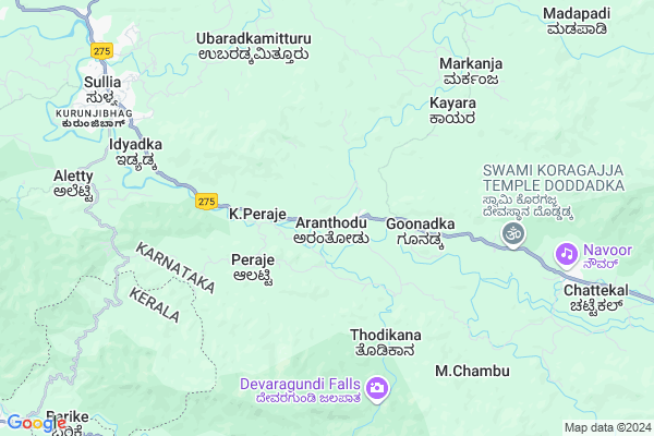
Aranthodu
Aranthodu Map
EDIT Map
Add Your House
 ..
..
Current Corona Virus Infected Patients Count in Dakshin Kannad District
| City Name | District Name | Total Covid cases |
|---|---|---|
| Dakshina Kannada District | Dakshina Kannada | 7 |
| Uppinangadi | Dakshina Kannada | 2 |
| Bantwala | Dakshina Kannada | 2 |
| Bantwal | Dakshina Kannada | 1 |
| Panemangalore | Dakshina Kannada | 1 |
Locality Name :
Aranthodu
( ಅರಂತೋಡು )
Taluk Name : Sulya
District : Dakshin Kannad
State : Karnataka
Division : Mysore
Language : Tulu and Kannada, Konkani, Beary Bashe.
Current Time 04:25 PM
Date: Wednesday , Feb 05,2025 (IST)
Time zone: IST (UTC+5:30)
Elevation / Altitude: 82 meters. Above Seal level
Telephone Code / Std Code: 08257
Assembly constituency : Sullia assembly constituency
Assembly MLA : Bhagirathi Murulya
Lok Sabha constituency : Dakshina Kannada parliamentary constituency
Parliament MP : NALIN KUMAR KATEEL
Serpanch Name :
Pin Code : 574314
Post Office Name : Aranthodu
Commodities Prices : Sulya Market / Mandi
Aranthodu Live Weather
Temperature: 35.4 °C
few clouds
Humidity: 24%
Wind : 1.99 mt/sec towards W
StationName : "Sullia"
observed on 2 Mins Back
Temperature: 35.4 °C
few clouds
Humidity: 24%
Wind : 1.99 mt/sec towards W
StationName : "Sullia"
observed on 2 Mins Back
Aranthodu Weather Forecast for Next 5 days
06-02-2025
20.2°C to 31.0°C
clear sky
20.2°C to 31.0°C
clear sky
07-02-2025
19.6°C to 38.0°C
clear sky, few clouds
19.6°C to 38.0°C
clear sky, few clouds
08-02-2025
19.4°C to 39.0°C
scattered clouds, overcast clouds, broken clouds, clear sky, few clouds
19.4°C to 39.0°C
scattered clouds, overcast clouds, broken clouds, clear sky, few clouds
09-02-2025
19.3°C to 38.8°C
clear sky, few clouds, scattered clouds, broken clouds
19.3°C to 38.8°C
clear sky, few clouds, scattered clouds, broken clouds
10-02-2025
20.2°C to 39.1°C
broken clouds, scattered clouds, few clouds, clear sky
20.2°C to 39.1°C
broken clouds, scattered clouds, few clouds, clear sky
National Highways Reachable To Aranthodu
Nationa High Way :NH66
Nationa High Way :NH275
Nationa High Way :NH66
Nationa High Way :NH275
Rivers Near Aranthodu
Uppala :ಉಪ್ಪಳ :ഉപ്പള
munchikana thodu
Uppala :ಉಪ್ಪಳ :ഉപ്പള
munchikana thodu
About Aranthodu
Correct below Info and add more info about AranthoduAranthodu is a Village in Sulya Taluk in Dakshin Kannad District of Karnataka State, India. It belongs to Mysore Division . It is located 92 KM towards East from District head quarters Mangalore. 14 KM from Sulya. 276 KM from State capital Bangalore
Aranthodu Pin code is 574314 and postal head office is Aranthodu .
Ivarnadu ( 8 KM ) , Ubaradka Mittur ( 9 KM ) , Aletty ( 9 KM ) , Mithadka ( 9 KM ) , Kukkundoor ( 9 KM ) are the nearby Villages to Aranthodu. Aranthodu is surrounded by Madikeri Taluk towards East , Puttur Taluk towards North , Kanhangad Taluk towards west , Nileshwar Taluk towards South .
Madikeri , Puttur , Kanhangad , Kasaragod are the near by Cities to Aranthodu.
Aranthodu 2011 Census Details
Aranthodu Local Language is Tulu. Aranthodu Village Total population is 3746 and number of houses are 852. Female Population is 50.4%. Village literacy rate is 82.0% and the Female Literacy rate is 39.9%.
Population
| Census Parameter | Census Data |
| Total Population | 3746 |
| Total No of Houses | 852 |
| Female Population % | 50.4 % ( 1887) |
| Total Literacy rate % | 82.0 % ( 3072) |
| Female Literacy rate | 39.9 % ( 1496) |
| Scheduled Tribes Population % | 5.2 % ( 196) |
| Scheduled Caste Population % | 7.3 % ( 275) |
| Working Population % | 48.8 % |
| Child(0 -6) Population by 2011 | 389 |
| Girl Child(0 -6) Population % by 2011 | 48.3 % ( 188) |
Aranthodu Census More Deatils.
Politics in Aranthodu
Bharatiya Janata Party , BJP , Bharatiya Janata Party (BJP) , INC are the major political parties in this area.Polling Stations /Booths near Aranthodu
1)Da. Ka. Zilla Panchayath Higher Primary School.. Goliyadka (north Wing)2)Govt Pre-university College Kadaba (west Wing)
3)Da. Ka. Zilla Panchayath Higher Primary School.. Idyadka(north Wing)
4)Grama Panchayath Meeting Hall Ramakunja
5)Da. Ka. Zilla Panchayath Higher Primary School.. Idyadka(sourth Wing)
HOW TO REACH Aranthodu
By Road
Sulya is the Nearest Town to Aranthodu. Sulya is 12 km from Aranthodu. Road connectivity is there from Sulya to Aranthodu.By Rail
There is no railway station near to Aranthodu in less than 10 km.Colleges near Aranthodu
Mangalore Marine College
Address :
Vijaya College Mulki
Address :
Govt Junior Collage
Address :
Goverment Pu College Koyyur
Address :
Govt. Primary School Kanchinadka
Address :
Schools in Aranthodu
Gups, Adthale
Address : aranthodu , sullia , dakshina kannada , Karnataka . PIN- 574314 , Post - Aranthodu
Gmups, Aranthodu
Address : aranthodu , sullia , dakshina kannada , Karnataka . PIN- 574314 , Post - Aranthodu
Govt Health Centers near Aranthodu
1) Kadaba , Primary Health Centre Kadaba , , CHC COMPOUND2) UPPINANGADI 24X7 , Primary Health Centre Uppinangady , , NEAR UPPINANGADY BUS STAND
3) UPPINANGADI 24X7 , , ,
Sub Villages in Aranthodu
Hospitals in Aranthodu,Sulya
Prasad Netralaya
C/o Sanjana Eye Clinic; 1st Floor; Janatha Complex; Gandhi Nagar;; Sullia; India
9.6 KM distance Detail
more ..
Petrol Bunks in Aranthodu,Sulya
Hindustan Petroleum- Payaswini Service Station
NH275; Gandhinagar; Sullia; Karnataka 574239; India
9.2 KM distance Detail
Rajesh service Indian oil petrol bunk
Srirampete; Sullia; Karnataka 574239; India
9.9 KM distance Detail
more ..
Colleges in Aranthodu,Sulya
Nehru Memorial Pre-University College Aranthodu
Mangalore - Mysore Highway; Aranthodu Post; Sullia; Karnataka 574314; India
0.5 KM distance Detail
more ..
Schools in Aranthodu,Sulya
Biliyaru Primary School
Biliyaru; & Post; Sullia Taluk; State; Aranthodu; Karnataka 574314; India
1.1 KM distance Detail
Governement Offices near Aranthodu,Sulya
Grama Phanchayat Office Arramthundu
Goonadka; Aranthodu; Dakshina Kannada; SH-88; Mangalore Mysore Highway; Sullia; Sullia; Karnataka 574234; India
1.1 KM distance Detail
Kemps Office. Court Road
Court Rd; Kurunjibhag; Sullia; Karnataka 574327; India
10.4 KM distance Detail
About Aranthodu &
History
How to reach Aranthodu
Tourist Places Near By Aranthodu
Schools in Aranthodu
Colleges in Aranthodu
Temperature & weather of Aranthodu
places in Aranthodu
Aranthodu photos
More Information
How to reach Aranthodu
Tourist Places Near By Aranthodu
Schools in Aranthodu
Colleges in Aranthodu
Temperature & weather of Aranthodu
places in Aranthodu
Aranthodu photos
More Information
Village Talk
Post News or Events about this Village
Near Cities
Madikeri 36 KM near
Puttur 43 KM near
Kanhangad 50 KM near
Kasaragod 57 KM near
Madikeri 36 KM near
Puttur 43 KM near
Kanhangad 50 KM near
Kasaragod 57 KM near
Near By Taluks
Sulya 13 KM near
Madikeri 34 KM near
Puttur 38 KM near
Kanhangad 42 KM near
Sulya 13 KM near
Madikeri 34 KM near
Puttur 38 KM near
Kanhangad 42 KM near
Near By Air Ports
Bajpe Airport 88 KM near
Mysore Airport 147 KM near
Calicut Airport 181 KM near
Peelamedu Airport 267 KM near
Bajpe Airport 88 KM near
Mysore Airport 147 KM near
Calicut Airport 181 KM near
Peelamedu Airport 267 KM near
Near By Tourist Places
Talacauvery 26 KM near
Kukke Subramanya 26 KM near
Madikeri 36 KM near
Kakkabe 38 KM near
Coorg 48 KM near
Talacauvery 26 KM near
Kukke Subramanya 26 KM near
Madikeri 36 KM near
Kakkabe 38 KM near
Coorg 48 KM near
Near By Districts
Kodagu 35 KM near
Kasaragod 57 KM near
Kannur 81 KM near
Dakshin Kannad 88 KM near
Kodagu 35 KM near
Kasaragod 57 KM near
Kannur 81 KM near
Dakshin Kannad 88 KM near
Near By RailWay Station
Subrahmanya Road Rail Way Station 28 KM near
Kabakaputtur Rail Way Station 43 KM near
Subrahmanya Road Rail Way Station 28 KM near
Kabakaputtur Rail Way Station 43 KM near