| Home | City Bus | Maps | Villages | Cities | Rail | Tourist Places | School | College | Pin Codes | Corona Cases Count |
| Distance Calculator Bus Services IFSC Codes Trace Mobile Number Weather Search Place Trace IP Available Cash ATM/Banks Locate Polling Booth Report an Error contact People |
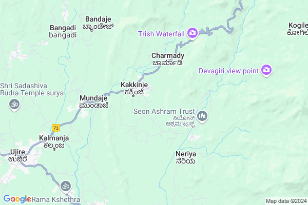
Kuntadi
Kuntadi Map
EDIT Map
Add Your House
 ..
..
Current Corona Virus Infected Patients Count in Dakshin Kannad District
| City Name | District Name | Total Covid cases |
|---|---|---|
| Dakshina Kannada District | Dakshina Kannada | 7 |
| Bantwala | Dakshina Kannada | 2 |
| Uppinangadi | Dakshina Kannada | 2 |
| Bantwal | Dakshina Kannada | 1 |
| Panemangalore | Dakshina Kannada | 1 |
Locality Name :
Kuntadi
( ಕುಂಟಾಡಿ )
Taluk Name : Beltangadi
District : Dakshin Kannad
State : Karnataka
Division : Mysore
Language : Tulu and Kannada, Konkani, Beary Bashe.
Current Time 08:05 AM
Date: Saturday , Apr 26,2025 (IST)
Time zone: IST (UTC+5:30)
Elevation / Altitude: 96 meters. Above Seal level
Telephone Code / Std Code: 08256
Assembly constituency : Belthangady assembly constituency
Assembly MLA : Harish Poonja
Lok Sabha constituency : Dakshina Kannada parliamentary constituency
Parliament MP : NALIN KUMAR KATEEL
Serpanch Name :
Pin Code : 574228
Post Office Name : Mundaje
Main Village Name : Thotathadi
Commodities Prices : Belthangdi Market / Mandi
Kuntadi Live Weather
Temperature: 24.3 °C
overcast clouds
Humidity: 97%
Wind : 0.41 mt/sec towards N
StationName : "Mudgere"
observed on 2 Hours Back
Temperature: 24.3 °C
overcast clouds
Humidity: 97%
Wind : 0.41 mt/sec towards N
StationName : "Mudgere"
observed on 2 Hours Back
Kuntadi Weather Forecast for Next 5 days
27-04-2025
25.3°C to 39.6°C
overcast clouds, broken clouds, light rain
25.3°C to 39.6°C
overcast clouds, broken clouds, light rain
28-04-2025
24.1°C to 36.2°C
overcast clouds, broken clouds, light rain, scattered clouds
24.1°C to 36.2°C
overcast clouds, broken clouds, light rain, scattered clouds
29-04-2025
23.9°C to 36.3°C
scattered clouds, clear sky, broken clouds, light rain
23.9°C to 36.3°C
scattered clouds, clear sky, broken clouds, light rain
30-04-2025
23.1°C to 36.2°C
broken clouds, few clouds, light rain, heavy intensity rain, overcast clouds
23.1°C to 36.2°C
broken clouds, few clouds, light rain, heavy intensity rain, overcast clouds
01-05-2025
23.0°C to 37.5°C
broken clouds, clear sky, few clouds, scattered clouds, light rain
23.0°C to 37.5°C
broken clouds, clear sky, few clouds, scattered clouds, light rain
National Highways Reachable To Kuntadi
Nationa High Way :NH66
Nationa High Way :NH75
Nationa High Way :NH66
Nationa High Way :NH75
Rivers Near Kuntadi
Neriya Hole :ನೆರಿಯಾ ಹೊಳೆ
Nandini :ನಂದಿನೀ
Neriya Hole :ನೆರಿಯಾ ಹೊಳೆ
Nandini :ನಂದಿನೀ
About Kuntadi
Correct below Info and add more info about KuntadiKuntadi is a small Village/hamlet in Beltangadi Taluk in Dakshin Kannad District of Karnataka State, India. It comes under Thotathadi Panchayath. It belongs to Mysore Division . It is located 72 KM towards East from District head quarters Mangalore. 20 KM from Beltangadi. 276 KM from State capital Bangalore
Kuntadi Pin code is 574228 and postal head office is Mundaje .
Kuntadi is surrounded by Mudigere Taluk towards East , Puttur Taluk towards South , Bantval Taluk towards west , Sakaleshpur Taluk towards East .
Puttur , Sakleshpur , Mudbidri , Karkala are the near by Cities to Kuntadi.
Demographics of Kuntadi
Tulu is the Local Language here. Total population of Kuntadi is 3222 .Males are 1527 and Females are 1,695 living in 634 Houses. Total area of Kuntadi is 1089 hectares.Politics in Kuntadi
Bharatiya Janata Party , BJP , Bharatiya Janata Party (BJP) , INC are the major political parties in this area.Polling Stations /Booths near Kuntadi
1)Dakshina Kannada Zilla Panchayath Higher Primary School Thannirupanta (north Wing)2)Dakshina Kannada Zilla Panchayath Model Higher Primary School Belthangady
3)Dakshina Kannada Zilla Panchayath Higher Primary School Thotathady (east Wing }
4)Dakshina Kannada Zilla Panchayath Higher Primary School Thotathady(south
5)Dakshina Kannada Zilla Panchayath Higher Primary School Andinje(north Wing )
HOW TO REACH Kuntadi
By Road
Beltangadi is the Nearest Town to Kuntadi. Beltangadi is 18 km from Kuntadi. Road connectivity is there from Beltangadi to Kuntadi.By Rail
There is no railway station near to Kuntadi in less than 10 km.Colleges near Kuntadi
Goverment Pu College Koyyur
Address :
Govt. Primary School Kanchinadka
Address :
Shri Dharmasthala Manjunatheshwara College (sdm College)
Address : Ujire, Belthangady Taluk, Dakshina Kannada, Karnat
Schools near Kuntadi
Gups, Govindoor
Address : kalia , belthangady , dakshina kannada , Karnataka . PIN- 574217 , Post - Guruvayanakere
Gups, Periyottu
Address : barya , belthangady , dakshina kannada , Karnataka . PIN- 574326 , Post - Kalleri
Gups, Kuttikala
Address : thekkar , belthangady , dakshina kannada , Karnataka . PIN- 574241 , Post - Uppinangady
Gups, Thurkalike
Address : karaya , belthangady , dakshina kannada , Karnataka . PIN- 574326 , Post - Kalleri
Govt Health Centers near Kuntadi
1) Sunkasale , Primary Health Centre Sunkasale , Kalasa Kottigehara Road ,2) SUNKASALE , Sub Centre Sunkasale , ,
3) Madhugundi , Sub Centre Madhugundi , ,
Hospitals in Kuntadi,Beltangadi
St. JOSEPH'S AYURVEDIC HOSPITAL KAKKINJE; BELTHANGADY TQ; D.K
Kakkinje; Karnataka 574228; India
1.6 KM distance Detail
more ..
Colleges in Kuntadi,Beltangadi
Sdm Polytecnic
Near Sidhavana;; Ujire-Dharmastala Rd; Dharmasthala; Karnataka 574240; India
11.1 KM distance Detail
Sri Dharmasthala Manjunatheshwara Polytechnic
Ujire Belthangadi; Karnataka 574240; India
11.1 KM distance Detail
SDM Institute of Technology
Dharmasthala Road; Near Sidhavana; Uijre; Karnataka 574240; India
11.3 KM distance Detail
more ..
Schools in Kuntadi,Beltangadi
Dakshina Kannada High Primary School;thotathadi 574228
ThotathaDi; Karnataka 574228; India
0.6 KM distance Detail
Govt High School Kakkinje ಸರಕಾರಿ ಪ್ರೌಢ ಶಾಲೆ ಕಕ್ಕಿಂಜೆ
Dakshina Kannada; Karnataka 574228; India
1.5 KM distance Detail
Local Parks in Kuntadi,Beltangadi
SDM Institute Of Technology Botanical Garden
Dakshina Kannada; Karnataka 574240; India
11.2 KM distance Detail
Dharmastala Park
Mangalore - Dharmastala Hwy; Dharmasthala; Karnataka 574216; India
11.4 KM distance Detail
About Kuntadi &
History
How to reach Kuntadi
Tourist Places Near By Kuntadi
Schools in Kuntadi
Colleges in Kuntadi
Temperature & weather of Kuntadi
places in Kuntadi
Kuntadi photos
More Information
How to reach Kuntadi
Tourist Places Near By Kuntadi
Schools in Kuntadi
Colleges in Kuntadi
Temperature & weather of Kuntadi
places in Kuntadi
Kuntadi photos
More Information
Village Talk
Post News or Events about this Village
Near Cities
Puttur 41 KM near
Sakleshpur 45 KM near
Mudbidri 53 KM near
Karkala 55 KM near
Puttur 41 KM near
Sakleshpur 45 KM near
Mudbidri 53 KM near
Karkala 55 KM near
Near By Taluks
Beltangadi 20 KM near
Mudigere 25 KM near
Puttur 42 KM near
Sakaleshpur 47 KM near
Beltangadi 20 KM near
Mudigere 25 KM near
Puttur 42 KM near
Sakaleshpur 47 KM near
Near By Air Ports
Bajpe Airport 64 KM near
Mysore Airport 174 KM near
Calicut Airport 244 KM near
Bengaluru International Airport 277 KM near
Bajpe Airport 64 KM near
Mysore Airport 174 KM near
Calicut Airport 244 KM near
Bengaluru International Airport 277 KM near
Near By Tourist Places
Dharamsthala 10 KM near
Horanadu 30 KM near
Sakleshpur 45 KM near
Kukke Subramanya 50 KM near
Sringeri 52 KM near
Dharamsthala 10 KM near
Horanadu 30 KM near
Sakleshpur 45 KM near
Kukke Subramanya 50 KM near
Sringeri 52 KM near
Near By Districts
Chikmagalur 56 KM near
Dakshin Kannad 70 KM near
Kasaragod 82 KM near
Hassan 83 KM near
Chikmagalur 56 KM near
Dakshin Kannad 70 KM near
Kasaragod 82 KM near
Hassan 83 KM near
Near By RailWay Station
Subrahmanya Road Rail Way Station 40 KM near
Kabakaputtur Rail Way Station 41 KM near
Subrahmanya Road Rail Way Station 40 KM near
Kabakaputtur Rail Way Station 41 KM near