| Home | City Bus | Maps | Villages | Cities | Rail | Tourist Places | School | College | Pin Codes | Corona Cases Count |
| Distance Calculator Bus Services IFSC Codes Trace Mobile Number Weather Search Place Trace IP Available Cash ATM/Banks Locate Polling Booth Report an Error contact People |
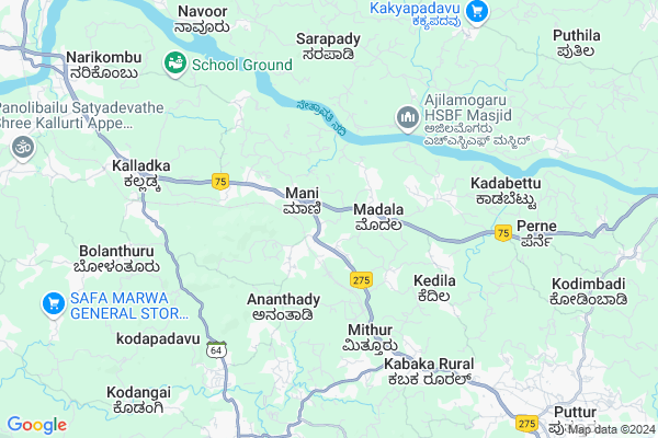
Parpakaje
Parpakaje Map
EDIT Map
Add Your House
 ..
..
Current Corona Virus Infected Patients Count in Dakshin Kannad District
| City Name | District Name | Total Covid cases |
|---|---|---|
| Dakshina Kannada District | Dakshina Kannada | 7 |
| Bantwala | Dakshina Kannada | 2 |
| Uppinangadi | Dakshina Kannada | 2 |
| Bantwal | Dakshina Kannada | 1 |
| Panemangalore | Dakshina Kannada | 1 |
Locality Name :
Parpakaje
( ಪರ್ಪಕಜೆ )
Taluk Name : Bantval
District : Dakshin Kannad
State : Karnataka
Division : Mysore
Language : Tulu and Kannada, Konkani, Beary Bashe.
Current Time 02:12 PM
Date: Friday , Apr 25,2025 (IST)
Time zone: IST (UTC+5:30)
Elevation / Altitude: 23 meters. Above Seal level
Telephone Code / Std Code: 08255
Assembly constituency : Bantval assembly constituency
Assembly MLA : Rajesh Naik U
Lok Sabha constituency : Dakshina Kannada parliamentary constituency
Parliament MP : NALIN KUMAR KATEEL
Serpanch Name :
Pin Code : 574253
Post Office Name : Mani
Main Village Name : Mani
Commodities Prices : Puttur Market / Mandi
Parpakaje Live Weather
Temperature: 30.6 °C
overcast clouds
Humidity: 45%
Wind : 2.2 mt/sec towards SW
StationName : "Puttūr"
observed on 1 Hours Back
Temperature: 30.6 °C
overcast clouds
Humidity: 45%
Wind : 2.2 mt/sec towards SW
StationName : "Puttūr"
observed on 1 Hours Back
Parpakaje Weather Forecast for Next 5 days
26-04-2025
25.4°C to 36.5°C
broken clouds, light rain, overcast clouds
25.4°C to 36.5°C
broken clouds, light rain, overcast clouds
27-04-2025
24.5°C to 37.9°C
broken clouds, overcast clouds, light rain
24.5°C to 37.9°C
broken clouds, overcast clouds, light rain
28-04-2025
24.5°C to 36.5°C
overcast clouds, broken clouds, light rain
24.5°C to 36.5°C
overcast clouds, broken clouds, light rain
29-04-2025
24.6°C to 38.2°C
overcast clouds, broken clouds, scattered clouds, light rain, few clouds
24.6°C to 38.2°C
overcast clouds, broken clouds, scattered clouds, light rain, few clouds
30-04-2025
24.1°C to 38.4°C
scattered clouds, few clouds, moderate rain, light rain, overcast clouds
24.1°C to 38.4°C
scattered clouds, few clouds, moderate rain, light rain, overcast clouds
National Highways Reachable To Parpakaje
Nationa High Way :NH66
Nationa High Way :NH169
Nationa High Way :NH66
Nationa High Way :NH169
Rivers Near Parpakaje
Gurupura :Phalguni :ಗುರುಪುರ
Talapadi :ತಲಪಾಡಿ :തലപ്പാടി
Gurupura :Phalguni :ಗುರುಪುರ
Talapadi :ತಲಪಾಡಿ :തലപ്പാടി
About Parpakaje
Correct below Info and add more info about ParpakajeParpakaje is a small Village/hamlet in Bantval Taluk in Dakshin Kannad District of Karnataka State, India. It comes under Mani Panchayath. It belongs to Mysore Division . It is located 35 KM towards East from District head quarters Mangalore. 9 KM from Bantval. 313 KM from State capital Bangalore
Parpakaje Pin code is 574253 and postal head office is Mani .
Parpakaje is surrounded by Puttur Taluk towards East , Beltangadi Taluk towards North , Manjeshwar Taluk towards South , Mangalore Taluk towards west .
Puttur , Mangalore , Mudbidri , Kasaragod are the near by Cities to Parpakaje.
This Place is in the border of the Dakshin Kannad District and Kasaragod District. Kasaragod District Manjeshwar is South towards this place . It is near to the Kerala State Border.
Demographics of Parpakaje
Tulu is the Local Language here. Total population of Parpakaje is 3515 .Males are 1779 and Females are 1,736 living in 611 Houses. Total area of Parpakaje is 524 hectares.Politics in Parpakaje
Bharatiya Janata Party , BJP , Bharatiya Janata Party (BJP) , INC are the major political parties in this area.Polling Stations /Booths near Parpakaje
1)Dakshina Kannada Zilla Panchayath Model Higher Primary School Kadeshwalya2)Dakshina Kannada Zilla Panchayath Higher Primary School Peraje (east Wing)
3)Dakshina Kannada Zilla Panchayath Higher Primary School
4)Dakshina Kannada Zilla Panchayath Higher Primary School Karaje Sajipamooda
5)Dakshina Kannada Zilla Panchayath Higher Primary School
HOW TO REACH Parpakaje
By Road
Bantval is the Nearest Town to Parpakaje. Bantval is 12 km from Parpakaje. Road connectivity is there from Bantval to Parpakaje.By Rail
There is no railway station near to Parpakaje in less than 10 km. How ever there are railway Stations from Near By town Bantval. are the railway Stations near to Bantval. You can reach from Bantval to Parpakaje by road after .Colleges near Parpakaje
Manipal College Of Dental Sciences- Mangalore
Address : Manipal College Of Dental Scienceslight House Hill
Schools in Parpakaje
Balavikasa English Medium Ups, Mani
Address : mani , bantwal , dakshina kannada , Karnataka . PIN- 574253 , Post - Mani
Gups, Mani
Address : mani , bantwal , dakshina kannada , Karnataka . PIN- 574253 , Post - Mani
St. Josephs Aid.ups, Barimaru
Address : mani , bantwal , dakshina kannada , Karnataka . PIN- 574253 , Post - Mani
Govt Health Centers near Parpakaje
1) Manchi , MELKAR WOMENS COLLEGE ROAD , BANTWAL TALUK DAKSHIN KANNADA ,2) UPPINANGADI 24X7 , , ,
3) Mogaru , building no 5-95/3 , muttur , nonal prim school
Petrol Bunks in Parpakaje,Bantval
HP Petrol Pump - B M R Enterprises
HPC Dealer B M Road NH 48 Mani; Mangalore; Karnataka 574253; India
2.9 KM distance Detail
Hindustan Petroleum
Soorikumeru; Dakshina Kannada; NH-48; Bangalore Mangalore Highway; Puttur; Puttur; Karnataka 574231; India
2.9 KM distance Detail
Indian Oil Petrol Pump
Dasakodi; Dakshina Kannada; NH-48; Bangalore Mangalore Highway; Puttur; Puttur; Karnataka 574231; India
4.2 KM distance Detail
BPCL Petrol Bunk
Bengaluru - Mangaluru Highway; Kadeshwalya; Karnataka 574325; India
5.8 KM distance Detail
more ..
Colleges in Parpakaje,Bantval
Anugraha Institutions
Pattekodi; Golthamajal; Kalladka; Karnataka 574222; India
7.2 KM distance Detail
more ..
Schools in Parpakaje,Bantval
Balavikas Vidyalaya
Bengaluru - Mangaluru Highway; Mani; Karnataka 574253; India
1.1 KM distance Detail
Neralekatte School
Mangalore-Puttur-Madikeri-Mysore Hwy; Karnataka 574220; India
1.4 KM distance Detail
Local Parks in Parpakaje,Bantval
Mahalingeshvara Temple Park; ಮಹಾಲಿಂಗೇಶ್ವರ ದೇವಸ್ಥಾನ ಉದ್ಯಾನ
Puttur; Karnataka 574201; India
12.6 KM distance Detail
Police Stations near Parpakaje,Bantval
Sub Divisional Police Office
Mangalore-Puttur-Madikeri-Mysore Hwy; Nehru Nagar; Puttur; Karnataka 574203; India
10.6 KM distance Detail
Governement Offices near Parpakaje,Bantval
Anantady Village Panchayath Office
Mangalore - Mysore Highway; Mani; Karnataka 574220; India
1.1 KM distance Detail
About Parpakaje &
History
How to reach Parpakaje
Tourist Places Near By Parpakaje
Schools in Parpakaje
Colleges in Parpakaje
Temperature & weather of Parpakaje
places in Parpakaje
Parpakaje photos
More Information
How to reach Parpakaje
Tourist Places Near By Parpakaje
Schools in Parpakaje
Colleges in Parpakaje
Temperature & weather of Parpakaje
places in Parpakaje
Parpakaje photos
More Information
Village Talk
Post News or Events about this Village
Near Cities
Puttur 12 KM near
Mangalore 33 KM near
Mudbidri 36 KM near
Kasaragod 41 KM near
Puttur 12 KM near
Mangalore 33 KM near
Mudbidri 36 KM near
Kasaragod 41 KM near
Near By Taluks
Bantval 9 KM near
Puttur 16 KM near
Beltangadi 25 KM near
Manjeshwar 29 KM near
Bantval 9 KM near
Puttur 16 KM near
Beltangadi 25 KM near
Manjeshwar 29 KM near
Near By Air Ports
Bajpe Airport 33 KM near
Mysore Airport 196 KM near
Calicut Airport 232 KM near
Hubli Airport 314 KM near
Bajpe Airport 33 KM near
Mysore Airport 196 KM near
Calicut Airport 232 KM near
Hubli Airport 314 KM near
Near By Tourist Places
Dharamsthala 33 KM near
Mangalore 35 KM near
Kasargod 44 KM near
Karkala 50 KM near
Bekal 52 KM near
Dharamsthala 33 KM near
Mangalore 35 KM near
Kasargod 44 KM near
Karkala 50 KM near
Bekal 52 KM near
Near By Districts
Dakshin Kannad 35 KM near
Kasaragod 41 KM near
Udupi 78 KM near
Kodagu 89 KM near
Dakshin Kannad 35 KM near
Kasaragod 41 KM near
Udupi 78 KM near
Kodagu 89 KM near
Near By RailWay Station
Kabakaputtur Rail Way Station 11 KM near
Bantawala Rail Way Station 13 KM near
Kabakaputtur Rail Way Station 11 KM near
Bantawala Rail Way Station 13 KM near