| Home | City Bus | Maps | Villages | Cities | Rail | Tourist Places | School | College | Pin Codes | Corona Cases Count |
| Distance Calculator Bus Services IFSC Codes Trace Mobile Number Weather Search Place Trace IP Available Cash ATM/Banks Locate Polling Booth Report an Error contact People |
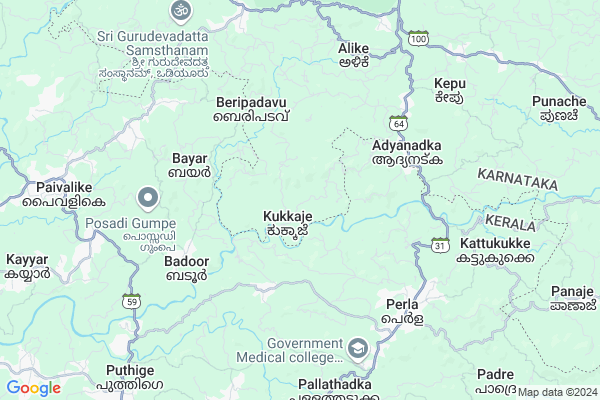
Pakkalakunja
Pakkalakunja Map
EDIT Map
Add Your House
 ..
..
Current Corona Virus Infected Patients Count in Dakshin Kannad District
| City Name | District Name | Total Covid cases |
|---|---|---|
| Dakshina Kannada District | Dakshina Kannada | 7 |
| Bantwala | Dakshina Kannada | 2 |
| Uppinangadi | Dakshina Kannada | 2 |
| Bantwal | Dakshina Kannada | 1 |
| Panemangalore | Dakshina Kannada | 1 |
Locality Name :
Pakkalakunja
( ಪಕ್ಕಳಕುಂಜ )
Taluk Name : Bantval
District : Dakshin Kannad
State : Karnataka
Division : Mysore
Language : Tulu and Kannada, Konkani, Beary Bashe.
Current Time 02:28 PM
Date: Friday , Apr 25,2025 (IST)
Time zone: IST (UTC+5:30)
Elevation / Altitude: 23 meters. Above Seal level
Telephone Code / Std Code: 08255
Assembly constituency : Puttur assembly constituency
Assembly MLA : Ashok Kumar Rai
Lok Sabha constituency : Dakshina Kannada parliamentary constituency
Parliament MP : NALIN KUMAR KATEEL
Serpanch Name :
Pin Code : 574260
Post Office Name : Adyanadka
Main Village Name : Manila
Commodities Prices : Puttur Market / Mandi
Pakkalakunja Live Weather
Temperature: 35.1 °C
overcast clouds
Humidity: 47%
Wind : 5.08 mt/sec towards W
StationName : "Puttūr"
observed on 5 Mins Back
Temperature: 35.1 °C
overcast clouds
Humidity: 47%
Wind : 5.08 mt/sec towards W
StationName : "Puttūr"
observed on 5 Mins Back
Pakkalakunja Weather Forecast for Next 5 days
26-04-2025
25.9°C to 35.3°C
overcast clouds, light rain
25.9°C to 35.3°C
overcast clouds, light rain
27-04-2025
24.8°C to 36.9°C
broken clouds, overcast clouds, light rain
24.8°C to 36.9°C
broken clouds, overcast clouds, light rain
28-04-2025
25.0°C to 35.4°C
overcast clouds, broken clouds, light rain
25.0°C to 35.4°C
overcast clouds, broken clouds, light rain
29-04-2025
25.1°C to 37.6°C
overcast clouds, broken clouds, scattered clouds, few clouds
25.1°C to 37.6°C
overcast clouds, broken clouds, scattered clouds, few clouds
30-04-2025
25.2°C to 37.6°C
light rain, broken clouds, scattered clouds, few clouds, overcast clouds
25.2°C to 37.6°C
light rain, broken clouds, scattered clouds, few clouds, overcast clouds
National Highways Reachable To Pakkalakunja
Nationa High Way :NH66
Nationa High Way :NH169
Nationa High Way :NH66
Nationa High Way :NH169
Rivers Near Pakkalakunja
Gurupura :Phalguni :ಗುರುಪುರ
Talapadi :ತಲಪಾಡಿ :തലപ്പാടി
Gurupura :Phalguni :ಗುರುಪುರ
Talapadi :ತಲಪಾಡಿ :തലപ്പാടി
About Pakkalakunja
Correct below Info and add more info about PakkalakunjaPakkalakunja is a small Village/hamlet in Bantval Taluk in Dakshin Kannad District of Karnataka State, India. It comes under Manila Panchayath. It belongs to Mysore Division . It is located 40 KM towards South from District head quarters Mangalore. 23 KM from Bantval. 322 KM from State capital Bangalore
Pakkalakunja Pin code is 574260 and postal head office is Adyanadka .
Pakkalakunja is surrounded by Kasargod Taluk towards South , Puttur Taluk towards East , Bantval Taluk towards North , Kanhangad Taluk towards South .
Puttur , Kasaragod , Mangalore , Kanhangad are the near by Cities to Pakkalakunja.
This Place is in the border of the Dakshin Kannad District and Kasaragod District. Kasaragod District Manjeshwar is west towards this place . It is near to the Kerala State Border.
Demographics of Pakkalakunja
Tulu is the Local Language here. Total population of Pakkalakunja is 3191 .Males are 1605 and Females are 1,586 living in 561 Houses. Total area of Pakkalakunja is 1121 hectares.Politics in Pakkalakunja
Bharatiya Janata Party , BJP , Bharatiya Janata Party (BJP) , INC are the major political parties in this area.Polling Stations /Booths near Pakkalakunja
1)Dakshina Kannada. Zilla Panchayath Higher Primary School 34 Nekkilady(west Wing)2)Aided Higher Primary. School Kollathadka Peruvai (east Wing)
3)Shree Sathya Sai Lokaseva Pu Collage Alike (west Wing)
4)Aided Higher Primary School Beliyurukatte Balnadu (west Wing)
5)Aided Higher Primary School Kedila
HOW TO REACH Pakkalakunja
By Road
Puttur is the Nearest Town to Pakkalakunja. Puttur is 22 km from Pakkalakunja. Road connectivity is there from Puttur to Pakkalakunja.By Rail
There is no railway station near to Pakkalakunja in less than 10 km. How ever there are railway Stations from Near By town Puttur. are the railway Stations near to Puttur. You can reach from Puttur to Pakkalakunja by road after .Colleges near Pakkalakunja
Manipal College Of Dental Sciences- Mangalore
Address : Manipal College Of Dental Scienceslight House Hill
Schools in Pakkalakunja
Gups, Kamajalu
Address : manila , bantwal , dakshina kannada , Karnataka . PIN- 574243 , Post - Vittal
Sri Venugopala Ups,pakalakunja
Address : manila , bantwal , dakshina kannada , Karnataka . PIN- 574243 , Post - Vittal
Aid. Ups, Manila
Address : manila , bantwal , dakshina kannada , Karnataka . PIN- 574243 , Post - Vittal
Govt Health Centers near Pakkalakunja
1) Manchi , MELKAR WOMENS COLLEGE ROAD , BANTWAL TALUK DAKSHIN KANNADA ,2) Nitte , , ,
3) UPPINANGADI 24X7 , , ,
Hospitals in Pakkalakunja,Bantval
Hospital Peruvai
Prathamika Aarogya Kendra Peruvai Post; Bantwal Taluk; Karnataka 574260; India
3.4 KM distance Detail
more ..
Petrol Bunks in Pakkalakunja,Bantval
Paivalike Fuels; BPCL Petrol Pump
Kanyana - Bayar - Uppala Rd; Paivalike; Kerala 671322; India
11.3 KM distance Detail
HP PETROL PUMP - BADIADKA PETROLEUM
HPC Dealer P.o.perdala Badiadka; Kozhicode (calicut); Kerala 671551; India
11.7 KM distance Detail
more ..
Colleges in Pakkalakunja,Bantval
Sri Sathya Sai Pre University College
Manjeshwar- Subrahmanya Road; Sathya Sai Vihar; Alike; Bantwal; Karnataka 574235; India
6.9 KM distance Detail
Kanyana Government PU College
Kanyana; Vitla; Kanyana - Peruvayi Rd; Kanyana; Karnataka 574279; India
8.5 KM distance Detail
more ..
Schools in Pakkalakunja,Bantval
shree Venugopala Primary School Pakalakunja
Manila Dambe Rd; Kepu; Karnataka 574260; India
1.1 KM distance Detail
Electronic Shops in Pakkalakunja,Bantval
DS Internet world
Kanyana - Bayar - Uppala Rd; Kanyana; Karnataka 574279; India
8.7 KM distance Detail
Shri Siddhi Vinayaka Electrical and Electronics
KJ tower near KSRTC bus stand; Vittal; Karnataka 574243; India
11.3 KM distance Detail
Local Parks in Pakkalakunja,Bantval
ALAR TENGINATHOTA
ALAR SHENI VILLAGE; KUKKILA; Seethangoli – Puthige – Perla Rd; Enmakaje; Kerala 671552; India
4.5 KM distance Detail
Police Stations near Pakkalakunja,Bantval
Badiadka Police Station
Kumbla-Badiyadka Road; Badiyadka; Kerala 671551; India
11.9 KM distance Detail
Sub Divisional Police Office
Mangalore-Puttur-Madikeri-Mysore Hwy; Nehru Nagar; Puttur; Karnataka 574203; India
19.0 KM distance Detail
Governement Offices near Pakkalakunja,Bantval
Badoor Village Office
Seethangoli – Puthige – Perla Rd; Badoor; Kerala 671321; India
8.0 KM distance Detail
About Pakkalakunja &
History
How to reach Pakkalakunja
Tourist Places Near By Pakkalakunja
Schools in Pakkalakunja
Colleges in Pakkalakunja
Temperature & weather of Pakkalakunja
places in Pakkalakunja
Pakkalakunja photos
More Information
How to reach Pakkalakunja
Tourist Places Near By Pakkalakunja
Schools in Pakkalakunja
Colleges in Pakkalakunja
Temperature & weather of Pakkalakunja
places in Pakkalakunja
Pakkalakunja photos
More Information
Village Talk
Post News or Events about this Village
Near Cities
Puttur 19 KM near
Kasaragod 21 KM near
Mangalore 36 KM near
Kanhangad 46 KM near
Puttur 19 KM near
Kasaragod 21 KM near
Mangalore 36 KM near
Kanhangad 46 KM near
Near By Taluks
Manjeshwar 13 KM near
Kasargod 19 KM near
Puttur 21 KM near
Bantval 22 KM near
Manjeshwar 13 KM near
Kasargod 19 KM near
Puttur 21 KM near
Bantval 22 KM near
Near By Air Ports
Bajpe Airport 41 KM near
Mysore Airport 197 KM near
Calicut Airport 219 KM near
Peelamedu Airport 315 KM near
Bajpe Airport 41 KM near
Mysore Airport 197 KM near
Calicut Airport 219 KM near
Peelamedu Airport 315 KM near
Near By Tourist Places
Kasargod 23 KM near
Bekal 32 KM near
Mangalore 36 KM near
Dharamsthala 50 KM near
Kukke Subramanya 65 KM near
Kasargod 23 KM near
Bekal 32 KM near
Mangalore 36 KM near
Dharamsthala 50 KM near
Kukke Subramanya 65 KM near
Near By Districts
Kasaragod 21 KM near
Dakshin Kannad 38 KM near
Kodagu 87 KM near
Udupi 90 KM near
Kasaragod 21 KM near
Dakshin Kannad 38 KM near
Kodagu 87 KM near
Udupi 90 KM near
Near By RailWay Station
Kabakaputtur Rail Way Station 19 KM near
Bantawala Rail Way Station 25 KM near
Kabakaputtur Rail Way Station 19 KM near
Bantawala Rail Way Station 25 KM near