| Home | City Bus | Maps | Villages | Cities | Rail | Tourist Places | School | College | Pin Codes | Corona Cases Count |
| Distance Calculator Bus Services IFSC Codes Trace Mobile Number Weather Search Place Trace IP Available Cash ATM/Banks Locate Polling Booth Report an Error contact People |
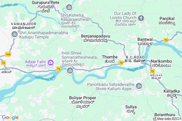
Paika
Paika Map
EDIT Map
Add Your House
 ..
..
Current Corona Virus Infected Patients Count in Dakshin Kannad District
| City Name | District Name | Total Covid cases |
|---|---|---|
| Dakshina Kannada District | Dakshina Kannada | 7 |
| Bantwala | Dakshina Kannada | 2 |
| Uppinangadi | Dakshina Kannada | 2 |
| Bantwal | Dakshina Kannada | 1 |
| Panemangalore | Dakshina Kannada | 1 |
Locality Name :
Paika
( ಪೈಕಿ )
Taluk Name : Bantval
District : Dakshin Kannad
State : Karnataka
Division : Mysore
Language : Tulu and Kannada, Konkani, Beary Bashe.
Current Time 02:41 PM
Date: Friday , Apr 25,2025 (IST)
Time zone: IST (UTC+5:30)
Elevation / Altitude: 23 meters. Above Seal level
Telephone Code / Std Code: 08255
Assembly constituency : Mangalore assembly constituency
Assembly MLA : U.T. Khader Fareed
Lok Sabha constituency : Dakshina Kannada parliamentary constituency
Parliament MP : NALIN KUMAR KATEEL
Serpanch Name :
Pin Code : 574143
Post Office Name : Farangipet
Main Village Name : Kodman
Commodities Prices : Bantwala Market / Mandi
Paika Live Weather
Temperature: 31.3 °C
scattered clouds
Humidity: 66%
Wind : 2.06 mt/sec towards W
StationName : "BantvÄ\u0081l"
observed on 2 Hours Back
Temperature: 31.3 °C
scattered clouds
Humidity: 66%
Wind : 2.06 mt/sec towards W
StationName : "BantvÄ\u0081l"
observed on 2 Hours Back
Paika Weather Forecast for Next 5 days
26-04-2025
26.3°C to 33.1°C
broken clouds, light rain, overcast clouds
26.3°C to 33.1°C
broken clouds, light rain, overcast clouds
27-04-2025
25.4°C to 35.8°C
overcast clouds
25.4°C to 35.8°C
overcast clouds
28-04-2025
25.4°C to 34.9°C
overcast clouds, few clouds, light rain
25.4°C to 34.9°C
overcast clouds, few clouds, light rain
29-04-2025
25.4°C to 36.9°C
overcast clouds, broken clouds, scattered clouds, few clouds
25.4°C to 36.9°C
overcast clouds, broken clouds, scattered clouds, few clouds
30-04-2025
25.3°C to 36.3°C
light rain, broken clouds, scattered clouds
25.3°C to 36.3°C
light rain, broken clouds, scattered clouds
National Highways Reachable To Paika
Nationa High Way :NH66
Nationa High Way :NH169
Nationa High Way :NH66
Nationa High Way :NH169
Rivers Near Paika
Gurupura :Phalguni :ಗುರುಪುರ
Talapadi :ತಲಪಾಡಿ :തലപ്പാടി
Gurupura :Phalguni :ಗುರುಪುರ
Talapadi :ತಲಪಾಡಿ :തലപ്പാടി
About Paika
Correct below Info and add more info about PaikaPaika is a small Village/hamlet in Bantval Taluk in Dakshin Kannad District of Karnataka State, India. It comes under Kodman Panchayath. It belongs to Mysore Division . It is located 16 KM towards East from District head quarters Mangalore. 10 KM from Bantval. 332 KM from State capital Bangalore
Paika Pin code is 574143 and postal head office is Farangipet .
Paika is surrounded by Mangalore Taluk towards west , Manjeshwar Taluk towards South , Puttur Taluk towards East , Beltangadi Taluk towards East .
Mangalore , Mudbidri , Puttur , Karkala are the near by Cities to Paika.
This Place is in the border of the Dakshin Kannad District and Kasaragod District. Kasaragod District Manjeshwar is South towards this place . It is near to the Kerala State Border.
Demographics of Paika
Tulu is the Local Language here. Total population of Paika is 1689 .Males are 811 and Females are 878 living in 314 Houses. Total area of Paika is 342 hectares.Politics in Paika
Bharatiya Janata Party , BJP , Indian National Congress (INC) , INC are the major political parties in this area.Polling Stations /Booths near Paika
1)Dakshina Kannada Zilla .panchayath. Higher Primary School Kallara Kodi Naringana2)Dakshina Kannada Zilla .panchayath. Higher Primary School Kodman (north Wing)
3)Dakshina Kannada Zilla .panchayath. Higher Primary School Panela Barke Pajiru
4)Dakshina Kannada Zilla Panchayath Higher Primary School Pavoor Innoli (east Wing Of Main Bldg)
5)Dakshina Kannada Zilla .panchayath. Higher Primary School Naringana(east Wing)
HOW TO REACH Paika
By Road
Bantval is the Nearest Town to Paika. Bantval is 13 km from Paika. Road connectivity is there from Bantval to Paika.By Rail
Bantawala Rail Way Station is the very nearby railway stations to Paika. Also you can consider railway Stations from Near By town Bantval. Bantawala Rail Way Station are the railway Stations near to Bantval. You can reach from Bantval to Paika by road after .Colleges near Paika
Manipal College Of Dental Sciences- Mangalore
Address : Manipal College Of Dental Scienceslight House Hill
Schools in Paika
Gups, Kodmannu
Address : kodman , bantwal , dakshina kannada , Karnataka . PIN- 574143 , Post - Farangipet
Govt Health Centers near Paika
1) Mogaru , building no 5-95/3 , muttur , nonal prim school2) THENKAYEDAPDAV , sub centre tenkayaedapadavu , tenkayedapadavu , near kondodi anganwadi
3) GANJIMATTA , building no 151 , ganjimata , ganjimata panchayat
Hospitals in Paika,Bantval
Father Muller Hospital
Thumbay; Bantwal Taluk; D.K; Mangalore; Karnataka 574143; India
1.4 KM distance Detail
Suraksha Clinic
Near Bus Stand; Main Road; Farangipete; Mangalore; Karnataka 574143; India
2.9 KM distance Detail
more ..
Petrol Bunks in Paika,Bantval
SRI KUMARALINGESHWARA AGENCIES
SHANIVARSANTHE; KODAGU; Karnataka 571235; India
1.6 KM distance Detail
KM Chowta Petrol Pump
Near Chawla Complex; Pudu Post; Farangipete; Mangalore; Karnataka 574143; India
2.7 KM distance Detail
more ..
Colleges in Paika,Bantval
Thumbe Pre-University College
Thumbe - Bantwal; Bangalore - Mangalore Hwy; Thumbe; Karnataka 574 170;; India
1.6 KM distance Detail
Electronic's & Communication engineering Department
Canara engineering college; Benjana Padavu; Karnataka; India
2.4 KM distance Detail
Canara Engineering College
Benjana Padavu; Mangalore; Karnataka 574219; India
2.5 KM distance Detail
more ..
Schools in Paika,Bantval
Dakshina Kannada Zilla Panchayath Higher Primary School
Kallige; Netherekera; Bantwal; Mangalore; Karnataka 574143; India
0.8 KM distance Detail
Electronic Shops in Paika,Bantval
Classic Communication
A.H Complex; D.K; Main Road; Thumbe; Bantwal; Mangalore; Karnataka 574170; India
1.7 KM distance Detail
Police Stations near Paika,Bantval
Farangipet Police Out Post
Opp. HSRTC Bus Stand;Farangipete Junction; Farangipete; Mangaluru; Karnataka 574143; India
2.9 KM distance Detail
carmine vas; omzoor
2-128 carmine vas mayyadi house mayyadi post po-574187; Mangalore - Bangalore Hwy; Karnataka; India
4.3 KM distance Detail
Bantwala Sub Division Police Office
BC Rd; B.C Road; Bantwal; Karnataka 574219; India
6.0 KM distance Detail
Governement Offices near Paika,Bantval
Shree Sharadha Sabha Bhavana Ramalkatte
Mangalore - Dharmastala Hwy; Thumbe; Karnataka 574143; India
1.9 KM distance Detail
Sevanjali Sabhagruha
Opp. Mobile Palace; Main Road; Farangipete; Karnataka 574143; India
3.3 KM distance Detail
About Paika &
History
How to reach Paika
Tourist Places Near By Paika
Schools in Paika
Colleges in Paika
Temperature & weather of Paika
places in Paika
Paika photos
More Information
How to reach Paika
Tourist Places Near By Paika
Schools in Paika
Colleges in Paika
Temperature & weather of Paika
places in Paika
Paika photos
More Information
Village Talk
Post News or Events about this Village
Near Cities
Mangalore 14 KM near
Mudbidri 24 KM near
Puttur 30 KM near
Karkala 39 KM near
Mangalore 14 KM near
Mudbidri 24 KM near
Puttur 30 KM near
Karkala 39 KM near
Near By Taluks
Bantval 9 KM near
Mangalore 15 KM near
Manjeshwar 27 KM near
Puttur 35 KM near
Bantval 9 KM near
Mangalore 15 KM near
Manjeshwar 27 KM near
Puttur 35 KM near
Near By Air Ports
Bajpe Airport 15 KM near
Mysore Airport 215 KM near
Calicut Airport 246 KM near
Hubli Airport 308 KM near
Bajpe Airport 15 KM near
Mysore Airport 215 KM near
Calicut Airport 246 KM near
Hubli Airport 308 KM near
Near By Tourist Places
Mangalore 16 KM near
Karkala 41 KM near
Kasargod 47 KM near
Dharamsthala 49 KM near
Bekal 57 KM near
Mangalore 16 KM near
Karkala 41 KM near
Kasargod 47 KM near
Dharamsthala 49 KM near
Bekal 57 KM near
Near By Districts
Dakshin Kannad 15 KM near
Kasaragod 44 KM near
Udupi 63 KM near
Kodagu 108 KM near
Dakshin Kannad 15 KM near
Kasaragod 44 KM near
Udupi 63 KM near
Kodagu 108 KM near
Near By RailWay Station
Bantawala Rail Way Station 6.8 KM near
Mangaluru Junction Rail Way Station 12 KM near
Bantawala Rail Way Station 6.8 KM near
Mangaluru Junction Rail Way Station 12 KM near