| Home | City Bus | Maps | Villages | Cities | Rail | Tourist Places | School | College | Pin Codes | Corona Cases Count |
| Distance Calculator Bus Services IFSC Codes Trace Mobile Number Weather Search Place Trace IP Available Cash ATM/Banks Locate Polling Booth Report an Error contact People |
Koppala Hc
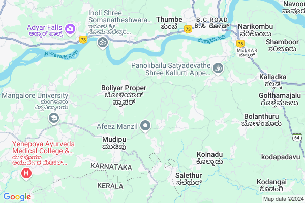
Koppala Hc Map
EDIT Map
Add Your House
 ..
..
Current Corona Virus Infected Patients Count in Dakshin Kannad District
| City Name | District Name | Total Covid cases |
|---|---|---|
| Dakshina Kannada District | Dakshina Kannada | 7 |
| Bantwala | Dakshina Kannada | 2 |
| Uppinangadi | Dakshina Kannada | 2 |
| Bantwal | Dakshina Kannada | 1 |
| Panemangalore | Dakshina Kannada | 1 |
Locality Name :
Koppala Hc
( ಕೊಪ್ಪಳ ಹ್ಚ್ )
Taluk Name : Bantval
District : Dakshin Kannad
State : Karnataka
Division : Mysore
Language : Tulu and Kannada, Konkani, Beary Bashe.
Current Time 02:12 PM
Date: Friday , Apr 25,2025 (IST)
Time zone: IST (UTC+5:30)
Elevation / Altitude: 23 meters. Above Seal level
Telephone Code / Std Code: 08255
Assembly constituency : Mangalore assembly constituency
Assembly MLA : U.T. Khader Fareed
Lok Sabha constituency : Dakshina Kannada parliamentary constituency
Parliament MP : NALIN KUMAR KATEEL
Serpanch Name :
Pin Code : 574153
Post Office Name : Kurnad
Main Village Name : Chelur
Commodities Prices : Bantwala Market / Mandi
Koppala Hc Live Weather
Temperature: 31.1 °C
overcast clouds
Humidity: 57%
Wind : 3.41 mt/sec towards W
StationName : "BantvÄ\u0081l"
observed on 1 Hours Back
Temperature: 31.1 °C
overcast clouds
Humidity: 57%
Wind : 3.41 mt/sec towards W
StationName : "BantvÄ\u0081l"
observed on 1 Hours Back
Koppala Hc Weather Forecast for Next 5 days
26-04-2025
26.4°C to 34.2°C
broken clouds, overcast clouds
26.4°C to 34.2°C
broken clouds, overcast clouds
27-04-2025
25.5°C to 35.5°C
overcast clouds, light rain
25.5°C to 35.5°C
overcast clouds, light rain
28-04-2025
25.5°C to 34.2°C
overcast clouds, broken clouds, light rain
25.5°C to 34.2°C
overcast clouds, broken clouds, light rain
29-04-2025
25.5°C to 36.4°C
broken clouds, scattered clouds
25.5°C to 36.4°C
broken clouds, scattered clouds
30-04-2025
25.3°C to 36.0°C
scattered clouds, broken clouds, few clouds, light rain, overcast clouds
25.3°C to 36.0°C
scattered clouds, broken clouds, few clouds, light rain, overcast clouds
National Highways Reachable To Koppala Hc
Nationa High Way :NH66
Nationa High Way :NH169
Nationa High Way :NH66
Nationa High Way :NH169
Rivers Near Koppala Hc
Gurupura :Phalguni :ಗುರುಪುರ
Talapadi :ತಲಪಾಡಿ :തലപ്പാടി
Gurupura :Phalguni :ಗುರುಪುರ
Talapadi :ತಲಪಾಡಿ :തലപ്പാടി
About Koppala Hc
Correct below Info and add more info about Koppala HcKoppala Hc is a small Village/hamlet in Bantval Taluk in Dakshin Kannad District of Karnataka State, India. It comes under Chelur Panchayath. It belongs to Mysore Division . It is located 19 KM towards East from District head quarters Mangalore. 9 KM from Bantval. 331 KM from State capital Bangalore
Koppala Hc Pin code is 574153 and postal head office is Kurnad .
Koppala Hc is surrounded by Mangalore Taluk towards west , Manjeshwar Taluk towards South , Puttur Taluk towards East , Beltangadi Taluk towards East .
Mangalore , Puttur , Mudbidri , Kasaragod are the near by Cities to Koppala Hc.
This Place is in the border of the Dakshin Kannad District and Kasaragod District. Kasaragod District Manjeshwar is South towards this place . It is near to the Kerala State Border.
Demographics of Koppala Hc
Tulu is the Local Language here. Total population of Koppala Hc is 1066 .Males are 518 and Females are 548 living in 204 Houses. Total area of Koppala Hc is 345 hectares.Politics in Koppala Hc
Bharatiya Janata Party , BJP , Indian National Congress (INC) , INC are the major political parties in this area.Polling Stations /Booths near Koppala Hc
1)St Joseph Aided Higher Primary School Pajiru2)Dakshina Kannada Zilla .panchayath. Higher Primary School Muluru Balepuni
3)Dakshina Kannada Zilla .panchayath. Higher Primary School Nadukenjila (north Wing)
4)Dakshina Kannada Zilla .panchayath. Higher Primary School Thalitha Bettu
5)Dakshina Kannada Zilla .panchayath. Higher Primary School Thalemogaru Sajipa Padu
HOW TO REACH Koppala Hc
By Road
Bantval is the Nearest Town to Koppala Hc. Bantval is 9 km from Koppala Hc. Road connectivity is there from Bantval to Koppala Hc.By Rail
Bantawala Rail Way Station is the very nearby railway stations to Koppala Hc. Also you can consider railway Stations from Near By town Bantval. Bantawala Rail Way Station are the railway Stations near to Bantval. You can reach from Bantval to Koppala Hc by road after .Colleges near Koppala Hc
Manipal College Of Dental Sciences- Mangalore
Address : Manipal College Of Dental Scienceslight House Hill
Schools in Koppala Hc
St. Thomas Aid. Ups, Chelur
Address : chelur , bantwal , dakshina kannada , Karnataka . PIN- 574153 , Post - Kurnad
Govt Health Centers near Koppala Hc
1) Nitte , , ,2) Mogaru , building no 5-95/3 , muttur , nonal prim school
3) Manchi , MELKAR WOMENS COLLEGE ROAD , BANTWAL TALUK DAKSHIN KANNADA ,
Petrol Bunks in Koppala Hc,Bantval
SRI KUMARALINGESHWARA AGENCIES
SHANIVARSANTHE; KODAGU; Karnataka 571235; India
5.4 KM distance Detail
Indian Oil Petrol Pump
Mangalore-Mudipu-Bakrabail Rd; Karnataka 574153; India
5.4 KM distance Detail
more ..
Colleges in Koppala Hc,Bantval
Vaishnavi Institute Fashion Technology And Ladies Tailors
Mudipu; Kurnad; Mangalore; Karnataka 574153; India
4.9 KM distance Detail
Thajul Ulama Foundation
AB Complex; Mudipu; Post Kurnad; Bantwal Taluk; Mangalore; Karnataka 575153; India
4.9 KM distance Detail
more ..
Schools in Koppala Hc,Bantval
ST. THOMAS AIDED HIGHER PRIMARY SCHOOL CHELUR
St.Thomas aided higher primary school;chelur village and post; Bantwal taluk; Karnataka 574153; India
1.8 KM distance Detail
Electronic Shops in Koppala Hc,Bantval
Shalom Technology
1st Floor; P.K Tower; Mudipu; Mangaluru; Karnataka 574153; India
4.8 KM distance Detail
Local Parks in Koppala Hc,Bantval
Mudipu View Point
Mudipu - Manjanady Road; Mudipu; Kurnad; Karnataka 574153; India
4.4 KM distance Detail
Police Stations near Koppala Hc,Bantval
Farangipet Police Out Post
Opp. HSRTC Bus Stand;Farangipete Junction; Farangipete; Mangaluru; Karnataka 574143; India
7.1 KM distance Detail
Bantwala Sub Division Police Office
BC Rd; B.C Road; Bantwal; Karnataka 574219; India
8.3 KM distance Detail
carmine vas; omzoor
2-128 carmine vas mayyadi house mayyadi post po-574187; Mangalore - Bangalore Hwy; Karnataka; India
9.5 KM distance Detail
Governement Offices near Koppala Hc,Bantval
Satheesh Rao K; Panjikal; SRK Commercial Accountants & Tax Consultants
Panjikal Kukkaje Road; D.No. 3-40 Panjikal House Post Bantwal Taluk Mangaluru;; Ira; Karnataka 574323; India
2.8 KM distance Detail
Shree Sharadha Sabha Bhavana Ramalkatte
Mangalore - Dharmastala Hwy; Thumbe; Karnataka 574143; India
5.5 KM distance Detail
About Koppala Hc &
History
How to reach Koppala Hc
Tourist Places Near By Koppala Hc
Schools in Koppala Hc
Colleges in Koppala Hc
Temperature & weather of Koppala Hc
places in Koppala Hc
Koppala Hc photos
More Information
How to reach Koppala Hc
Tourist Places Near By Koppala Hc
Schools in Koppala Hc
Colleges in Koppala Hc
Temperature & weather of Koppala Hc
places in Koppala Hc
Koppala Hc photos
More Information
Village Talk
Post News or Events about this Village
Near Cities
Mangalore 17 KM near
Puttur 27 KM near
Mudbidri 31 KM near
Kasaragod 38 KM near
Mangalore 17 KM near
Puttur 27 KM near
Mudbidri 31 KM near
Kasaragod 38 KM near
Near By Taluks
Bantval 9 KM near
Mangalore 19 KM near
Manjeshwar 21 KM near
Puttur 31 KM near
Bantval 9 KM near
Mangalore 19 KM near
Manjeshwar 21 KM near
Puttur 31 KM near
Near By Air Ports
Bajpe Airport 20 KM near
Mysore Airport 212 KM near
Calicut Airport 240 KM near
Hubli Airport 315 KM near
Bajpe Airport 20 KM near
Mysore Airport 212 KM near
Calicut Airport 240 KM near
Hubli Airport 315 KM near
Near By Tourist Places
Mangalore 18 KM near
Kasargod 41 KM near
Karkala 47 KM near
Dharamsthala 49 KM near
Bekal 51 KM near
Mangalore 18 KM near
Kasargod 41 KM near
Karkala 47 KM near
Dharamsthala 49 KM near
Bekal 51 KM near
Near By Districts
Dakshin Kannad 19 KM near
Kasaragod 38 KM near
Udupi 69 KM near
Kodagu 104 KM near
Dakshin Kannad 19 KM near
Kasaragod 38 KM near
Udupi 69 KM near
Kodagu 104 KM near
Near By RailWay Station
Bantawala Rail Way Station 8.4 KM near
Mangaluru Junction Rail Way Station 14 KM near
Bantawala Rail Way Station 8.4 KM near
Mangaluru Junction Rail Way Station 14 KM near