| Home | City Bus | Maps | Villages | Cities | Rail | Tourist Places | School | College | Pin Codes | Corona Cases Count |
| Distance Calculator Bus Services IFSC Codes Trace Mobile Number Weather Search Place Trace IP Available Cash ATM/Banks Locate Polling Booth Report an Error contact People |
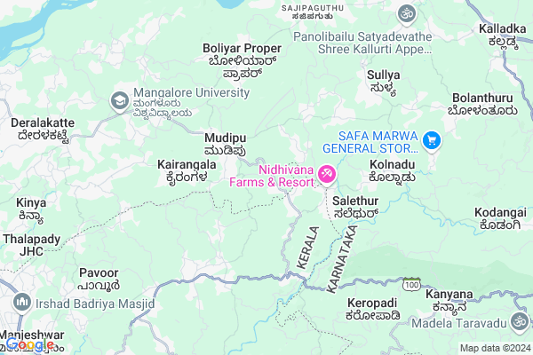
Kayar
Kayar Map
EDIT Map
Add Your House
 ..
..
Current Corona Virus Infected Patients Count in Dakshin Kannad District
| City Name | District Name | Total Covid cases |
|---|---|---|
| Dakshina Kannada District | Dakshina Kannada | 7 |
| Bantwala | Dakshina Kannada | 2 |
| Uppinangadi | Dakshina Kannada | 2 |
| Bantwal | Dakshina Kannada | 1 |
| Panemangalore | Dakshina Kannada | 1 |
Locality Name :
Kayar
( ಕಾಯರ್ )
Taluk Name : Bantval
District : Dakshin Kannad
State : Karnataka
Division : Mysore
Language : Tulu and Kannada, Konkani, Beary Bashe.
Current Time 02:30 PM
Date: Friday , Apr 25,2025 (IST)
Time zone: IST (UTC+5:30)
Elevation / Altitude: 23 meters. Above Seal level
Telephone Code / Std Code: 08255
Assembly constituency : Mangalore assembly constituency
Assembly MLA : U.T. Khader Fareed
Lok Sabha constituency : Dakshina Kannada parliamentary constituency
Parliament MP : NALIN KUMAR KATEEL
Serpanch Name :
Pin Code : 574153
Post Office Name : Kurnad
Main Village Name : Balepuni
Commodities Prices : Manjeswaram Market / Mandi
Kayar Live Weather
Temperature: 31.1 °C
overcast clouds
Humidity: 57%
Wind : 3.41 mt/sec towards W
StationName : "BantvÄ\u0081l"
observed on 2 Hours Back
Temperature: 31.1 °C
overcast clouds
Humidity: 57%
Wind : 3.41 mt/sec towards W
StationName : "BantvÄ\u0081l"
observed on 2 Hours Back
Kayar Weather Forecast for Next 5 days
26-04-2025
26.4°C to 34.2°C
broken clouds, overcast clouds
26.4°C to 34.2°C
broken clouds, overcast clouds
27-04-2025
25.5°C to 35.5°C
overcast clouds, light rain
25.5°C to 35.5°C
overcast clouds, light rain
28-04-2025
25.5°C to 34.2°C
overcast clouds, broken clouds, light rain
25.5°C to 34.2°C
overcast clouds, broken clouds, light rain
29-04-2025
25.5°C to 36.4°C
broken clouds, scattered clouds
25.5°C to 36.4°C
broken clouds, scattered clouds
30-04-2025
25.3°C to 36.0°C
scattered clouds, broken clouds, few clouds, light rain, overcast clouds
25.3°C to 36.0°C
scattered clouds, broken clouds, few clouds, light rain, overcast clouds
National Highways Reachable To Kayar
Nationa High Way :NH66
Nationa High Way :NH169
Nationa High Way :NH66
Nationa High Way :NH169
Rivers Near Kayar
Gurupura :Phalguni :ಗುರುಪುರ
Talapadi :ತಲಪಾಡಿ :തലപ്പാടി
Gurupura :Phalguni :ಗುರುಪುರ
Talapadi :ತಲಪಾಡಿ :തലപ്പാടി
About Kayar
Correct below Info and add more info about KayarKayar is a small Village/hamlet in Bantval Taluk in Dakshin Kannad District of Karnataka State, India. It comes under Balepuni Panchayath. It belongs to Mysore Division . It is located 21 KM towards East from District head quarters Mangalore. 13 KM from Bantval. 332 KM from State capital Bangalore
Kayar Pin code is 574153 and postal head office is Kurnad .
Kayar is surrounded by Manjeshwar Taluk towards South , Mangalore Taluk towards North , Puttur Taluk towards East , Kasargod Taluk towards South .
Mangalore , Puttur , Kasaragod , Mudbidri are the near by Cities to Kayar.
This Place is in the border of the Dakshin Kannad District and Kasaragod District. Kasaragod District Manjeshwar is South towards this place . It is near to the Kerala State Border.
Demographics of Kayar
Tulu is the Local Language here. Total population of Kayar is 3865 .Males are 1959 and Females are 1,906 living in 713 Houses. Total area of Kayar is 742 hectares.Politics in Kayar
Bharatiya Janata Party , BJP , Indian National Congress (INC) , INC are the major political parties in this area.Polling Stations /Booths near Kayar
1)Dakshina Kannada Zilla .panchayath. Higher Primary School Kumudelu Pudu2)Dakshina Kannada Zilla .panchayath. Higher Primary School Hu Hakuvakallu Balepuni (north Wing)
3)Dakshina Kannada Zilla .panchayath. Higher Primary School Arkana Pajiru (north Wing)
4)Dakshina Kannada Zilla .panchayath. Higher Primary School Mudungaru Katte Balepuni
5)Govt Composite P U Collage Naringana Montepadavu
HOW TO REACH Kayar
By Road
Mangalore is the Nearest Town to Kayar. Mangalore is 20 km from Kayar. Road connectivity is there from Mangalore to Kayar.By Rail
There is no railway station near to Kayar in less than 10 km. How ever there are railway Stations from Near By town Mangalore. are the railway Stations near to Mangalore. You can reach from Mangalore to Kayar by road after .Colleges near Kayar
Manipal College Of Dental Sciences- Mangalore
Address : Manipal College Of Dental Scienceslight House Hill
Schools in Kayar
Jawahar Navodaya Vidyalaya, Mudipu
Address : balepuni , bantwal , dakshina kannada , Karnataka . PIN- 574153 , Post - Kurnad
Gups, Balepuni
Address : balepuni , bantwal , dakshina kannada , Karnataka . PIN- 574153 , Post - Kurnad
Gups, Mulur
Address : balepuni , bantwal , dakshina kannada , Karnataka . PIN- 574153 , Post - Kurnad
Gups, Huhakuva Kallu
Address : balepuni , bantwal , dakshina kannada , Karnataka . PIN- 574153 , Post - Kurnad
Govt Health Centers near Kayar
1) Nitte , , ,2) Someshwara , Sub Center Someshwara , ,
3) Manchi , MELKAR WOMENS COLLEGE ROAD , BANTWAL TALUK DAKSHIN KANNADA ,
Hospitals in Kayar,Bantval
Kaushik Clinic
Mudipu - Manjanady Road; Mudipu; Kairangala; Karnataka 574153; India
2.2 KM distance Detail
more ..
Petrol Bunks in Kayar,Bantval
Indian Oil Petrol Pump
Mangalore-Mudipu-Bakrabail Rd; Karnataka 574153; India
4.0 KM distance Detail
Nattakal
Natekal - Manjanady Road; Manjanady; Natekal; Karnataka 575018; India
9.2 KM distance Detail
more ..
Colleges in Kayar,Bantval
Vaishnavi Institute Fashion Technology And Ladies Tailors
Mudipu; Kurnad; Mangalore; Karnataka 574153; India
2.8 KM distance Detail
Thajul Ulama Foundation
AB Complex; Mudipu; Post Kurnad; Bantwal Taluk; Mangalore; Karnataka 575153; India
2.9 KM distance Detail
Government Pre University College
Mudipu; Kurnad; Mangalore; Karnataka 574153; India
2.9 KM distance Detail
more ..
Schools in Kayar,Bantval
Jawahar Navodaya Vidyalaya Mudipu
Post Kurnad; Balepuni; Mudipu; Bantwal Taluk; Mangalore; Karnataka 574153; India
1.6 KM distance Detail
Government Primary School hoohakuvakallu
Hoohakuva Kallu; Balepuni Village; Mudipu - Manjanady Road; Karnataka 574153; India
1.7 KM distance Detail
Electronic Shops in Kayar,Bantval
Shalom Technology
1st Floor; P.K Tower; Mudipu; Mangaluru; Karnataka 574153; India
2.6 KM distance Detail
Local Parks in Kayar,Bantval
Mudipu View Point
Mudipu - Manjanady Road; Mudipu; Kurnad; Karnataka 574153; India
2.2 KM distance Detail
Police Stations near Kayar,Bantval
Karnataka State Reserve Police
7th BN; Assaigoli; Mangalore; Karnataka 574199; India
9.0 KM distance Detail
Farangipet Police Out Post
Opp. HSRTC Bus Stand;Farangipete Junction; Farangipete; Mangaluru; Karnataka 574143; India
11.4 KM distance Detail
Governement Offices near Kayar,Bantval
Satheesh Rao K; Panjikal; SRK Commercial Accountants & Tax Consultants
Panjikal Kukkaje Road; D.No. 3-40 Panjikal House Post Bantwal Taluk Mangaluru;; Ira; Karnataka 574323; India
4.7 KM distance Detail
About Kayar &
History
How to reach Kayar
Tourist Places Near By Kayar
Schools in Kayar
Colleges in Kayar
Temperature & weather of Kayar
places in Kayar
Kayar photos
More Information
How to reach Kayar
Tourist Places Near By Kayar
Schools in Kayar
Colleges in Kayar
Temperature & weather of Kayar
places in Kayar
Kayar photos
More Information
Village Talk
Post News or Events about this Village
Near Cities
Mangalore 19 KM near
Puttur 27 KM near
Kasaragod 33 KM near
Mudbidri 36 KM near
Mangalore 19 KM near
Puttur 27 KM near
Kasaragod 33 KM near
Mudbidri 36 KM near
Near By Taluks
Bantval 13 KM near
Manjeshwar 16 KM near
Mangalore 22 KM near
Puttur 31 KM near
Bantval 13 KM near
Manjeshwar 16 KM near
Mangalore 22 KM near
Puttur 31 KM near
Near By Air Ports
Bajpe Airport 24 KM near
Mysore Airport 211 KM near
Calicut Airport 237 KM near
Hubli Airport 320 KM near
Bajpe Airport 24 KM near
Mysore Airport 211 KM near
Calicut Airport 237 KM near
Hubli Airport 320 KM near
Near By Tourist Places
Mangalore 19 KM near
Kasargod 36 KM near
Bekal 46 KM near
Dharamsthala 52 KM near
Karkala 52 KM near
Mangalore 19 KM near
Kasargod 36 KM near
Bekal 46 KM near
Dharamsthala 52 KM near
Karkala 52 KM near
Near By Districts
Dakshin Kannad 21 KM near
Kasaragod 33 KM near
Udupi 73 KM near
Kodagu 102 KM near
Dakshin Kannad 21 KM near
Kasaragod 33 KM near
Udupi 73 KM near
Kodagu 102 KM near
Near By RailWay Station
Bantawala Rail Way Station 12 KM near
Mangaluru Junction Rail Way Station 15 KM near
Bantawala Rail Way Station 12 KM near
Mangaluru Junction Rail Way Station 15 KM near