| Home | City Bus | Maps | Villages | Cities | Rail | Tourist Places | School | College | Pin Codes | Corona Cases Count |
| Distance Calculator Bus Services IFSC Codes Trace Mobile Number Weather Search Place Trace IP Available Cash ATM/Banks Locate Polling Booth Report an Error contact People |
Sainto
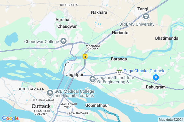
Sainto Map
EDIT Map
Add Your House
 ..
..
Current Corona Virus Infected Patients Count in Cuttack District
| City Name | District Name | Total Covid cases |
|---|---|---|
| Cuttack District | Cuttack | 1 |
Locality Name :
Sainto
( ସିଣ୍ଟୋ )
Tehsil Name : Tangi Choudwar
District : Cuttack
State : Odisha
Language : Oriya and Hindi
Current Time 03:15 PM
Date: Wednesday , Feb 05,2025 (IST)
Time zone: IST (UTC+5:30)
Elevation / Altitude: 29 meters. Above Seal level
Telephone Code / Std Code: 06843
Assembly constituency : Barabati-Cuttack assembly constituency
Assembly MLA : debashish samantaray
Lok Sabha constituency : Cuttack parliamentary constituency
Parliament MP : BHARTRUHARI MAHTAB
Serpanch Name :
Commodities Prices : Chatta Krushak Bazar Market / Mandi
Sainto Live Weather
Temperature: 33.1 °C
overcast clouds
Humidity: 29%
Wind : 2.16 mt/sec towards W
StationName : "Cuttack"
observed on 35 Mins Back
Temperature: 33.1 °C
overcast clouds
Humidity: 29%
Wind : 2.16 mt/sec towards W
StationName : "Cuttack"
observed on 35 Mins Back
Sainto Weather Forecast for Next 5 days
06-02-2025
22.9°C to 32.5°C
overcast clouds, scattered clouds, clear sky, broken clouds
22.9°C to 32.5°C
overcast clouds, scattered clouds, clear sky, broken clouds
07-02-2025
21.9°C to 35.2°C
broken clouds, clear sky
21.9°C to 35.2°C
broken clouds, clear sky
08-02-2025
21.2°C to 33.9°C
clear sky, few clouds
21.2°C to 33.9°C
clear sky, few clouds
09-02-2025
20.5°C to 33.1°C
clear sky, few clouds
20.5°C to 33.1°C
clear sky, few clouds
10-02-2025
20.6°C to 33.9°C
few clouds, broken clouds, scattered clouds, clear sky
20.6°C to 33.9°C
few clouds, broken clouds, scattered clouds, clear sky
National Highways Reachable To Sainto
Nationa High Way :NH53
Nationa High Way :NH55
Nationa High Way :NH53
Nationa High Way :NH55
Rivers Near Sainto
Rana
Mahanadi
Rana
Mahanadi
About Sainto
Correct below Info and add more info about SaintoSainto is a small Village/hamlet in Tangi Choudwar Tehsil in Cuttack District of Odisha State, India. It is located 8 KM towards East from District head quarters Cuttack. 6 KM from Tangi Choudwar. 33 KM from State capital Bhubaneswar
Napanga ( 4 KM ) , Harianta ( 4 KM ) , Trilochanpur ( 5 KM ) , Mutarifa ( 5 KM ) , Madhyakachha ( 6 KM ) are the nearby Villages to Sainto. Sainto is surrounded by Cuttack Tehsil towards South , Salepur Tehsil towards East , Baranga Tehsil towards South , Badchana Tehsil towards East .
Cuttack , Bhubaneswar , Jagatsinghapur , Dhenkanal are the near by Cities to Sainto.
Sainto 2011 Census Details
Sainto Local Language is Oriya. Sainto Village Total population is 728 and number of houses are 149. Female Population is 50.0%. Village literacy rate is 79.4% and the Female Literacy rate is 35.4%.
Population
| Census Parameter | Census Data |
| Total Population | 728 |
| Total No of Houses | 149 |
| Female Population % | 50.0 % ( 364) |
| Total Literacy rate % | 79.4 % ( 578) |
| Female Literacy rate | 35.4 % ( 258) |
| Scheduled Tribes Population % | 0.0 % ( 0) |
| Scheduled Caste Population % | 24.5 % ( 178) |
| Working Population % | 36.7 % |
| Child(0 -6) Population by 2011 | 61 |
| Girl Child(0 -6) Population % by 2011 | 54.1 % ( 33) |
Sainto Census More Deatils.
Polling Stations /Booths near Sainto
1)Class-3 Gopabandhu Kakshya Rajabagicha Primary School2)Practising Urdu Training School
3)Bamphi Sahi U.g.m.e.
4)Radhanath Traning College
5)Mission High School (e)
HOW TO REACH Sainto
By Rail
Kendrapara Road Rail Way Station , Manguli Chowdwar Rail Way Station are the very nearby railway stations to Sainto.Pincodes near Sainto
754025 ( Choudwar ) , 754021 ( Jagatpur (Cuttack) ) , 753006 ( C R R I (Cuttack) )Colleges near Sainto
Gokhale Ideal College
Address :
Mahanadi Mahavidyalaya, Kakhadi
Address :
Schools near Sainto
Saraswati Sisu Mandir, Sarada Nagar
Address : ward no.16 , choudwar mpl , cuttack , Sikkim . PIN- 754026 , Post - Daulatabad (Cuttack)
Jayanti Vidyapitha
Address : haripur , tangi , cuttack , Sikkim . PIN- 754022 , Post - Kotasahi
Nigamananda Girls Hs
Address : ward no.16 , choudwar mpl , cuttack , Sikkim . PIN- 754026 , Post - Daulatabad (Cuttack)
Birol Hs
Address : birol , tangi , cuttack , Sikkim . PIN- 754025 , Post - Choudwar
Govt Health Centers near Sainto
1) Leprosy Home & Hospital , Cuttack , Cuttack , Cuttack2) PPC-SCB MCH , SCBMCH , Mangalabag , SCBMCH
3) Kenduapatna , KENDUPATNA SC , KENDUPATNA , Kenduapatna
Hospitals in Sainto,Tangi Choudwar
Sadguru Medical & Research Centre Pvt Ltd
Jagatpur Industrial Estate; Cuttack; Odisha 754021; India
2.1 KM distance Detail
more ..
Petrol Bunks in Sainto,Tangi Choudwar
Chandi Filling Station Hindustan Petroleum
Manguli; Choudwar; NH-5; Baharagora Chennai Highway; Cuttack; Odisha 754025; India
1.6 KM distance Detail
more ..
Colleges in Sainto,Tangi Choudwar
Reshma Sc Degree College
Sambalpur - Angul - Dhenkanal - Cuttack Rd; Jagatpur Industrial Estate; Jagatpur; Odisha 754021; India
1.6 KM distance Detail
Lakshmi Narayan Sahu Mahavidyalaya
National Highway 5; Jagatpur Industrial Estate; Jagatpur; Odisha 754021; India
2.3 KM distance Detail
Santoshi Institute Of Pharmaceutical Education & Research; Manguli; Cuttack; Odisha
Nuntikiri; देउलाचुआ; ओड़िशा 754025; India
2.7 KM distance Detail
more ..
Schools in Sainto,Tangi Choudwar
CESMA CONSTRUCTION SKILL CENTRE JAGATPUR
Jagatpur Industrial Estate; Jagatpur; Odisha 754021; India
2.1 KM distance Detail
Super Markets in Sainto,Tangi Choudwar
Patanjali & A1 chicken store
Jagatpur Industrial Estate; Nehru Colony; Vinayak Nagar; Jagatpur; Odisha 754021; India
2.8 KM distance Detail
Police Stations near Sainto,Tangi Choudwar
Jagatpur Police Station
SH 9A; Jagatpur Industrial Estate; Jagatpur; Odisha 754021; India
2.5 KM distance Detail
Governement Offices near Sainto,Tangi Choudwar
State Warehouse Corporation Jagatpur
Barrage Colony; Nehru Colony; Vinayak Nagar; Jagatpur; Odisha 754021; India
2.3 KM distance Detail
Municipality Office
Choudwar; Cuttack; IB Road; Cuttack; Cuttack; Odisha 754025; India
3.2 KM distance Detail
About Sainto &
History
How to reach Sainto
Tourist Places Near By Sainto
Schools in Sainto
Colleges in Sainto
Temperature & weather of Sainto
places in Sainto
Sainto photos
More Information
How to reach Sainto
Tourist Places Near By Sainto
Schools in Sainto
Colleges in Sainto
Temperature & weather of Sainto
places in Sainto
Sainto photos
More Information
Village Talk
Post News or Events about this Village
Near Cities
Cuttack 9 KM near
Bhubaneswar 31 KM near
Jagatsinghapur 40 KM near
Dhenkanal 43 KM near
Cuttack 9 KM near
Bhubaneswar 31 KM near
Jagatsinghapur 40 KM near
Dhenkanal 43 KM near
Near By Taluks
Tangi Choudwar 7 KM near
Cuttack 8 KM near
Salepur 17 KM near
Baranga 20 KM near
Tangi Choudwar 7 KM near
Cuttack 8 KM near
Salepur 17 KM near
Baranga 20 KM near
Near By Air Ports
Bhubaneswar Airport 35 KM near
Ranchi Airport 356 KM near
Netaji Subhas Chandra Bose Airport 393 KM near
Vishakhapatnam Airport 471 KM near
Bhubaneswar Airport 35 KM near
Ranchi Airport 356 KM near
Netaji Subhas Chandra Bose Airport 393 KM near
Vishakhapatnam Airport 471 KM near
Near By Tourist Places
Cuttack 9 KM near
Nandan Kanan National Park 20 KM near
Bhubaneswar 29 KM near
Konark 78 KM near
Paradeep Beach 82 KM near
Cuttack 9 KM near
Nandan Kanan National Park 20 KM near
Bhubaneswar 29 KM near
Konark 78 KM near
Paradeep Beach 82 KM near
Near By Districts
Cuttack 7 KM near
Khordha 30 KM near
Jagatsinghapur 40 KM near
Dhenkanal 44 KM near
Cuttack 7 KM near
Khordha 30 KM near
Jagatsinghapur 40 KM near
Dhenkanal 44 KM near
Near By RailWay Station
Kendrapara Road Rail Way Station 3.1 KM near
Manguli Chowdwar Rail Way Station 4.3 KM near
Nergundi Junction Rail Way Station 6.6 KM near
Cuttack Junction Rail Way Station 7 KM near
Mancheswar Rail Way Station 25 KM near
Kendrapara Road Rail Way Station 3.1 KM near
Manguli Chowdwar Rail Way Station 4.3 KM near
Nergundi Junction Rail Way Station 6.6 KM near
Cuttack Junction Rail Way Station 7 KM near
Mancheswar Rail Way Station 25 KM near