| Home | City Bus | Maps | Villages | Cities | Rail | Tourist Places | School | College | Pin Codes | Corona Cases Count |
| Distance Calculator Bus Services IFSC Codes Trace Mobile Number Weather Search Place Trace IP Available Cash ATM/Banks Locate Polling Booth Report an Error contact People |
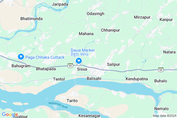
Katikata Map
EDIT Map
Add Your House
 ..
..
Current Corona Virus Infected Patients Count in Cuttack District
| City Name | District Name | Total Covid cases |
|---|---|---|
| Cuttack District | Cuttack | 1 |
Locality Name :
Katikata
( କଟିକଟ )
Tehsil Name : Salepur
District : Cuttack
State : Odisha
Language : Oriya and Hindi
Current Time 04:29 AM
Date: Saturday , Apr 26,2025 (IST)
Time zone: IST (UTC+5:30)
Elevation / Altitude: 24 meters. Above Seal level
Telephone Code / Std Code: 06843
Assembly constituency : Salepur assembly constituency
Assembly MLA : prakash chandra behera
Lok Sabha constituency : Kendrapara parliamentary constituency
Parliament MP : Anubhav Mohanty
Serpanch Name :
Pin Code : 754209
Post Office Name : Asureswar
Commodities Prices : Kendupatna Market / Mandi
Katikata Live Weather
Temperature: 26.9 °C
clear sky
Humidity: 86%
Wind : 5.93 mt/sec towards SW
StationName : "Cuttack"
observed on 23 Mins Back
Temperature: 26.9 °C
clear sky
Humidity: 86%
Wind : 5.93 mt/sec towards SW
StationName : "Cuttack"
observed on 23 Mins Back
Katikata Weather Forecast for Next 5 days
27-04-2025
26.7°C to 40.8°C
clear sky, broken clouds
26.7°C to 40.8°C
clear sky, broken clouds
28-04-2025
27.8°C to 41.2°C
broken clouds, scattered clouds
27.8°C to 41.2°C
broken clouds, scattered clouds
29-04-2025
26.9°C to 39.2°C
light rain, scattered clouds, broken clouds, few clouds
26.9°C to 39.2°C
light rain, scattered clouds, broken clouds, few clouds
30-04-2025
25.1°C to 37.5°C
scattered clouds, few clouds, clear sky, light rain, broken clouds
25.1°C to 37.5°C
scattered clouds, few clouds, clear sky, light rain, broken clouds
National Highways Reachable To Katikata
Nationa High Way :NH53
Nationa High Way :NH55
Nationa High Way :NH53
Nationa High Way :NH55
Rivers Near Katikata
Brahmani :Брагмані
Rana
Brahmani :Брагмані
Rana
About Katikata
Correct below Info and add more info about KatikataKatikata is a small Village/hamlet in Salepur Tehsil in Cuttack District of Odisha State, India. It is located 25 KM towards East from District head quarters Cuttack. 41 KM from State capital Bhubaneswar
Katikata Pin code is 754209 and postal head office is Asureswar .
Katikata is surrounded by Nischinta Koili Tehsil towards East , Mahanga Tehsil towards East , Tangi Choudwar Tehsil towards west , Biridi Tehsil towards South .
Cuttack , Jagatsinghapur , Kendrapara , Bhubaneswar are the near by Cities to Katikata.
Katikata 2011 Census Details
Katikata Local Language is Oriya. Katikata Village Total population is 693 and number of houses are 167. Female Population is 50.1%. Village literacy rate is 77.8% and the Female Literacy rate is 35.2%.
Population
| Census Parameter | Census Data |
| Total Population | 693 |
| Total No of Houses | 167 |
| Female Population % | 50.1 % ( 347) |
| Total Literacy rate % | 77.8 % ( 539) |
| Female Literacy rate | 35.2 % ( 244) |
| Scheduled Tribes Population % | 0.0 % ( 0) |
| Scheduled Caste Population % | 36.2 % ( 251) |
| Working Population % | 41.7 % |
| Child(0 -6) Population by 2011 | 69 |
| Girl Child(0 -6) Population % by 2011 | 60.9 % ( 42) |
Katikata Census More Deatils.
Politics in Katikata
BJD , INC are the major political parties in this area.Polling Stations /Booths near Katikata
1)Mutaripha Pry. School2)Purusottamapur Pry. School
3)Sankharisahi Project Pry. School
4)Boilo Pry. School
5)Kahneipur Pry. School
HOW TO REACH Katikata
By Rail
There is no railway station near to Katikata in less than 10 km.Colleges near Katikata
Japkud Womens College
Address :
Schools in Katikata
Natara Ps
Address : katikata , salipur , cuttack , Sikkim . PIN- 754201 , Post - Rameswar
Govt Health Centers near Katikata
1) NAGASPUR , , , Nagaspur Chhak2) Leprosy Home & Hospital , Cuttack , Cuttack , Cuttack
3) ORTI , , , Orti PHC (New)
Petrol Bunks in Katikata,Salepur
Mani Filling Station
Cuttack; SH-9A; Aul Kendrapada Jagatpur Road; Salepur; Salipur; Odisha 754202; India
1.1 KM distance Detail
more ..
Colleges in Katikata,Salepur
Sabitri Devi College of Science
Sisua; Cuttack; SH-9A; Aul Kendrapada Jagatpur Road; Salepur; Salipur; Odisha 754200; India
2.0 KM distance Detail
more ..
Electronic Shops in Katikata,Salepur
Deepika Electronices (All Tayep Light Gate ;Kunda Light )
near; Santoshi Maa Temple; Sapanpur; Odisha 754202; India
1.1 KM distance Detail
Super Markets in Katikata,Salepur
Sri Guru Auto Services
Cuttack - Kendrapada Rd; Salipur; Odisha 754202; India
1.9 KM distance Detail
About Katikata &
History
How to reach Katikata
Tourist Places Near By Katikata
Schools in Katikata
Colleges in Katikata
Temperature & weather of Katikata
places in Katikata
Katikata photos
More Information
How to reach Katikata
Tourist Places Near By Katikata
Schools in Katikata
Colleges in Katikata
Temperature & weather of Katikata
places in Katikata
Katikata photos
More Information
Village Talk
Post News or Events about this Village
Near Cities
Cuttack 24 KM near
Jagatsinghapur 28 KM near
Kendrapara 38 KM near
Bhubaneswar 41 KM near
Cuttack 24 KM near
Jagatsinghapur 28 KM near
Kendrapara 38 KM near
Bhubaneswar 41 KM near
Near By Taluks
Salepur 0 KM near
Nischinta Koili 12 KM near
Mahanga 14 KM near
Tangi Choudwar 16 KM near
Salepur 0 KM near
Nischinta Koili 12 KM near
Mahanga 14 KM near
Tangi Choudwar 16 KM near
Near By Air Ports
Bhubaneswar Airport 43 KM near
Ranchi Airport 363 KM near
Netaji Subhas Chandra Bose Airport 382 KM near
Vishakhapatnam Airport 481 KM near
Bhubaneswar Airport 43 KM near
Ranchi Airport 363 KM near
Netaji Subhas Chandra Bose Airport 382 KM near
Vishakhapatnam Airport 481 KM near
Near By Tourist Places
Cuttack 24 KM near
Nandan Kanan National Park 34 KM near
Bhubaneswar 39 KM near
Paradeep Beach 65 KM near
Konark 74 KM near
Cuttack 24 KM near
Nandan Kanan National Park 34 KM near
Bhubaneswar 39 KM near
Paradeep Beach 65 KM near
Konark 74 KM near
Near By Districts
Cuttack 23 KM near
Jagatsinghapur 29 KM near
Kendrapara 38 KM near
Khordha 40 KM near
Cuttack 23 KM near
Jagatsinghapur 29 KM near
Kendrapara 38 KM near
Khordha 40 KM near
Near By RailWay Station
Cuttack Junction Rail Way Station 22 KM near
Mancheswar Rail Way Station 35 KM near
Cuttack Junction Rail Way Station 22 KM near
Mancheswar Rail Way Station 35 KM near