| Home | City Bus | Maps | Villages | Cities | Rail | Tourist Places | School | College | Pin Codes | Corona Cases Count |
| Distance Calculator Bus Services IFSC Codes Trace Mobile Number Weather Search Place Trace IP Available Cash ATM/Banks Locate Polling Booth Report an Error contact People |
Teldia
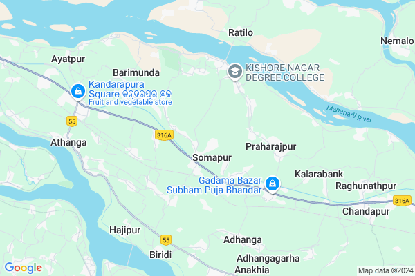
Teldia Map
EDIT Map
Add Your House
 ..
..
Current Corona Virus Infected Patients Count in Cuttack District
| City Name | District Name | Total Covid cases |
|---|---|---|
| Cuttack District | Cuttack | 1 |
Locality Name :
Teldia
( ତୈଳଦୀରେ )
Tehsil Name : Nischinta Koili
District : Cuttack
State : Odisha
Language : Oriya and Hindi
Current Time 10:19 AM
Date: Wednesday , Apr 30,2025 (IST)
Time zone: IST (UTC+5:30)
Elevation / Altitude: 14 meters. Above Seal level
Telephone Code / Std Code: 06725
Assembly constituency : Cuttack Sadar assembly constituency
Assembly MLA : chandra sarathi behera
Lok Sabha constituency : Cuttack parliamentary constituency
Parliament MP : BHARTRUHARI MAHTAB
Serpanch Name :
Pin Code : 754130
Post Office Name : Sompur
Commodities Prices : Kendupatna Market / Mandi
Teldia Live Weather
Temperature: 31.0 °C
clear sky
Humidity: 60%
Wind : 3.21 mt/sec towards SW
StationName : "Jagatsinghapur"
observed on 1 Hours Back
Temperature: 31.0 °C
clear sky
Humidity: 60%
Wind : 3.21 mt/sec towards SW
StationName : "Jagatsinghapur"
observed on 1 Hours Back
Teldia Weather Forecast for Next 5 days
01-05-2025
23.9°C to 36.4°C
clear sky, scattered clouds, moderate rain, light rain, broken clouds
23.9°C to 36.4°C
clear sky, scattered clouds, moderate rain, light rain, broken clouds
02-05-2025
22.1°C to 33.0°C
light rain, heavy intensity rain, broken clouds, few clouds
22.1°C to 33.0°C
light rain, heavy intensity rain, broken clouds, few clouds
03-05-2025
23.9°C to 35.0°C
clear sky, scattered clouds, light rain, broken clouds
23.9°C to 35.0°C
clear sky, scattered clouds, light rain, broken clouds
04-05-2025
26.4°C to 35.6°C
scattered clouds, clear sky, light rain, broken clouds
26.4°C to 35.6°C
scattered clouds, clear sky, light rain, broken clouds
05-05-2025
27.6°C to 38.7°C
broken clouds, few clouds, clear sky
27.6°C to 38.7°C
broken clouds, few clouds, clear sky
National Highways Reachable To Teldia
Nationa High Way :NH53
Nationa High Way :NH55
Nationa High Way :NH53
Nationa High Way :NH55
Rivers Near Teldia
Brahmani :Брагмані
Rana
Brahmani :Брагмані
Rana
About Teldia
Correct below Info and add more info about TeldiaTeldia is a small Village/hamlet in Nischinta Koili Tehsil in Cuttack District of Odisha State, India. It is located 26 KM towards East from District head quarters Cuttack. 15 KM from Nischintakoili. 33 KM from State capital Bhubaneswar
Teldia Pin code is 754130 and postal head office is Sompur .
Manapur ( 3 KM ) , Praharajpur ( 4 KM ) , Kishorenagar ( 4 KM ) , Dharina ( 6 KM ) , Jasapada ( 6 KM ) are the nearby Villages to Teldia. Teldia is surrounded by Salepur Tehsil towards North , Nischinta Koili Tehsil towards East , Raghunathpur Tehsil towards East , Kantapada Tehsil towards South .
Jagatsinghapur , Cuttack , Bhubaneswar , Kendrapara are the near by Cities to Teldia.
This Place is in the border of the Cuttack District and Kendrapara District. Kendrapara District Derabish is East towards this place . Also it is in the Border of other district Jagatsinghapur .
Demographics of Teldia
Oriya is the Local Language here.Politics in Teldia
BJP , BJD , are the major political parties in this area.Polling Stations /Booths near Teldia
1)Siuli Pry. School2)Taanrapa Pry. School
3)Tarilo Pry. School
4)Teladia High School
5)Thoriapada Pry. School
HOW TO REACH Teldia
By Rail
Badakhandita Rail Way Station , Kandarpur Rail Way Station are the very nearby railway stations to Teldia.Colleges near Teldia
Panchayat Prahallad College
Address :
Schools near Teldia
Mother Teresa Deaf & Dumb Rhs
Address : kulagan ishalo , nischintakoili , cuttack , Sikkim . PIN- 754209 , Post - Asureswar
Janaki Ballav Hs
Address : jaganathpur , nischintakoili , cuttack , Sikkim . PIN- 754221 , Post - Sungura (Cuttack)
Narayani Uchha Bidyapitha
Address : narendrapur , nischintakoili , cuttack , Sikkim . PIN- 754134 , Post - Tyandakura
Lalbag Girls Hs
Address : jiginipur , nischintakoili , cuttack , Sikkim . PIN- 754207 , Post - Nischintakoili
Govt Health Centers near Teldia
1) NAGASPUR , , , Nagaspur Chhak2) Leprosy Home & Hospital , Cuttack , Cuttack , Cuttack
3) Bhingarpur , BHINGAPUR , BHINGAPUR , BHINGAPUR
Petrol Bunks in Teldia,Nischinta Koili
Haramani Filling Station Indian Oil Petrol Pump
Kamarpada; Cuttack; SH-12; Cuttack Paradeep Road; Tirtol; Tirtol; Odisha 754130; India
5.1 KM distance Detail
HP PETROL PUMP - PRADHAN & PRADHAN FILLING STATION
At/po: Kamarpada PS: Kishannagar; Bhubaneshwar; Odisha 754130; India
5.2 KM distance Detail
more ..
Colleges in Teldia,Nischinta Koili
Xavier College Of Hotel Management
Parabil ; Kandarpur; cuttack; Odisha 754100; India
6.0 KM distance Detail
more ..
Schools in Teldia,Nischinta Koili
Saraswati Sishu Mandir
Mohanty sahi; Teldia Sompur; Cuttack Paradip Rd; Somapur; Odisha 754130; India
0.9 KM distance Detail
Teldia Primary School
teldia; teldia; Cuttack - Paradeep Rd; Kalantira; Odisha 754111; India
1.1 KM distance Detail
Teldia High School
Teldia;somepur; teldia; Cuttack - Paradeep Rd; Somapur; Odisha 754130; India
1.1 KM distance Detail
Electronic Shops in Teldia,Nischinta Koili
Raja Mobile & Electronic Shop
Cuttack Praharaj pur (Namajpadia; Cuttack; Odisha 754130; India
3.5 KM distance Detail
Abdur Rahaman Khan Verity Store
Namajpadia; Praharajpur; Odisha 754130; India
3.9 KM distance Detail
Super Markets in Teldia,Nischinta Koili
Nanpur; Bazaar; Cuttack-Paradeep; Road
Cuttack - Paradeep Rd; Nanpur; Odisha 754111; India
3.6 KM distance Detail
About Teldia &
History
How to reach Teldia
Tourist Places Near By Teldia
Schools in Teldia
Colleges in Teldia
Temperature & weather of Teldia
places in Teldia
Teldia photos
More Information
How to reach Teldia
Tourist Places Near By Teldia
Schools in Teldia
Colleges in Teldia
Temperature & weather of Teldia
places in Teldia
Teldia photos
More Information
Village Talk
Post News or Events about this Village
Near Cities
Jagatsinghapur 18 KM near
Cuttack 24 KM near
Bhubaneswar 33 KM near
Kendrapara 41 KM near
Jagatsinghapur 18 KM near
Cuttack 24 KM near
Bhubaneswar 33 KM near
Kendrapara 41 KM near
Near By Taluks
Biridi 6 KM near
Salepur 12 KM near
Nischinta Koili 14 KM near
Raghunathpur 16 KM near
Biridi 6 KM near
Salepur 12 KM near
Nischinta Koili 14 KM near
Raghunathpur 16 KM near
Near By Air Ports
Bhubaneswar Airport 35 KM near
Ranchi Airport 375 KM near
Netaji Subhas Chandra Bose Airport 391 KM near
Vishakhapatnam Airport 471 KM near
Bhubaneswar Airport 35 KM near
Ranchi Airport 375 KM near
Netaji Subhas Chandra Bose Airport 391 KM near
Vishakhapatnam Airport 471 KM near
Near By Tourist Places
Cuttack 25 KM near
Nandan Kanan National Park 30 KM near
Bhubaneswar 32 KM near
Konark 62 KM near
Paradeep Beach 63 KM near
Cuttack 25 KM near
Nandan Kanan National Park 30 KM near
Bhubaneswar 32 KM near
Konark 62 KM near
Paradeep Beach 63 KM near
Near By Districts
Jagatsinghapur 19 KM near
Cuttack 24 KM near
Khordha 33 KM near
Kendrapara 42 KM near
Jagatsinghapur 19 KM near
Cuttack 24 KM near
Khordha 33 KM near
Kendrapara 42 KM near
Near By RailWay Station
Badakhandita Rail Way Station 3.2 KM near
Kandarpur Rail Way Station 7.6 KM near
Cuttack Junction Rail Way Station 22 KM near
Mancheswar Rail Way Station 28 KM near
Badakhandita Rail Way Station 3.2 KM near
Kandarpur Rail Way Station 7.6 KM near
Cuttack Junction Rail Way Station 22 KM near
Mancheswar Rail Way Station 28 KM near