| Home | City Bus | Maps | Villages | Cities | Rail | Tourist Places | School | College | Pin Codes | Corona Cases Count |
| Distance Calculator Bus Services IFSC Codes Trace Mobile Number Weather Search Place Trace IP Available Cash ATM/Banks Locate Polling Booth Report an Error contact People |
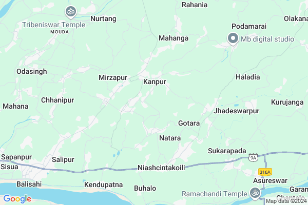
Dahapada
Dahapada Map
EDIT Map
Add Your House
 ..
..
Current Corona Virus Infected Patients Count in Cuttack District
| City Name | District Name | Total Covid cases |
|---|---|---|
| Cuttack District | Cuttack | 1 |
Locality Name :
Dahapada
( ଦହପାଦ )
Tehsil Name : Nischinta Koili
District : Cuttack
State : Odisha
Language : Oriya and Hindi
Current Time 01:11 PM
Date: Wednesday , Feb 05,2025 (IST)
Time zone: IST (UTC+5:30)
Elevation / Altitude: 14 meters. Above Seal level
Telephone Code / Std Code: 06725
Assembly constituency : Mahanga assembly constituency
Assembly MLA : pratap jena
Lok Sabha constituency : Kendrapara parliamentary constituency
Parliament MP : Anubhav Mohanty
Serpanch Name :
Pin Code : 754221
Post Office Name : Sungura (Cuttack)
Commodities Prices : Kendupatna Market / Mandi
Dahapada Live Weather
Temperature: 29.8 °C
overcast clouds
Humidity: 53%
Wind : 1.96 mt/sec towards SW
StationName : "KendrÄ\u0081parha"
observed on 2 Hours Back
Temperature: 29.8 °C
overcast clouds
Humidity: 53%
Wind : 1.96 mt/sec towards SW
StationName : "KendrÄ\u0081parha"
observed on 2 Hours Back
Dahapada Weather Forecast for Next 5 days
06-02-2025
23.3°C to 34.4°C
overcast clouds, broken clouds, clear sky, scattered clouds
23.3°C to 34.4°C
overcast clouds, broken clouds, clear sky, scattered clouds
07-02-2025
22.4°C to 34.9°C
overcast clouds, broken clouds, scattered clouds, few clouds, clear sky
22.4°C to 34.9°C
overcast clouds, broken clouds, scattered clouds, few clouds, clear sky
08-02-2025
21.1°C to 32.5°C
clear sky, light rain
21.1°C to 32.5°C
clear sky, light rain
09-02-2025
20.6°C to 32.2°C
clear sky
20.6°C to 32.2°C
clear sky
10-02-2025
20.5°C to 33.7°C
clear sky, scattered clouds, few clouds
20.5°C to 33.7°C
clear sky, scattered clouds, few clouds
National Highways Reachable To Dahapada
Nationa High Way :NH53
Nationa High Way :NH55
Nationa High Way :NH53
Nationa High Way :NH55
Rivers Near Dahapada
Brahmani :Брагмані
Rana
Brahmani :Брагмані
Rana
About Dahapada
Correct below Info and add more info about DahapadaDahapada is a small Village/hamlet in Nischinta Koili Tehsil in Cuttack District of Odisha State, India. It is located 36 KM towards East from District head quarters Cuttack. 9 KM from Nischintakoili. 52 KM from State capital Bhubaneswar
Dahapada Pin code is 754221 and postal head office is Sungura (Cuttack).
Jairampur ( 2 KM ) , Bhaunria ( 2 KM ) , Paikarapur ( 3 KM ) , Gotara ( 3 KM ) , Raisunguda ( 3 KM ) are the nearby Villages to Dahapada. Dahapada is surrounded by Nischinta Koili Tehsil towards South , Salepur Tehsil towards west , Derabish Tehsil towards East , Badchana Tehsil towards North .
Kendrapara , Jagatsinghapur , Cuttack , Jajapur are the near by Cities to Dahapada.
This Place is in the border of the Cuttack District and Kendrapara District. Kendrapara District Derabish is East towards this place . Also it is in the Border of other district Jagatsinghapur .
Dahapada 2011 Census Details
Dahapada Local Language is Oriya. Dahapada Village Total population is 1383 and number of houses are 340. Female Population is 51.1%. Village literacy rate is 78.6% and the Female Literacy rate is 39.5%.
Population
| Census Parameter | Census Data |
| Total Population | 1383 |
| Total No of Houses | 340 |
| Female Population % | 51.1 % ( 707) |
| Total Literacy rate % | 78.6 % ( 1087) |
| Female Literacy rate | 39.5 % ( 546) |
| Scheduled Tribes Population % | 0.0 % ( 0) |
| Scheduled Caste Population % | 24.2 % ( 334) |
| Working Population % | 25.2 % |
| Child(0 -6) Population by 2011 | 153 |
| Girl Child(0 -6) Population % by 2011 | 47.7 % ( 73) |
Dahapada Census More Deatils.
Politics in Dahapada
BJD is the major political party in this area.Polling Stations /Booths near Dahapada
1)Chhualia Pry. School2)Nahalpur Pry. School
3)Nahanga Pry. School
4)Ranigoda U.p. School
5)Jagannath Project. U.p. School Khandasahi
HOW TO REACH Dahapada
By Rail
There is no railway station near to Dahapada in less than 10 km.Colleges near Dahapada
Panchayat Prahallad College
Address :
Schools in Dahapada
Patapary Ps
Address : dahapada , nischintakoili , cuttack , Sikkim . PIN- 754221 , Post - Sungura (Cuttack)
Govt Health Centers near Dahapada
1) NAGASPUR , , , Nagaspur Chhak2) ORTI , , , Orti PHC (New)
3) Gardapur PHC(N) , , Patkura , Near Patkura Block Office
Hospitals in Dahapada,Nischinta Koili
Pallisahi homeopathic hospital
754221; Salepur-Mahanga Road; Pallisahi; Odisha; India
2.3 KM distance Detail
more ..
Petrol Bunks in Dahapada,Nischinta Koili
Vishwanath Fuel Station Petrol Pump
Nischintakoili; Cuttack; SH-9A; Aul Kendrapada Jagatpur Road; Salepur; Salepur; Odisha 754207; India
6.0 KM distance Detail
more ..
Colleges in Dahapada,Nischinta Koili
Mahanga Women's College; Pallisahi
Pallisahi; Sungara; Mahanga; Cuttack; Odisha 754221; India
2.0 KM distance Detail
more ..
Electronic Shops in Dahapada,Nischinta Koili
Mahavir Electronics & Tv Work Shop; Airtel Digital Service Point.
Dharmagatpur; Odisha 754221; India
2.9 KM distance Detail
Governement Offices near Dahapada,Nischinta Koili
Venvik Gst Suvidha kendra - Cuttack
Asureswar; Po: Asureswar; via nichinta koil block; Cuttack; Odisha 754209; India
4.9 KM distance Detail
About Dahapada &
History
How to reach Dahapada
Tourist Places Near By Dahapada
Schools in Dahapada
Colleges in Dahapada
Temperature & weather of Dahapada
places in Dahapada
Dahapada photos
More Information
How to reach Dahapada
Tourist Places Near By Dahapada
Schools in Dahapada
Colleges in Dahapada
Temperature & weather of Dahapada
places in Dahapada
Dahapada photos
More Information
Village Talk
Post News or Events about this Village
Near Cities
Kendrapara 28 KM near
Jagatsinghapur 31 KM near
Cuttack 35 KM near
Jajapur 44 KM near
Kendrapara 28 KM near
Jagatsinghapur 31 KM near
Cuttack 35 KM near
Jajapur 44 KM near
Near By Taluks
Mahanga 5 KM near
Nischinta Koili 9 KM near
Salepur 11 KM near
Derabish 16 KM near
Mahanga 5 KM near
Nischinta Koili 9 KM near
Salepur 11 KM near
Derabish 16 KM near
Near By Air Ports
Bhubaneswar Airport 53 KM near
Ranchi Airport 362 KM near
Netaji Subhas Chandra Bose Airport 372 KM near
Vishakhapatnam Airport 491 KM near
Bhubaneswar Airport 53 KM near
Ranchi Airport 362 KM near
Netaji Subhas Chandra Bose Airport 372 KM near
Vishakhapatnam Airport 491 KM near
Near By Tourist Places
Cuttack 35 KM near
Nandan Kanan National Park 45 KM near
Bhubaneswar 49 KM near
Paradeep Beach 57 KM near
Konark 78 KM near
Cuttack 35 KM near
Nandan Kanan National Park 45 KM near
Bhubaneswar 49 KM near
Paradeep Beach 57 KM near
Konark 78 KM near
Near By Districts
Kendrapara 27 KM near
Jagatsinghapur 32 KM near
Cuttack 34 KM near
Jajapur 45 KM near
Kendrapara 27 KM near
Jagatsinghapur 32 KM near
Cuttack 34 KM near
Jajapur 45 KM near
Near By RailWay Station
Cuttack Junction Rail Way Station 33 KM near
Mancheswar Rail Way Station 46 KM near
Cuttack Junction Rail Way Station 33 KM near
Mancheswar Rail Way Station 46 KM near